Komarna Beach, Croatia
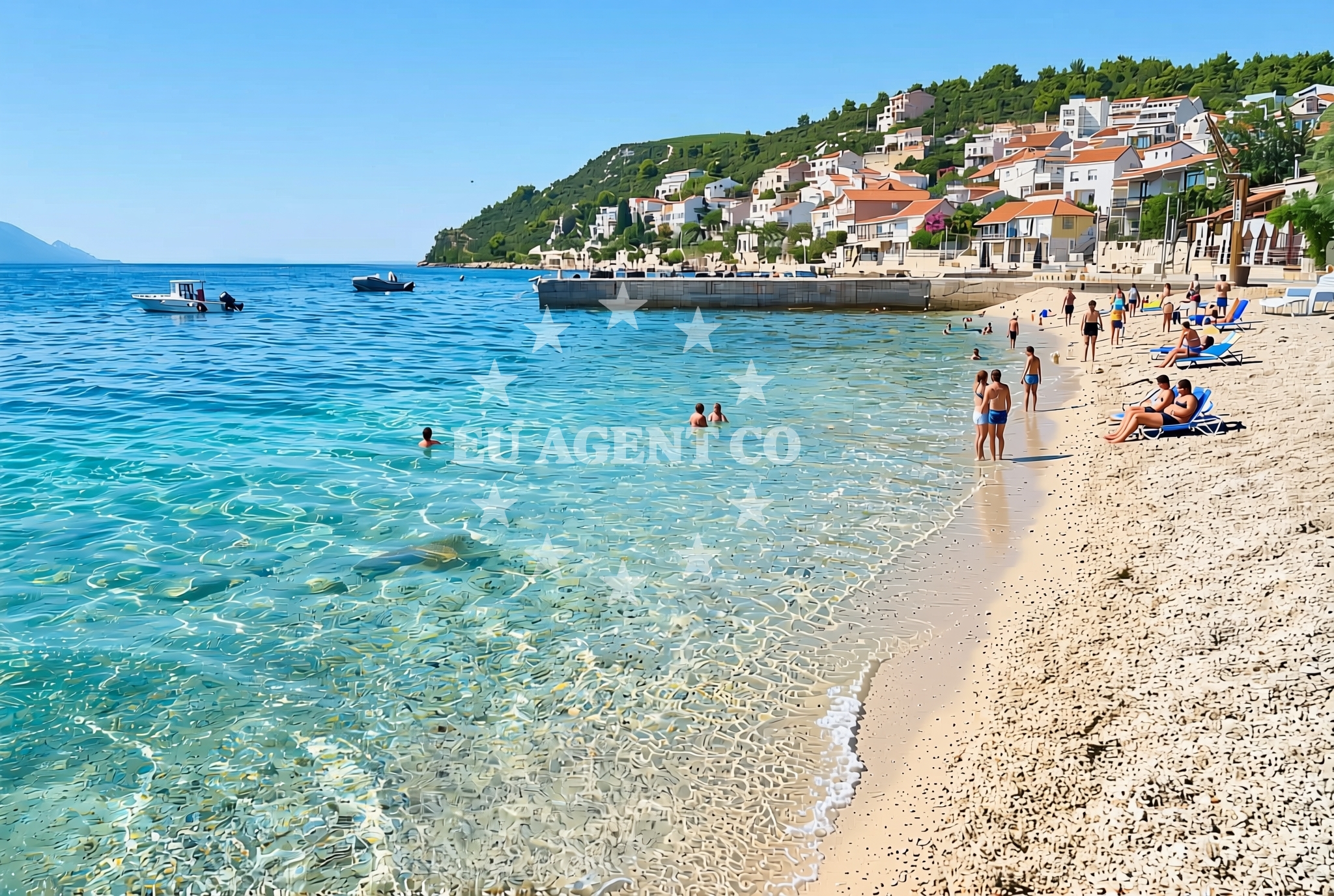
Komarna Beach, located in the village of Komarna on Croatia's southern coast, offers a simple shoreline experience with a focus on accessibility and basic amenities. Situated near the mouth of the Neretva River, the beach is part of a region known for its historical significance and coastal sailing opportunities. The gravel and concrete/stone slabs that make up the beach surface provide a stable walking area, while nearby facilities include a restaurant, snack bar, and caffe bar for visitors seeking refreshments.
About this beach
Komarna jug, Komarna
Beach: Komarna jug
Location: Komarna
Characteristics and facilities
Gravel, concrete / stone slabs
50 m
Restaurant / snack bar
Caffe bar / Drinks stand
Beach character
The beach's surface consists of gravel and concrete/stone slabs, creating a flat and stable area suitable for walking and sunbathing. The beach is 50 meters in length, offering a compact space for relaxation. While the shoreline lacks natural sand, the hard surface makes it accessible for visitors with mobility needs. The presence of a restaurant, snack bar, and caffe bar within close proximity suggests the area is designed for casual beachgoers seeking light meals and drinks without needing to travel far.
Swimming and shore
Swimming conditions at Komarna Beach are not explicitly detailed in available records, but the gravel and concrete shoreline may indicate limited direct access to the water. The beach's short length and lack of detailed natural features suggest it may be more suited for brief shoreline visits rather than extended aquatic activities. Visitors should note that the beach does not appear to have dedicated swimming zones, showers, or changing facilities.
Facilities and activities
The beach is equipped with a restaurant, snack bar, and caffe bar, providing visitors with options for meals and beverages. These facilities are likely located within the village of Komarna, given the absence of on-site infrastructure details. No other amenities such as parking, restrooms, or shade structures are mentioned in authoritative records. The beach does not appear to host organized activities or events, focusing instead on passive recreation.
Access and location
Komarna Beach is located in Komarna, a village on Croatia's Adriatic coast within the Dubrovnik-Neretva County. The area is historically significant, with connections to medieval trade routes and coastal defense systems. The beach's proximity to the Neretva River mouth places it near the boundary between the Pelješac Peninsula and the mainland, offering potential vantage points for observing maritime traffic. The region is part of a larger sailing area that includes the Bay of Kotor and the Adriatic islands, though specific nautical details for this beach are not documented.
What to expect
Visitors to Komarna Beach should expect a straightforward shoreline experience with a gravel and concrete surface. The beach is best suited for those seeking minimalistic coastal access with nearby dining options. The absence of detailed facilities information means visitors should plan for basic amenities rather than expecting extensive infrastructure. The beach's location in Komarna offers opportunities to explore the village's historical sites and nearby natural attractions, though specific recommendations are not provided in available records.
Practical tips
Given the beach's short length and lack of detailed facilities, visitors may want to allocate limited time here. The presence of nearby dining options suggests it's a good spot for a quick meal before or after exploring other parts of Komarna. The gravel surface may be uncomfortable for prolonged sunbathing but offers stability for walking. Visitors should be aware that this beach is not typically highlighted in tourism guides, focusing instead on more developed coastal areas in the region.
Exploring the coast by yacht
For yacht charter guests exploring the Dalmatian coast, Komarna Beach represents one of many accessible points along the route between Dubrovnik and the Pelješac Peninsula. While the beach itself does not serve as an anchorage or marina, the surrounding area includes established sailing destinations. Charter yachts operating in this region may find Komarna a convenient stop for brief land excursions, though the beach's limited facilities mean it's unlikely to be a primary docking point. The nearby Neretva River and surrounding coastline offer broader opportunities for sailing exploration.
Historical Context of Komarna
The village of Komarna has historical ties to the medieval Kingdom of Croatia and the Venetian Republic, with remnants of old fortifications and trade infrastructure still visible in the area. Its location near the Neretva River made it a strategic point for maritime commerce and defense. While the beach itself does not contain historical landmarks, the village offers opportunities to explore this heritage through nearby cultural sites.
Anchorages in the surrounding area
Anchorages in the surrounding area include Anchorage — duboka and Anchorage — klek, situated near Komarna jug.
- Anchorage — duboka — 0.5 NM from beach
- Anchorage — klek — 0.9 NM from beach
- Anchorage — klek — 1.3 NM from beach
- Anchorage — brijesta — 2.2 NM from beach
- Anchorage — duba — 2.7 NM from beach
- Anchorage — blace — 4.2 NM from beach
- Anchorage — zuljana — 4.7 NM from beach
- Anchorage — zuljana — 5.1 NM from beach
Distances are straight-line geographic distances, not sailing routes.
Mooring buoys in the surrounding area
Mooring buoys in the surrounding area include Brijesta and Jetty — blace, located near Komarna jug.
- Brijesta — 2.2 NM from beach
- Jetty — blace — 4.2 NM from beach
- Quay — prapratno — 9.9 NM from beach
- Buoy — mljet — 11.0 NM from beach
- Restaurant Dalmatinac quay — mljet — 11.0 NM from beach
Distances are straight-line geographic distances, not sailing routes.
Marine fuel stations
- Fuel station — ploce — 7.8 NM from beach
- Fuel station — sobra — mljet — 12.9 NM from beach
- Fuel station — korcula — 16.9 NM from beach
- Ina — dubrovnik — 29.5 NM from beach
Distances are straight-line geographic distances, not sailing routes.
Harbours in the surrounding area
Harbors in the surrounding area include Drače — drace and Sresar — rat, situated near Komarna jug.
- Drače — drace — 3.8 NM from beach
- Sresar — rat — 3.9 NM from beach
- Opuzen — 4.7 NM from beach
- Žuljana — zuljana — 4.7 NM from beach
- Trstenik — 6.1 NM from beach
- Ploče — ploce — 7.9 NM from beach
Distances are straight-line geographic distances, not sailing routes.
Marinas in the surrounding area
Marinas in the surrounding area include Marina Lumbarda — korcula and ACI Marina Korčula, located in the vicinity of Komarna jug.
- Marina Lumbarda — korcula — 15.9 NM from beach
- ACI Marina Korčula — korcula — 17.5 NM from beach
- ACI Marina Slano — 18.4 NM from beach
- Marina Tučepi — marina tucepi — 28.3 NM from beach
- Marina Frapa Dubrovnik — 29.6 NM from beach
Distances are straight-line geographic distances, not sailing routes.
Restaurants near the beach
Restaurants near the beach include Bistro Ankora — zuljana and Konoba Riva — zuljana, located close to Komarna jug.
- Bistro Ankora — zuljana — 4.7 NM from beach
- Konoba Riva — zuljana — 4.8 NM from beach
Distances are straight-line geographic distances, not sailing routes.
Navigation guides for the surrounding area
Navigation guides for the surrounding area include Uvala Kljemtine and Uvala Klek, providing key points near Komarna jug.
- Uvala Kljemtine — 1.2 NM from beach
- Uvala Klek — 1.4 NM from beach
- Uvala Lopata — 1.9 NM from beach
- Bl ace — 4.1 NM from beach
- Trstenik — 5.9 NM from beach
Distances are straight-line geographic distances, not sailing routes.
Yachts from nearby departure bases
Yachts from nearby departure bases include Elan 40 Impression (Karleta) and Lagoon 450 Fly (Alba Mouse), based at Ploče City Port near Komarna jug.
Sailing yachts
- Elan 40 Impression (Karleta) — Ploče City Port — 7.8 NM from departure base to beach
- Elan 514 Impression (Cesarica III) — Ploče City Port — 7.8 NM from departure base to beach
- Salona 44 (SAMOA) — Ploče City Port — 7.8 NM from departure base to beach
- Sun Odyssey 349 (Visnjica) — Ploče City Port — 7.8 NM from departure base to beach
- Sun Odyssey 419 (Luka Ploce) — Ploče City Port — 7.8 NM from departure base to beach
- More 55 (MRS. ROBINSON) — Ploče City Port — 7.8 NM from departure base to beach
- Sun Odyssey 349 (Porto Tolero) — Ploče City Port — 7.8 NM from departure base to beach
- Elan 45 Impression (Skyfall) — Slano ACI Marina — 18.4 NM from departure base to beach
Catamarans
- Lagoon 450 Fly (Alba Mouse) — Ploče City Port — 7.8 NM from departure base to beach
- Lagoon 40 (MARINERO) — Slano ACI Marina — 18.4 NM from departure base to beach
Distances are straight-line geographic distances, not sailing routes.