Kolanjsko Blato sjever, Kolan (Pag) Beach, Croatia
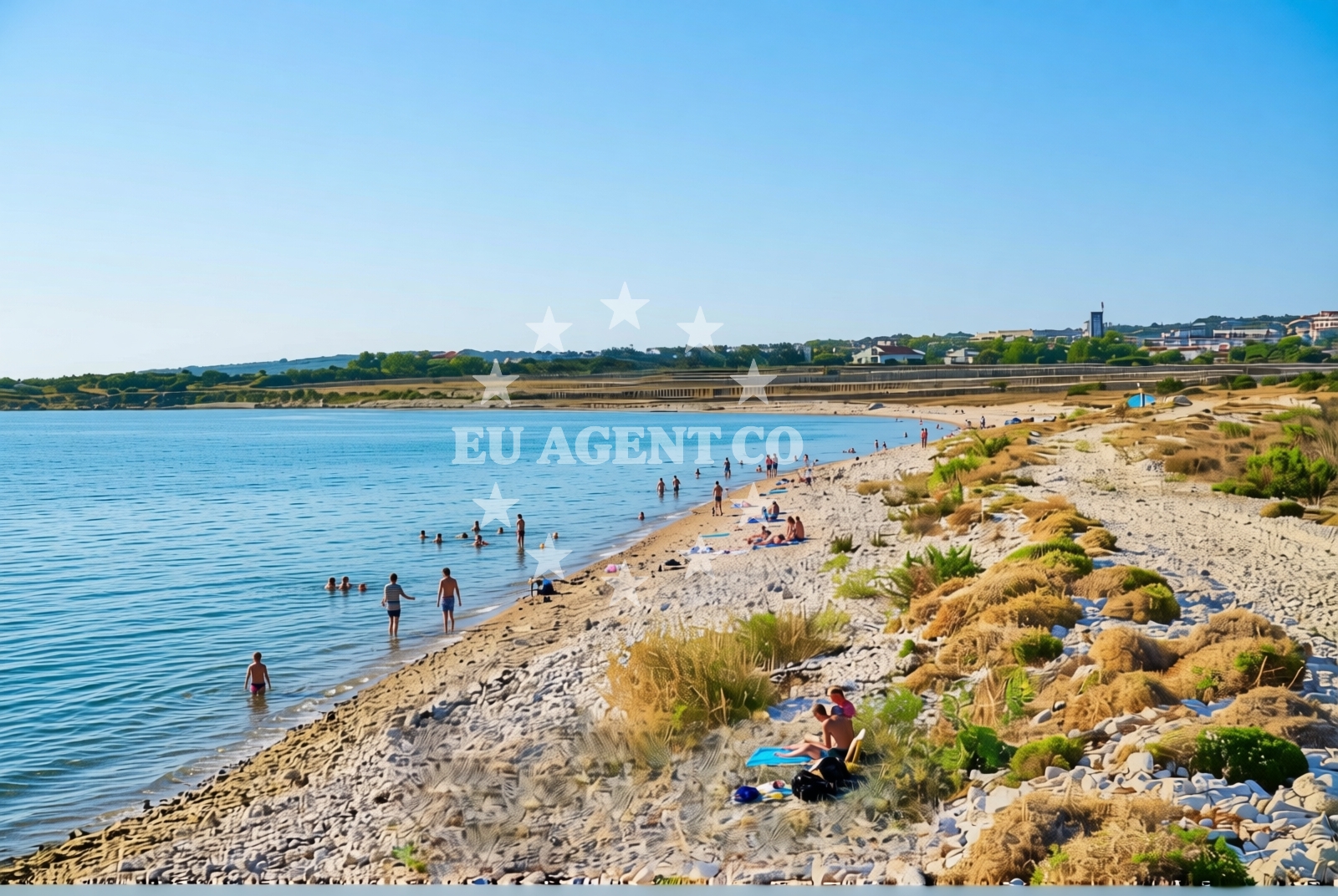
About this beach
Kolanjsko Blato sjever, Kolan (Pag)
Beach: Kolanjsko Blato sjever
Location: Kolan (Pag)
Characteristics and facilities
Gravel, rocks
750 m
Beach character
The beach’s surface is composed primarily of gravel and rocky outcrops, creating a rugged shoreline that contrasts with the more sheltered coves typical of Pag’s southern coast. The terrain here is less suited for sunbathing but offers opportunities for exploration, with tide pools and crevices that may reveal marine life. The beach’s northern exposure means it is often subject to stronger winds and waves, though the shallow waters near the shore create a dynamic environment for coastal geomorphology. Visitors should expect a more utilitarian experience compared to the island’s more developed beaches, with no formal amenities or structures along the shore.Swimming and shore
Swimming conditions at Kolanjsko Blato sjever are mixed. The shallow, gravelly shallows near the beach make it accessible for wading, but the rocky terrain and exposed position mean the water can be rougher than in more sheltered areas of Pag. The shore itself is a study in coastal erosion, with uneven surfaces and scattered boulders that make it unsuitable for sunbeds or umbrellas. However, the beach’s position offers panoramic views of the open sea, with the horizon unbroken by nearby islands or headlands. The lack of sand means it is less likely to be crowded, though the beach’s character may appeal more to those seeking solitude than to families with young children.Facilities and activities
There are no formal facilities at Kolanjsko Blato sjever, including parking, restrooms, or changing rooms. The beach’s remote nature means it is not served by regular transportation, though visitors arriving by car can park on the surrounding roads. The absence of infrastructure aligns with Pag’s broader trend of preserving its natural coastline, which has led to the island being designated a protected area in parts. Activities here are limited to passive observation of the landscape and coastal processes, though the beach’s proximity to Pag’s historic sites—such as the medieval town of Pag and the salt pans—offers opportunities for cultural exploration.Access and location
Kolanjsko Blato sjever is located on the northern coast of the island of Pag, approximately 15 kilometers northeast of the island’s main town. The beach is accessible by car via local roads that wind through the island’s interior, though the lack of signage may make it challenging for first-time visitors. Pag itself is a car-free island in parts, with ferries connecting to the mainland town of Zadar and other nearby islands. The beach’s position on the open coast means it is more exposed than Pag’s southern beaches, which are often sheltered by headlands and smaller islets.What to expect
Visitors to Kolanjsko Blato sjever should prepare for a beach experience that prioritizes natural character over comfort. The gravel and rock surface is not conducive to sunbathing, but the area offers a chance to observe the raw coastline of Pag. The beach’s northern orientation means it is often windy, though this also ensures it remains relatively uncrowded. The surrounding landscape includes salt pans and agricultural fields, reflecting Pag’s historical reliance on salt production. For those interested in the island’s heritage, the nearby town of Pag provides a contrast to the beach’s ruggedness, with its well-preserved medieval architecture and traditional way of life.Practical tips
Wear sturdy footwear to navigate the gravel and rocky terrain. Bring water and snacks, as there are no facilities for purchase. Arrive early to avoid the strongest winds, which can make the beach uncomfortable later in the day. The beach’s remoteness means it is best suited for visitors with a car, though local knowledge may be required to locate it.Exploring the coast by yacht
For sailors and yacht charter guests, the waters around Pag offer a mix of open sea and sheltered anchorages. The island’s northern coast, where Kolanjsko Blato sjever is located, is part of a broader sailing route that connects the Adriatic’s eastern islands. While the beach itself is not a marina or anchorage, the surrounding area includes several harbors and marinas that cater to motor yachts and sailboats. Charterers exploring the region may find the proximity to Pag’s historic sites and natural landscapes a compelling reason to include the area in their itinerary. For more information on available yachts and sailing routes, visit the Euro-Agent Yacht Search page.Historical Context of Pag Island
The island of Pag has a long history tied to salt production, with evidence of saltworks dating back to Roman times. The medieval town of Pag, a UNESCO-protected site, features fortified walls and a cathedral that reflect the island’s strategic importance. This historical legacy contrasts with the natural landscapes found along the northern coast, including Kolanjsko Blato sjever.
Anchorages in the surrounding area
Anchorages near Mandre and Novalja on Pag offer nearby options for mooring.
- Anchorage — mandre — pag — 0.5 NM from beach
- Anchorage — mandre — pag — 1.3 NM from beach
- Anchorage — mandre — pag — 1.4 NM from beach
- Anchorage — novalja — pag — 1.6 NM from beach
- Straško — novalja — pag — 1.8 NM from beach
- Anchorage — stara novalja — pag — 3.3 NM from beach
- Anchorage — novalja — pag — 3.4 NM from beach
- Anchorage — skrda — 3.5 NM from beach
Distances are straight-line geographic distances, not sailing routes.
Mooring buoys in the surrounding area
- Buoy field — novalja — pag — 2.6 NM from beach
- Jetty — zubovici — pag — 3.0 NM from beach
- Jetty — zubovici — pag — 3.2 NM from beach
- Jetty — simuni — pag — 4.5 NM from beach
- Drljanda — stara novalja — pag — 5.1 NM from beach
Distances are straight-line geographic distances, not sailing routes.
Marine fuel stations
- Ina — rab — 15.5 NM from beach
- Ina — mali losinj — 19.0 NM from beach
- Adria Oil — mali losinj — 19.4 NM from beach
- Tifon — nerezine — losinj — 23.6 NM from beach
Distances are straight-line geographic distances, not sailing routes.
Harbours in the surrounding area
- Novalja — pag — 2.4 NM from beach
- Žigljen — zigljen — pag — 4.0 NM from beach
- Stara Novalja — pag — 4.7 NM from beach
- Prizna — 5.5 NM from beach
- Karlobag — 7.0 NM from beach
- Pag — 7.7 NM from beach
Distances are straight-line geographic distances, not sailing routes.
Marinas in the surrounding area
- ACI Marina Šimuni — simuni — pag — 3.7 NM from beach
- ACI Marina Rab — 15.4 NM from beach
- ACI Marina Supetarska Draga — rab — 18.6 NM from beach
- Y/C Marina Mali Lošinj — mali losinj — 19.1 NM from beach
- Marina Lošinj — mali losinj — 19.4 NM from beach
Distances are straight-line geographic distances, not sailing routes.
Restaurants near the beach
Restaurants in Novalja offer dining options close to the beach.
- Margarita — novalja — pag — 1.8 NM from beach
- Restaurant — novalja — pag — 1.9 NM from beach
- Konoba Grill Matulo — novalja — pag — 2.0 NM from beach
- Restaurant — novalja — pag — 2.0 NM from beach
- Konoba Reful — novalja — pag — 2.0 NM from beach
- Restaurant — novalja — pag — 2.1 NM from beach
- La Tortilla — novalja — pag — 2.1 NM from beach
Distances are straight-line geographic distances, not sailing routes.
Navigation guides for the surrounding area
Navigation guides for Caska and Novalja assist in route planning around the area.
- Caska — 1.7 NM from beach
- Novalja — 2.2 NM from beach
- Uvala Prizna — 5.6 NM from beach
- Uvala Jakisnica — 9.0 NM from beach
- Luka Olib — 10.0 NM from beach
Distances are straight-line geographic distances, not sailing routes.
Yachts from nearby departure bases
Yachts departing from Novalja, Šimuni, and Pag provide options for charters near the beach.
Sailing yachts
- First 45 (Egeria) — Šimuni Kolan ACI Marina — 3.6 NM from departure base to beach
- Elan 35 Impression (Essi) — Mali Lošinj — 19.1 NM from departure base to beach
- First 31.7 (Ruta) — Mali Lošinj — 19.1 NM from departure base to beach
Motor yachts
- Absolute 50 Fly (Acrobat) — Rab ACI Marina — 15.4 NM from departure base to beach
Motor boats
- Balt 818 Titanium (Valentina) — Novalja — 2.4 NM from departure base to beach
- Balt 818 Titanium (Valentina 2) — Novalja — 2.4 NM from departure base to beach
- BWA Sport 22GT (BWA ) — Pag City Port — 7.8 NM from departure base to beach
- Merry Fisher 895 — Povljana Marina — 13.4 NM from departure base to beach
- Galeon Galia 700 — Mali Lošinj — 19.1 NM from departure base to beach
- Galeon Galia 630 (Kali) — Mali Lošinj — 19.1 NM from departure base to beach
Distances are straight-line geographic distances, not sailing routes.