Koceljevići sredina, Slano Beach, Croatia
About this beach
Koceljevići sredina, Slano
Beach: Koceljevići sredina
Location: Slano
Characteristics and facilities
Gravel, concrete / stone slabs
180 m
Natural shade
Beach character
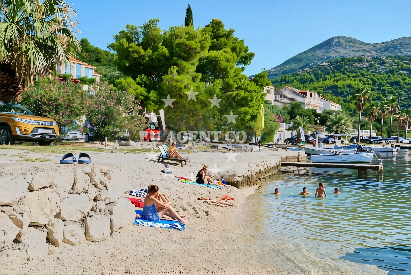
The beach's surface composition of gravel and stone slabs defines its character. While this may not appeal to all visitors, it creates a stable walking surface that contrasts with typical sandy or pebbled shores. The 180-meter length allows for a leisurely stroll along the water's edge, with the natural shade from nearby rock formations or vegetation providing intermittent relief from direct sunlight. This configuration suggests the beach may be more suited to those seeking a low-maintenance shoreline experience rather than a traditional sunbathing spot.Swimming and shore
The beach's gravel and stone composition may influence swimming conditions, though specific water depth or current information is not available. The shoreline's firm surface could make it easier for visitors to access the water from multiple points along the 180-meter stretch. The natural shade suggests the area may be used during midday hours when direct sunlight is strongest, though no official guidance on swimming safety or seasonal conditions is provided in the catalog.Facilities and activities
The beach lacks explicitly listed facilities or structured amenities. The gravel and stone surface suggests minimal infrastructure, with no mention of showers, toilets, or changing rooms. Activities are not formally cataloged, but the beach's characteristics could support walking, photography, or casual exploration of the shoreline. The absence of marked recreational facilities means visitors should plan accordingly for basic needs.Access and location
Situated in Slano, a coastal settlement on the Adriatic coast of Croatia, the beach is part of a region known for its maritime traditions and sailing opportunities. While specific access details like parking or road proximity are not documented, Slano's location suggests it is connected to regional road networks. The beach's coordinates (42.78635, 17.883554) place it near the broader Dalmatian coast, which is a popular sailing destination with multiple marinas and anchorages within reach.What to expect
Expect a shoreline defined by gravel and concrete/stone slabs, with a total length of 180 meters. The natural shade from surrounding terrain provides intermittent relief from sunlight. This beach appears to prioritize accessibility over traditional recreational amenities, making it a practical choice for visitors seeking a straightforward coastal experience. The lack of formal facilities means visitors should bring necessary provisions for comfort and hygiene.Practical tips
Consider bringing sturdy footwear for the gravel and stone surfaces. The natural shade can be a benefit during midday hours, but sun protection remains essential. The 180-meter length allows for a short walk along the shore, which could be combined with exploration of nearby Slano village or regional attractions.Exploring the coast by yacht
Slano's location on the Adriatic coast places it within a popular sailing region. Yacht charter guests may find the surrounding waters appealing for cruising, with multiple marinas and anchorages available in the area. While the beach itself is not marked as a formal anchorage, its proximity to the coast suggests it could be a convenient landing point for sailors exploring the region. For specific yacht charter options and availability, visitors are directed to Euro-Agent's Yacht Search page.Regional Context and Connectivity
Slano is part of the Split-Dalmatia County, a region with a rich maritime history and well-developed coastal infrastructure. The nearby town of Supetar, known for its marinas and yacht services, is within a short drive. The area's sailing routes connect to other Adriatic destinations, making it a logical stop for charter guests exploring the Croatian coast.Anchorages in the surrounding area
Anchorages near Koceljevići sredina, Slano Beach include Banici, Jakljan, and Sipanska Luka, offering nearby mooring options.
- Anchorage — banici — 1.6 NM from beach
- Šipanska Luka — sipanska luka — 3.5 NM from beach
- Anchorage — jakljan — 3.8 NM from beach
- Anchorage — jakljan — 3.8 NM from beach
- Anchorage — sipanska luka — 4.1 NM from beach
- Anchorage — brsecine — 4.7 NM from beach
- Anchorage — olipa — 5.0 NM from beach
- Anchorage — broce — 5.8 NM from beach
Distances are straight-line geographic distances, not sailing routes.
Mooring buoys in the surrounding area
- Jetty — slano — 0.3 NM from beach
- Quay — slano — 1.5 NM from beach
- Konoba Kod Marka Buoys — sipanska luka — 3.7 NM from beach
- Jetty — jakljan — 3.7 NM from beach
- Jetty — sipanska luka — 4.2 NM from beach
Distances are straight-line geographic distances, not sailing routes.
Marine fuel stations
Marine fuel stations in Dubrovnik and Mljet serve as refueling options for vessels traveling to the area.
- Ina — dubrovnik — 11.5 NM from beach
- Fuel station — sobra — mljet — 11.9 NM from beach
- Ina — dubrovnik — 12.7 NM from beach
- Fuel station — ploce — 25.4 NM from beach
Distances are straight-line geographic distances, not sailing routes.
Harbours in the surrounding area
- Slano — 0.2 NM from beach
- Šipan Harbour — sipanska luka — 3.6 NM from beach
- Doli — 4.1 NM from beach
- Suđurađ — sudurad — sipan — 4.7 NM from beach
- Trsteno — 6.1 NM from beach
- Lopud — 6.3 NM from beach
Distances are straight-line geographic distances, not sailing routes.
Marinas in the surrounding area
- ACI Marina Slano — 0.3 NM from beach
- Marina Frapa Dubrovnik — 11.6 NM from beach
- ACI Marina Dubrovnik — 12.7 NM from beach
Distances are straight-line geographic distances, not sailing routes.
Restaurants near the beach
Restaurants like Mirakul and Nono in Slano, along with options in Sipan, offer dining choices close to the beach.
- Mirakul — slano — 0.2 NM from beach
- Nono — slano — 0.3 NM from beach
- Restaurant — banici — 1.5 NM from beach
- Restaurant — sipanska luka — 3.6 NM from beach
- Kod Marka — sipanska luka — 3.7 NM from beach
- Tauris — sipanska luka — 3.7 NM from beach
- Bowa Restaurant — sipanska luka — 4.2 NM from beach
Distances are straight-line geographic distances, not sailing routes.
Navigation guides for the surrounding area
Navigation guides for areas such as Siano and Uvala Tiha assist in planning routes near the beach.
- Siano (Neprobic1 — 0.4 NM from beach
- Uvala Tiha — 2.3 NM from beach
- Luka (Sipanska Luka) — 2.8 NM from beach
- Doli — 3.9 NM from beach
- Uvala Lupeska — 5.2 NM from beach
Distances are straight-line geographic distances, not sailing routes.
Yachts from nearby departure bases
Sailing yachts
- Oceanis 45 (Soul) — Slano ACI Marina — 0.3 NM from departure base to beach
- Elan 45 Impression (Skyfall) — Slano ACI Marina — 0.3 NM from departure base to beach
- Elan 50 Impression (Timeless) — Slano ACI Marina — 0.3 NM from departure base to beach
- Oceanis 45 (Mambo 1) — Slano ACI Marina — 0.3 NM from departure base to beach
- Oceanis 45 (Cancan) — Slano ACI Marina — 0.3 NM from departure base to beach
Catamarans
- Lagoon 40 (SAILOR MOON) — Slano ACI Marina — 0.3 NM from departure base to beach
- Lagoon 42 (ALMA SOFIA) — Slano ACI Marina — 0.3 NM from departure base to beach
- Lagoon 42 (MALA KATE I) — Slano ACI Marina — 0.3 NM from departure base to beach
- MY 37 (Jam) — Slano ACI Marina — 0.3 NM from departure base to beach
- Lagoon 40 (SUNLIGHT) — Slano ACI Marina — 0.3 NM from departure base to beach
Distances are straight-line geographic distances, not sailing routes.