Koceljevići istok, Slano Beach, Croatia
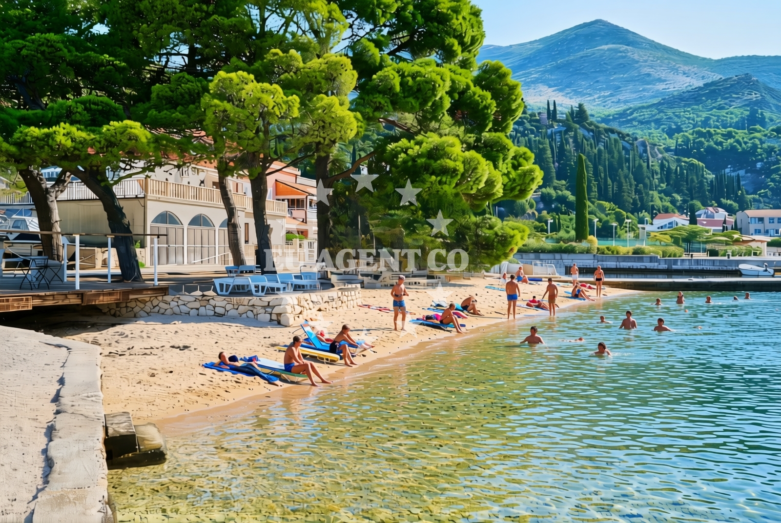
About this beach
Koceljevići istok, Slano
Beach: Koceljevići istok
Location: Slano
Characteristics and facilities
Gravel, concrete / stone slabs
150 m
Caffe bar / Drinks stand
Natural shade
shower
Changing cabin
Beach character
The beach's surface is composed of gravel and concrete/stone slabs, a characteristic that reflects its utilitarian design and integration with the surrounding landscape. This type of shoreline is typical of areas where natural sand is limited, and the terrain has been shaped by coastal erosion and human development. The beach’s modest length of 150 meters makes it a compact destination, ideal for those looking to enjoy a quiet stretch of coastline without the crowds of larger, more tourist-oriented beaches.Swimming and shore
Swimming conditions at Koceljevići istok are influenced by its rocky and gravelly shoreline. While the beach is not known for calm, sheltered waters, its proximity to the open sea means visitors may encounter variable wave action depending on the season and weather. The shore itself is accessible via a straightforward path, with no reported obstacles or steep inclines. The gravel and concrete surfaces provide stable footing, though they may be less comfortable for prolonged sunbathing compared to sandy alternatives.Facilities and activities
The beach is equipped with a caffe bar, offering basic refreshments for visitors. Natural shade is available, likely provided by nearby vegetation or structures, though the exact source is not specified. A shower and changing cabin are present, catering to those who wish to freshen up after swimming or exploring the surrounding area. No additional facilities such as toilets, parking, or umbrellas are mentioned in the official records, so visitors should plan accordingly.Access and location
Koceljevići istok, Slano Beach is located in the Slano peninsula, a region that sits between the towns of Supetar and Bol on the island of Brač. The beach’s coordinates (42.787601, 17.885271) place it near the eastern edge of the peninsula, where the coastline transitions from rocky to more open sea. The area is accessible by road, with nearby settlements offering basic services and accommodations. For those arriving by sea, the beach’s proximity to the open Adriatic makes it a potential stop for sailors exploring the Brač coast.What to expect
Visitors to Koceljevići istok, Slano Beach should expect a straightforward coastal experience centered on its gravel and concrete shoreline. The beach is well-suited for those seeking basic amenities such as a caffe bar, showers, and changing cabins, though it lacks the extensive facilities found at more developed resorts. The 150-meter length offers a quiet stretch of coastline, ideal for a short swim or a walk along the shore. The natural shade available provides some relief from the sun, though visitors may need to bring their own towels and sunscreen, as no additional comfort items are listed in the beach’s records.Practical tips
Given the beach’s gravel and concrete surface, visitors may want to wear sturdy footwear for walking along the shore. The caffe bar is a convenient spot for refreshments, but those seeking more extensive amenities should consider nearby settlements like Slano or Supetar. Due to the beach’s modest size, arriving early in the day may help avoid crowds, particularly during peak summer months.Exploring the coast by yacht
For sailors and yacht charter guests, the Slano peninsula offers a strategic vantage point along the Brač coast. The area is part of a broader sailing route that connects the islands of Brač, Hvar, and Šolta, with nearby marinas in Supetar and Bol providing docking options. While Koceljevići istok itself is not marked as an anchorage, its proximity to the open sea and the surrounding coastline make it a potential waypoint for those exploring the Adriatic’s eastern shores. Charter guests may find the beach useful as a brief stop for a swim or to enjoy the views of the nearby islands.Regional Context and Nearby Settlements
The Slano peninsula is a lesser-known but historically significant area of Brač, characterized by its rugged terrain and small fishing communities. Nearby, the town of Slano offers basic amenities, while the more developed resort of Supetar provides a range of services, including restaurants, shops, and marinas. The peninsula’s coastline is marked by a series of small bays and inlets, many of which are accessible by boat or on foot. For visitors interested in exploring the region further, the nearby village of Vela Luka on the island of Hvar is a popular destination, though it lies further along the coast.
Anchorages in the surrounding area
Anchorages in the surrounding area include Banici, Sipanska Luka, and Jakljan.
- Anchorage — banici — 1.6 NM from beach
- Šipanska Luka — sipanska luka — 3.6 NM from beach
- Anchorage — jakljan — 3.9 NM from beach
- Anchorage — jakljan — 3.9 NM from beach
- Anchorage — sipanska luka — 4.2 NM from beach
- Anchorage — brsecine — 4.7 NM from beach
- Anchorage — olipa — 5.0 NM from beach
- Anchorage — broce — 5.9 NM from beach
Distances are straight-line geographic distances, not sailing routes.
Mooring buoys in the surrounding area
Mooring buoys in the surrounding area include Slano Jetty, Slano Quay, and Konoba Kod Marka Buoys in Sipanska Luka.
- Jetty — slano — 0.4 NM from beach
- Quay — slano — 1.6 NM from beach
- Konoba Kod Marka Buoys — sipanska luka — 3.8 NM from beach
- Jetty — jakljan — 3.8 NM from beach
- Jetty — sipanska luka — 4.2 NM from beach
Distances are straight-line geographic distances, not sailing routes.
Marine fuel stations
- Ina — dubrovnik — 11.5 NM from beach
- Fuel station — sobra — mljet — 12.0 NM from beach
- Ina — dubrovnik — 12.7 NM from beach
- Fuel station — ploce — 25.4 NM from beach
Distances are straight-line geographic distances, not sailing routes.
Harbours in the surrounding area
Harbours in the surrounding area include Slano, Sipan Harbour, and Doli.
- Slano — 0.2 NM from beach
- Šipan Harbour — sipanska luka — 3.7 NM from beach
- Doli — 4.2 NM from beach
- Suđurađ — sudurad — sipan — 4.8 NM from beach
- Trsteno — 6.1 NM from beach
- Lopud — 6.3 NM from beach
Distances are straight-line geographic distances, not sailing routes.
Marinas in the surrounding area
Marinas in the surrounding area include ACI Marina Slano and Marina Frapa Dubrovnik.
- ACI Marina Slano — 0.3 NM from beach
- Marina Frapa Dubrovnik — 11.6 NM from beach
- ACI Marina Dubrovnik — 12.7 NM from beach
Distances are straight-line geographic distances, not sailing routes.
Restaurants near the beach
Restaurants near the beach include Mirakul, Nono, and Konoba Kod Marka in Sipanska Luka.
- Mirakul — slano — 0.4 NM from beach
- Nono — slano — 0.4 NM from beach
- Restaurant — banici — 1.6 NM from beach
- Restaurant — sipanska luka — 3.7 NM from beach
- Kod Marka — sipanska luka — 3.8 NM from beach
- Tauris — sipanska luka — 3.8 NM from beach
- Bowa Restaurant — sipanska luka — 4.2 NM from beach
Distances are straight-line geographic distances, not sailing routes.
Navigation guides for the surrounding area
Navigation guides for the surrounding area include Siano, Uvala Tiha, and Luka in Sipanska Luka.
- Siano (Neprobic1 — 0.4 NM from beach
- Uvala Tiha — 2.5 NM from beach
- Luka (Sipanska Luka) — 2.9 NM from beach
- Doli — 3.9 NM from beach
- Uvala Lupeska — 5.3 NM from beach
Distances are straight-line geographic distances, not sailing routes.
Yachts from nearby departure bases
Yachts departing from nearby bases include sail boats and catamarans based at Slano ACI Marina.
Sailing yachts
- Elan 45 Impression (Skyfall) — Slano ACI Marina — 0.3 NM from departure base to beach
- Oceanis 45 (Mambo 1) — Slano ACI Marina — 0.3 NM from departure base to beach
- Elan 50 Impression (Timeless) — Slano ACI Marina — 0.3 NM from departure base to beach
- Oceanis 45 (Soul) — Slano ACI Marina — 0.3 NM from departure base to beach
- Oceanis 45 (Cancan) — Slano ACI Marina — 0.3 NM from departure base to beach
Catamarans
- Lagoon 42 (HAPPY KEY) — Slano ACI Marina — 0.3 NM from departure base to beach
- Lagoon 42 (ALMA SOFIA) — Slano ACI Marina — 0.3 NM from departure base to beach
- Lagoon 450 Flybridge (MALA MARE) — Slano ACI Marina — 0.3 NM from departure base to beach
- Lagoon 40 (SAILOR MOON) — Slano ACI Marina — 0.3 NM from departure base to beach
- Lagoon 42 (MALA KATE I) — Slano ACI Marina — 0.3 NM from departure base to beach
Distances are straight-line geographic distances, not sailing routes.