Kljušna, Zastražišće (Hvar) Beach, Croatia
Kljušna Beach, located in Zastražišće on the island of Hvar, presents a distinctive shoreline characterized by gravel, concrete slabs, and rocky formations. Situated along the southern Adriatic coast, this beach is part of a region renowned for its medieval architecture, vineyards, and proximity to the Hvar Town marina, a key hub for yacht charter operations in the area.
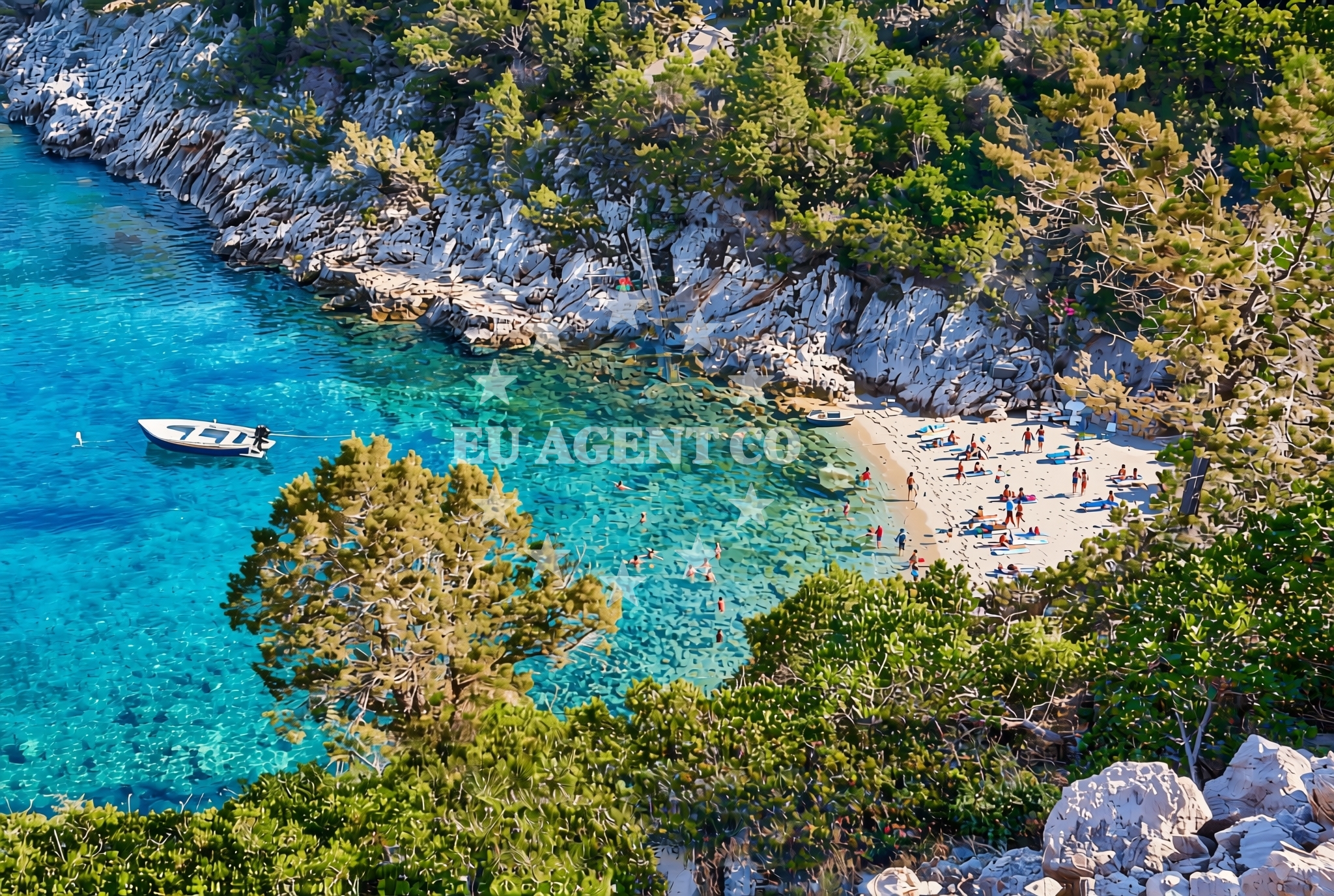
About this beach
Kljušna, Zastražišće (Hvar)
Beach: Kljušna
Location: Zastražišće (Hvar)
Characteristics and facilities
Gravel, concrete / stone slabs, rocks
Beach character
The beach's surface consists primarily of gravel, concrete slabs, and natural rock formations, creating a rugged yet accessible shoreline. This texture contrasts with the soft sands of other Hvar beaches, offering a unique tactile experience for visitors. The absence of traditional sandy beaches means this location is better suited for those seeking a more rugged coastal environment, though the rocky terrain provides natural seating opportunities during low tide.
Swimming and shore
Swimming conditions at Kljušna are influenced by the surrounding rocky outcrops, which can create sheltered pockets of calmer water during certain tides. The shoreline's steep gradient means direct access to the water is limited to specific points where the rocks are less densely packed. While not ideal for swimming due to the uneven terrain, the beach serves as a vantage point for observing marine life in the shallows, particularly during early morning hours when visibility is highest.
Facilities and activities
No formal facilities are present at Kljušna Beach, consistent with its status as a natural shoreline. The lack of amenities such as showers, restrooms, or shaded seating aligns with the beach's unmodified character. However, the nearby village of Zastražišće offers basic services including local taverns and small-scale agricultural produce sales, reflecting the region's agrarian heritage. The beach's rocky nature makes it unsuitable for water sports equipment rental, though it provides an excellent spot for rock climbing and photography of the island's geological features.
Access and location
Access to Kljušna Beach is via a narrow road connecting Zastražišće to the main Hvar-Trogir road network. The beach lies approximately 12 kilometers northeast of Hvar Town, placing it within easy reach of the island's primary marina and cultural attractions. The surrounding area is marked by terraced vineyards and olive groves, characteristic of Hvar's agricultural landscape. The nearest public transportation stop is the Zastražišće village center, with seasonal bus services linking to Hvar Town and Split.
What to expect
Visitors should expect a rugged shoreline with gravel, concrete slabs, and exposed rock formations. The beach lacks traditional amenities but offers panoramic views of the Hvar coast and the Adriatic Sea. The rocky terrain is best navigated with sturdy footwear, and access to the water is limited to specific points. The surrounding area provides opportunities to explore local vineyards and historic sites, with the nearest village offering basic services. Due to the beach's character, it is recommended for visitors seeking a more authentic, less commercialized coastal experience.
Practical tips
Bring comfortable shoes to navigate the rocky terrain effectively. Sun protection is essential given the exposed nature of the beach. The nearest freshwater source is in Zastražišće village, approximately 800 meters inland. Visitors should be mindful of tide times, as the beach's accessibility to the water varies significantly with the lunar cycle.
Exploring the coast by yacht
For yacht charter guests, Kljušna Beach's proximity to Hvar Town (approximately 12 kilometers) makes it a convenient anchorage point for those exploring the southern Adriatic. The Hvar Town marina, a major yacht charter hub, is within a 20-minute drive, offering access to a range of sailing routes along the Dalmatian coast. The surrounding waters are known for their clear visibility and moderate currents, making them suitable for both motor and sailboat excursions. Nearby anchorages include the sheltered bays of Vela Luka and Stari Grad, which are frequently used by charter vessels.
Historical Context of Zastražišće
The village of Zastražišće, from which the beach derives its name, has historical ties to the Venetian Republic, evidenced by the remains of defensive structures in the area. The name 'Kljušna' is believed to originate from the Croatian word for 'keyhole,' referencing the beach's narrow entrance to the sea. This historical context adds depth to the visit, connecting the natural landscape with the region's medieval past.
Anchorages in the surrounding area
- Anchorage — pokrivenik — hvar — 0.5 NM from beach
- Anchorage — pokrivenik — hvar — 1.0 NM from beach
- Anchorage — pokrivenik — hvar — 1.1 NM from beach
- Anchorage — velika stiniva — hvar — 2.2 NM from beach
- Anchorage — hvar — 2.5 NM from beach
- Anchorage — dugi dolac — hvar — 2.8 NM from beach
- Anchorage — dugi dolac — hvar — 2.9 NM from beach
- Anchorage — dugi dolac — hvar — 3.1 NM from beach
Distances are straight-line geographic distances, not sailing routes.
Mooring buoys in the surrounding area
Mooring buoys and jetties including Restaurant Preza quay in Pokrivenik.
- Restaurant Preza quay — pokrivenik — hvar — 1.1 NM from beach
- Jetty — velika stiniva — hvar — 2.2 NM from beach
- Quay — hvar — 3.6 NM from beach
- Quay — bogomolje — hvar — 6.7 NM from beach
- Jetty — zavala — hvar — 7.5 NM from beach
Distances are straight-line geographic distances, not sailing routes.
Marine fuel stations
Marine fuel stations on Brac and Makarska islands.
- Fuel station — sumartin — brac — 7.9 NM from beach
- Ina — vrboska — hvar — 8.4 NM from beach
- Ina — makarska — 10.7 NM from beach
- Fuel station — bol — brac — 11.1 NM from beach
Distances are straight-line geographic distances, not sailing routes.
Harbours in the surrounding area
Harbours in Hvar, Brac, and Makarska regions.
- Port Jelsa — hvar — 7.4 NM from beach
- Sumartin — brac — 7.8 NM from beach
- Vrboska — hvar — 8.5 NM from beach
- Podgora — 10.5 NM from beach
- Lovište — loviste — 10.6 NM from beach
- Makarska — 10.7 NM from beach
Distances are straight-line geographic distances, not sailing routes.
Marinas in the surrounding area
Marinas in Vrboska, Tucepi, and Baska Voda.
- ACI Marina Vrboska — hvar — 8.4 NM from beach
- Marina Tučepi — marina tucepi — 10.7 NM from beach
- Marina Ramova — krvavica — 11.3 NM from beach
- Marina Baška Voda — marina baska voda — 12.7 NM from beach
- Marina Korkyra — vela luka — korcula — 13.5 NM from beach
Distances are straight-line geographic distances, not sailing routes.
Restaurants near the beach
- Restaurant Timun — pokrivenik — hvar — 1.1 NM from beach
- Pakomina — hvar — 3.6 NM from beach
- Konoba Humac — hvar — 4.7 NM from beach
Distances are straight-line geographic distances, not sailing routes.
Navigation guides for the surrounding area
Navigation guides for Uvala Pokrivenik and surrounding waters.
- Uvala Pokrivenik — 1.2 NM from beach
- Uvala Studena — 7.0 NM from beach
- Jelsa — 7.2 NM from beach
- Zavala (Pitavska Plaza) — 7.5 NM from beach
- Otocic Zecevo — 7.5 NM from beach
Distances are straight-line geographic distances, not sailing routes.
Yachts from nearby departure bases
Yachts departing from Makarska and Baška Voda ports.
Sailing yachts
- Bavaria 40 Cruiser (LADY BUTTERFLY) — Tučepi Port — 10.7 NM from departure base to beach
- Elan 50 Impression (FINES DE CLAIRES) — Baška Voda — 12.7 NM from departure base to beach
- Bavaria 50 (NINA AC) — Baška Voda — 12.7 NM from departure base to beach
Catamarans
- Lagoon 450 (LAMANTIN) — Baška Voda — 12.7 NM from departure base to beach
Motor yachts
- Princess V53 (Chablis) — Makarska Port — 10.6 NM from departure base to beach
- Canados 86 (Karisma) — Baška Voda — 12.7 NM from departure base to beach
Motor boats
- Jeanneau NC 37 (Black Pearl) — Makarska Port — 10.6 NM from departure base to beach
- Galeon 430 Skydeck (BELLAGIO) — Makarska Port — 10.6 NM from departure base to beach
- Jeanneau NC 37 (Black Pearl) — Makarska Port — 10.6 NM from departure base to beach
- Galeon 430 Skydeck (Bellagio) — Makarska Port — 10.6 NM from departure base to beach
Distances are straight-line geographic distances, not sailing routes.