Katarina's Beach, Croatia
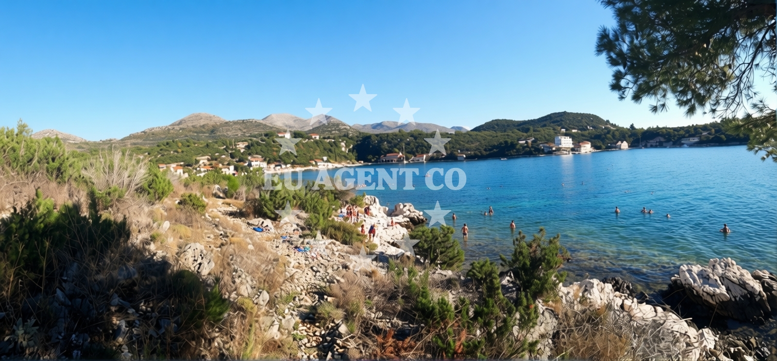
Beach character
The beach's defining feature is its pebbled surface, composed of small beige stones that cover most of the shoreline. This contrasts with the nearby mountainous terrain, which frames the cove and contributes to the area's dramatic coastal scenery. The sea floor is similarly pebbled, with depth increasing gradually from the shore. While the beach lacks formal amenities, its natural setting and good cleanliness rating make it a suitable destination for visitors prioritizing tranquility over commercial facilities.Swimming and shore
Swimming conditions at Katarina's Beach are shaped by the pebbled seabed and moderate depth progression. The gradual increase in depth allows for safe wading, though the pebbles may make prolonged standing uncomfortable. The beach's orientation as a cove offers some natural shelter, though wind patterns from the surrounding mountains can influence surface conditions. The absence of artificial structures means visitors should bring their own equipment for water activities.Facilities and activities
No formal facilities or structured activities are listed for Katarina's Beach. The beach's character is defined by its natural features rather than commercial offerings. Visitors are advised to bring personal items such as towels, sunscreen, and water. The lack of amenities aligns with its designation as a leisure-focused destination, emphasizing unspoiled natural access over tourist infrastructure.Access and location
Katarina's Beach is situated in Banići, a small settlement on the Adriatic coast of Croatia. The area is part of a broader region known for its rugged coastline and traditional maritime culture. While specific transportation details are not cataloged, the beach's proximity to the main road network suggests accessibility by car. For those exploring by sea, the broader Adriatic sailing routes pass near this part of the coast, though no specific anchorages or marinas are mentioned in the immediate vicinity.What to expect
Visitors to Katarina's Beach should expect a secluded, natural environment with minimal infrastructure. The beach's pebbled shoreline and mountainous surroundings create a distinct atmosphere compared to more developed coastal areas. The moderate crowd index during high season indicates it is neither overly busy nor completely isolated. The beach's suitability for leisure seekers suggests it is well-suited for quiet relaxation, though its lack of amenities requires self-sufficiency.Practical tips
Given the pebbled shoreline, visitors may want to bring water shoes for comfort. The beach's natural setting means shade is limited, so sun protection is essential. While no formal parking or entry fees are documented, visitors should be mindful of local regulations regarding beach access. The beach's orientation as a cove may offer sheltered conditions during certain weather patterns, but wind from the surrounding mountains can affect surface conditions.Exploring the coast by yacht
The Adriatic coast near Banići is part of a region with established sailing routes, though specific marinas or anchorages are not detailed in the immediate vicinity of Katarina's Beach. Yacht charter guests exploring this area may find opportunities to anchor in nearby bays or use marinas in larger nearby settlements. The beach's location provides a potential stop for those sailing along the coast, though its lack of formal docking facilities means it is not a primary anchorage point.Regional Context
Banići is a small coastal village in Croatia's Dalmatian region, known for its traditional architecture and proximity to historic sites. The area's rugged coastline and clear waters are characteristic of the broader Adriatic landscape. While Katarina's Beach itself is modest in scale, the surrounding region offers opportunities for both land and sea exploration, including nearby villages, hiking trails, and cultural landmarks.Anchorages in the surrounding area
Nearby anchorages include Banici and Jakljan, with options extending to Sipan and Broce.
- Anchorage — banici — 0.1 NM from beach
- Anchorage — jakljan — 3.5 NM from beach
- Anchorage — jakljan — 3.5 NM from beach
- Anchorage — olipa — 3.8 NM from beach
- Šipanska Luka — sipanska luka — 3.8 NM from beach
- Anchorage — broce — 4.4 NM from beach
- Anchorage — broce — 4.8 NM from beach
- Anchorage — broce — 4.8 NM from beach
Distances are straight-line geographic distances, not sailing routes.
Mooring buoys in the surrounding area
- Quay — slano — 0.0 NM from beach
- Jetty — slano — 1.4 NM from beach
- Jetty — jakljan — 3.5 NM from beach
- Konoba Kod Marka Buoys — sipanska luka — 4.0 NM from beach
- Konoba Nico jetty — kobas — 4.7 NM from beach
Distances are straight-line geographic distances, not sailing routes.
Marine fuel stations
Fuel stations are located in Mljet and Dubrovnik, with further options in Ploce.
- Fuel station — sobra — mljet — 10.6 NM from beach
- Ina — dubrovnik — 13.0 NM from beach
- Ina — dubrovnik — 14.2 NM from beach
- Fuel station — ploce — 23.9 NM from beach
Distances are straight-line geographic distances, not sailing routes.
Harbours in the surrounding area
Harbors in Slano, Doli, and Sipan provide proximity to the beach, with additional options in Ston and Mali Ston.
- Slano — 1.8 NM from beach
- Doli — 2.6 NM from beach
- Šipan Harbour — sipanska luka — 4.0 NM from beach
- Suđurađ — sudurad — sipan — 5.7 NM from beach
- Ston — 7.1 NM from beach
- Mali Ston — 7.2 NM from beach
Distances are straight-line geographic distances, not sailing routes.
Marinas in the surrounding area
Marinas at Slano ACI Marina and Dubrovnik offer departure points near the beach.
- ACI Marina Slano — 1.8 NM from beach
- Marina Frapa Dubrovnik — 13.1 NM from beach
- ACI Marina Dubrovnik — 14.2 NM from beach
Distances are straight-line geographic distances, not sailing routes.
Restaurants near the beach
Restaurants in Banici and Slano are close to the beach, with additional options in Sipan and Kobas.
- Restaurant — banici — 0.1 NM from beach
- Nono — slano — 1.4 NM from beach
- Mirakul — slano — 1.4 NM from beach
- Restaurant — sipanska luka — 4.0 NM from beach
- Kod Marka — sipanska luka — 4.1 NM from beach
- Tauris — sipanska luka — 4.1 NM from beach
- Nico — kobas — 4.8 NM from beach
Distances are straight-line geographic distances, not sailing routes.
Navigation guides for the surrounding area
Navigation guides cover areas like Siano, Doli, and Uvala Tiha near the beach.
- Siano (Neprobic1 — 2.0 NM from beach
- Doli — 2.3 NM from beach
- Uvala Tiha — 2.4 NM from beach
- Luka (Sipanska Luka) — 2.5 NM from beach
- Uvala Lupeska — 3.9 NM from beach
Distances are straight-line geographic distances, not sailing routes.
Yachts from nearby departure bases
Sailing yachts
- Elan 50 Impression (Timeless) — Slano ACI Marina — 1.8 NM from departure base to beach
- Oceanis 45 (Cancan) — Slano ACI Marina — 1.8 NM from departure base to beach
- Elan 45 Impression (Skyfall) — Slano ACI Marina — 1.8 NM from departure base to beach
- Oceanis 45 (Mambo 1) — Slano ACI Marina — 1.8 NM from departure base to beach
- Oceanis 45 (Soul) — Slano ACI Marina — 1.8 NM from departure base to beach
Catamarans
- Lagoon 42 (ALMA SOFIA) — Slano ACI Marina — 1.8 NM from departure base to beach
- MY 37 (Jam) — Slano ACI Marina — 1.8 NM from departure base to beach
- Lagoon 42 (MALA KATE I) — Slano ACI Marina — 1.8 NM from departure base to beach
- Lagoon 50 (TWIN JOY) — Slano ACI Marina — 1.8 NM from departure base to beach
- Lagoon 42 (MALA KATE I) — Slano ACI Marina — 1.8 NM from departure base to beach
Distances are straight-line geographic distances, not sailing routes.