Karin Slana, Gornji Karin Beach, Croatia
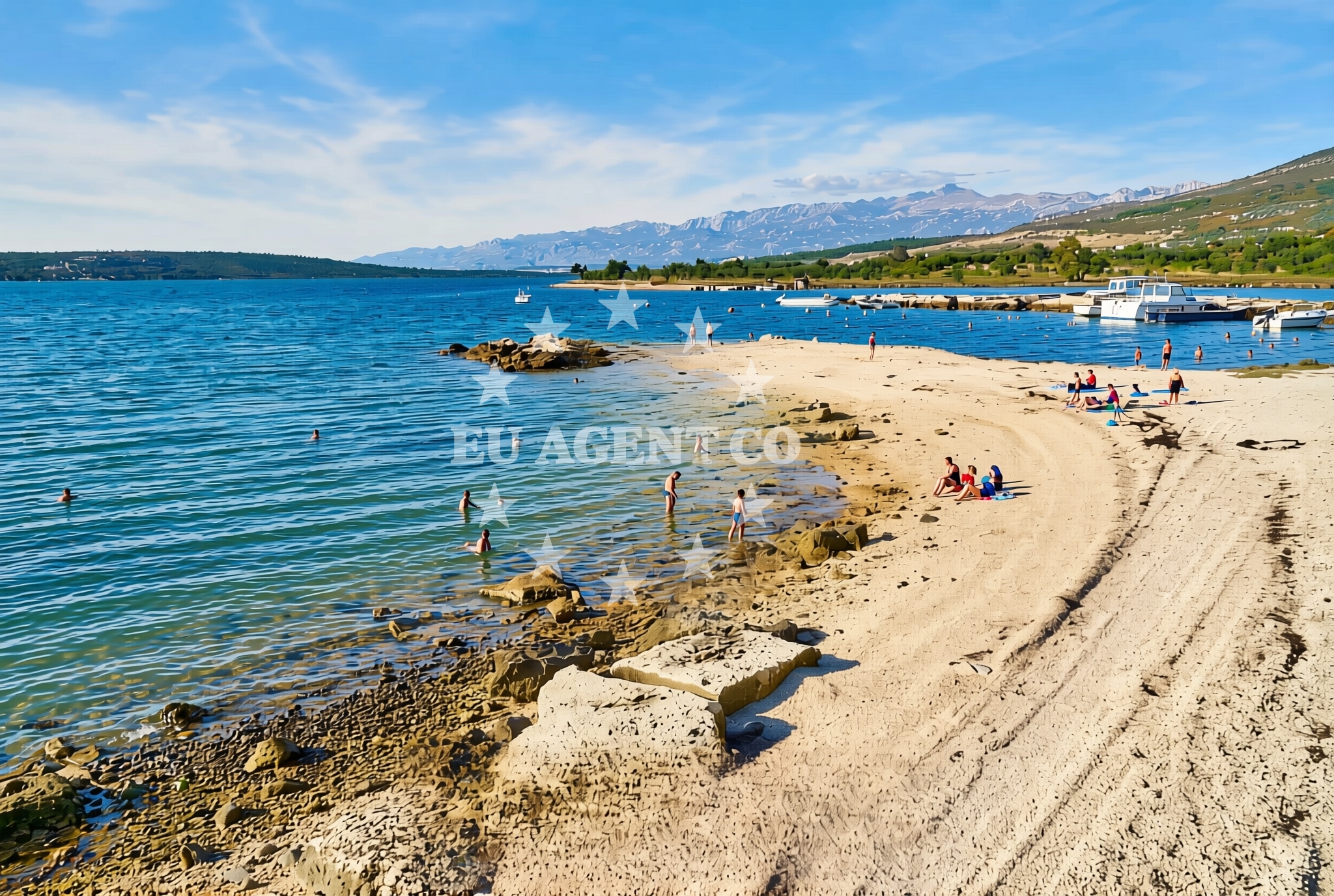
About this beach
Karin Slana, Gornji Karin
Beach: Karin Slana
Location: Gornji Karin
Characteristics and facilities
Gravel
100 m
Beach character
The beach's gravel composition sets it apart from more conventional sandy beaches, creating a textured surface that may be more suitable for walking or exploration than swimming. While the specific conditions of the gravel—such as size or firmness—are not detailed in the catalog, this type of shoreline is often found in areas with rocky coastlines or where wave action shapes the terrain. The 100-meter length provides a modest but accessible stretch for visitors to enjoy, though the absence of detailed natural features in the catalog means further insights into the beach's topography or surrounding ecosystems would require local knowledge.Swimming and shore
Given the gravel composition, swimming may not be the primary activity here. The beach’s shoreline is more likely suited for leisurely walks or photography, with the gravel offering a stable surface for exploration. The absence of structured amenities or facilities in the catalog suggests that visitors should prepare for a more rustic experience, focusing on the natural character of the beach rather than recreational infrastructure.Facilities and activities
The beach does not list specific facilities in its authoritative features, indicating that amenities such as showers, toilets, or parking may not be present. However, the surrounding area of Gornji Karin may offer nearby services or accommodations, though these would need to be confirmed through local resources. Activities associated with the beach are not explicitly mentioned, but the region’s coastal context implies opportunities for hiking, cycling, or exploring nearby settlements.Access and location
Karin Slana, Gornji Karin Beach is located in the Karin Slana area of Croatia, a region that blends coastal landscapes with inland terrain. While specific access routes are not detailed in the catalog, the beach’s proximity to Gornji Karin suggests it may be reachable via local roads or trails. Visitors are encouraged to consult maps or local guides for the most accurate navigation details, as the beach’s exact accessibility conditions are not specified.What to expect
Visitors to Karin Slana, Gornji Karin Beach should expect a gravel shoreline that contrasts with typical sandy beaches. The 100-meter length offers a modest but distinct coastal experience, ideal for those interested in exploring a less conventional shoreline. While the beach lacks detailed facility listings, its location in Croatia’s Adriatic region connects it to broader opportunities for maritime exploration, including yacht charters and coastal excursions.Practical tips
Given the gravel surface, visitors may wish to wear sturdy footwear for comfort. The beach’s rustic nature means amenities are likely minimal, so bringing personal items such as water or snacks is advisable. Those interested in nearby activities should research local options, as the beach itself does not list structured recreational opportunities.Exploring the coast by yacht
Karin Slana’s location in Croatia places it within a region renowned for its sailing opportunities. The Adriatic Sea, with its clear waters and scenic coastlines, is a popular destination for yacht charters, and Euro-Agent offers access to a range of motor and sailing yachts in the area. While the beach itself is not explicitly marked as an anchorage or marina, its proximity to the coast may provide a scenic vantage point for sailors exploring the region. For those combining beach visits with yacht travel, nearby ports and marinas in the Istrian Peninsula or along the Croatian coast could serve as convenient bases for exploration.Regional Context and Nearby Settlements
The Karin Slana area is part of the Istrian Peninsula, a region in Croatia known for its historical significance, vineyards, and coastal charm. Nearby towns such as Rovinj and Umag offer cultural attractions, dining, and access to other beaches. Visitors to Karin Slana may find it rewarding to explore these settlements, which are often reachable via short drives or cycling routes.Anchorages in the surrounding area
Anchorages near Karin Slana include Karin dock and nearby anchorage areas in Karin and Novigrad.
- Karin dock — 0.1 NM from beach
- Anchorage — karin — 0.4 NM from beach
- Anchorage — novigrad — 3.1 NM from beach
- Anchorage — maslenica — 4.9 NM from beach
- Anchorage — vinjerac — 10.2 NM from beach
- Sv. Katarina — sv katarina — sveta katarina — 15.0 NM from beach
Distances are straight-line geographic distances, not sailing routes.
Mooring buoys in the surrounding area
Mooring buoys in the surrounding area extend to Crvena Luka jetty and buoy fields in Sukosan.
- Crvena Luka jetty — 14.8 NM from beach
- Buoy field — sukosan — 14.9 NM from beach
- Buoy field — sukosan — 15.0 NM from beach
Distances are straight-line geographic distances, not sailing routes.
Marine fuel stations
- Ina — biograd na moru — 14.5 NM from beach
- Fuel station — sukosan — 15.2 NM from beach
- Ina — zadar — 17.3 NM from beach
- Flash — murter — 18.8 NM from beach
Distances are straight-line geographic distances, not sailing routes.
Harbours in the surrounding area
Harbours in the vicinity include Obrovac, Maslenica, and Vinjerac in North Dalmatia.
- Obrovac — 4.5 NM from beach
- Maslenica — 6.3 NM from beach
- Vinjerac — 10.2 NM from beach
- Seline — 10.7 NM from beach
- Starigrad Paklenica — 12.5 NM from beach
- Sv. Filip and Jakov — sv filip and jakov — sveti filip i jakov — 13.8 NM from beach
Distances are straight-line geographic distances, not sailing routes.
Marinas in the surrounding area
Marinas near Karin Slana include Dry dock marina Biograd and Marina Kornati in Biograd na Moru.
- Dry dock marina Biograd — biograd na moru — 13.3 NM from beach
- Molum Marine Club — sveti filip i jakov — 13.8 NM from beach
- Marina Kornati — biograd na moru — 14.3 NM from beach
- Marina Šangulin — marina sangulin — biograd na moru — 14.3 NM from beach
- Marina Dalmacija — sukosan — 15.0 NM from beach
Distances are straight-line geographic distances, not sailing routes.
Navigation guides for the surrounding area
Navigation guides cover areas such as Posedarje, Starigrad-Paklenica, and Turanj in North Dalmatia.
- Posedarje (Novigradsko More) — 7.7 NM from beach
- Starigrad-Paklenica {Velebitski Kanai) — 12.3 NM from beach
- Filip Jakov — 13.7 NM from beach
- Turanj — 13.9 NM from beach
- Pakostane — 14.7 NM from beach
Distances are straight-line geographic distances, not sailing routes.
Yachts from nearby departure bases
Yachts depart from nearby bases in Novigrad Dalmatia and Biograd Marina Kornati.
Sailing yachts
- Bavaria Cruiser 34 (Aria ) — Biograd Marina Kornati — 14.3 NM from departure base to beach
- Elan 350 (X-Ray) — Biograd Marina Kornati — 14.3 NM from departure base to beach
- Oceanis 35.1 (Aquarius) — Biograd Marina Kornati — 14.3 NM from departure base to beach
- Dehler 34 (B&B) — Biograd Marina Kornati — 14.3 NM from departure base to beach
Catamarans
- Lucia 40 (Luce) — Biograd Marina Kornati — 14.3 NM from departure base to beach
Motor boats
- Merry Fisher 795 () — Novigrad Dalmatia — 4.5 NM from departure base to beach
- Merry Fisher 795 (Danica) — Biograd Marina Kornati — 14.3 NM from departure base to beach
- Zar 59 SL (Snow) — Biograd Marina Kornati — 14.3 NM from departure base to beach
- Sessa Key Largo 24 (Panda) — Biograd Marina Kornati — 14.3 NM from departure base to beach
- Zar 61 Suite (Spartan) — Biograd Marina Kornati — 14.3 NM from departure base to beach
Distances are straight-line geographic distances, not sailing routes.