Kapeć jug, Podaca Beach, Croatia
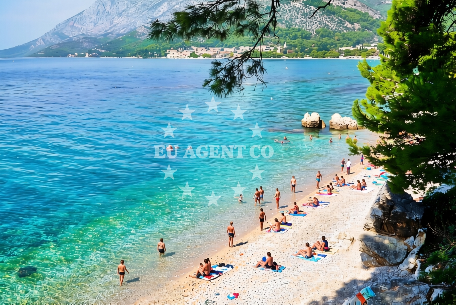
About this beach
Kapeć jug, Podaca
Beach: Kapeć jug
Location: Podaca
Characteristics and facilities
Gravel
170 m
Restaurant / snack bar
Caffe bar / Drinks stand
Natural shade
Changing cabin
Beach character
The beach consists of gravel, which influences both its visual profile and the activities available to visitors. While not ideal for barefoot walking, the gravel substrate provides a stable surface for movement. The beach is 170 meters in length, offering a modest stretch of coastline. Natural shade is available, likely provided by nearby vegetation or topographical features, which helps mitigate the intensity of direct sunlight during peak hours.Swimming and shore
Swimming conditions at Kapeć jug, Podaca Beach are shaped by the gravel seabed. This type of shoreline can create uneven water entry points, which may affect comfort for swimmers. The shore itself is straightforward, with no prominent rock formations or tidal variations reported. The beach's character is defined by its simplicity, with no artificial structures or marked recreational zones.Facilities and activities
Basic amenities are available at the beach, including a restaurant and snack bar for food service, as well as a café and drinks stand for refreshments. A changing cabin is provided, offering visitors a private space for preparing for water activities. There are no additional facilities such as showers, toilets, or parking areas explicitly mentioned in the beach's authoritative records.Access and location
Kapeć jug, Podaca Beach is situated within the settlement of Podaca, a coastal area in Croatia. The beach's location integrates it with the broader Adriatic coastline, placing it within reach of other nearby settlements and maritime routes. While specific access details such as road proximity or pedestrian pathways are not documented, the beach's inclusion in local infrastructure suggests reasonable connectivity for visitors.What to expect
Visitors to Kapeć jug, Podaca Beach should anticipate a straightforward coastal experience centered on its gravel shoreline and essential amenities. The beach provides a restaurant, café, and changing cabin, catering to basic needs without extensive recreational infrastructure. The natural shade available offers some respite from the sun, though the gravel surface may require appropriate footwear. The beach's character is defined by its simplicity and integration with the surrounding landscape.Practical tips
Given the gravel composition of the beach, visitors may wish to bring a towel or beach mat for comfort. The changing cabin is available for privacy, and the on-site restaurant and café provide convenient dining options. As with any coastal visit, respecting local environmental guidelines and maintaining beach cleanliness is encouraged.Exploring the coast by yacht
For sailors and yacht charter guests exploring the Croatian coast, Kapeć jug, Podaca Beach lies within a region known for its maritime accessibility. While the beach itself is not a designated anchorage or marina, its location in Podaca places it near sailing routes that connect to other coastal settlements. Yacht charter guests may find the surrounding area conducive to short excursions, with opportunities to explore nearby harbors and sailing destinations.Local Context and Regional Significance
Podaca is a settlement that reflects the broader characteristics of the Croatian Adriatic coast, with a focus on maritime traditions and coastal living. The area's geography supports both residential and recreational use, with beaches like Kapeć jug serving as accessible points along the shoreline. While no specific cultural or historical highlights are documented for this beach, its presence contributes to the settlement's coastal identity.Anchorages in the surrounding area
Anchorages in the surrounding area include Drvenik and Sucuraj, offering nearby mooring options.
- Anchorage — drvenik — 2.2 NM from beach
- Anchorage — sucuraj — hvar — 4.5 NM from beach
- Anchorage — sucuraj — hvar — 5.4 NM from beach
- Anchorage — ploce — 5.8 NM from beach
- Anchorage — sucuraj — hvar — 6.0 NM from beach
- Anchorage — selca kod bogomolja — hvar — 6.4 NM from beach
- Anchorage — sucuraj — hvar — 6.4 NM from beach
- Anchorage — selca kod bogomolja — hvar — 6.4 NM from beach
Distances are straight-line geographic distances, not sailing routes.
Mooring buoys in the surrounding area
- Brist — 1.7 NM from beach
- Drvenik - Ferry dock — drvenik ferry dock — 2.1 NM from beach
- Jetty — sucuraj — hvar — 4.3 NM from beach
- Konoba Gambo buoys — selca kod bogomolja — hvar — 8.2 NM from beach
- Kraj - Soline — kraj soline — drasnice — 9.4 NM from beach
Distances are straight-line geographic distances, not sailing routes.
Marine fuel stations
- Fuel station — ploce — 8.1 NM from beach
- Fuel station — korcula — 12.2 NM from beach
- Ina — makarska — 15.3 NM from beach
- Fuel station — sumartin — brac — 20.8 NM from beach
Distances are straight-line geographic distances, not sailing routes.
Harbours in the surrounding area
Harbours in the surrounding area include Zaostrog and Drvenik, offering convenient port access.
- Zaostrog — 0.6 NM from beach
- Drvenik — 2.3 NM from beach
- Gradac — 2.9 NM from beach
- Sućuraj — sucuraj — hvar — 4.3 NM from beach
- Živogošće — zivogosce — 6.5 NM from beach
- Trpanj — 7.3 NM from beach
Distances are straight-line geographic distances, not sailing routes.
Marinas in the surrounding area
- ACI Marina Korčula — korcula — 12.3 NM from beach
- Marina Tučepi — marina tucepi — 12.7 NM from beach
- Marina Lumbarda — korcula — 13.4 NM from beach
- Marina Ramova — krvavica — 17.6 NM from beach
- Marina Baška Voda — marina baska voda — 20.1 NM from beach
Distances are straight-line geographic distances, not sailing routes.
Restaurants near the beach
Restaurants near the beach include Riblji Restoran and Restaurant in Sucuraj, offering dining options close by.
- Riblji Restoran — sucuraj — hvar — 4.3 NM from beach
- Restaurant — sucuraj — hvar — 4.4 NM from beach
Distances are straight-line geographic distances, not sailing routes.
Navigation guides for the surrounding area
Navigation guides for the surrounding area include Uvala Drvenik and Gradac, aiding route planning.
- Uvala Drvenik (Donja Vala) — 1.9 NM from beach
- Gradac — 3.2 NM from beach
- OTOK HVAR — 3.6 NM from beach
- Trpanj — 7.3 NM from beach
- Uvala Divna — 7.7 NM from beach
Distances are straight-line geographic distances, not sailing routes.
Yachts from nearby departure bases
Yachts from nearby departure bases include those from Ploče City Port and Tučepi Port, offering sailing options in the region.
Sailing yachts
- Elan 40 Impression (Karleta) — Ploče City Port — 8.1 NM from departure base to beach
- Salona 44 (SAMOA) — Ploče City Port — 8.1 NM from departure base to beach
- Elan 514 Impression (Cesarica III) — Ploče City Port — 8.1 NM from departure base to beach
- Sun Odyssey 349 (Porto Tolero) — Ploče City Port — 8.1 NM from departure base to beach
- More 55 (MRS. ROBINSON) — Ploče City Port — 8.1 NM from departure base to beach
- Sun Odyssey 419 (Luka Ploce) — Ploče City Port — 8.1 NM from departure base to beach
- Sun Odyssey 349 (Visnjica) — Ploče City Port — 8.1 NM from departure base to beach
- Bavaria 40 Cruiser (LADY BUTTERFLY) — Tučepi Port — 12.7 NM from departure base to beach
Catamarans
- Lagoon 450 Fly (Alba Mouse) — Ploče City Port — 8.1 NM from departure base to beach
Motor yachts
- Princess V53 (Chablis) — Makarska Port — 15.1 NM from departure base to beach
Distances are straight-line geographic distances, not sailing routes.