Kanica Beach, Croatia
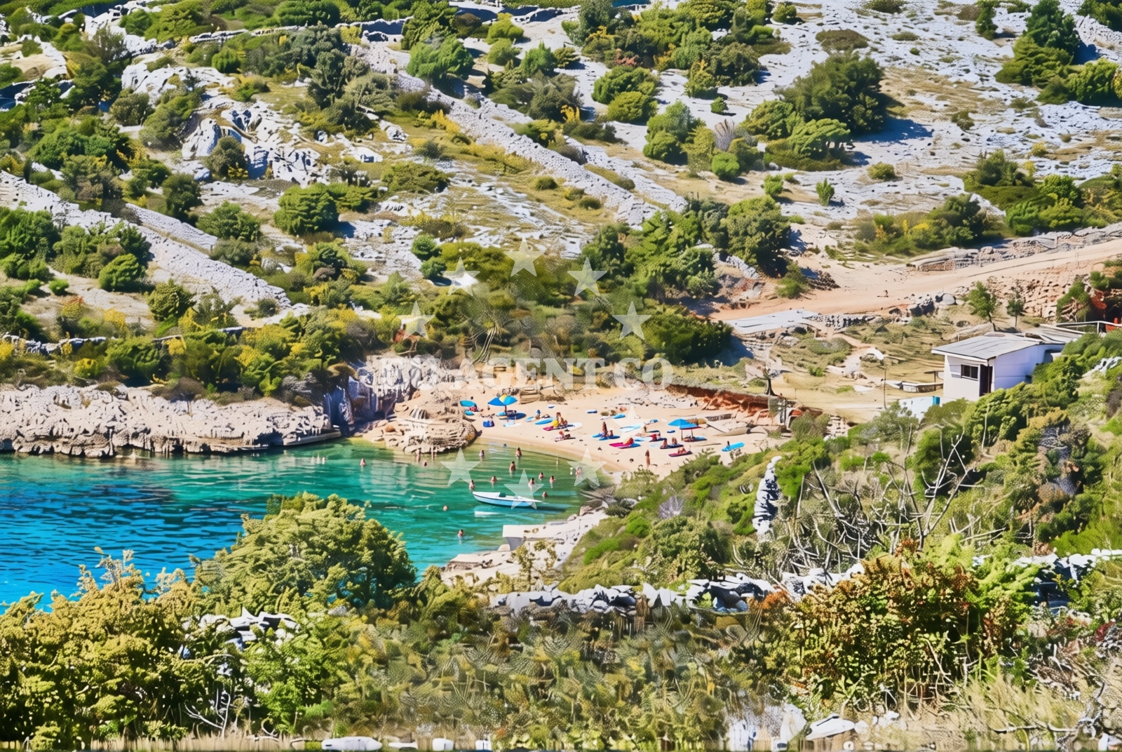
About this beach
Kanica, Kanica
Beach: Kanica
Location: Kanica
Characteristics and facilities
Gravel
20 m
Beach character
The beach consists of gravel deposits, creating a surface that contrasts with the sandy shores found elsewhere along the Croatian coast. Its short length of 20 meters suggests it functions more as a coastal feature than a primary recreational area. The gravel composition may influence swimming conditions, though specific water depth data is not available in the catalog.Swimming and shore
Swimming conditions at Kanica Beach are not explicitly documented in the beach catalog. The gravel shoreline may present challenges for barefoot swimming, though this is not confirmed. The beach's limited length suggests it may not be a primary destination for water-based activities.Facilities and activities
No structured facilities or activities are listed in the beach catalog. The absence of amenities such as showers, restrooms, or parking indicates this is likely an undeveloped shoreline. No recreational equipment rentals or organized activities are mentioned in available records.Access and location
Located in the settlement of Kanica, this beach is positioned along the northern Dalmatian coast. Its coordinates (43.501035°N, 15.997677°E) place it near the broader coastal network connecting Split to Zadar. The area is part of a region with historical maritime significance, though specific local transport connections are not detailed in the catalog.What to expect
Visitors should expect a short, gravelly shoreline with limited infrastructure. The beach appears to function more as a coastal feature than a recreational destination. Its location in Kanica provides proximity to the broader Adriatic coastline, though specific local context about nearby settlements or transport options is not detailed in the catalog.Practical tips
Footwear is recommended for the gravel shoreline. The beach's limited length suggests it may be more suitable for passing observation than extended停留. No facilities are available for visitors to use.Exploring the coast by yacht
For yacht charter guests exploring the northern Dalmatian coast, Kanica Beach represents one of many undeveloped shorelines along the route between Split and Zadar. While not a primary anchorage point, its location provides context for the varied coastal character encountered in this region. Nearby marinas and sailing routes can be explored through Euro-Agent's yacht search platform.Regional Coastal Context
The beach's gravel composition reflects the geological diversity of the northern Dalmatian coast, which transitions from sandy beaches to rocky and gravelly shorelines. This area has historically been used for fishing and small-scale maritime activities, though modern tourism infrastructure is more concentrated in nearby towns like Split and Zadar.Anchorages in the surrounding area
Anchorages near Kanica Beach include Borovica — razanj and Stari Trogir — sevid, with Uvala Borovica noted as a key navigation point.
- Borovica — razanj — 0.6 NM from beach
- Anchorage — razanj — 1.1 NM from beach
- Anchorage — razanj — 1.7 NM from beach
- Stari Trogir — sevid — 2.1 NM from beach
- Anchorage — sevid — 2.1 NM from beach
- Ankerplatz vor Rogoznica — 2.3 NM from beach
- Anchorage — rogoznica — 2.7 NM from beach
- Vela Rina — drvenik mali — 5.0 NM from beach
Distances are straight-line geographic distances, not sailing routes.
Mooring buoys in the surrounding area
- Sičenica — sicenica — sevid — 0.8 NM from beach
- Sevid buoy field — 0.8 NM from beach
- Konoba Lanterna quay — sevid — 0.9 NM from beach
- Quay — razanj — 1.2 NM from beach
- Buoy field — rogoznica — 2.1 NM from beach
Distances are straight-line geographic distances, not sailing routes.
Marine fuel stations
Marine fuel stations such as Flash — rogoznica and Petrol — primosten are located within a few nautical miles of Kanica Beach.
- Flash — rogoznica — 2.5 NM from beach
- Petrol — primosten — 4.8 NM from beach
- B-Max — b max — trogir — 10.5 NM from beach
- Ina — trogir — 10.9 NM from beach
Distances are straight-line geographic distances, not sailing routes.
Harbours in the surrounding area
- Rogoznica — 2.0 NM from beach
- Marina — 5.0 NM from beach
- Borak — drvenik mali — 5.1 NM from beach
- Primošten — primosten — 6.0 NM from beach
- Drvenik Veli — 7.0 NM from beach
- Vranjica — trogir — 8.1 NM from beach
Distances are straight-line geographic distances, not sailing routes.
Marinas in the surrounding area
Marinas such as Marina Frapa — rogoznica and Marina Kremik — primosten are within reach of Kanica Beach.
- Marina Frapa — rogoznica — 2.3 NM from beach
- Marina Kremik — primosten — 4.8 NM from beach
- Marina Agana — 5.1 NM from beach
- Marina Baotić — marina baotic — trogir — 10.3 NM from beach
- Marina Trogir — 10.7 NM from beach
Distances are straight-line geographic distances, not sailing routes.
Restaurants near the beach
Restaurants near Kanica Beach include Konoba Lanterna — sevid and Konoba Mario — rogoznica, located in close proximity.
- Konoba Lanterna — sevid — 0.9 NM from beach
- Konoba Mario — rogoznica — 1.9 NM from beach
- Konoba Planka — rogoznica — 1.9 NM from beach
- Konoba Antonijo — rogoznica — 1.9 NM from beach
- San Marco — rogoznica — 2.0 NM from beach
- Antonijo — rogoznica — 2.0 NM from beach
- Restaurant Jere — rogoznica — 2.1 NM from beach
Distances are straight-line geographic distances, not sailing routes.
Navigation guides for the surrounding area
Navigation guides for the area include Uvala Borovica and Rogoznica, aiding route planning from Kanica Beach.
- Uvala Borovica — 0.4 NM from beach
- Rogoznica — 2.0 NM from beach
- Uvala Stari Trogir — 2.2 NM from beach
- Uvala Stupin — 2.2 NM from beach
- Luka Peles and Marina Kremik (Primosten) — 4.5 NM from beach
Distances are straight-line geographic distances, not sailing routes.
Yachts from nearby departure bases
Sailing yachts
- Sun Odyssey 409 (Veterano) — Rogoznica Marina Frapa — 2.3 NM from departure base to beach
- Bavaria Cruiser 41 (Maestral) — Rogoznica Marina Frapa — 2.3 NM from departure base to beach
- Delphia 47 (Team Adventure) — Rogoznica Marina Frapa — 2.3 NM from departure base to beach
Catamarans
- Lagoon 40 (KORINA) — Rogoznica Marina Frapa — 2.3 NM from departure base to beach
- Lagoon 38 (STELLA) — Rogoznica Marina Frapa — 2.3 NM from departure base to beach
- Lagoon 43 (WANDERER) — Rogoznica Marina Frapa — 2.3 NM from departure base to beach
Motor yachts
- Navetta 48 (FREEDOM) — Rogoznica Marina Frapa — 2.3 NM from departure base to beach
- Navetta 52 (KAIROS) — Rogoznica Marina Frapa — 2.3 NM from departure base to beach
Motor boats
- Platinum 40 (Excalibur) — Rogoznica Marina Frapa — 2.3 NM from departure base to beach
- Antares 11 OB (FALCON) — Rogoznica Marina Frapa — 2.3 NM from departure base to beach
Distances are straight-line geographic distances, not sailing routes.