Kanica Beaches and Coves, Croatia
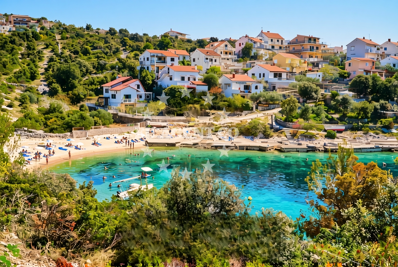
About this beach
Kanica: beaches and coves
Beach character
The beaches and coves of Kanica are defined by their natural contours, with a mix of pebbled shores and shallow, sheltered bays. The coastline here is marked by low-lying cliffs and scattered rock formations, creating a landscape that feels both ancient and unspoiled. The waters are typically calm, making them suitable for swimming, though the absence of lifeguards or formal safety measures means visitors should exercise caution. The area's remoteness contributes to a sense of seclusion, though this also means infrastructure is limited to basic necessities.Swimming and shore
Swimming conditions in Kanica's coves are generally favorable during the summer months, with water temperatures reaching comfortable levels by July. The shorelines are accessible in most areas, though some coves require a short walk along rocky paths. The sea floor near the beaches is composed of fine sand in sheltered spots and pebbles in more exposed areas. Snorkeling is possible in several locations, with underwater visibility often exceeding 20 meters due to the region's low pollution levels and clear waters.Facilities and activities
Facilities in Kanica are minimal, reflecting the area's focus on preserving its natural state. There are no restaurants, cafes, or changing rooms directly on the beach, though nearby villages offer basic services. Activities centered around the coast include hiking along the cliffs, kayaking to secluded coves, and fishing in designated areas. The absence of formalized recreational infrastructure means visitors should plan accordingly, bringing their own provisions and equipment for water-based activities.Access and location
Kanica is located approximately 40 kilometers northeast of Split, within the municipality of Šibenik-Knin. The nearest major road is the A1 motorway, which connects Split to Zagreb. Visitors can reach the area by car via the D8 coastal highway or by bus from Split's central station. The closest port for yacht charter operations is Šibenik, about 25 kilometers away, which serves as a hub for sailing excursions along the eastern Adriatic coast.What to expect
Visitors to Kanica should expect a landscape that prioritizes natural preservation over commercial development. The beaches are best suited for those who appreciate solitude and unspoiled scenery, though this also means services are limited. The region's charm lies in its untouched character, with opportunities for quiet reflection and exploration of the coastline. Travelers should be prepared for basic conditions, as there are no designated parking areas, waste disposal facilities, or shaded seating on the beach itself.Practical tips
For those planning a visit, consider arriving early in the day to secure a spot on the more accessible beaches. Bring sunscreen, water, and a reusable bottle for hydration, as there are no vendors on-site. A map of the area is recommended to navigate the network of coves, and local knowledge about safe swimming zones is advisable. The nearest medical facility is in Šibenik, approximately 25 minutes by car.Exploring the coast by yacht
For yacht charter guests, Kanica's location offers a strategic base for exploring the eastern Adriatic. The region is part of a sailing route that connects Šibenik to the islands of Hvar and Brač, with anchorages available in nearby bays. The proximity to Šibenik Marina provides access to a range of charter services, including crewed and skippered options. Yacht owners should note that while the immediate coastline lacks formal marinas, the surrounding waters are navigable and suitable for both motor and sail boats.Cultural Context of Kanica
The Kanica area has historical ties to the medieval Kingdom of Croatia, with remnants of fortifications and monastic sites scattered along the coast. The nearby town of Šibenik, a UNESCO World Heritage Site, offers a glimpse into the region's rich history through its 15th-century cathedral and Renaissance architecture. Local traditions include seasonal festivals celebrating the sea, though these are less formalized than in more tourist-oriented areas.Anchorages in the surrounding area
Anchorages in the surrounding area include Borovica and other nearby locations.
- Borovica — razanj — 1.0 NM from beach
- Anchorage — razanj — 1.4 NM from beach
- Anchorage — sevid — 1.8 NM from beach
- Stari Trogir — sevid — 1.8 NM from beach
- Anchorage — razanj — 2.0 NM from beach
- Ankerplatz vor Rogoznica — 2.6 NM from beach
- Anchorage — rogoznica — 3.1 NM from beach
- Vela Rina — drvenik mali — 4.6 NM from beach
Distances are straight-line geographic distances, not sailing routes.
Mooring buoys in the surrounding area
Mooring buoys in the surrounding area include Sičenica and the Sevid buoy field.
- Sičenica — sicenica — sevid — 0.6 NM from beach
- Sevid buoy field — 0.7 NM from beach
- Konoba Lanterna quay — sevid — 0.7 NM from beach
- Quay — razanj — 1.5 NM from beach
- Buoy field — rogoznica — 2.4 NM from beach
Distances are straight-line geographic distances, not sailing routes.
Marine fuel stations
Marine fuel stations in the surrounding area include Flash in Rogoznica and Petrol in Primosten.
- Flash — rogoznica — 2.8 NM from beach
- Petrol — primosten — 5.1 NM from beach
- B-Max — b max — trogir — 10.3 NM from beach
- Ina — trogir — 10.7 NM from beach
Distances are straight-line geographic distances, not sailing routes.
Harbours in the surrounding area
Harbours in the surrounding area include Rogoznica and Borak in Drvenik Mali.
- Rogoznica — 2.3 NM from beach
- Borak — drvenik mali — 4.7 NM from beach
- Marina — 4.9 NM from beach
- Primošten — primosten — 6.4 NM from beach
- Drvenik Veli — 6.7 NM from beach
- Vranjica — trogir — 8.0 NM from beach
Distances are straight-line geographic distances, not sailing routes.
Marinas in the surrounding area
Marinas in the surrounding area include Marina Frapa in Rogoznica and Marina Agana.
- Marina Frapa — rogoznica — 2.6 NM from beach
- Marina Agana — 5.0 NM from beach
- Marina Kremik — primosten — 5.2 NM from beach
- Marina Baotić — marina baotic — trogir — 10.1 NM from beach
- Marina Trogir — 10.6 NM from beach
Distances are straight-line geographic distances, not sailing routes.
Restaurants near the beach
Restaurants near the beach include Konoba Lanterna in Sevid and Konoba Mario in Rogoznica.
- Konoba Lanterna — sevid — 0.7 NM from beach
- Konoba Mario — rogoznica — 2.3 NM from beach
- Konoba Planka — rogoznica — 2.3 NM from beach
- Konoba Antonijo — rogoznica — 2.3 NM from beach
- San Marco — rogoznica — 2.3 NM from beach
- Antonijo — rogoznica — 2.4 NM from beach
- Restaurant Jere — rogoznica — 2.5 NM from beach
Distances are straight-line geographic distances, not sailing routes.
Navigation guides for the surrounding area
Navigation guides for the surrounding area include Uvala Borovica and Uvala Stari Trogir.
- Uvala Borovica — 0.7 NM from beach
- Uvala Stari Trogir — 1.9 NM from beach
- Rogoznica — 2.4 NM from beach
- Uvala Stupin — 2.6 NM from beach
- Luka Peles and Marina Kremik (Primosten) — 4.8 NM from beach
Distances are straight-line geographic distances, not sailing routes.
Yachts from nearby departure bases
Yachts from nearby departure bases include models like Bavaria Cruiser 41 and Lagoon 38, based at Rogoznica Marina Frapa.
Sailing yachts
- Bavaria Cruiser 41 (Maestral) — Rogoznica Marina Frapa — 2.6 NM from departure base to beach
- Bavaria Cruiser 46 (Blizzard) — Rogoznica Marina Frapa — 2.6 NM from departure base to beach
- Oceanis 50 (Big Tasty) — Rogoznica Marina Frapa — 2.6 NM from departure base to beach
Catamarans
- Lagoon 38 (FURIA) — Rogoznica Marina Frapa — 2.6 NM from departure base to beach
- Lagoon 40 (KORINA) — Rogoznica Marina Frapa — 2.6 NM from departure base to beach
- Bali Catspace (Moje Sunce) — Rogoznica Marina Frapa — 2.6 NM from departure base to beach
Motor yachts
- Navetta 48 (FREEDOM) — Rogoznica Marina Frapa — 2.6 NM from departure base to beach
- Sunseeker Portofino 53 (Polly) — Rogoznica Marina Frapa — 2.6 NM from departure base to beach
Motor boats
- Platinum 40 (Excalibur) — Rogoznica Marina Frapa — 2.6 NM from departure base to beach
- Antares 11 OB (FALCON) — Rogoznica Marina Frapa — 2.6 NM from departure base to beach
Distances are straight-line geographic distances, not sailing routes.