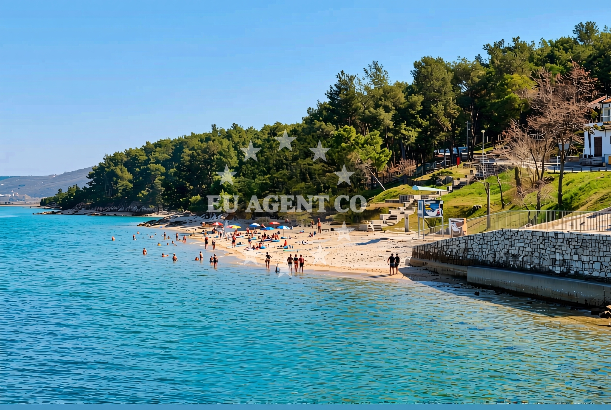
Kanegra sredina, Kanegra Beach, Croatia
About this beach
Kanegra sredina, Kanegra
Beach: Kanegra sredina
Location: Kanegra
Characteristics and facilities
Gravel, concrete / stone slabs, rocks
220 m
Restaurant / snack bar
Caffe bar / Drinks stand
Natural shade
shower
Changing cabin
Beach character
The beach's surface is characterized by a combination of gravel, concrete slabs, and natural rock formations, creating a rugged yet accessible shoreline. The 220-meter length offers space for visitors to spread out, though the rocky terrain may appeal more to those seeking a less conventional beach experience. Natural shade is available in areas where rock formations and vegetation provide coverage, and the presence of a shower and changing cabin adds practicality for visitors.Swimming and shore
While the beach's rocky composition may limit traditional swimming areas, the shoreline offers opportunities for exploration along the water's edge. The absence of explicit details about water depth or safety means visitors should exercise caution when entering the sea. The beach's proximity to the Adriatic Sea places it within a region known for its maritime activity, though specific swimming conditions are not detailed in the catalog.Facilities and activities
On-site amenities include a restaurant and snack bar for meals, a café and drinks stand for refreshments, and a changing cabin with a shower. No structured activities are listed in the catalog, but the beach's location in Kanegra—part of the Šibenik-Knin County—suggests potential for nearby cultural or historical exploration. The facilities cater to basic needs, making it a practical stop for travelers combining beach visits with regional sightseeing.Access and location
Kanegra sredina Beach is situated in Kanegra, a village on the Pelješac Peninsula in Croatia. The coordinates (45.484127, 13.568267) place it near the mouth of the Cetina River, a region known for its natural beauty and historical significance. The beach is accessible via local roads connecting to Šibenik and the broader Adriatic coast, with nearby settlements offering additional services and accommodations.What to expect
Visitors should expect a beach with a rugged, mixed surface of gravel, concrete, and rock, ideal for those seeking a non-sandy shoreline. The on-site restaurant, snack bar, café, and changing cabin provide essential amenities. The beach's location in Kanegra offers proximity to cultural sites, including the medieval fortress of Klis and the town of Šibenik, both within a short drive. The area's maritime character means it may be of particular interest to yacht charter guests exploring the Adriatic coast.Practical tips
The beach's rocky terrain may require sturdy footwear for comfortable navigation. The availability of a changing cabin and shower suggests it is suitable for short stays or day visits. Visitors should note the absence of explicit information about parking, crowd levels, or seasonal variations in accessibility.Exploring the coast by yacht
Kanegra sredina Beach lies within a region popular with yacht charter guests, situated near the Pelješac Peninsula and the broader Adriatic sailing routes. The area's proximity to Šibenik, a hub for maritime activity, and its location along the Cetina River mouth make it a strategic point for exploring the region. Yacht charter guests may find the surrounding waters appealing for cruising, anchoring, or accessing nearby islands and coastal towns.Cultural and Historical Context
Kanegra's location on the Pelješac Peninsula places it near several historical sites, including the Klis Fortress and the Šibenik Cathedral. The region's medieval heritage and maritime history contribute to its appeal for travelers interested in cultural exploration alongside natural attractions.Anchorages in the surrounding area
Anchorages near Kanegra include options in Kanegra, Krizine, and Lovrecica.
- Anchorage — kanegra — 0.1 NM from beach
- Anchorage — krizine — 5.1 NM from beach
- Anchorage — lovrecica — 5.7 NM from beach
- Anchorage — lovrecica — 6.4 NM from beach
- Anchorage — dalja — 7.6 NM from beach
- Anchorage — novigrad istarski — 10.5 NM from beach
- Anchorage — novigrad istarski — 10.5 NM from beach
- Anchorage — cervar porat — 12.5 NM from beach
Distances are straight-line geographic distances, not sailing routes.
Mooring buoys in the surrounding area
Mooring buoys and jetties near Kanegra include the Jetty — kanegra and Buoy field — savudrija.
- Jetty — kanegra — 0.1 NM from beach
- Buoy field — savudrija — 2.9 NM from beach
- Buoy field — umag — 3.4 NM from beach
- Buoy — barbat — rab — 5.8 NM from beach
- Buoy — ceja — 5.8 NM from beach
Distances are straight-line geographic distances, not sailing routes.
Marine fuel stations
Fuel stations in the vicinity include Ina — umag and Fuel station — drace.
- Ina — umag — 3.4 NM from beach
- Fuel station — drace — 5.8 NM from beach
- Fuel station — split — 5.8 NM from beach
- Crodux — novigrad istarski — 9.9 NM from beach
Distances are straight-line geographic distances, not sailing routes.
Harbours in the surrounding area
Harbours in the surrounding area include Stella Maris — umag and Stara Savudrija.
- Stella Maris — umag — 2.9 NM from beach
- Stara Savudrija — 2.9 NM from beach
- Umag — 3.6 NM from beach
- Novigrad — novigrad istarski — 9.8 NM from beach
- Mirna — novigrad istarski — 10.4 NM from beach
Distances are straight-line geographic distances, not sailing routes.
Marinas in the surrounding area
Marinas near Kanegra include ACI marina Umag and Marina Nautica — novigrad istarski.
- ACI marina Umag — 3.5 NM from beach
- Marina Nautica — novigrad istarski — 9.9 NM from beach
- Marina Červar Porat — marina cervar porat — 12.5 NM from beach
- Marina Poreč — marina porec — 15.6 NM from beach
- Marina Parentium — porec — 16.8 NM from beach
Distances are straight-line geographic distances, not sailing routes.
Restaurants near the beach
Restaurants near the beach include Restaurant Punta — umag and Lido — umag in Umag.
- Restaurant Punta — umag — 3.3 NM from beach
- Lido — umag — 3.3 NM from beach
- Konoba Nono — umag — 3.6 NM from beach
- Amfora — umag — 3.8 NM from beach
Distances are straight-line geographic distances, not sailing routes.
Navigation guides for the surrounding area
Navigation guides for the area cover Pi ran, Umag, and Izola.
- Pi ran — 2.5 NM from beach
- Umag — 3.4 NM from beach
- Izola — 5.0 NM from beach
- San Bartolomeo — 9.4 NM from beach
- Novi grad — 9.9 NM from beach
Distances are straight-line geographic distances, not sailing routes.
Yachts from nearby departure bases
Yachts depart from bases like Marina Novigrad and Poreč Marina Funtana.
Sailing yachts
- Bavaria 49 (Claudia) — Poreč Marina Funtana — 18.5 NM from departure base to beach
- Bavaria 46 Cruiser (Hansi) — Poreč Marina Funtana — 18.5 NM from departure base to beach
- Bavaria 44 (Franzi) — Poreč Marina Funtana — 18.5 NM from departure base to beach
- Bavaria 46 Cruiser (Barbados) — Poreč Marina Funtana — 18.5 NM from departure base to beach
- Bavaria 40 Cruiser (Franzi) — Poreč Marina Funtana — 18.5 NM from departure base to beach
Catamarans
- Lagoon Power 44 (Monteki) — Poreč Marina Funtana — 18.5 NM from departure base to beach
Motor boats
- Prestige 46 Fly (Anima Maris) — Marina Novigrad — 9.8 NM from departure base to beach
- Maiora 20 (Sea Heaven) — Marina Novigrad — 9.8 NM from departure base to beach
- AC DC Daycruiser 12.0 — Marina Novigrad — 9.8 NM from departure base to beach
- Maiora 20 (Sea Heaven) — Marina Novigrad — 9.8 NM from departure base to beach
Distances are straight-line geographic distances, not sailing routes.