Kamenica Beach, Croatia
Beach character
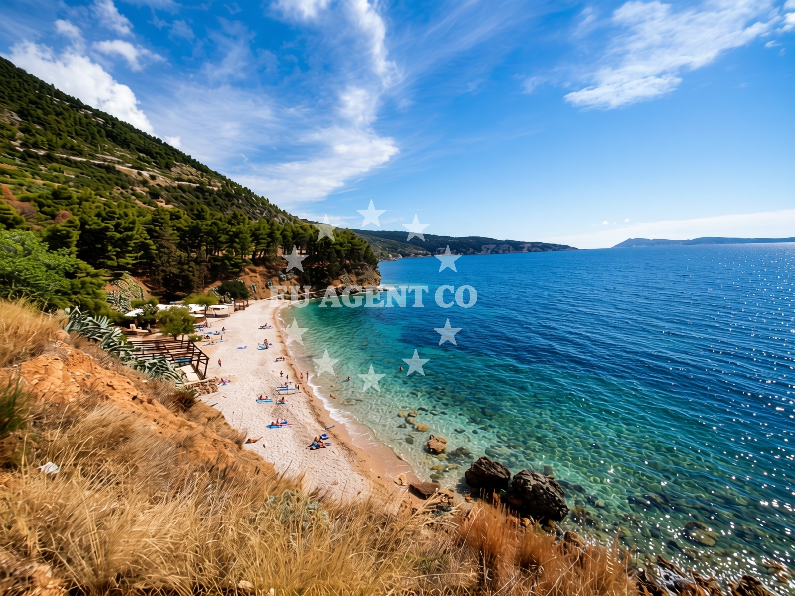
Kamenica Beach is defined by its beige pebble composition, a surface that dominates most of the shoreline. The seabed extends with medium-sized pebbles, creating a gradual depth increase that is neither abrupt nor shallow. The beach's character is shaped by its surrounding geography, with mountainous terrain and cliffs providing a dramatic backdrop. While the beach is noted for its natural beauty, visitor reviews highlight a 'very poor' cleanliness index, suggesting visitors should approach with realistic expectations regarding maintenance.Swimming and shore
The pebble-covered shore may present challenges for barefoot swimmers, though the moderate depth progression offers some flexibility for different swimming styles. The beach's natural features make it particularly suited for water sports enthusiasts, with kayaking, surfing, and snorkeling available in the vicinity. The absence of structured amenities means visitors should plan to bring personal items for comfort.Facilities and activities
No formal facilities are listed for Kamenica Beach, aligning with the catalog's structured amenities section. However, the beach is explicitly associated with three primary activities: kayaking, surfing, and snorkeling. These opportunities are supported by the beach's natural topography and proximity to the Adriatic Sea's dynamic currents.Access and location
Located at Gurnji put 37 in Komiža, Kamenica Beach is positioned within the Pelješac Peninsula, a region known for its dramatic coastal landscapes and historical significance. The coordinates (43.03821, 16.09207) place it near the mouth of the Neretva River, a strategic location for both land and sea travel. Komiža itself is a coastal town with connections to Dubrovnik, offering yacht charter guests a gateway to explore the Adriatic's southern reaches.What visitors say
Visitor reviews present a mixed picture. One reviewer noted the beach's 'quiet' character during low season, while another described it as a 'beautiful cove in Lovisto.' However, recurring themes include the beach's suitability for 'a young and active crowd' and its pet-friendliness, with dedicated areas for dogs. The high season 'busy' designation contrasts with these observations, suggesting seasonal variability in crowd levels.Practical tips
Consider bringing sturdy footwear for the pebble shore. Be mindful of seasonal crowd levels, as the beach transitions from 'quiet' in low season to 'busy' in high season. The lack of formal facilities means self-sufficiency is essential for comfort.Exploring the coast by yacht
For yacht charter guests, Komiža's coastal position offers access to the Adriatic's sailing routes. While Kamenica Beach itself is not a marina or anchorage, its proximity to the Neretva River and Dubrovnik's maritime corridors makes it a potential stop for those exploring the Pelješac Peninsula. The region's popularity with charter boats aligns with the beach's appeal to active travelers.Regional Context
Komiža, where Kamenica Beach is located, is a historic coastal town with connections to the Dubrovnik Republic. The Pelješac Peninsula is renowned for its vineyards and dramatic coastline, offering yacht charter guests a mix of cultural heritage and natural beauty. The nearby town of Cavtat, accessible via the Neretva River, adds to the region's appeal for both land and sea exploration.Anchorages in the surrounding area
Anchorages in Komiza and nearby areas offer proximity to Kamenica beach.
- Anchorage — komiza — vis — 0.4 NM from beach
- Uvala Knezice — komiza — vis — 1.4 NM from beach
- Anchorage — komiza — vis — 2.6 NM from beach
- Stiniva — vis — 3.6 NM from beach
- Anchorage — vis — 4.0 NM from beach
- Anchorage — vis — 4.2 NM from beach
- Vis luka — 4.4 NM from beach
- Parja — vis — 4.5 NM from beach
Distances are straight-line geographic distances, not sailing routes.
Mooring buoys in the surrounding area
Mooring buoys in Komiza and Vis provide nearby options for vessels approaching Kamenica beach.
- Lucka Uprava buoys, Komiza — vis — 0.6 NM from beach
- Komiza Buoy field — vis — 0.6 NM from beach
- Quay — vis — 1.8 NM from beach
- Buoy field — vis — 4.5 NM from beach
- Jetty — vis — 4.6 NM from beach
Distances are straight-line geographic distances, not sailing routes.
Marine fuel stations
Marine fuel stations in Vis and other regions serve vessels traveling to Kamenica beach.
- Petrol station Ina — vis — 4.4 NM from beach
- Fuel station — hvar — 17.2 NM from beach
- Ina — milna brac — 23.2 NM from beach
- Fuel station — rogac — solta — 23.3 NM from beach
Distances are straight-line geographic distances, not sailing routes.
Harbours in the surrounding area
Harbors in Komiza and surrounding areas provide nearby access points to Kamenica beach.
- Komiža — komiza — vis — 0.4 NM from beach
- Luka — vis — 4.3 NM from beach
- Rogačić — vis — 4.7 NM from beach
- Kut — vis — 4.8 NM from beach
Distances are straight-line geographic distances, not sailing routes.
Marinas in the surrounding area
Marinas in St Klement, Solta, and Brac cater to vessels traveling to Kamenica beach.
- ACI Marina Palmižana — aci marina palmizana — st klement — 15.2 NM from beach
- Marina Martinis Marchi — maslinica — solta — 22.2 NM from beach
- Marina Vlaška — milna brac — 23.2 NM from beach
- Marina Milna Kanarija — milna brac — 23.2 NM from beach
- ACI Marina Milna — milna brac — 23.3 NM from beach
Distances are straight-line geographic distances, not sailing routes.
Restaurants near the beach
Restaurants in Komiza offer onshore dining options near Kamenica beach.
- Pizzeria Charly — komiza — vis — 0.4 NM from beach
- Pizzeria Hum — komiza — vis — 0.4 NM from beach
- Fabrika — komiza — vis — 0.4 NM from beach
- Riblji Komiza — vis — 0.4 NM from beach
- Restaurant — komiza — vis — 0.5 NM from beach
- Bako — komiza — vis — 0.6 NM from beach
- Barba — komiza — vis — 0.6 NM from beach
Distances are straight-line geographic distances, not sailing routes.
Navigation guides for the surrounding area
Navigation guides for Komiža and nearby areas assist in reaching Kamenica beach.
- Komiža — 0.4 NM from beach
- Uvala Stoncica — 7.1 NM from beach
- Luka Soline — 14.1 NM from beach
- Uvala Tarsce — 14.5 NM from beach
- Uvala Stari Stani — 14.7 NM from beach
Distances are straight-line geographic distances, not sailing routes.
Yachts from nearby departure bases
Yachts departing from Milna and Šolta bases are positioned to access Kamenica beach.
Sailing yachts
- Bavaria 46 Cruiser (MO) — Milna Marina Vlaška — 23.2 NM from departure base to beach
- Hanse 455 (AURUM 1) — Milna Marina Vlaška — 23.2 NM from departure base to beach
- Hanse 388 (BANJO) — Milna Marina Vlaška — 23.2 NM from departure base to beach
- Hanse 505 (AVALON) — Milna Marina Vlaška — 23.2 NM from departure base to beach
- Sun Odyssey 449 (Port Royal) — Šolta Rogač — 23.3 NM from departure base to beach
- Cyclades 39.3 (Patagonia) — Šolta Rogač — 23.3 NM from departure base to beach
- Cyclades 43.4 (Tigris) — Šolta Rogač — 23.3 NM from departure base to beach
Catamarans
- Lagoon 450 Flybridge (Samogon) — Šolta Rogač — 23.3 NM from departure base to beach
- Lagoon 400 (Greenland) — Šolta Rogač — 23.3 NM from departure base to beach
- Lagoon 450 (Madagascar) — Šolta Rogač — 23.3 NM from departure base to beach
Distances are straight-line geographic distances, not sailing routes.
Frequently asked questions
Is Kamenica Beach suitable for families with young children?
Yes, the beach is explicitly recommended for families with kids, though the pebble shore may require caution for very young children.Are there facilities for pets at Kamenica Beach?
Yes, the beach is pet-friendly with designated areas for dogs, as noted in the audience recommendations.What water sports are available at Kamenica Beach?
Kayaking, surfing, and snorkeling are explicitly listed as available activities.Nearby beaches
Reviews
Very nice here and quiet in the low season.
A beautiful cove in Lovisto.
Amazing and quiet beach
It's wonderfull here Dubrovnik-Neretva