Kalić sjever, Sveti Juraj Beach, Croatia
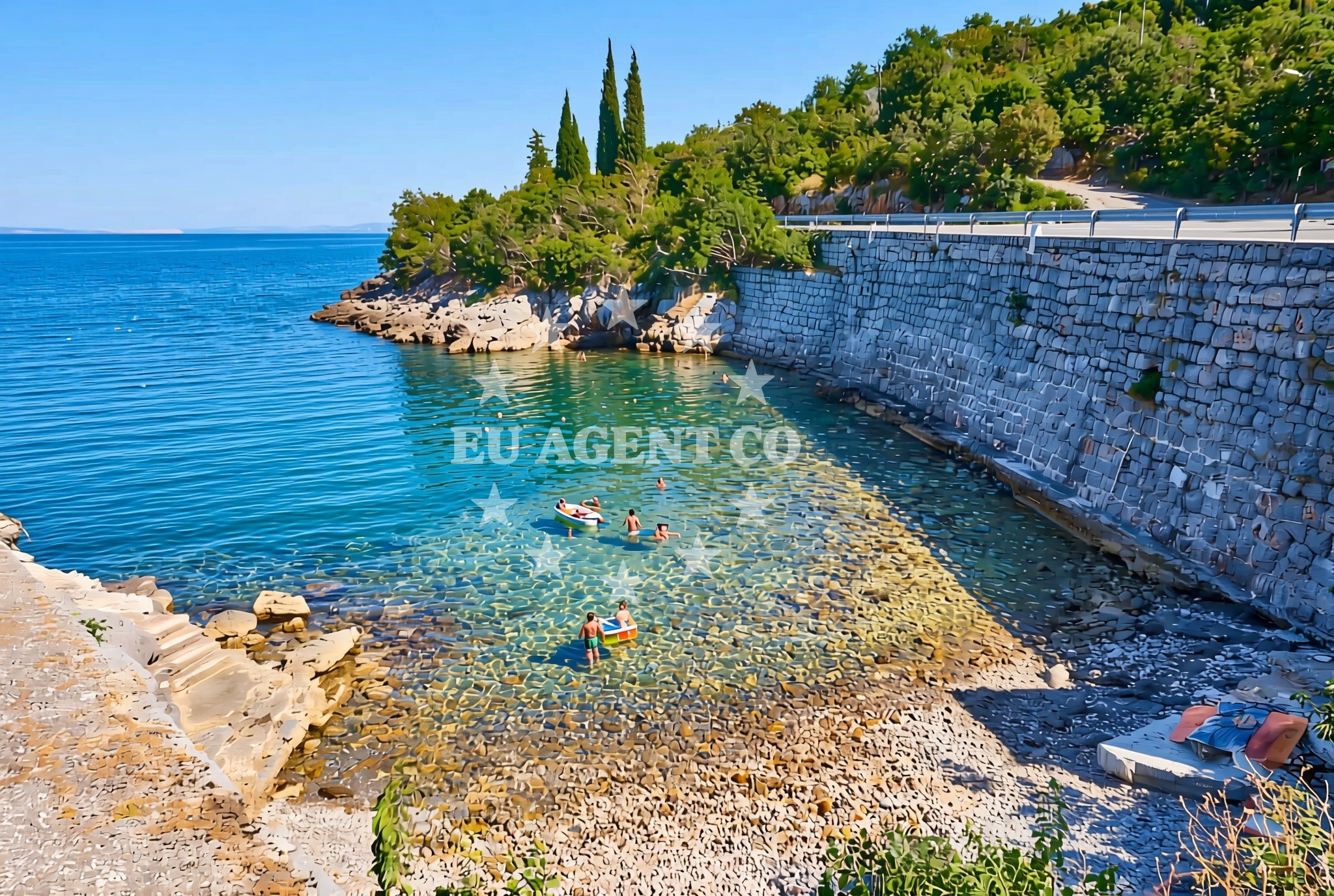
About this beach
Kalić sjever, Sveti Juraj
Beach: Kalić sjever
Location: Sveti Juraj
Characteristics and facilities
Gravel, concrete / stone slabs
20 m
Natural shade
Beach character
The beach's surface consists of gravel and concrete/stone slabs, creating a distinct texture underfoot. The natural shade, which spans about 20 meters, provides a sheltered area along the shoreline. This feature may be particularly useful for visitors seeking respite from direct sunlight. The beach does not appear to have structured amenities such as showers, restrooms, or designated seating areas, as no such facilities are listed in the catalog.Swimming and shore
Swimming conditions at Kalić sjever are not explicitly detailed in the catalog, but the beach's gravel and stone slab composition suggests it may be more suited for walking or casual exploration than for swimming. The shoreline's natural contours and the absence of structured beach infrastructure indicate a more rugged, less developed coastal environment.Facilities and activities
No structured facilities or activities are listed for Kalić sjever, Sveti Juraj Beach. The beach appears to be a natural, undeveloped shoreline without amenities such as lifeguard services, rental equipment, or marked recreational zones. Visitors are advised to rely on the beach's natural features, such as the 20-meter shaded area, for comfort.Access and location
Kalić sjever is located in Sveti Juraj, a coastal settlement in Croatia. The beach's proximity to the Adriatic Sea places it within a region that is part of the broader Dalmatian coast. While specific transportation details are not provided in the catalog, the area is likely accessible via local roads connecting to nearby towns and marinas. The beach's coordinates (44.952056, 14.927965) situate it near the central Adriatic, where maritime routes and coastal settlements are common.What to expect
Visitors to Kalić sjever, Sveti Juraj Beach should expect a natural shoreline composed of gravel and stone slabs, with a 20-meter stretch of natural shade along the shore. The beach lacks structured facilities, so visitors should plan accordingly. The area's coastal setting places it within a region known for its maritime heritage and scenic sailing routes. Nearby, the Adriatic coast offers opportunities for yacht charter, with marinas and anchorages accessible to those exploring the area by boat.Practical tips
Given the beach's gravel and stone slab surface, visitors may want to wear sturdy footwear for comfort. The natural shade can provide a cool respite, but visitors should still take standard sun protection measures. As no facilities are listed, bringing personal items such as water or snacks is advisable.Exploring the coast by yacht
The Adriatic coast near Sveti Juraj is a well-known sailing region, with marinas and anchorages available to charter guests. Yacht charter companies operating in this area often highlight the scenic routes along the Dalmatian coast, including stops near historic towns, islands, and other natural shorelines. While Kalić sjever itself does not appear to be a designated anchorage or marina, its proximity to the sea makes it a potential waypoint for sailors exploring the region.Regional Context and Coastal Exploration
Sveti Juraj is part of the central Adriatic, an area renowned for its clear waters, historic coastal towns, and yacht-friendly routes. The surrounding region includes marinas such as those in Supetar and Split, which are popular hubs for charter boats. Visitors to Kalić sjever may find it useful to explore nearby settlements, where cultural landmarks, restaurants, and other beaches are accessible by car or boat.Anchorages in the surrounding area
Anchorages near St. Juraj, including Jurjevo (Luka Sv. Juraj) and Senj.
- Anchorage — senj — 1.3 NM from beach
- Anchorage — st juraj — 1.6 NM from beach
- Anchorage — zrnovnica — 2.9 NM from beach
- Anchorage — senj — 4.1 NM from beach
- Anchorage — senj — 4.8 NM from beach
- Vela Luka — krk — 5.7 NM from beach
- Mala Luka — krk — 5.9 NM from beach
- Anchorage — lukovo — 6.0 NM from beach
Distances are straight-line geographic distances, not sailing routes.
Mooring buoys in the surrounding area
Mooring buoys near Zrnovnica and Krk in the surrounding area.
- Quay — zrnovnica — 2.9 NM from beach
- Quay — zrnovnica — 3.5 NM from beach
- Jetty — krk — 5.5 NM from beach
- Jetty — krk — 5.8 NM from beach
- Buoy field — krk — 8.3 NM from beach
Distances are straight-line geographic distances, not sailing routes.
Marine fuel stations
Marine fuel stations in Novi Vinodolski and Krk.
- INA — novi vinodolski — 12.0 NM from beach
- Ina — rab — 13.6 NM from beach
- Flash — krk — 15.7 NM from beach
- Ina — krk — 15.8 NM from beach
Distances are straight-line geographic distances, not sailing routes.
Harbours in the surrounding area
Harbours including St. Juraj, Senj, and Lukovo in the region.
- St. Juraj — st juraj — 1.4 NM from beach
- Senj — 2.6 NM from beach
- Lukovo — 6.0 NM from beach
- Baška — baska — krk — 7.2 NM from beach
- Melna — goli otok — 8.4 NM from beach
- Starigrad — starigrad senj — 9.5 NM from beach
Distances are straight-line geographic distances, not sailing routes.
Marinas in the surrounding area
Marinas in Novi Vinodolski, Rab, and Krk, such as Mitan Marina and ACI Marina Supetarska Draga.
- Mitan Marina — novi vinodolski — 11.4 NM from beach
- Marina Novi — novi vinodolski — 12.1 NM from beach
- ACI Marina Supetarska Draga — rab — 12.5 NM from beach
- Marina Punat — krk — 13.6 NM from beach
- ACI Marina Rab — 13.7 NM from beach
Distances are straight-line geographic distances, not sailing routes.
Restaurants near the beach
Restaurants like Riva in Senj near the beach.
- Riva — senj — 2.6 NM from beach
Distances are straight-line geographic distances, not sailing routes.
Navigation guides for the surrounding area
Navigation guides for Jurjevo (Luka Sv. Juraj), Senj, and Uvala Sv. Jelena.
- Jurjevo (Luka Sv. Juraj) — 1.2 NM from beach
- Senj — 2.5 NM from beach
- Uvala Sv. Jelena — 4.1 NM from beach
- Uvala Vela Luka — 5.3 NM from beach
- Baška — 6.9 NM from beach
Distances are straight-line geographic distances, not sailing routes.
Yachts from nearby departure bases
Yachts departing from Vinodolski Novi Marina, including Mitan Marina and Novi Marina.
Sailing yachts
- Elan 494 Impression (LUCIJA I) — Vinodolski Novi Marina — 12.1 NM from departure base to beach
- Sun Odyssey 36i (Mia) — Vinodolski Novi Marina — 12.1 NM from departure base to beach
- Elan 40 Impression (AVISA) — Vinodolski Novi Marina — 12.1 NM from departure base to beach
- Bavaria C38 (Simbad) — Vinodolski Novi Marina — 12.1 NM from departure base to beach
Catamarans
- Excess 12 (Kiss Me Twice) — Vinodolski Novi Marina — 12.1 NM from departure base to beach
- Lagoon 380 (Queen Mia) — Vinodolski Novi Marina — 12.1 NM from departure base to beach
- Bali 4.6 (MY QUEEN) — Vinodolski Novi Marina — 12.1 NM from departure base to beach
- Lagoon 40 (Paco) — Vinodolski Novi Marina — 12.1 NM from departure base to beach
Motor yachts
- Galeon 700 (Obsession two) — Vinodolski Novi Mitan Marina — 11.4 NM from departure base to beach
Motor boats
- Adriana 36 (Gaja) — Vinodolski Novi Marina — 12.1 NM from departure base to beach
Distances are straight-line geographic distances, not sailing routes.