Kalac Beach, Korčula, Croatia
About this beach
Kalac, Korčula (Korčula)
Beach: Kalac
Location: Korčula (Korčula)
Characteristics and facilities
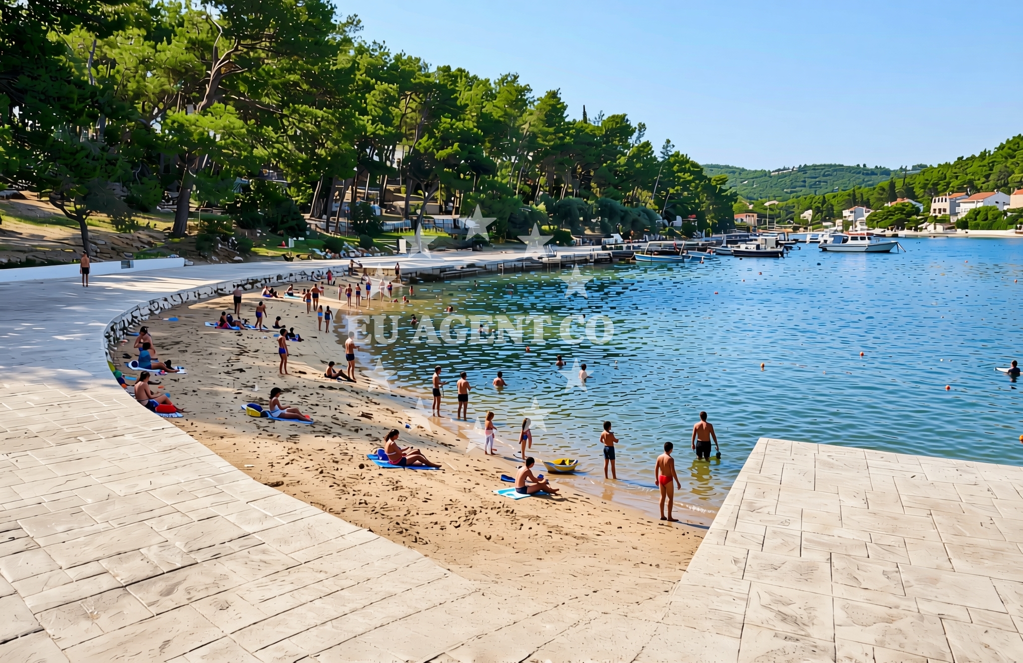
Sand, concrete / stone slabs
Natural shade
Beach character
The beach's character is defined by its mix of sand and hardened surfaces, which reflect the island's historical use of local materials for coastal infrastructure. Natural rock formations along the shoreline create shaded areas, a feature that is particularly useful during the warmer months. While the beach lacks artificial amenities, its simplicity aligns with the rugged, unspoiled charm of Korčula's coastal regions.Swimming and shore
The waters near Kalac Beach are part of the broader Adriatic coastline, known for its generally clear conditions and moderate currents. The shoreline slopes gently into the sea, making it accessible for swimmers. The combination of sand and stone surfaces creates a varied texture underfoot, which may appeal to those seeking a more rugged beach experience compared to the polished resorts of other parts of Croatia.Facilities and activities
There are no formal facilities at Kalac Beach, such as showers, restrooms, or umbrellas. The absence of commercial infrastructure means visitors should bring their own supplies. The beach's natural features are its primary attraction, with the shaded areas offering a unique microclimate that can be particularly pleasant during midday heat.Access and location
Kalac Beach is located in the village of Kalac on Korčula Island, accessible by road from the island's main town, Korčula. The nearest major port is Korčula Town, which is served by ferries connecting to the mainland and other Dalmatian islands. The beach's proximity to the village means it is more accessible to local residents than to international tourists, contributing to its tranquil atmosphere.What to expect
Visitors to Kalac Beach should expect a straightforward, low-key coastal experience. The beach is not developed with tourist amenities, so it is best suited for those seeking solitude or a base for exploring Korčula's more traditional villages. The natural shade provided by rock formations is a consistent feature, though the beach's appeal may be limited by its lack of modern comforts. Its location on Korčula Island places it within reach of the island's cultural landmarks, including the medieval town of Korčula and the nearby Šipan and Mljet islands.Practical tips
For visitors planning to spend time at Kalac Beach, it is advisable to bring sunscreen, water, and a hat, given the exposed areas of the beach. The shaded rock formations offer relief but do not cover the entire shoreline. Parking options in the village of Kalac are limited, so arriving early is recommended if visiting by car.Exploring the coast by yacht
For yacht charter guests exploring the Adriatic, Kalac Beach represents one of many lesser-known anchorages along Korčula's coast. While not a formal marina, the beach's proximity to the village of Kalac makes it a potential stop for sailors seeking a quiet landing point. The surrounding waters are part of the broader sailing routes connecting Dubrovnik, Hvar, and the Pelješac Peninsula, offering opportunities for both short cruises and longer itineraries in the region.Historical Context of Korčula Island
Korčula Island has a rich medieval heritage, with its town recognized as a UNESCO World Heritage Site. The island's history as a maritime republic in the 13th century is reflected in its fortifications and coastal settlements. Kalac, like many villages on the island, retains traces of this history, with its stone buildings and traditional layout.Anchorages in the surrounding area
Anchorages near Korčula include Korcula, Badija, and Lumbarda.
- Anchorage — korcula — 0.1 NM from beach
- Anchorage — badija — 0.9 NM from beach
- Anchorage — korcula — 1.3 NM from beach
- Anchorage — korcula — 1.5 NM from beach
- Anchorage — lumbarda — korcula — 1.6 NM from beach
- Anchorage — korcula — 1.9 NM from beach
- Anchorage — korcula — 2.1 NM from beach
- Anchorage — korcula — 2.5 NM from beach
Distances are straight-line geographic distances, not sailing routes.
Mooring buoys in the surrounding area
Mooring buoys in the area include Korcula Fuel Jetty and Vrnik Arts Club buoys.
- Fuel jetty — korcula — 0.3 NM from beach
- Vrnik Arts Club buoys — 1.3 NM from beach
- Quay — vrnik — 1.3 NM from beach
- Jetty — korcula — 1.5 NM from beach
- Restaurant Moro buoys — stupe — 2.2 NM from beach
Distances are straight-line geographic distances, not sailing routes.
Marine fuel stations
- Fuel station — korcula — 0.3 NM from beach
- Fuel station — ploce — 14.2 NM from beach
- Ina — ubli — lastovo — 18.7 NM from beach
- Ina — vela luka — korcula — 18.8 NM from beach
Distances are straight-line geographic distances, not sailing routes.
Harbours in the surrounding area
Harbours nearby include Korčula E and W harbours, Orebić, and Viganj.
- Korčula E harbour — korcula — 0.6 NM from beach
- Korčula W harbour — korcula — 0.8 NM from beach
- Orebić — orebic — 2.0 NM from beach
- Kučišće — kucisce — 2.1 NM from beach
- Tatinja — lumbarda — korcula — 2.2 NM from beach
- Viganj — 2.6 NM from beach
Distances are straight-line geographic distances, not sailing routes.
Marinas in the surrounding area
Marinas in the vicinity include ACI Marina Korčula and Marina Lumbarda.
- ACI Marina Korčula — korcula — 0.5 NM from beach
- Marina Lumbarda — korcula — 2.1 NM from beach
- Marina Solitudo — lastovo — 18.0 NM from beach
- Marina Korkyra — vela luka — korcula — 18.9 NM from beach
- Marina Tučepi — marina tucepi — 19.1 NM from beach
Distances are straight-line geographic distances, not sailing routes.
Restaurants near the beach
Restaurants near the beach include Aborda and Konoba Belin in Korcula.
- Restaurant — korcula — 0.5 NM from beach
- Restaurant — korcula — 0.5 NM from beach
- Aborda — korcula — 0.5 NM from beach
- Konoba Belin — korcula — 0.6 NM from beach
- Restaurant&Bar Fish'N'Go — korcula — 0.6 NM from beach
- Restaurant — korcula — 0.6 NM from beach
- Restaurant Lesic Dimitri — korcula — 0.7 NM from beach
Distances are straight-line geographic distances, not sailing routes.
Navigation guides for the surrounding area
Navigation guides cover areas such as Otocic Badija and Uvala Banja.
- Otocic Badija — 1.1 NM from beach
- Uvala Banja — 1.1 NM from beach
- Uvala Racisce — 1.7 NM from beach
- Uvala Vrbovica — 1.8 NM from beach
- Orebic — 2.1 NM from beach
Distances are straight-line geographic distances, not sailing routes.
Yachts from nearby departure bases
Yachts depart from Ploče City Port and Tučepi Port, offering sail and motor options.
Sailing yachts
- Elan 40 Impression (Karleta) — Ploče City Port — 14.1 NM from departure base to beach
- Sun Odyssey 349 (Porto Tolero) — Ploče City Port — 14.1 NM from departure base to beach
- More 55 (MRS. ROBINSON) — Ploče City Port — 14.1 NM from departure base to beach
- Elan 514 Impression (Cesarica III) — Ploče City Port — 14.1 NM from departure base to beach
- Salona 44 (SAMOA) — Ploče City Port — 14.1 NM from departure base to beach
- Sun Odyssey 419 (Luka Ploce) — Ploče City Port — 14.1 NM from departure base to beach
- Sun Odyssey 349 (Visnjica) — Ploče City Port — 14.1 NM from departure base to beach
- Bavaria 40 Cruiser (LADY BUTTERFLY) — Tučepi Port — 19.1 NM from departure base to beach
Catamarans
- Lagoon 450 Fly (Alba Mouse) — Ploče City Port — 14.1 NM from departure base to beach
Motor yachts
- Princess V53 (Chablis) — Makarska Port — 21.2 NM from departure base to beach
Distances are straight-line geographic distances, not sailing routes.