Kabli sjever, Putniković Beach, Croatia
About this beach
Kabli sjever, Putniković
Beach: Kabli sjever
Location: Putniković
Characteristics and facilities
Gravel, concrete / stone slabs
100 m
Natural shade
Beach character
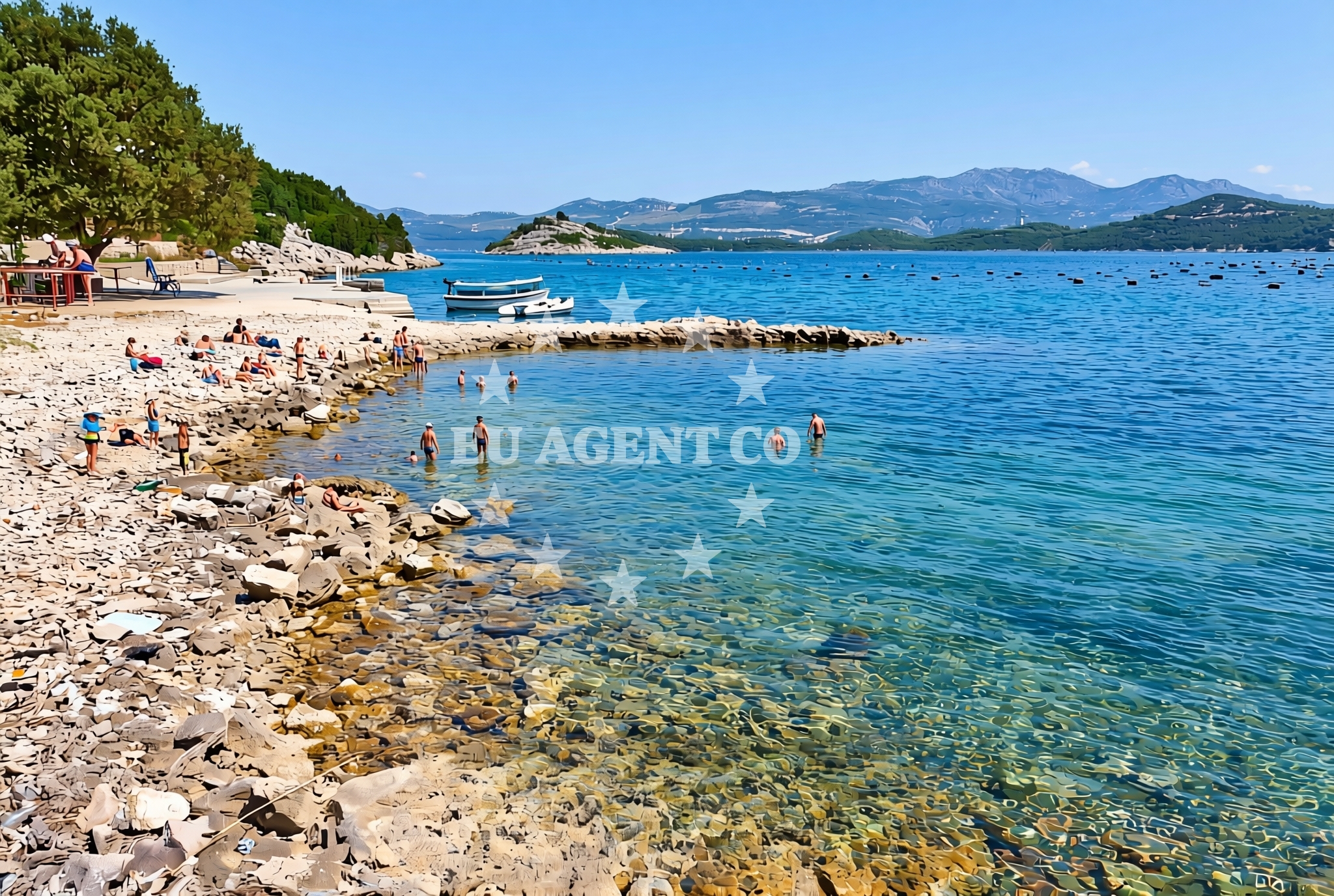
The beach's surface composition of gravel and stone slabs defines its character, suitable for those preferring a more utilitarian shoreline experience. The 100-meter length accommodates small groups, though the lack of artificial structures or designated zones means visitors will find an unembellished coastal environment. Natural shade is available in scattered clusters along the shoreline, likely provided by low-lying vegetation or rock formations.Swimming and shore
While the beach's gravel and stone slabs may not be ideal for prolonged sunbathing, the shoreline's direct access to the sea makes it a viable starting point for swimming. The absence of detailed water quality reports in the catalog means conditions should be assessed on-site. The beach's orientation and surrounding geography suggest exposure to typical Adriatic wave patterns, though specific surf intensity remains undocumented.Facilities and activities
No structured amenities or activities are explicitly listed for this beach. The gravel and stone surface suggests limited scope for recreational facilities beyond basic shoreline access. Visitors should expect a minimalist coastal experience focused on direct sea access rather than organized beach activities.Access and location
Located in Kabli sjever, this beach is part of a coastal area that connects to broader regional networks. While specific transport details are not cataloged, the settlement's position along Croatia's Adriatic coast implies proximity to maritime routes and potential links to nearby towns. The beach's coordinates (42.909627°N, 17.514521°E) place it within a sailing region known for its rugged coastline and scattered islands.What to expect
Visitors should prepare for a straightforward shoreline experience defined by gravel and stone slabs. The 100-meter length offers minimal space for group activities, with natural shade providing intermittent relief from sunlight. The beach's character aligns with Croatia's coastal tradition of utilitarian shorelines, where accessibility often takes precedence over recreational amenities. The surrounding area's maritime orientation suggests potential for nearby yacht charter exploration, though specific sailing connections remain unquantified in the catalog.Practical tips
Footwear with good traction is advisable due to the gravel and stone surface. The natural shade clusters can be used strategically for sun protection. Visitors should be aware that facilities are limited to the beach's basic characteristics, with no additional infrastructure documented.Exploring the coast by yacht
Kabli sjever's coastal position places it within a sailing region that includes numerous anchorages and marinas along Croatia's Adriatic coast. Yacht charter guests exploring this area may find opportunities to visit nearby islands and bays, though specific distances or routes are not detailed in the catalog. The beach's direct access to the sea aligns with Euro-Agent's focus on connecting coastal points to broader maritime experiences.Regional Coastal Context
The Kabli sjever coastline is part of a larger Adriatic stretch known for its dramatic cliffs and clear waters. Nearby settlements may offer additional amenities for visitors, though specific details are not cataloged here. The area's maritime character supports both recreational boating and yacht charter operations, with potential for exploring nearby islands and coastal towns.Anchorages in the surrounding area
- Anchorage — brijesta — 0.7 NM from beach
- Anchorage — duboka — 2.5 NM from beach
- Anchorage — klek — 2.6 NM from beach
- Anchorage — klek — 2.9 NM from beach
- Anchorage — zuljana — 2.9 NM from beach
- Anchorage — zuljana — 3.2 NM from beach
- Anchorage — duba — 4.2 NM from beach
- Anchorage — trstenik — 4.4 NM from beach
Distances are straight-line geographic distances, not sailing routes.
Mooring buoys in the surrounding area
Mooring buoys and jetties like Brijesta, Blace, and Mljet are located in the surrounding area of Kabli sjever, Putniković Beach.
- Brijesta — 0.8 NM from beach
- Jetty — blace — 5.8 NM from beach
- Buoy — mljet — 8.8 NM from beach
- Restaurant Dalmatinac quay — mljet — 8.9 NM from beach
- Quay — prapratno — 9.0 NM from beach
Distances are straight-line geographic distances, not sailing routes.
Marine fuel stations
Marine fuel stations in Ploce, Mljet, Korcula, and Dubrovnik serve the region near Kabli sjever, Putniković Beach.
- Fuel station — ploce — 9.2 NM from beach
- Fuel station — sobra — mljet — 11.3 NM from beach
- Fuel station — korcula — 16.3 NM from beach
- Ina — dubrovnik — 29.1 NM from beach
Distances are straight-line geographic distances, not sailing routes.
Harbours in the surrounding area
Harbors such as Zuljana, Drace, and Sresar are situated close to Kabli sjever, Putniković Beach.
- Žuljana — zuljana — 2.9 NM from beach
- Drače — drace — 3.1 NM from beach
- Sresar — rat — 3.8 NM from beach
- Trstenik — 5.1 NM from beach
- Opuzen — 6.9 NM from beach
- Hodilje — 8.3 NM from beach
Distances are straight-line geographic distances, not sailing routes.
Marinas in the surrounding area
- Marina Lumbarda — korcula — 15.1 NM from beach
- ACI Marina Korčula — korcula — 16.9 NM from beach
- ACI Marina Slano — 18.1 NM from beach
- Marina Frapa Dubrovnik — 29.2 NM from beach
- Marina Tučepi — marina tucepi — 29.2 NM from beach
Distances are straight-line geographic distances, not sailing routes.
Restaurants near the beach
Restaurants such as Bistro Ankora and Konoba Riva are located near Kabli sjever, Putniković Beach.
- Bistro Ankora — zuljana — 2.9 NM from beach
- Konoba Riva — zuljana — 3.0 NM from beach
Distances are straight-line geographic distances, not sailing routes.
Navigation guides for the surrounding area
Navigation guides including Uvala Kljemtine, Uvala Lopata, and Trstenik are relevant to the area around Kabli sjever, Putniković Beach.
- Uvala Kljemtine — 2.7 NM from beach
- Uvala Lopata — 2.9 NM from beach
- Uvala Klek — 2.9 NM from beach
- Trstenik — 4.8 NM from beach
- Bl ace — 5.6 NM from beach
Distances are straight-line geographic distances, not sailing routes.
Yachts from nearby departure bases
Yachts departing from Ploče City Port and Slano ACI Marina, offering sail boats and catamarans, are based near Kabli sjever, Putniković Beach.
Sailing yachts
- Elan 40 Impression (Karleta) — Ploče City Port — 9.2 NM from departure base to beach
- Sun Odyssey 419 (Luka Ploce) — Ploče City Port — 9.2 NM from departure base to beach
- Elan 514 Impression (Cesarica III) — Ploče City Port — 9.2 NM from departure base to beach
- Sun Odyssey 349 (Porto Tolero) — Ploče City Port — 9.2 NM from departure base to beach
- Salona 44 (SAMOA) — Ploče City Port — 9.2 NM from departure base to beach
- More 55 (MRS. ROBINSON) — Ploče City Port — 9.2 NM from departure base to beach
- Sun Odyssey 349 (Visnjica) — Ploče City Port — 9.2 NM from departure base to beach
- Oceanis 45 (Cancan) — Slano ACI Marina — 18.1 NM from departure base to beach
Catamarans
- Lagoon 450 Fly (Alba Mouse) — Ploče City Port — 9.2 NM from departure base to beach
- Lagoon 40 (SAILOR MOON) — Slano ACI Marina — 18.1 NM from departure base to beach
Distances are straight-line geographic distances, not sailing routes.