Južnja, Gdinj (Hvar) Beach, Croatia
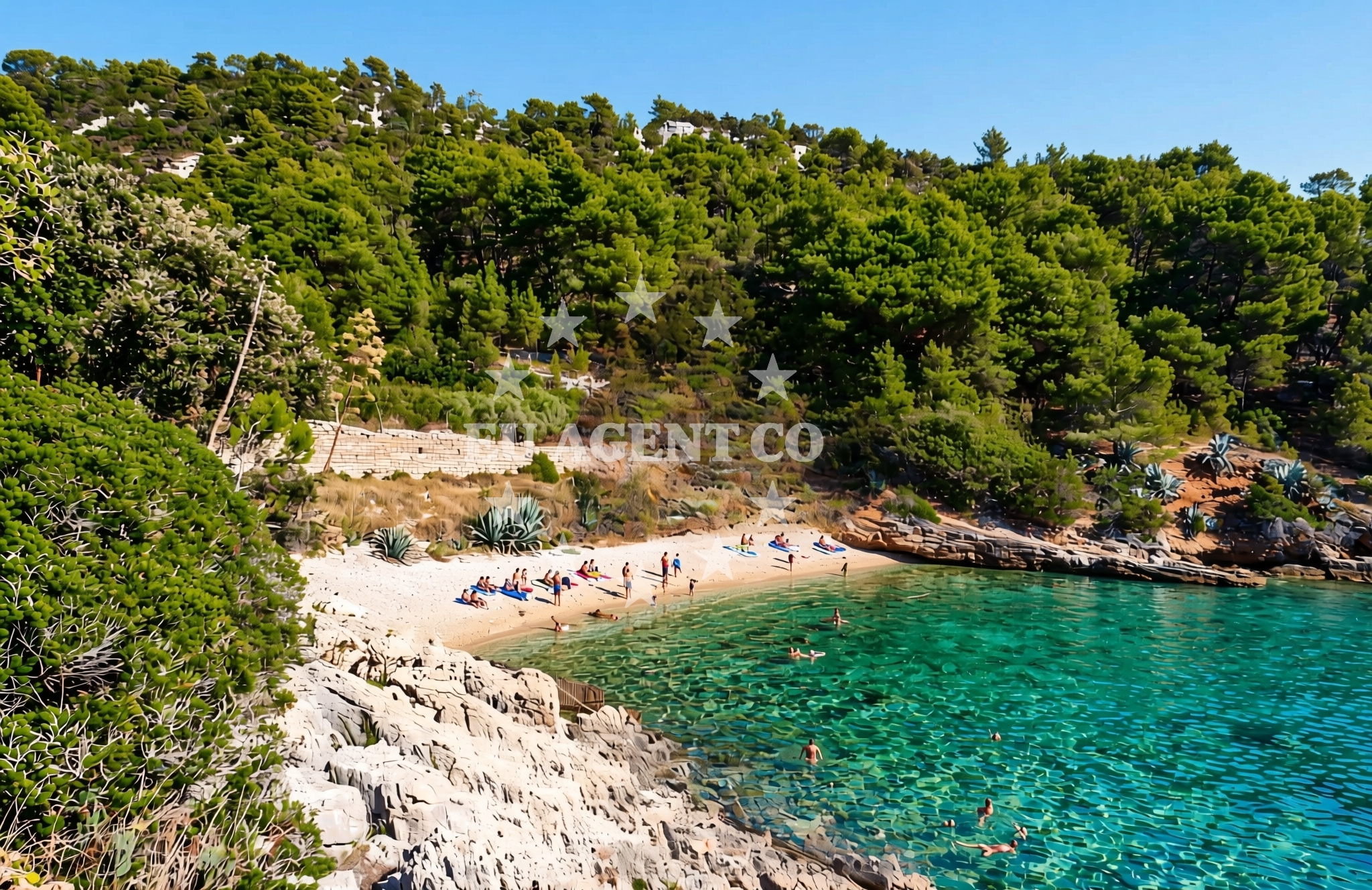
About this beach
Južnja, Gdinj (Hvar)
Beach: Južnja
Location: Gdinj (Hvar)
Characteristics and facilities
Pebbles, gravel
Beach character
The beach's composition of pebbles and gravel defines its character, making it more suitable for those seeking a less conventional shoreline experience. The area around Južnja is marked by rocky outcrops and sparse vegetation, typical of Hvar's southern coast. The beach is not enclosed by headlands, offering an open view of the sea, though the pebbles may make prolonged sunbathing uncomfortable. The surrounding terrain slopes gently toward the water, with no significant elevation changes.Swimming and shore
Swimming at Južnja Beach is possible but may be challenging due to the pebble-strewn shore. The water is generally clear, reflecting the typical conditions of the Adriatic coast. However, the lack of a sandy beach means that the area is less family-friendly for young children. The shore is not lined with vegetation or structures, and the pebbles can be uneven underfoot. The beach does not appear to have designated swimming zones or lifeguard services.Facilities and activities
There are no on-site facilities at Južnja Beach, such as showers, restrooms, or umbrellas. The absence of structured amenities aligns with the beach's natural, unembellished character. No specific activities are listed for the beach itself, though the surrounding area of Gdinj and Hvar offers opportunities for hiking, wine tasting, and exploring historical sites. Nearby, the island's famous Hvar Town and its Venetian architecture provide cultural attractions for visitors.Access and location
Južnja Beach is located in Gdinj, a village on the southern coast of Hvar. The island of Hvar is accessible by ferry from Split, with regular services operating throughout the season. For yacht charter guests, the area is well-positioned within the Adriatic sailing routes, offering proximity to the islands of Brac, Vis, and the mainland. The beach is not directly served by roads, requiring visitors to approach by foot or via local pathways from Gdinj. The nearest major settlement is Hvar Town, approximately 15 kilometers northeast.What to expect
Visitors to Južnja Beach should expect a natural, unspoiled shoreline composed of pebbles and gravel. The beach is not equipped with modern amenities, making it ideal for those seeking a more rustic coastal experience. The open shore and lack of structures provide an uninterrupted view of the sea, though the terrain may not be comfortable for extended periods of sunbathing. The area is best suited for short visits, with opportunities to explore the surrounding landscape of Gdinj and Hvar.Practical tips
Wear sturdy footwear to navigate the pebbles comfortably. The beach is not ideal for young children due to the uneven surface. Consider visiting during off-peak hours to avoid crowds, as the area is not heavily trafficked. For additional amenities, nearby Gdinj and Hvar Town offer dining, accommodations, and cultural sites.Exploring the coast by yacht
For yacht charter guests, the Hvar region is a prime destination within the Adriatic, offering sheltered bays, scenic anchorages, and proximity to popular sailing routes. The area around Gdinj and Hvar provides opportunities to explore the island's coastline, with nearby marinas in Hvar Town and Supetar facilitating yacht access. Euro-Agent's yacht charter services can help guests navigate the region's sailing opportunities, from tranquil bays to open sea routes.Cultural and Historical Context
Gdinj, like much of Hvar, has a rich history influenced by Venetian rule and medieval traditions. The island is known for its production of white wine, particularly the Plavac Mali variety. Visitors can explore nearby Hvar Town, a UNESCO-protected site with striking architecture, or venture to the island's vineyards for tastings. The coastal landscape of Hvar, including areas like Južnja, reflects the island's rugged beauty and maritime heritage.Anchorages in the surrounding area
Anchorages near Hvar, including Dugi Dolac and Gdinj.
- Anchorage — dugi dolac — hvar — 0.1 NM from beach
- Anchorage — dugi dolac — hvar — 0.2 NM from beach
- Anchorage — dugi dolac — hvar — 0.5 NM from beach
- Anchorage — hvar — 0.7 NM from beach
- Anchorage — dugi dolac — hvar — 0.8 NM from beach
- Anchorage — dugi dolac — hvar — 1.5 NM from beach
- Anchorage — gdinj — hvar — 1.8 NM from beach
- Anchorage — pokrivenik — hvar — 1.9 NM from beach
Distances are straight-line geographic distances, not sailing routes.
Mooring buoys in the surrounding area
Mooring buoys near Pokrivenik and other Hvar locations.
- Restaurant Preza quay — pokrivenik — hvar — 2.0 NM from beach
- Quay — hvar — 2.9 NM from beach
- Jetty — velika stiniva — hvar — 4.3 NM from beach
- Quay — bogomolje — hvar — 5.3 NM from beach
- Restaurant Korkyra xyz buoys — loviste — 7.6 NM from beach
Distances are straight-line geographic distances, not sailing routes.
Marine fuel stations
Marine fuel stations in Brac, Hvar, Makarska, and Korcula.
- Fuel station — sumartin — brac — 10.3 NM from beach
- Ina — vrboska — hvar — 10.5 NM from beach
- Ina — makarska — 11.8 NM from beach
- Ina — vela luka — korcula — 12.4 NM from beach
Distances are straight-line geographic distances, not sailing routes.
Harbours in the surrounding area
Harbors in Hvar, Korcula, and nearby areas like Lovište and Jelsa.
- Lovište — loviste — 7.9 NM from beach
- Port Jelsa — hvar — 9.3 NM from beach
- Prigradica — korcula — 9.9 NM from beach
- Sumartin — brac — 10.1 NM from beach
- Račišće — racisce — korcula — 10.1 NM from beach
- Vrboska — hvar — 10.5 NM from beach
Distances are straight-line geographic distances, not sailing routes.
Marinas in the surrounding area
Marinas in Hvar, Tučepi, and Korcula, including ACI Marina Vrboska.
- ACI Marina Vrboska — hvar — 10.4 NM from beach
- Marina Tučepi — marina tucepi — 11.2 NM from beach
- Marina Korkyra — vela luka — korcula — 12.5 NM from beach
- Marina Ramova — krvavica — 12.9 NM from beach
- ACI Marina Korčula — korcula — 14.2 NM from beach
Distances are straight-line geographic distances, not sailing routes.
Restaurants near the beach
Restaurants near the beach, including Restaurant Timun in Pokrivenik and Pakomina on Hvar.
- Restaurant Timun — pokrivenik — hvar — 2.0 NM from beach
- Pakomina — hvar — 2.9 NM from beach
Distances are straight-line geographic distances, not sailing routes.
Navigation guides for the surrounding area
Navigation guides for areas like Uvala Pokrivenik and Uvala Kozja, useful for planning routes.
- Uvala Pokrivenik — 1.9 NM from beach
- Uvala Duboka — 6.5 NM from beach
- Uvala Kozja — 6.7 NM from beach
- Uvala Manastir — 8.2 NM from beach
- Luka Lovisce — 8.5 NM from beach
Distances are straight-line geographic distances, not sailing routes.
Yachts from nearby departure bases
Yachts departing from Tučepi Port, Makarska Port, and Baška Voda, offering sail and motor options.
Sailing yachts
- Bavaria 40 Cruiser (LADY BUTTERFLY) — Tučepi Port — 11.2 NM from departure base to beach
- Elan 50 Impression (FINES DE CLAIRES) — Baška Voda — 14.5 NM from departure base to beach
- Elan 384 Impression (Lissa) — Baška Voda — 14.5 NM from departure base to beach
Catamarans
- Lagoon 450 (LAMANTIN) — Baška Voda — 14.5 NM from departure base to beach
Motor yachts
- Princess V53 (Chablis) — Makarska Port — 11.7 NM from departure base to beach
- Canados 86 (Karisma) — Baška Voda — 14.5 NM from departure base to beach
Motor boats
- Jeanneau NC 37 (Black Pearl) — Makarska Port — 11.7 NM from departure base to beach
- Galeon 430 Skydeck (BELLAGIO) — Makarska Port — 11.7 NM from departure base to beach
- Jeanneau NC 37 (Black Pearl) — Makarska Port — 11.7 NM from departure base to beach
- Galeon 430 Skydeck (Bellagio) — Makarska Port — 11.7 NM from departure base to beach
Distances are straight-line geographic distances, not sailing routes.