Jurline, Seline Beach, Croatia
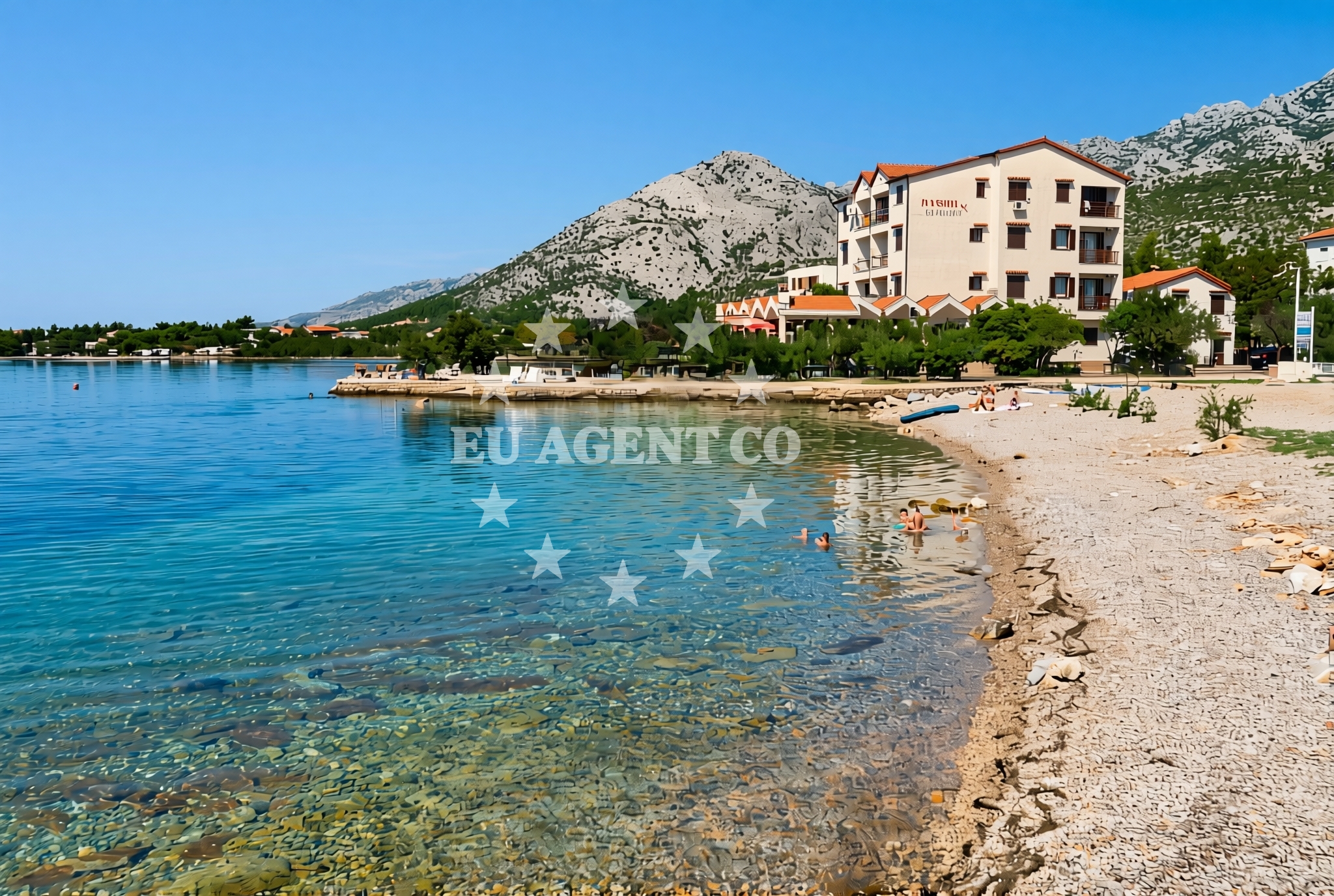
Jurline, Seline Beach lies along the Adriatic coast near the settlement of Jurline, offering a gravel shoreline that stretches approximately 150 meters. The beach's composition and positioning reflect the rugged coastal character of this part of Croatia's Dalmatian coast. While the beach itself lacks formal amenities, its location provides access to broader regional attractions and maritime routes that define this part of the Adriatic.
About this beach
Jurline, Seline
Beach: Jurline
Location: Seline
Characteristics and facilities
Gravel
150 m
Beach character
The beach consists of gravel deposits, creating a shoreline that contrasts with the more common sandy beaches of the region. This composition suggests the area may be subject to coastal erosion processes typical of the Adriatic's rocky coastlines. The 150-meter length offers limited space for beachgoers, though the gravel substrate may provide stable footing for those exploring the shoreline. The beach's positioning appears to be influenced by local geological formations, which shape the coastal profile in this part of Croatia.
Swimming and shore
The gravel substrate may present challenges for swimming activities, as the beach lacks the smooth, sandy gradients typical of more developed coastal areas. However, the beach's proximity to the sea could offer opportunities for wading or exploring tidal zones. The shoreline's natural character suggests minimal human modification, preserving the area's original coastal features.
Facilities and activities
No formal facilities or structured activities are documented for Jurline, Seline Beach. The absence of amenities indicates this may be an undeveloped or minimally maintained shoreline. Visitors should expect a natural, unmodified beach experience without access to showers, restrooms, or other infrastructure typically found at more tourist-oriented beaches.
Access and location
The beach is located in Jurline, a settlement on the Adriatic coast of Croatia. Its exact positioning relative to nearby roads or settlements is not specified in available records, but its coordinates (44.280854, 15.469528) place it within a region known for its rugged coastline and historic maritime routes. The area's geography suggests it may be accessible via local roads connecting to larger coastal towns in the region.
What to expect
Visitors to Jurline, Seline Beach should anticipate a natural shoreline composed of gravel, with limited space for recreational activities. The beach's undeveloped state means there are no formal amenities or services available. The area's coastal character reflects the Adriatic's natural landscape, with potential for exploring the surrounding terrain and maritime environment. Those visiting should consider the beach's positioning within the broader context of the region's coastal geography and available maritime routes.
Practical tips
Given the beach's gravel composition and lack of amenities, visitors may want to bring appropriate footwear for walking along the shoreline. The area's natural state suggests limited facilities for refreshments or shade, so planning accordingly is advisable. The beach's location offers potential for exploring nearby coastal settlements and maritime routes, which may be of interest to those combining beach visits with broader regional exploration.
Exploring the coast by yacht
For yacht charter guests, Jurline's position on the Adriatic coast places it within reach of several sailing routes popular with Euro-Agent clients. The nearby waters connect to historic maritime pathways that have long linked Croatia's coastal settlements. While the beach itself is not a formal anchorage, its location provides a reference point for sailors exploring the region's coastline. Charter guests may find the area useful as a landmark when navigating between larger ports and marinas in the region.
Regional Coastal Context
The beach lies within a stretch of Croatia's coast known for its rugged terrain and historic maritime significance. This part of the Dalmatian coast features a mix of rocky shorelines and smaller coves, with settlements that have maintained traditional coastal lifestyles. The area's geography influences local sailing patterns, with currents and coastal formations shaping navigational routes that remain relevant to modern yacht charter operations.
Anchorages in the surrounding area
Anchorages in the surrounding area include Vinjerac, Maslenica, and Rtina, offering nearby options for mooring near Jurline, Seline Beach.
- Anchorage — vinjerac — 1.4 NM from beach
- Anchorage — maslenica — 6.2 NM from beach
- Anchorage — rtina — 7.4 NM from beach
- Anchorage — rtina — 7.4 NM from beach
- Anchorage — ljubac — 7.6 NM from beach
- Anchorage — ljubac — 7.6 NM from beach
- Anchorage — novigrad — 8.2 NM from beach
- Anchorage — tribanj — 9.1 NM from beach
Distances are straight-line geographic distances, not sailing routes.
Mooring buoys in the surrounding area
- Šibuljina Point — sibuljina point — 6.5 NM from beach
- Jetty — ljubac — 7.7 NM from beach
- Jetty — zadar — 14.2 NM from beach
- Jetty — zadar — 14.2 NM from beach
- Punta Skala — petrcane — 14.9 NM from beach
Distances are straight-line geographic distances, not sailing routes.
Marine fuel stations
Marine fuel stations in the surrounding area include Ina in Zadar and Sukosan, ensuring refueling options for vessels near Jurline, Seline Beach.
- Ina — zadar — 14.3 NM from beach
- Fuel station — sukosan — 15.6 NM from beach
- Ina — preko — ugljan — 17.1 NM from beach
- Ina — biograd na moru — 20.6 NM from beach
Distances are straight-line geographic distances, not sailing routes.
Harbours in the surrounding area
Harbours in the surrounding area include Seline and Vinjerac, with Seline being a nearby harbor just a short distance from Jurline, Seline Beach.
- Seline — 0.3 NM from beach
- Vinjerac — 1.4 NM from beach
- Starigrad Paklenica — 1.6 NM from beach
- Maslenica — 4.7 NM from beach
- Ražanac — razanac — 5.3 NM from beach
- Obrovac — 10.3 NM from beach
Distances are straight-line geographic distances, not sailing routes.
Marinas in the surrounding area
- Marina Zadar — 14.2 NM from beach
- Vitrenjak Zadar — 14.3 NM from beach
- Marina Borik — zadar — 14.4 NM from beach
- Marina Dalmacija — sukosan — 15.5 NM from beach
- Olive Island Marina — sutomiscica — ugljan — 17.0 NM from beach
Distances are straight-line geographic distances, not sailing routes.
Restaurants near the beach
Restaurants near the beach include Restaurant Seline and Gostionica Ivan, providing dining options in the immediate vicinity of Jurline, Seline Beach.
- Restaurant — seline — 0.4 NM from beach
- Gostionica Ivan — seline — 0.6 NM from beach
- Buffet Paklenica — starigrad paklenica — 0.8 NM from beach
- Restaurant — starigrad paklenica — 1.0 NM from beach
Distances are straight-line geographic distances, not sailing routes.
Navigation guides for the surrounding area
Navigation guides for the surrounding area include Starigrad-Paklenica and Posedarje, assisting in route planning near Jurline, Seline Beach.
- Starigrad-Paklenica {Velebitski Kanai) — 1.4 NM from beach
- Posedarje (Novigradsko More) — 4.4 NM from beach
- VELESITSKI KANAL (S) — 5.1 NM from beach
- KrusCica and Uvala KrusCica Duboka — 7.5 NM from beach
- Privlaka — 15.0 NM from beach
Distances are straight-line geographic distances, not sailing routes.
Yachts from nearby departure bases
Yachts from nearby departure bases include those based in Novigrad Dalmatia and Zadar Marina, offering options for charters traveling to Jurline, Seline Beach.
Sailing yachts
- Bavaria Cruiser 37 (GOSPOJA ) — Zadar Marina — 14.2 NM from departure base to beach
- Elan 45 Impression (Reina Del Mar) — Zadar Marina — 14.2 NM from departure base to beach
Catamarans
- Delta F40-XT (Veronchie) — Zadar Marina — 14.2 NM from departure base to beach
- Bali 4.6 (Jako 2) — Zadar Marina — 14.2 NM from departure base to beach
Motor boats
- Merry Fisher 795 () — Novigrad Dalmatia — 6.8 NM from departure base to beach
- Rancraft RS Cinque.5 — Zadar Diklo Port — 13.8 NM from departure base to beach
- Rancraft RM21 (Dugi otok) — Zadar Diklo Port — 13.8 NM from departure base to beach
- Rancraft RM19 (Daycruiser) — Zadar Diklo Port — 13.8 NM from departure base to beach
- Tempest 600 (CAPELLI) — Zadar Marina — 14.2 NM from departure base to beach
- Balt 918 Titanium (Wanderer) — Zadar Marina — 14.2 NM from departure base to beach
Distances are straight-line geographic distances, not sailing routes.