Jurkovica Beach, Komiža (Vis), Croatia
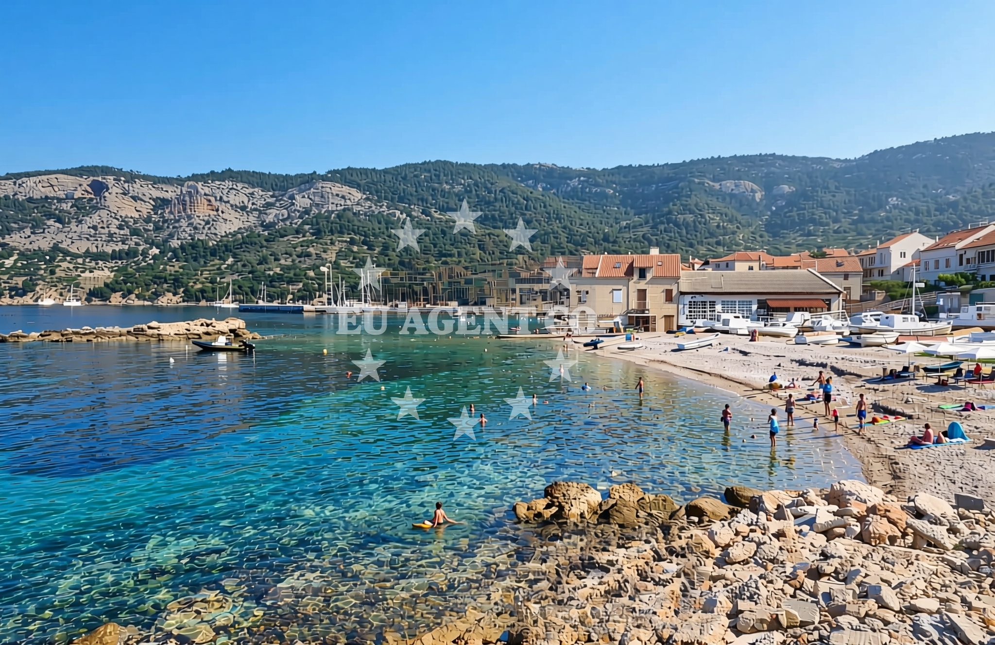
About this beach
Jurkovica, Komiža (Vis)
Beach: Jurkovica
Location: Komiža (Vis)
Characteristics and facilities
Gravel, concrete / stone slabs
110 m
Beach character
Jurkovica's shoreline is characterized by gravel and concrete slabs, a feature that sets it apart from the more common sandy beaches of the region. The beach extends for 110 meters along the coast, offering a linear stretch that contrasts with the island's more typical pebbled or rocky shores. While the lack of sand may limit traditional sunbathing, the flat, stable surface provides a practical area for walking or light recreational activities. The beach's immediate surroundings include rocky outcrops and low-lying coastal terrain, typical of Vis's rugged coastline.Swimming and shore
The gravel and concrete composition of Jurkovica Beach may present challenges for swimming, as the shoreline lacks the gradual slope typical of sandy beaches. The immediate coastal waters are likely to be shallow and subject to wave action, which could make entry difficult for some visitors. However, the beach's proximity to the open sea means that the waters beyond the immediate shoreline may offer calmer conditions for boating or snorkeling, depending on weather and tidal patterns.Facilities and activities
The beach does not appear to have formal amenities such as showers, restrooms, or changing facilities. No structured activities are listed in the beach's catalog records, though the surrounding area of Komiža offers opportunities for cultural exploration, including historic sites and traditional fishing villages. Visitors should note that the beach's facilities are limited to its natural features, with no additional infrastructure reported in the authoritative records.Access and location
Jurkovica Beach is situated within Komiža, a village on the island of Vis, which is part of Croatia's Dalmatian Coast. Access to the beach requires reaching Vis, which can be done via ferry services from nearby mainland ports such as Split or Šibenik. The island's road network connects Komiža to other settlements, though the beach itself is likely accessible via local pathways or short walks from the village. The beach's location on the southern coast of Vis places it within a region known for its dramatic cliffs and clear waters, making it a strategic point for exploring the island's maritime landscape.What to expect
Jurkovica Beach offers a unique coastal experience defined by its gravel and concrete shoreline. Visitors should expect a 110-meter stretch of flat, stable surface that contrasts with the island's more typical pebbled or rocky beaches. The beach's immediate surroundings include rocky outcrops and low-lying coastal terrain, creating a setting that emphasizes natural features over recreational amenities. While no formal facilities are listed, the beach's location within Komiža provides proximity to the village's cultural and historical attractions. The shoreline's composition may influence swimming conditions, with the immediate waters likely to be shallow and subject to wave action. For those seeking a more conventional beach experience, other stretches of Vis's coast may offer sandy or pebbled alternatives.Practical tips
Visitors to Jurkovica Beach should consider the gravel and concrete surface when planning activities, as it may be less suitable for traditional sunbathing. Footwear with good traction is recommended for navigating the shoreline. Given the lack of formal facilities, visitors may want to bring personal items such as towels or water containers. The beach's location in Komiža means that visitors can combine their visit with explorations of the village's historic sites, including its medieval fortifications and traditional fishing architecture.Exploring the coast by yacht
For yacht charter guests, Jurkovica Beach's location on the southern coast of Vis offers a strategic vantage point for exploring the island's maritime landscape. The nearby waters are part of the Adriatic's renowned sailing routes, with Vis itself being a popular destination for charter yachts due to its sheltered bays and clear waters. While the beach itself is not a formal anchorage, the surrounding area includes several marinas and harbors that cater to yachts of varying sizes. The proximity to Komiža means that visitors can easily access the village's amenities after a day spent exploring the coastline or anchoring in nearby bays.Historical Context of Komiža
Komiža, the village that hosts Jurkovica Beach, has a rich history dating back to the medieval period. The village is home to the Komiža Fortress, a 16th-century structure that offers panoramic views of the surrounding coastline. The area's historical significance is further highlighted by its role in the Adriatic's maritime trade routes, which influenced the development of local fishing and naval traditions. These historical elements provide a cultural backdrop for visitors exploring the beach and its surroundings.Anchorages in the surrounding area
Anchorages in Komiza and Stiniva offer nearby mooring options within a few nautical miles of Jurkovica Beach.
- Anchorage — komiza — vis — 0.2 NM from beach
- Uvala Knezice — komiza — vis — 1.2 NM from beach
- Anchorage — komiza — vis — 2.5 NM from beach
- Stiniva — vis — 3.8 NM from beach
- Anchorage — vis — 4.2 NM from beach
- Anchorage — vis — 4.4 NM from beach
- Vis luka — 4.4 NM from beach
- Parja — vis — 4.5 NM from beach
Distances are straight-line geographic distances, not sailing routes.
Mooring buoys in the surrounding area
- Lucka Uprava buoys, Komiza — vis — 0.3 NM from beach
- Komiza Buoy field — vis — 0.3 NM from beach
- Quay — vis — 1.6 NM from beach
- Buoy field — vis — 4.6 NM from beach
- Jetty — vis — 4.6 NM from beach
Distances are straight-line geographic distances, not sailing routes.
Marine fuel stations
Fuel stations in Vis, Hvar, Brac, and Solta serve as refueling options for vessels traveling to Jurkovica Beach.
- Petrol station Ina — vis — 4.4 NM from beach
- Fuel station — hvar — 17.2 NM from beach
- Ina — milna brac — 23.1 NM from beach
- Fuel station — rogac — solta — 23.2 NM from beach
Distances are straight-line geographic distances, not sailing routes.
Harbours in the surrounding area
Harbors in Komiža and Vis offer nearby port facilities within a short distance of Jurkovica Beach.
- Komiža — komiza — vis — 0.1 NM from beach
- Luka — vis — 4.4 NM from beach
- Rogačić — vis — 4.7 NM from beach
- Kut — vis — 4.9 NM from beach
Distances are straight-line geographic distances, not sailing routes.
Marinas in the surrounding area
- ACI Marina Palmižana — aci marina palmizana — st klement — 15.2 NM from beach
- Marina Martinis Marchi — maslinica — solta — 22.0 NM from beach
- Marina Vlaška — milna brac — 23.1 NM from beach
- Marina Milna Kanarija — milna brac — 23.1 NM from beach
- ACI Marina Milna — milna brac — 23.2 NM from beach
Distances are straight-line geographic distances, not sailing routes.
Restaurants near the beach
- Pizzeria Hum — komiza — vis — 0.1 NM from beach
- Fabrika — komiza — vis — 0.1 NM from beach
- Riblji Komiza — vis — 0.1 NM from beach
- Pizzeria Charly — komiza — vis — 0.1 NM from beach
- Restaurant — komiza — vis — 0.3 NM from beach
- Barba — komiza — vis — 0.3 NM from beach
- Bako — komiza — vis — 0.3 NM from beach
Distances are straight-line geographic distances, not sailing routes.
Navigation guides for the surrounding area
Navigation guides for Komiža and surrounding areas assist in planning routes to Jurkovica Beach.
- Komiža — 0.2 NM from beach
- Uvala Stoncica — 7.1 NM from beach
- Luka Soline — 14.1 NM from beach
- Uvala Tarsce — 14.5 NM from beach
- Uvala Stari Stani — 14.7 NM from beach
Distances are straight-line geographic distances, not sailing routes.
Yachts from nearby departure bases
Sailing yachts
- Hanse 455 (AURUM 1) — Milna Marina Vlaška — 23.1 NM from departure base to beach
- Hanse 388 (BANJO) — Milna Marina Vlaška — 23.1 NM from departure base to beach
- Bavaria 46 Cruiser (MO) — Milna Marina Vlaška — 23.1 NM from departure base to beach
- Hanse 505 (AVALON) — Milna Marina Vlaška — 23.1 NM from departure base to beach
- Cyclades 39.3 (Patagonia) — Šolta Rogač — 23.1 NM from departure base to beach
- Sun Odyssey 449 (Odessa) — Šolta Rogač — 23.1 NM from departure base to beach
- Cyclades 43.4 (Tigris) — Šolta Rogač — 23.1 NM from departure base to beach
Catamarans
- Lagoon 42 (Galapagos) — Šolta Rogač — 23.1 NM from departure base to beach
- Lagoon 450 (Madagascar) — Šolta Rogač — 23.1 NM from departure base to beach
- Lagoon 450 Flybridge (Samogon) — Šolta Rogač — 23.1 NM from departure base to beach
Distances are straight-line geographic distances, not sailing routes.