Jurišnica, Cesarica Beach, Croatia
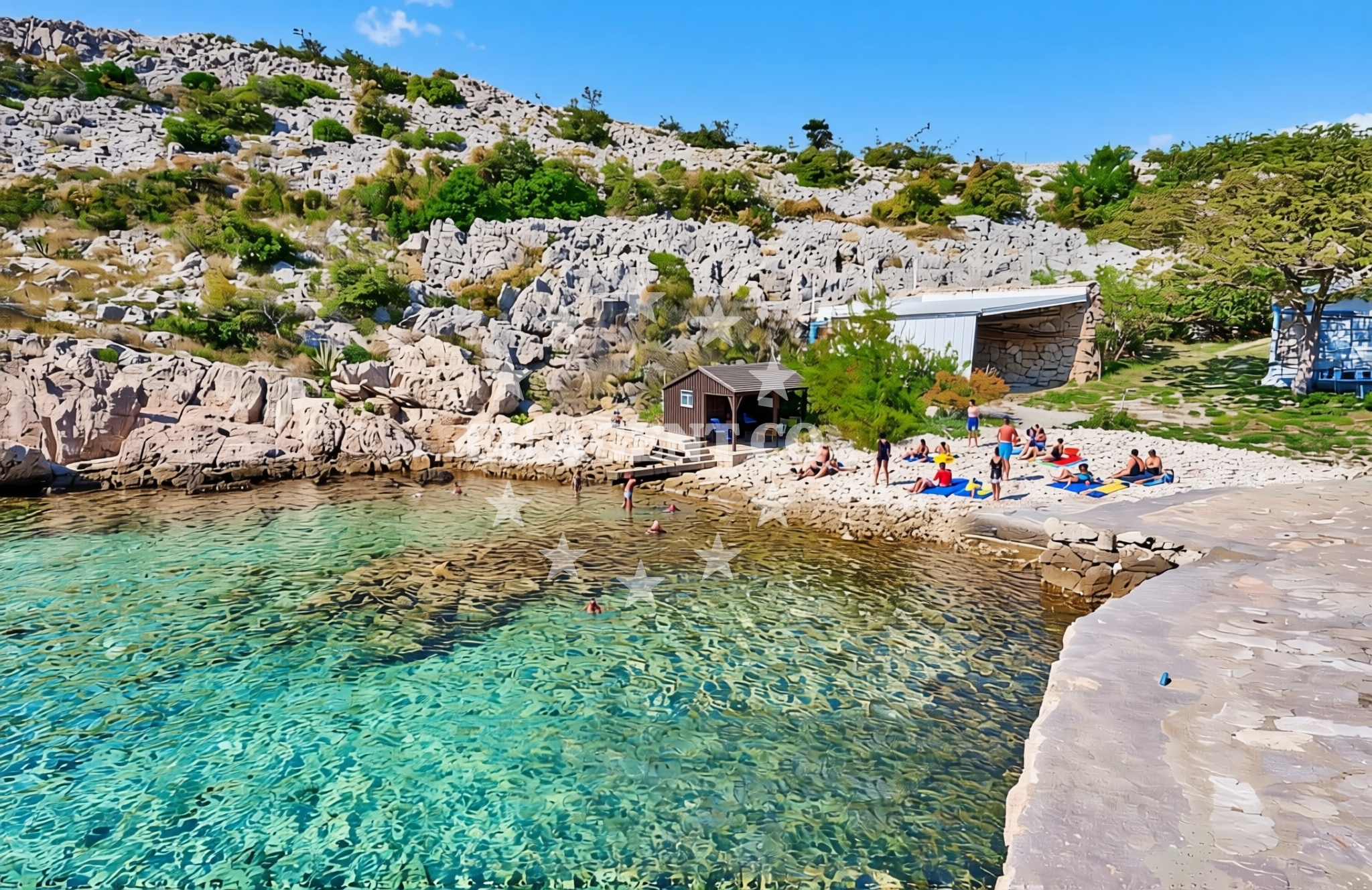
About this beach
Jurišnica, Cesarica
Beach: Jurišnica
Location: Cesarica
Characteristics and facilities
Gravel, concrete / stone slabs
Beach character
The beach's primary feature is its gravel and stone slab composition, which contrasts with the more common sandy or pebbly shorelines found elsewhere in the Adriatic. This surface type suggests limited direct water access for swimming, though it may provide stable footing for walking along the shore. The absence of structured amenities or facilities in the catalog indicates a more natural, unembellished setting. Visitors should expect a rugged coastline profile, with potential for uneven terrain near the water's edge.Swimming and shore
Due to the gravel and stone slab characteristics, direct swimming from the beach itself may be impractical. The shoreline's composition appears better suited for coastal walking or exploration rather than water-based activities. The lack of explicit swimming-related features in the catalog suggests that this beach is not primarily oriented toward aquatic recreation, though adjacent areas might offer alternative access points for swimming or water sports.Facilities and activities
The beach does not list any structured facilities or activities in its authoritative features. This absence implies minimal infrastructure for visitor services such as showers, restrooms, or seating. The activities section remains empty, indicating no specific recreational offerings are associated with the beach itself. However, the broader Jurišnica area may provide opportunities for hiking, cycling, or exploring nearby coastal settlements.Access and location
Located in Jurišnica, Cesarica Beach is positioned within a region that connects to the wider Adriatic sailing network. While the beach's coordinates (44.574025°N, 14.989421°E) place it near the coast, the lack of detailed access information in the catalog suggests visitors should investigate local road networks or nearby settlements for entry points. The beach's proximity to Jurišnica may provide connections to regional transport routes, though specific pathways are not outlined in available data.What to expect
Visitors to Jurišnica, Cesarica Beach should prepare for a shoreline defined by gravel and stone slabs, which may present challenges for barefoot walking or direct water access. The beach appears to function more as a transitional zone between land and sea rather than a recreational hub. While no amenities are explicitly listed, the area's connection to Jurišnica suggests potential for exploring nearby coastal villages or accessing regional trails. The beach's character aligns with the rugged Adriatic coastline, where natural formations often take precedence over developed facilities.Practical tips
Given the beach's gravel and stone slab surface, sturdy footwear is recommended for walking along the shore. Visitors should be aware that direct swimming may not be feasible from this specific location. Exploring nearby Jurišnica could provide additional context about local access routes or complementary activities in the area.Exploring the coast by yacht
For yacht charter guests, the broader Adriatic region offers extensive sailing opportunities, though Jurišnica, Cesarica Beach itself is not marked as an anchorage or marina. The area's proximity to the Adriatic Sea suggests potential for exploring nearby coastal routes, with marinas and harbors available in larger settlements along the Croatian coast. Charter yachts may use this region as a reference point for navigating the Dalmatian coast, where sailing conditions are generally favorable.Regional Context
Jurišnica is part of the Split-Dalmatia County, an area known for its rugged coastline and historic settlements. The beach's location reflects the geological diversity of the region, where limestone formations and rocky shores are common. Nearby, the town of Jurišnica provides access to local services and may serve as a base for exploring the surrounding Adriatic waters.Anchorages in the surrounding area
Anchorages in the surrounding area, including nearby Prizna and Cesarica.
- Anchorage — cesarica — 0.4 NM from beach
- Anchorage — cesarica — 1.5 NM from beach
- Anchorage — prizna — 1.6 NM from beach
- Anchorage — cesarica — 1.9 NM from beach
- Anchorage — novalja — pag — 3.4 NM from beach
- Anchorage — pag — 3.4 NM from beach
- Anchorage — prizna — 3.6 NM from beach
- Anchorage — pag — 3.6 NM from beach
Distances are straight-line geographic distances, not sailing routes.
Mooring buoys in the surrounding area
Mooring buoys in the surrounding area, such as those in Pag and Novalja.
- Jetty — zubovici — pag — 3.2 NM from beach
- Jetty — zubovici — pag — 3.2 NM from beach
- Buoy field — novalja — pag — 5.0 NM from beach
- Drljanda — stara novalja — pag — 5.3 NM from beach
- Jetty — simuni — pag — 6.8 NM from beach
Distances are straight-line geographic distances, not sailing routes.
Marine fuel stations
Marine fuel stations in nearby areas like Rab and Mali Losinj.
- Ina — rab — 14.7 NM from beach
- Ina — mali losinj — 22.6 NM from beach
- Adria Oil — mali losinj — 22.9 NM from beach
- Tifon — nerezine — losinj — 26.0 NM from beach
Distances are straight-line geographic distances, not sailing routes.
Harbours in the surrounding area
Harbours in the surrounding area, including Prizna and Pag.
- Žigljen — zigljen — pag — 1.8 NM from beach
- Prizna — 1.9 NM from beach
- Karlobag — 4.6 NM from beach
- Novalja — pag — 4.9 NM from beach
- Stara Novalja — pag — 5.1 NM from beach
- Pag — 8.2 NM from beach
Distances are straight-line geographic distances, not sailing routes.
Marinas in the surrounding area
Marinas in nearby areas such as Rab, Mali Lošinj, and Simuni.
- ACI Marina Šimuni — simuni — pag — 6.4 NM from beach
- ACI Marina Rab — 14.6 NM from beach
- ACI Marina Supetarska Draga — rab — 17.8 NM from beach
- Y/C Marina Mali Lošinj — mali losinj — 22.7 NM from beach
- Marina Lošinj — mali losinj — 22.9 NM from beach
Distances are straight-line geographic distances, not sailing routes.
Restaurants near the beach
Restaurants near the beach, including options in Novalja.
- Margarita — novalja — pag — 4.6 NM from beach
- Restaurant — novalja — pag — 4.6 NM from beach
- Restaurant — novalja — pag — 4.6 NM from beach
- Konoba Antika — novalja — pag — 4.6 NM from beach
- Restaurant — novalja — pag — 4.6 NM from beach
- Moby Dick — novalja — pag — 4.6 NM from beach
- Restaurant — novalja — pag — 4.6 NM from beach
Distances are straight-line geographic distances, not sailing routes.
Navigation guides for the surrounding area
Navigation guides for nearby areas, including Uvala Prizna.
- Uvala Prizna — 1.8 NM from beach
- Caska — 3.2 NM from beach
- Novalja — 4.5 NM from beach
- Uvala Zavratnica — 8.4 NM from beach
- Uvala Bliznica — 8.7 NM from beach
Distances are straight-line geographic distances, not sailing routes.
Yachts from nearby departure bases
Yachts from nearby departure bases such as Novalja and Šimuni.
Sailing yachts
- First 45 (Egeria) — Šimuni Kolan ACI Marina — 6.3 NM from departure base to beach
- Elan 35 Impression (Essi) — Mali Lošinj — 22.7 NM from departure base to beach
- Elan 40 Impression (Laali) — Mali Lošinj — 22.7 NM from departure base to beach
Motor yachts
- Absolute 50 Fly (Acrobat) — Rab ACI Marina — 14.6 NM from departure base to beach
Motor boats
- Balt 818 Titanium (Valentina) — Novalja — 4.8 NM from departure base to beach
- Balt 818 Titanium (Valentina 2) — Novalja — 4.8 NM from departure base to beach
- BWA Sport 22GT (BWA ) — Pag City Port — 8.3 NM from departure base to beach
- Merry Fisher 895 — Povljana Marina — 14.4 NM from departure base to beach
- Barracuda 530 RIB (Hvar) — Mali Lošinj — 22.7 NM from departure base to beach
- Atlantic Marine Sun Cruiser 690 — Mali Lošinj — 22.7 NM from departure base to beach
Distances are straight-line geographic distances, not sailing routes.