Jaz, Privlaka (Zadarska županija) Beach, Croatia
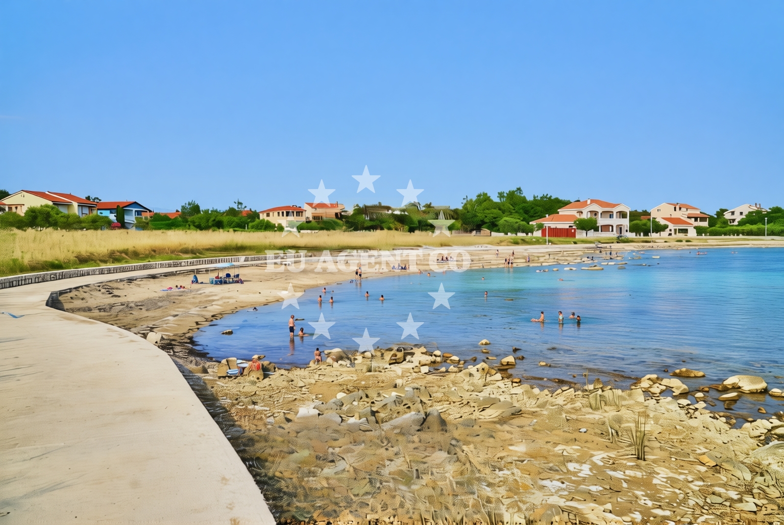
About this beach
Jaz, Privlaka (Zadarska županija)
Beach: Jaz
Location: Privlaka (Zadarska županija)
Characteristics and facilities
Sand, concrete / stone slabs, rocks
220 m
Beach character
The beach's composition reflects its geological context, with sandy sections ideal for sunbathing and concrete/stone slabs that may serve as transitional zones between land and sea. Rocky areas extend along parts of the shore, offering opportunities for exploration or quiet retreats. The 220-meter length provides sufficient space for visitors to spread out, though the absence of structured facilities means the beach remains largely undeveloped. Its position in Zadarska županija places it within a region known for its rugged coastline and historical significance.Swimming and shore
The sandy portions of the beach are likely suitable for swimming, though water conditions are not specified in the catalog. The rocky sections may be less accessible for swimming but could provide vantage points for observing marine life or enjoying the shoreline's natural contours. As with many Adriatic beaches, seasonal variations in water clarity and temperature would influence the swimming experience.Facilities and activities
No formal facilities such as showers, restrooms, or parking are documented for this beach. The lack of structured activities suggests it is primarily a natural destination rather than a recreational hub. However, the surrounding area of Zadarska županija offers cultural and historical sites that may complement a visit to the beach.Access and location
Situated in Jaz, a small coastal village within Zadarska županija, the beach is part of a region characterized by its mix of historic towns, rural landscapes, and coastal trails. The nearest major town, Zadar, lies approximately 30 kilometers to the northeast, offering connections to regional transportation networks and cultural attractions. The beach's coordinates (44.258132, 15.117104) place it along the central Dalmatian coast, a popular corridor for maritime travel.What to expect
Visitors should anticipate a beach that prioritizes natural features over developed infrastructure. The sandy areas provide basic sunbathing opportunities, while the rocky sections may require footwear for safe navigation. The beach's undeveloped state means it lacks services such as lifeguards, rental equipment, or food vendors. Its appeal lies in its unaltered coastal environment, making it suitable for those seeking solitude or a connection to the Adriatic's raw coastline.Practical tips
Bring a towel and sunscreen for the sandy areas, and consider sturdy shoes for exploring the rocky sections. Due to the absence of formal facilities, visitors should plan to bring personal supplies. The beach's location in Zadarska županija means it may be less crowded than more commercialized Adriatic destinations.Exploring the coast by yacht
For yacht charter guests, the central Dalmatian coast—including Zadarska županija—offers a range of sailing opportunities. The region's sheltered bays, historic ports, and scenic anchorages make it a favored route for both motor and sail boats. While this specific beach does not appear to be a designated marina or anchorage, nearby ports in Zadar and surrounding islands provide access to charter services. Euro-Agent's yacht search tool can help identify vessels available for exploring this coastline.Regional Context
Zadarska županija is part of Croatia's historic northern Dalmatia region, known for its medieval fortifications, vineyards, and coastal trails. The area's maritime heritage is reflected in its ports and the presence of nautical routes connecting it to the rest of the Adriatic. Visitors interested in combining beach time with cultural exploration may find nearby towns like Zadar, Šibenik, and the islands of Vis and Hvar of particular interest.Anchorages in the surrounding area
- Anchorage — privlaka — 0.4 NM from beach
- Anchorage — privlaka — 0.9 NM from beach
- Anchorage — vir — 1.9 NM from beach
- Anchorage — vir — 2.4 NM from beach
- Anchorage — vir — 2.6 NM from beach
- Anchorage — vir — 3.3 NM from beach
- Anchorage — nin — 3.5 NM from beach
- Anchorage — nin — 3.6 NM from beach
Distances are straight-line geographic distances, not sailing routes.
Mooring buoys in the surrounding area
Mooring buoys in Vir and Punta Skala are located near Jaz, Privlaka (Zadarska županija) Beach.
- Vir — 2.7 NM from beach
- Punta Skala — petrcane — 4.1 NM from beach
- Jetty — ugljan — 7.3 NM from beach
- Buoy field — muline — ugljan — 7.3 NM from beach
- Jetty — ljubac — 7.6 NM from beach
Distances are straight-line geographic distances, not sailing routes.
Marine fuel stations
Fuel stations in Zadar and Ugljan are situated near Jaz, Privlaka (Zadarska županija) Beach.
- Ina — zadar — 9.7 NM from beach
- Ina — preko — ugljan — 11.4 NM from beach
- Fuel station — sukosan — 14.6 NM from beach
- Ina — zaglav — dugi otok — 18.6 NM from beach
Distances are straight-line geographic distances, not sailing routes.
Harbours in the surrounding area
- Privlaka — 0.4 NM from beach
- Nin — 2.9 NM from beach
- Mulo — nin — 4.1 NM from beach
- Petrčane — petrcane — 4.7 NM from beach
- Povljana — pag — 5.2 NM from beach
- Miškovići — miskovici — pag — 6.7 NM from beach
Distances are straight-line geographic distances, not sailing routes.
Marinas in the surrounding area
Marinas in Zadar and Ugljan are located near Jaz, Privlaka (Zadarska županija) Beach.
- Marina Borik — zadar — 8.7 NM from beach
- Vitrenjak Zadar — 9.0 NM from beach
- Marina Zadar — 9.6 NM from beach
- Olive Island Marina — sutomiscica — ugljan — 10.0 NM from beach
- Marina Preko — ugljan — 11.1 NM from beach
Distances are straight-line geographic distances, not sailing routes.
Restaurants near the beach
- Restaurant — vir — 2.1 NM from beach
- Grill Marion — vir — 2.3 NM from beach
- Restaurant — vir — 2.6 NM from beach
- Monica — vir — 2.7 NM from beach
- Viranka — 2.9 NM from beach
- Restaurant — vir — 2.9 NM from beach
- Tomislav — nin — 3.0 NM from beach
Distances are straight-line geographic distances, not sailing routes.
Navigation guides for the surrounding area
- Privlaka — 0.5 NM from beach
- OTOK PAG — 3.5 NM from beach
- Muline — 7.3 NM from beach
- Ugljan — 7.7 NM from beach
- Ceprljanda — 8.0 NM from beach
Distances are straight-line geographic distances, not sailing routes.
Yachts from nearby departure bases
Sailing yachts
- Bavaria Cruiser 37 (Lupe) — Zadar Marina Borik — 8.7 NM from departure base to beach
- Oceanis 46.1 (Antonela M.) — Zadar Marina Borik — 8.7 NM from departure base to beach
Catamarans
- Sunreef 60 (SINATA) — Zadar Marina Borik — 8.7 NM from departure base to beach
- Leopard 50 (Solaia) — Zadar Marina Borik — 8.7 NM from departure base to beach
Motor yachts
- Ferretti 780 (TESORO) — Zadar Marina Borik — 8.7 NM from departure base to beach
Motor boats
- Merry Fisher 895 — Povljana Marina — 5.4 NM from departure base to beach
- Rancraft RM19 (Daycruiser) — Zadar Diklo Port — 7.4 NM from departure base to beach
- Rancraft RM21 (Dugi otok) — Zadar Diklo Port — 7.4 NM from departure base to beach
- Rancraft RS Cinque.5 — Zadar Diklo Port — 7.4 NM from departure base to beach
- Axopar 37 ST Brabus — Zadar Marina Borik — 8.7 NM from departure base to beach
Distances are straight-line geographic distances, not sailing routes.