Janska Sjever, Banići Beach, Croatia
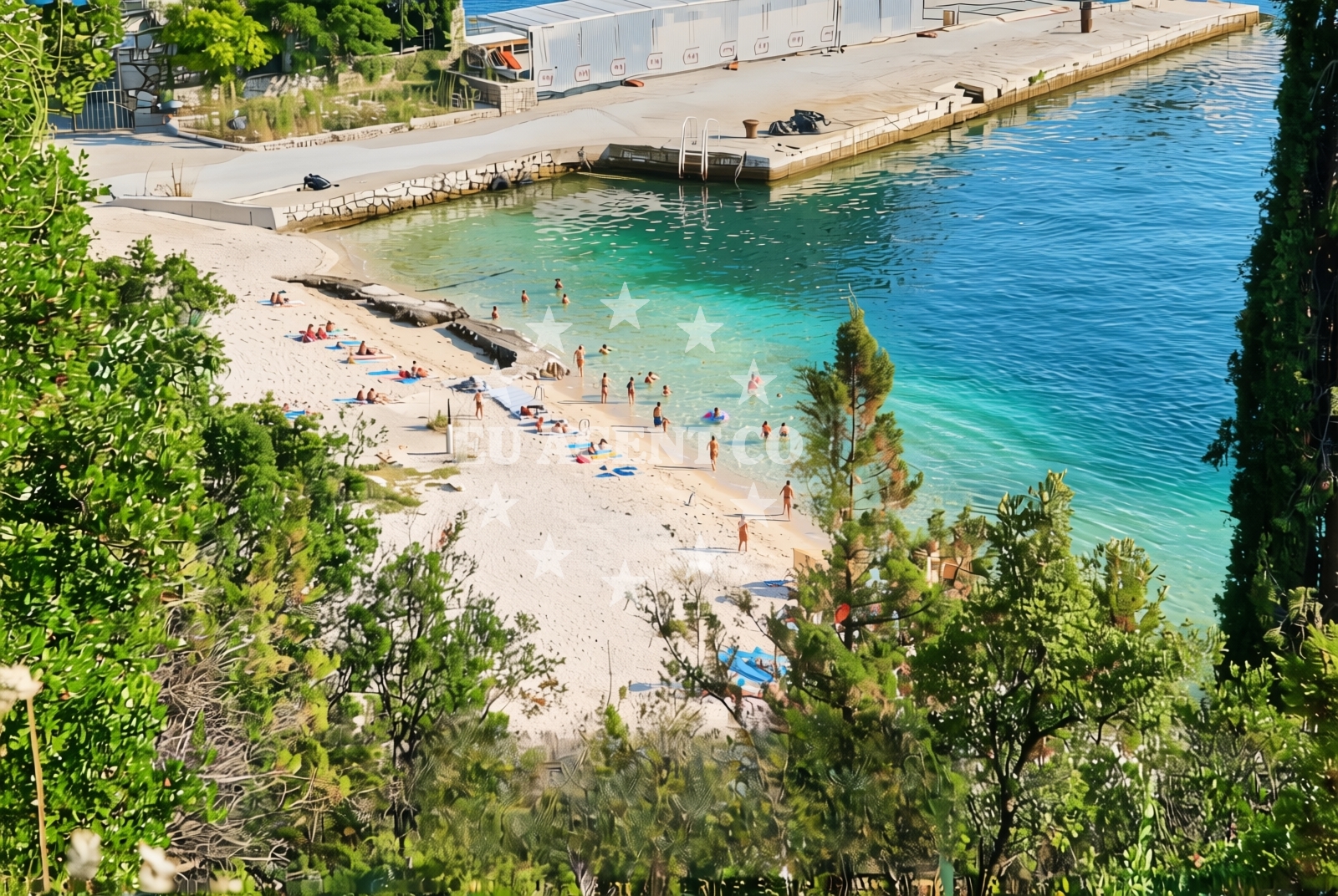
About this beach
Janska sjever, Banići
Beach: Janska sjever
Location: Banići
Characteristics and facilities
Sand, gravel, concrete / stone slabs
200 m
Natural shade
Beach character
The beach's composition includes a combination of sand, gravel, and concrete/stone slabs, creating a varied walking surface. The 200-meter length provides a modest stretch for relaxation, with natural shade available from the landward side. The absence of artificial structures or amenities means the beach retains a raw, unmodified character typical of many coastal areas in this part of Croatia. The shoreline's texture may influence footwear choices, particularly on the gravel and slab sections.Swimming and shore
Swimming conditions at Janska Sjever are influenced by the open coastline's exposure to waves and currents. The beach's mix of sandy and rocky sections may create uneven water entry points. The shore itself is largely unaltered, with no designated swimming zones or lifeguard services. Visitors should exercise caution when entering the water, particularly near the gravel and concrete areas where wave action may be more pronounced.Facilities and activities
No formal facilities such as showers, restrooms, or changing rooms are available at Janska Sjever Beach. The lack of infrastructure aligns with its status as a simpler, less-developed shoreline. Recreational activities are limited to passive enjoyment of the beach and surrounding landscape. The area may appeal to visitors seeking solitude or those willing to explore the coastline on foot, though no specific amenities or guided experiences are offered.Access and location
Janska Sjever Beach is situated within the village of Banići, a coastal settlement on the island of Brač. Access to the beach is via local roads connecting to the main island routes. Banići itself is a small community with limited tourism infrastructure, positioned between the more developed areas of Supetar and Bol on Brač. The beach's location makes it a potential stop for those traveling along Brač's eastern coast, though it is not a primary destination for organized tourism.What to expect
Visitors to Janska Sjever should anticipate a beach with minimal amenities and a natural, unmodified shoreline. The 200-meter stretch includes sand, gravel, and concrete slabs, requiring appropriate footwear for comfort. The absence of structured facilities means the beach is best suited for those seeking a quiet, undeveloped coastal experience. The natural shade provided by the terrain offers limited relief from direct sunlight, though the beach's orientation may influence sun exposure patterns throughout the day.Practical tips
Consider bringing sturdy footwear for the gravel and concrete sections of the beach. Sun protection is recommended due to the limited shade. Visitors should check local conditions for any temporary access restrictions, as the beach's proximity to Banići may be affected by seasonal road closures or maintenance.Exploring the coast by yacht
For yacht charter guests exploring the Brač coastline, Janska Sjever Beach lies along a route that connects to the island's primary marinas, including Supetar and Bol. The beach's location offers a brief stop for those sailing along Brač's eastern shore, though it is not a designated anchorage or docking point. Charter yachts navigating the area may use nearby marinas for refueling or overnight stays, with Janska Sjever serving as a reference point for coastal orientation.Regional Context: Banići and Brač Island
Banići is a small village on Brač, one of the Dalmatian islands known for its limestone cliffs and traditional stone houses. The village maintains a rural character, with few tourist services beyond basic accommodations. Brač itself is a popular sailing destination, with its coastline featuring a mix of sheltered bays and open stretches like Janska Sjever. The island's sailing routes are well-established, connecting to Hvar, Split, and the mainland via regular ferry services.Anchorages in the surrounding area
Anchorages in the surrounding area include those near Banići, Jakljan, and Olipa.
- Anchorage — banici — 0.1 NM from beach
- Anchorage — jakljan — 3.5 NM from beach
- Anchorage — jakljan — 3.6 NM from beach
- Anchorage — olipa — 3.8 NM from beach
- Šipanska Luka — sipanska luka — 3.8 NM from beach
- Anchorage — broce — 4.5 NM from beach
- Anchorage — broce — 4.8 NM from beach
- Anchorage — broce — 4.8 NM from beach
Distances are straight-line geographic distances, not sailing routes.
Mooring buoys in the surrounding area
Mooring buoys and jetties in Slano and Jakljan are located near the beach.
- Quay — slano — 0.0 NM from beach
- Jetty — slano — 1.4 NM from beach
- Jetty — jakljan — 3.5 NM from beach
- Konoba Kod Marka Buoys — sipanska luka — 4.1 NM from beach
- Konoba Nico jetty — kobas — 4.8 NM from beach
Distances are straight-line geographic distances, not sailing routes.
Marine fuel stations
- Fuel station — sobra — mljet — 10.7 NM from beach
- Ina — dubrovnik — 13.0 NM from beach
- Ina — dubrovnik — 14.2 NM from beach
- Fuel station — ploce — 23.9 NM from beach
Distances are straight-line geographic distances, not sailing routes.
Harbours in the surrounding area
Harbours in Slano, Doli, and Šipan are situated within a few nautical miles of the beach.
- Slano — 1.7 NM from beach
- Doli — 2.6 NM from beach
- Šipan Harbour — sipanska luka — 4.1 NM from beach
- Suđurađ — sudurad — sipan — 5.7 NM from beach
- Ston — 7.2 NM from beach
- Mali Ston — 7.2 NM from beach
Distances are straight-line geographic distances, not sailing routes.
Marinas in the surrounding area
- ACI Marina Slano — 1.8 NM from beach
- Marina Frapa Dubrovnik — 13.1 NM from beach
- ACI Marina Dubrovnik — 14.2 NM from beach
Distances are straight-line geographic distances, not sailing routes.
Restaurants near the beach
Restaurants in Banići and Slano offer dining options close to the beach.
- Restaurant — banici — 0.0 NM from beach
- Nono — slano — 1.4 NM from beach
- Mirakul — slano — 1.4 NM from beach
- Restaurant — sipanska luka — 4.0 NM from beach
- Kod Marka — sipanska luka — 4.1 NM from beach
- Tauris — sipanska luka — 4.2 NM from beach
- Nico — kobas — 4.8 NM from beach
Distances are straight-line geographic distances, not sailing routes.
Navigation guides for the surrounding area
Navigation guides for Siano, Doli, and Uvala Tiha assist in local sailing routes.
- Siano (Neprobic1 — 2.0 NM from beach
- Doli — 2.4 NM from beach
- Uvala Tiha — 2.4 NM from beach
- Luka (Sipanska Luka) — 2.5 NM from beach
- Uvala Lupeska — 4.0 NM from beach
Distances are straight-line geographic distances, not sailing routes.
Yachts from nearby departure bases
Sailing yachts
- Oceanis 45 (Cancan) — Slano ACI Marina — 1.8 NM from departure base to beach
- Elan 45 Impression (Skyfall) — Slano ACI Marina — 1.8 NM from departure base to beach
- Elan 50 Impression (Timeless) — Slano ACI Marina — 1.8 NM from departure base to beach
- Oceanis 45 (Mambo 1) — Slano ACI Marina — 1.8 NM from departure base to beach
- Oceanis 45 (Soul) — Slano ACI Marina — 1.8 NM from departure base to beach
Catamarans
- Lagoon 50 (TWIN JOY) — Slano ACI Marina — 1.8 NM from departure base to beach
- Lagoon 450 Flybridge (ANJA I) — Slano ACI Marina — 1.8 NM from departure base to beach
- MY 44 (Fusion) — Slano ACI Marina — 1.8 NM from departure base to beach
- Lagoon 42 (MALA KATE I) — Slano ACI Marina — 1.8 NM from departure base to beach
- Lagoon 42 (MALA KATE I) — Slano ACI Marina — 1.8 NM from departure base to beach
Distances are straight-line geographic distances, not sailing routes.