Ivan Dolac zapad Beach, Hvar, Croatia
Ivan Dolac zapad Beach lies on the southern coast of Hvar, a sun-drenched island in the Adriatic Sea renowned for its medieval towns, lavender fields, and crystal-clear waters. This lesser-known stretch of coastline offers a quiet alternative to Hvar’s bustling town center, with sweeping views of the island’s rugged hills and the open sea. While the beach itself lacks formal amenities, its location provides a gateway to the natural and cultural richness of the region.
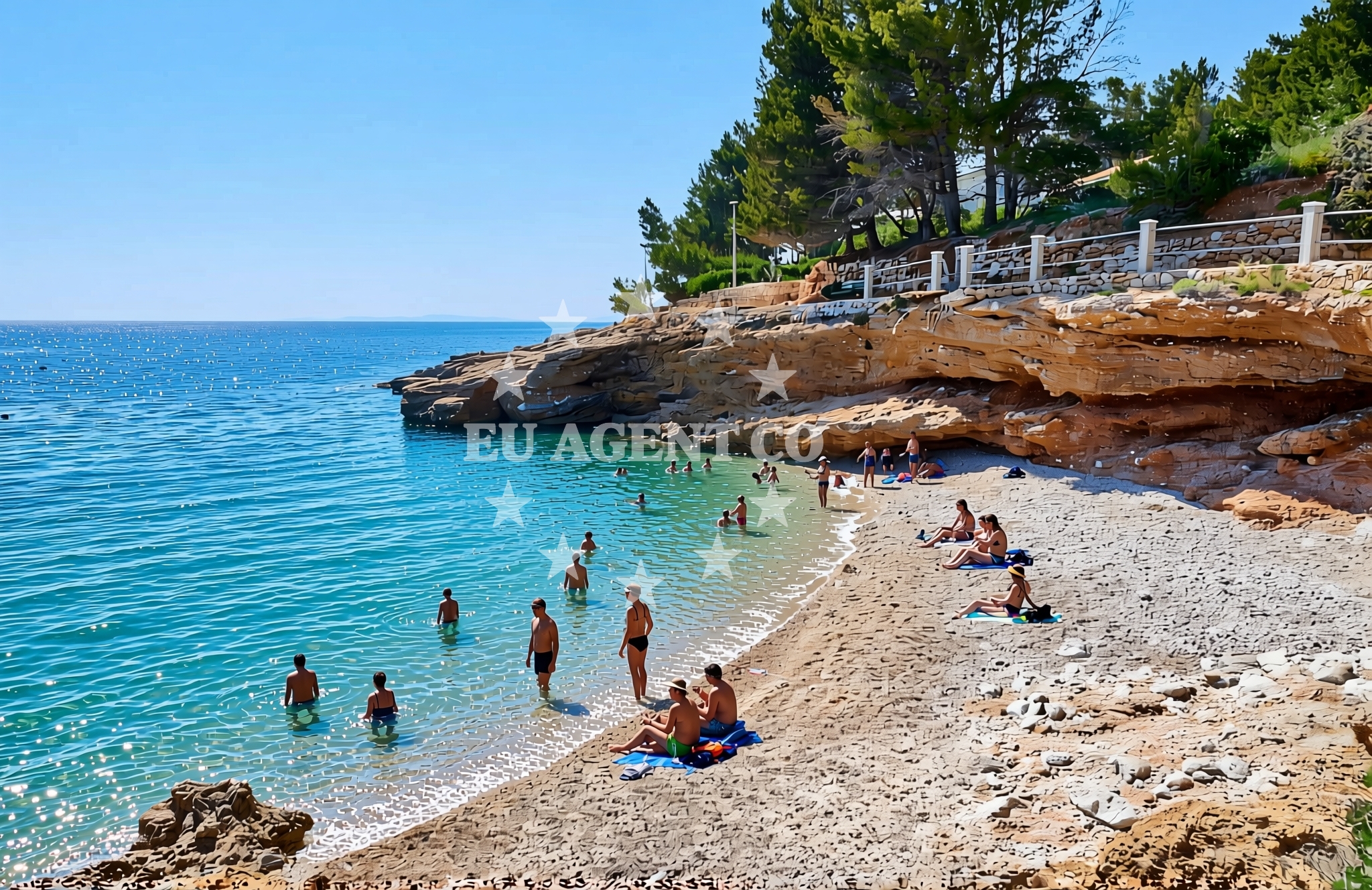
About this beach
Ivan Dolac zapad, Ivan Dolac (Hvar)
Beach: Ivan Dolac zapad
Location: Ivan Dolac (Hvar)
Beach character
Though specific details about the beach’s physical characteristics are not documented, Ivan Dolac zapad likely shares traits common to Hvar’s coastal terrain. The island’s shores often feature a mix of pebbled and sandy coves, framed by limestone cliffs and dense vegetation. The Adriatic’s reputation for transparent waters and gentle waves suggests this beach may offer opportunities for swimming, though visitors should note that no lifeguard services or formal safety measures are recorded for the area.
Swimming and shore
The Adriatic Sea’s generally calm waters during summer months make Ivan Dolac zapad a plausible spot for swimming, snorkeling, or simply relaxing on the shore. However, the absence of structured beach facilities means visitors should come prepared with their own equipment and provisions. The shoreline’s natural state—whether sandy or pebbled—remains speculative, as no definitive descriptions are available in the catalog.
Facilities and activities
No formal amenities such as restrooms, showers, or umbrellas are documented for Ivan Dolac zapad Beach. The lack of structured activities suggests this is a destination for those seeking solitude or self-guided exploration. Nearby, Hvar’s historic town offers museums, taverns, and the iconic Hvar Fortress, while the island’s inland roads reveal vineyards and olive groves. For those interested in water-based pursuits, the surrounding coast is dotted with more developed beaches and marinas.
Access and location
Reaching Ivan Dolac zapad requires a journey to the southern tip of Hvar, a short drive or boat ride from the island’s main settlements. The beach’s remote location makes it an ideal stop for travelers seeking respite from crowds, though its lack of signage or parking infrastructure may pose challenges. GPS coordinates (43.127187, 16.637583) can guide visitors to the area, where they’ll find the beach nestled between the island’s hills and the sea.
What to expect
Visitors to Ivan Dolac zapad should anticipate a raw, unspoiled coastal experience. The beach’s character is likely shaped by its isolation, with minimal human intervention preserving its natural state. While no specific facilities are guaranteed, the surrounding Hvar region offers a wealth of cultural and recreational opportunities. The beach’s appeal lies in its setting: a secluded spot to absorb the Adriatic’s beauty, with the island’s landmarks—such as the ancient town of Hvar and the Pakleni Islands—visible on clear days.
Practical tips
Given the beach’s lack of formal infrastructure, visitors are advised to bring essentials such as water, sunscreen, and a picnic. The area’s remoteness means limited options for food or shelter nearby, though Hvar’s town center is a short journey away for those seeking additional services.
Exploring the coast by yacht
For yacht charter guests, Ivan Dolac zapad’s location on Hvar’s southern coast positions it as a potential stop along sailing routes exploring the Adriatic’s eastern shores. The island’s proximity to Split, Brač, and the Pakleni Islands makes it a strategic base for charters seeking to balance cultural immersion with maritime exploration. Nearby marinas in Hvar town and along the coast provide docking options, though specific distances or sailing times are not documented in the catalog.
Hvar’s Cultural and Natural Landscape
The island of Hvar, where Ivan Dolac zapad is located, is a mosaic of history and natural beauty. Its medieval town, a UNESCO-protected site, features cobblestone streets, Venetian architecture, and a vibrant nightlife. Beyond the town, the island’s interior is marked by lavender fields, vineyards, and the dramatic cliffs of the Hvar Mountains. This blend of cultural heritage and unspoiled nature makes Hvar a compelling destination for travelers seeking both relaxation and exploration.
Anchorages in the surrounding area
Anchorages near Ivan Dolac (Hvar) Beach include locations in Hvar and nearby areas.
- Anchorage — hvar — 0.3 NM from beach
- Anchorage — zavala — hvar — 2.6 NM from beach
- Anchorage — vrboska — hvar — 3.9 NM from beach
- Anchorage — hvar — 4.1 NM from beach
- Anchorage — vrboska — hvar — 4.1 NM from beach
- Anchorage — scedro — 4.3 NM from beach
- Maslinica — stari grad — hvar — 4.3 NM from beach
- Anchorage — scedro — 4.3 NM from beach
Distances are straight-line geographic distances, not sailing routes.
Mooring buoys in the surrounding area
- Jetty — zavala — hvar — 2.6 NM from beach
- Buoy field Lovišće, Šćedro — buoy field lovisce scedro — 3.4 NM from beach
- Lovisce — scedro — 3.5 NM from beach
- Konoba Mostir buoys — scedro — 3.7 NM from beach
- Buoy field — stari grad — hvar — 4.0 NM from beach
Distances are straight-line geographic distances, not sailing routes.
Marine fuel stations
Marine fuel stations near Ivan Dolac (Hvar) Beach are located in Hvar, Brac, and Korcula.
- Ina — vrboska — hvar — 3.5 NM from beach
- Fuel station — bol — brac — 8.0 NM from beach
- Fuel station — hvar — 8.8 NM from beach
- Ina — vela luka — korcula — 10.5 NM from beach
Distances are straight-line geographic distances, not sailing routes.
Harbours in the surrounding area
Harbours near Ivan Dolac (Hvar) Beach include ports in Hvar and Brac.
- Marina Bilo Idro — sveta nedjelja — hvar — 2.3 NM from beach
- Port Jelsa — hvar — 3.3 NM from beach
- Vrboska — hvar — 3.6 NM from beach
- Stari Grad — hvar — 4.0 NM from beach
- Bol — brac — 8.1 NM from beach
- Hvar — 9.0 NM from beach
Distances are straight-line geographic distances, not sailing routes.
Marinas in the surrounding area
Marinas near Ivan Dolac (Hvar) Beach are found in Hvar, Korcula, and Brac.
- ACI Marina Vrboska — hvar — 3.5 NM from beach
- Marina Korkyra — vela luka — korcula — 10.6 NM from beach
- ACI Marina Palmižana — aci marina palmizana — st klement — 10.9 NM from beach
- ACI Marina Milna — milna brac — 14.6 NM from beach
- Marina Milna Kanarija — milna brac — 14.7 NM from beach
Distances are straight-line geographic distances, not sailing routes.
Restaurants near the beach
Restaurants near Ivan Dolac (Hvar) Beach are located in Hvar.
- Tamaris — sveta nedjelja — hvar — 2.2 NM from beach
- Bilo Idro — sveta nedjelja — hvar — 2.3 NM from beach
- Davor — zavala — hvar — 2.6 NM from beach
- Restaurant Murvica — jelsa — hvar — 3.1 NM from beach
- Tavern Turan — jelsa — hvar — 3.1 NM from beach
- Restaurant — jelsa — hvar — 3.2 NM from beach
- Bistro Star — jelsa — hvar — 3.2 NM from beach
Distances are straight-line geographic distances, not sailing routes.
Navigation guides for the surrounding area
Navigation guides for the surrounding area of Ivan Dolac (Hvar) Beach include locations such as Zavala, Jelsa, and Vrboska.
- Zavala (Pitavska Plaza) — 2.8 NM from beach
- Jelsa — 3.5 NM from beach
- Luka Lovisce — 3.6 NM from beach
- Vrboska — 3.7 NM from beach
- Uvala Manastir — 3.8 NM from beach
Distances are straight-line geographic distances, not sailing routes.
Yachts from nearby departure bases
Yachts departing from bases near Ivan Dolac (Hvar) Beach include options from Milna Marina Vlaška and Omiš City Port.
Sailing yachts
- Hanse 455 (AURUM 1) — Milna Marina Vlaška — 14.9 NM from departure base to beach
- Bavaria 46 Cruiser (MO) — Milna Marina Vlaška — 14.9 NM from departure base to beach
- Hanse 388 (BANJO) — Milna Marina Vlaška — 14.9 NM from departure base to beach
- Hanse 505 (AVALON) — Milna Marina Vlaška — 14.9 NM from departure base to beach
- Elan Impression 40 (KARLETA) — Baška Voda Port — 19.4 NM from departure base to beach
- D&D Kufner 54 (Komiza) — Baška Voda — 19.4 NM from departure base to beach
Gulets / Cruisers
- Gulet (Primorac) — Omiš City Port — 19.1 NM from departure base to beach
- Gulet (Trebenna) — Omiš City Port — 19.1 NM from departure base to beach
- Gulet (PATRONICE) — Omiš City Port — 19.2 NM from departure base to beach
Motor boats
- Pearl Sea 31 Hard Top (Aero) — Baška Voda Port — 19.4 NM from departure base to beach
Distances are straight-line geographic distances, not sailing routes.