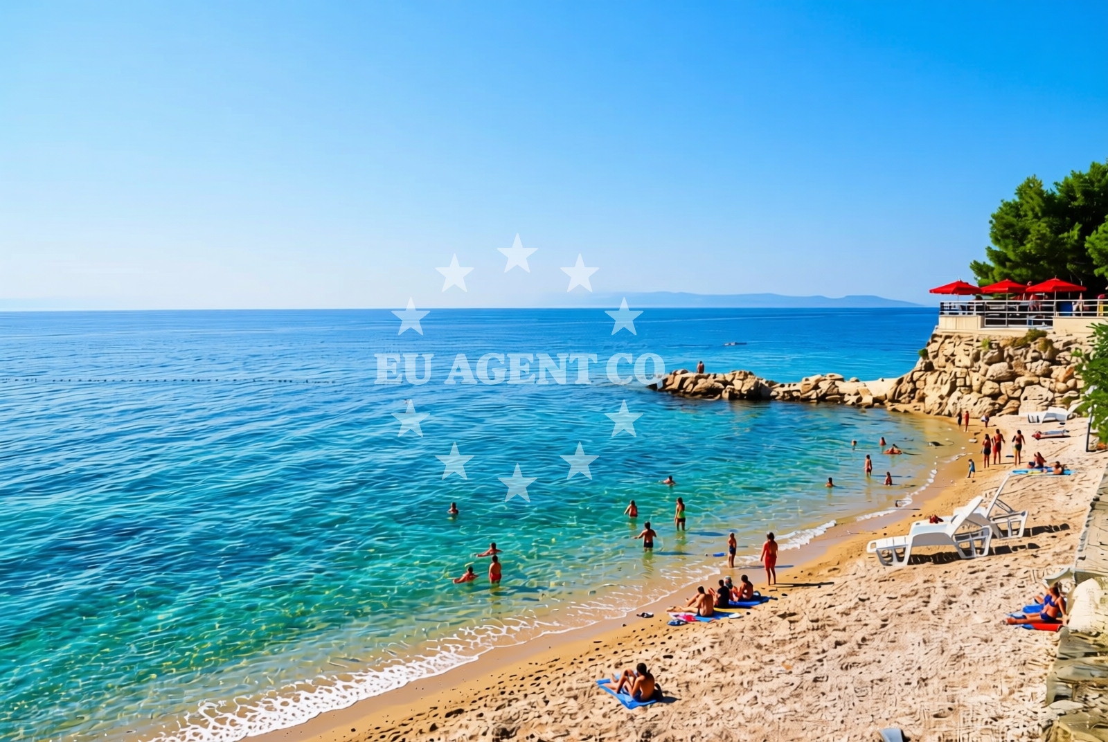
Ijak, Podgora Beach, Croatia
About this beach
Ijak, Podgora
Beach: Ijak
Location: Podgora
Characteristics and facilities
Gravel
90 m
Restaurant / snack bar
Caffe bar / Drinks stand
Natural shade
Beach character
The beach consists of gravel, creating a distinct texture underfoot that differs from typical sandy shores. Its 90-meter length offers a compact space for visitors, with natural shade provided by surrounding vegetation. While not a traditional swimming beach, the gravel composition makes it suitable for walking and leisurely strolls along the shore. The beach's character is defined by its simplicity and integration with the surrounding landscape.Swimming and shore
The gravel substrate makes this beach less ideal for swimming but creates a stable surface for walking along the shore. The natural shade from vegetation provides welcome relief from direct sunlight, particularly during midday hours. The shoreline's composition allows for easy access to the water's edge, though the gravel may require caution for those unaccustomed to its texture.Facilities and activities
Basic amenities include a restaurant/snack bar and a café with drinks stands, offering refreshments for visitors. These facilities provide convenience for those seeking light meals or beverages during their visit. While no structured activities are listed, the beach's proximity to Ijak's coastal infrastructure suggests opportunities for exploring nearby attractions or participating in local tourism offerings.Access and location
Situated in Ijak, this beach is part of the broader Adriatic coastline known for its historic villages and maritime traditions. Visitors can reach the beach via local roads connecting to the village center. The beach's location within Ijak places it near the village's cultural and commercial hubs, though specific details about parking or road access are not documented in the beach's authoritative records.What to expect
Expect a straightforward beach experience centered on its gravel shoreline and basic amenities. The 90-meter length provides a compact space for relaxation, with natural shade offering comfort during warmer hours. On-site dining options ensure visitors can enjoy meals without leaving the immediate area. The beach's character is defined by its simplicity, making it a practical choice for those prioritizing accessibility over extensive recreational facilities.Practical tips
Given the gravel surface, consider wearing appropriate footwear for comfort. The on-site dining options make it convenient to enjoy meals without traveling far. As with all coastal areas, it's advisable to check local conditions for any temporary changes in access or services.Exploring the coast by yacht
For yacht charter guests exploring the Dalmatian coast, Ijak's position along the Adriatic provides a convenient reference point. While the beach itself is not a docking location, the surrounding area aligns with sailing routes that connect to larger marinas and harbors in the region. Charter travelers may find the beach useful as a landmark when navigating near Ijak's coastline.Regional Context
Ijak is part of the Split-Dalmatia County, a region with a rich maritime history and a network of coastal villages. The area is known for its traditional stone architecture and proximity to both the Adriatic Sea and inland cultural sites. Yacht charter guests often use nearby ports as bases for exploring the coastline, with Ijak serving as a minor waypoint in broader sailing itineraries.Anchorages in the surrounding area
Anchorages in the surrounding area including Makarska, Hvar, and nearby islands.
- Anchorage — makarska — 4.1 NM from beach
- Anchorage — selca kod bogomolja — hvar — 6.4 NM from beach
- Anchorage — bogomolje — hvar — 6.4 NM from beach
- Anchorage — bogomolje — hvar — 6.6 NM from beach
- Anchorage — selca kod bogomolja — hvar — 6.7 NM from beach
- Anchorage — promajna — 6.9 NM from beach
- Anchorage — sucuraj — hvar — 7.1 NM from beach
- Anchorage — selca kod bogomolja — hvar — 7.7 NM from beach
Distances are straight-line geographic distances, not sailing routes.
Mooring buoys in the surrounding area
Mooring buoys in the surrounding area including Kraj-Soline and Krvavica.
- Kraj - Soline — kraj soline — drasnice — 2.3 NM from beach
- Quay — krvavica — 6.1 NM from beach
- Quay — bogomolje — hvar — 6.6 NM from beach
- Konoba Gambo buoys — selca kod bogomolja — hvar — 7.7 NM from beach
- Quay — hvar — 7.7 NM from beach
Distances are straight-line geographic distances, not sailing routes.
Marine fuel stations
Marine fuel stations in the surrounding area including Makarska and Brac.
- Ina — makarska — 3.9 NM from beach
- Fuel station — sumartin — brac — 9.4 NM from beach
- Fuel station — korcula — 17.7 NM from beach
- Ina — vrboska — hvar — 17.7 NM from beach
Distances are straight-line geographic distances, not sailing routes.
Harbours in the surrounding area
Harbours in the surrounding area including nearby Podgora and Caklje.
- Podgora — 0.1 NM from beach
- Čaklje — caklje — podgora — 1.1 NM from beach
- Tučepi — tucepi — 1.2 NM from beach
- Drašnice — drasnice — 2.4 NM from beach
- Makarska — 3.7 NM from beach
- Igrane — 4.3 NM from beach
Distances are straight-line geographic distances, not sailing routes.
Marinas in the surrounding area
Marinas in the surrounding area including Tučepi and Ramova.
- Marina Tučepi — marina tucepi — 1.3 NM from beach
- Marina Ramova — krvavica — 6.1 NM from beach
- Marina Baška Voda — marina baska voda — 8.7 NM from beach
- ACI Marina Korčula — korcula — 17.4 NM from beach
- ACI Marina Vrboska — hvar — 17.7 NM from beach
Distances are straight-line geographic distances, not sailing routes.
Restaurants near the beach
Restaurants near the beach including Restoran Ivo in Makarska.
- Restoran Ivo — makarska — 3.9 NM from beach
Distances are straight-line geographic distances, not sailing routes.
Navigation guides for the surrounding area
Navigation guides for the surrounding area including Uvala Kozja and nearby islands.
- Podgora — 0.5 NM from beach
- Uvala Kozja — 7.7 NM from beach
- Uvala Duboka — 7.7 NM from beach
- Su martin — 8.8 NM from beach
- OTOK HVAR — 9.2 NM from beach
Distances are straight-line geographic distances, not sailing routes.
Yachts from nearby departure bases
Yachts from nearby departure bases including Tučepi Port and Makarska Port.
Sailing yachts
- Bavaria 40 Cruiser (LADY BUTTERFLY) — Tučepi Port — 1.3 NM from departure base to beach
- Elan 45 Impression (" MONACO ") — Baška Voda — 8.7 NM from departure base to beach
- Bavaria 50 (Marastina) — Baška Voda — 8.7 NM from departure base to beach
Catamarans
- Lagoon 450 (LAMANTIN) — Baška Voda — 8.7 NM from departure base to beach
Motor yachts
- Princess V53 (Chablis) — Makarska Port — 3.7 NM from departure base to beach
- Canados 86 (Karisma) — Baška Voda — 8.7 NM from departure base to beach
Motor boats
- Galeon 430 Skydeck (Bellagio) — Makarska Port — 3.7 NM from departure base to beach
- Jeanneau NC 37 (Black Pearl) — Makarska Port — 3.7 NM from departure base to beach
- Jeanneau NC 37 (Black Pearl) — Makarska Port — 3.7 NM from departure base to beach
- Galeon 430 Skydeck (BELLAGIO) — Makarska Port — 3.7 NM from departure base to beach
Distances are straight-line geographic distances, not sailing routes.