Gusareva draga sjever, Pridraga Beach, Croatia
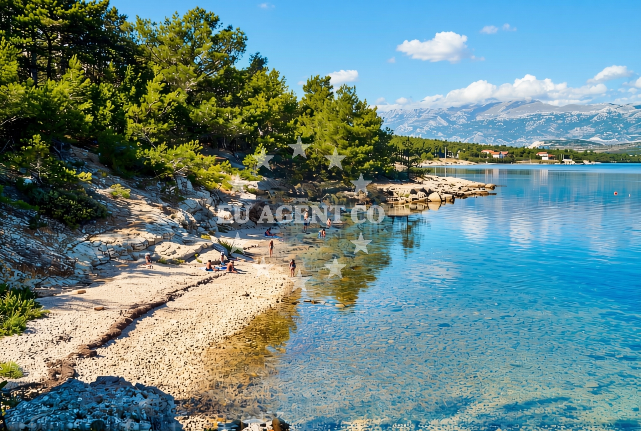
About this beach
Gusareva draga sjever, Pridraga
Beach: Gusareva draga sjever
Location: Pridraga
Characteristics and facilities
Gravel, rocks
60 m
Natural shade
Beach character
The beach’s composition of gravel and rocks defines its character. The shoreline is uneven, with larger stones interspersed among smaller pebbles. This texture makes it less suitable for sunbathing but ideal for those seeking a tactile connection to the shore. The beach’s natural shade, created by the angle of the land and surrounding vegetation, offers intermittent relief from direct sunlight. The modest length of 60 meters means the beach is best experienced as a short, focused visit rather than an extended stay.Swimming and shore
Swimming conditions at Gusareva draga sjever are influenced by the rocky shoreline. The water’s clarity is typical of the Adriatic, though the presence of stones may make entry and exit more challenging. The shore’s unevenness means it is not ideal for young children or those unaccustomed to rocky terrain. However, the beach’s position within the broader Adriatic sailing region means it is occasionally used by boaters as a reference point during coastal navigation.Facilities and activities
There are no formal facilities at Gusareva draga sjever, including parking, restrooms, or changing rooms. The absence of infrastructure aligns with its status as a more remote and naturally preserved coastal site. Activities are limited to passive enjoyment of the landscape, though the beach’s proximity to the Adriatic makes it a potential stop for sailors exploring the region’s coastline.Access and location
Gusareva draga sjever is located in Pridraga, a small settlement on the island of Brač, Croatia. The beach is accessible via local roads that wind through the island’s interior. Its position on Brač places it within reach of the island’s main towns, including Supetar and Bol, which offer services and amenities for visitors. The Adriatic Sea’s influence is evident in the surrounding waters, which are part of a sailing area frequented by charter yachts during the summer season.What to expect
Visitors should expect a beach that prioritizes natural features over comfort. The gravel and rock composition requires sturdy footwear, and the lack of amenities means preparation for minimal infrastructure. The natural shade provides intermittent relief, though it is not consistent across the entire beach. The site is best suited for those seeking a quiet, unspoiled coastal experience rather than a conventional beach day.Practical tips
Wear grippy shoes to navigate the rocky shoreline. Bring a towel or mat for sitting, as the gravel may be uncomfortable for prolonged contact. Use the natural shade strategically, as it is not uniformly distributed. Arrive early to avoid crowds, as the beach’s limited size and lack of facilities make it less popular than other nearby spots.Exploring the coast by yacht
Gusareva draga sjever lies within the Adriatic sailing region, a popular area for motor yacht and sailboat charters. Its proximity to Brač’s main marinas, such as those in Supetar, makes it a potential reference point for sailors navigating the island’s coastline. While not a formal anchorage, the beach’s visibility from the water may be useful for orientation during coastal passages. Charter guests exploring the area may consider it as part of a broader itinerary that includes Brač’s more developed coastal amenities.Regional Context
Pridraga is a small village on Brač, known for its traditional stone houses and vineyards. The island’s interior is characterized by rugged hills and olive groves, while the coastline features a mix of pebbly beaches and limestone cliffs. Visitors to Gusareva draga sjever may also consider exploring nearby attractions such as the island’s famous Zlatni Rat beach or the historic town of Bol.Anchorages in the surrounding area
Anchorages near Gusareva draga sjever, Pridraga Beach include Karin dock and Anchorage — karin, located in the nearby Karin area.
- Karin dock — 1.2 NM from beach
- Anchorage — karin — 1.3 NM from beach
- Anchorage — novigrad — 2.6 NM from beach
- Anchorage — maslenica — 4.1 NM from beach
- Anchorage — vinjerac — 9.1 NM from beach
- Sv. Katarina — sv katarina — sveta katarina — 14.6 NM from beach
- Anchorage — mrljane — pasman — 14.6 NM from beach
- Anchorage — ljubac — 14.6 NM from beach
Distances are straight-line geographic distances, not sailing routes.
Mooring buoys in the surrounding area
Mooring buoys in the surrounding area include Buoy field — sukosan and Crvena Luka jetty, situated in Sukosan and Crvena Luka respectively.
- Buoy field — sukosan — 13.9 NM from beach
- Buoy field — sukosan — 14.0 NM from beach
- Crvena Luka jetty — 14.6 NM from beach
Distances are straight-line geographic distances, not sailing routes.
Marine fuel stations
Marine fuel stations in the vicinity include Ina — biograd na moru and Fuel station — sukosan, positioned in Biograd na moru and Sukosan.
- Ina — biograd na moru — 14.1 NM from beach
- Fuel station — sukosan — 14.2 NM from beach
- Ina — zadar — 16.1 NM from beach
- Ina — preko — ugljan — 18.0 NM from beach
Distances are straight-line geographic distances, not sailing routes.
Harbours in the surrounding area
Harbours in the surrounding area include Obrovac and Maslenica, located in Obrovac and Maslenica respectively.
- Obrovac — 5.0 NM from beach
- Maslenica — 5.4 NM from beach
- Vinjerac — 9.2 NM from beach
- Seline — 9.7 NM from beach
- Starigrad Paklenica — 11.5 NM from beach
- Sv. Filip and Jakov — sv filip and jakov — sveti filip i jakov — 13.4 NM from beach
Distances are straight-line geographic distances, not sailing routes.
Marinas in the surrounding area
Marinas near Gusareva draga sjever, Pridraga Beach include Dry dock marina Biograd and Molum Marine Club, situated in Biograd na moru and Sveti Filip i Jakov.
- Dry dock marina Biograd — biograd na moru — 12.9 NM from beach
- Molum Marine Club — sveti filip i jakov — 13.4 NM from beach
- Marina Kornati — biograd na moru — 13.9 NM from beach
- Marina Šangulin — marina sangulin — biograd na moru — 14.0 NM from beach
- Marina Dalmacija — sukosan — 14.0 NM from beach
Distances are straight-line geographic distances, not sailing routes.
Navigation guides for the surrounding area
Navigation guides for the surrounding area cover Posedarje (Novigradsko More) and Starigrad-Paklenica (Velebitski Kanai), located in Novigrad and Starigrad-Paklenica.
- Posedarje (Novigradsko More) — 6.6 NM from beach
- Starigrad-Paklenica {Velebitski Kanai) — 11.3 NM from beach
- Filip Jakov — 13.3 NM from beach
- Turanj — 13.4 NM from beach
- O. Pasman & O. Ugljan — 14.3 NM from beach
Distances are straight-line geographic distances, not sailing routes.
Yachts from nearby departure bases
Yachts departing from nearby bases include Merry Fisher 795 from Novigrad Dalmatia and models from Sukošan Brodogradilište Filipi and Biograd Marina Kornati.
Sailing yachts
- Bavaria Cruiser 34 (Aria ) — Biograd Marina Kornati — 13.9 NM from departure base to beach
Catamarans
- Lucia 40 (Luce) — Biograd Marina Kornati — 13.9 NM from departure base to beach
Motor boats
- Merry Fisher 795 () — Novigrad Dalmatia — 3.3 NM from departure base to beach
- Merry Fisher 695 — Sukošan Brodogradilište Filipi — 13.8 NM from departure base to beach
- Quicksilver Activ 555 — Sukošan Brodogradilište Filipi — 13.8 NM from departure base to beach
- Zar 57 WD — Sukošan Brodogradilište Filipi — 13.8 NM from departure base to beach
- Zar 61 Suite (Tucepi) — Sukošan Brodogradilište Filipi — 13.8 NM from departure base to beach
- Elan 650 (Biokovo) — Sukošan Brodogradilište Filipi — 13.8 NM from departure base to beach
- Zar 65 Suite — Sukošan Brodogradilište Filipi — 13.8 NM from departure base to beach
- Zar 59 SL (Snow) — Biograd Marina Kornati — 13.9 NM from departure base to beach
Distances are straight-line geographic distances, not sailing routes.