Grand Veleš, Banjole Beach, Croatia
About this beach
Grand Veleš, Banjole
Beach: Grand Veleš
Location: Banjole
Characteristics and facilities
Gravel
80 m
Natural shade
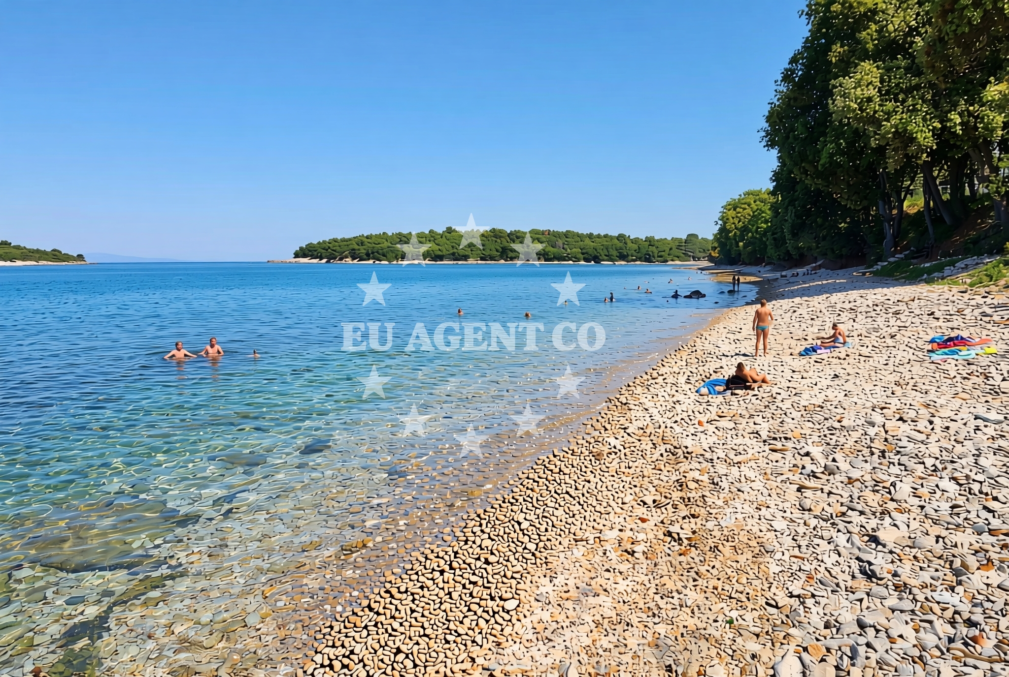
Beach character
Banjole Beach is defined by its gravel composition, a characteristic that sets it apart from the more common pebble or sandy beaches of the Dalmatian coast. The 80-meter shoreline is flanked by natural shade, likely provided by the topography of the surrounding hills and cliffs typical of this part of Croatia. This geological feature may influence the beach's use, as gravel can be less comfortable for barefoot walking compared to sand. However, it also contributes to the beach's distinctiveness, offering a rare example of a gravel shoreline in a region known for its diverse coastal landscapes.Swimming and shore
While specific water quality data is not available in the beach catalog, the gravel shoreline suggests that the beach may be more suited to activities like wading or exploring the rocky intertidal zones rather than traditional swimming. The natural shade from the surrounding terrain provides welcome relief from the Adriatic sun, though visitors should be mindful of the beach's geological character when planning activities. The absence of formal facilities means that swimmers should bring their own equipment and consider the beach's unique conditions when assessing its suitability for water-based recreation.Facilities and activities
The beach catalog does not list any formal amenities or structured activities at Banjole Beach. However, its location within the Grand Veleš settlement suggests potential access to nearby services in the town. The Dalmatian coast is known for its vibrant coastal towns, many of which offer restaurants, shops, and other tourist infrastructure within short driving distances. For structured activities, visitors may need to look to the broader region, where the Adriatic offers opportunities for sailing, hiking, and cultural exploration.Access and location
Banjole Beach is situated in Grand Veleš, a coastal town on the island of Brač, part of the Split-Dalmatia County in Croatia. The beach's coordinates (44.822989, 13.848013) place it within the broader sailing area of the Adriatic, a region renowned for its clear waters and scenic coastlines. Access to the beach likely involves a combination of road networks connecting Grand Veleš to nearby towns like Bol and Supetar, as well as the island's main road system. The beach's proximity to the Brač island ferry routes and the mainland port of Split makes it a potentially convenient starting point for both land and sea-based exploration.What to expect
Visitors to Banjole Beach should expect a gravel shoreline with natural shade, offering a distinctive alternative to the more common pebble or sandy beaches of the Dalmatian coast. The beach's catalog does not list formal facilities, so visitors should plan accordingly for amenities like shade, seating, or water access. The surrounding area of Grand Veleš and Brač island provides opportunities for cultural and culinary experiences, with nearby towns offering restaurants, shops, and other services. The beach's location within the Adriatic sailing area means it could serve as a convenient stop for yacht charter guests exploring the region, though specific docking or anchoring information would need to be confirmed through Euro-Agent's Yacht Search page.Practical tips
Given the gravel composition of the beach, visitors may want to bring appropriate footwear for walking along the shoreline. The natural shade provided by the surrounding terrain offers protection from the sun, but visitors should still take standard precautions for sun exposure. For those interested in yacht charter opportunities in the area, the nearby sailing routes of the Adriatic and access to marinas in Split and Brač make this a potentially strategic location for boating excursions.Exploring the coast by yacht
Banjole Beach's location in Grand Veleš places it within the heart of the Adriatic sailing region, a popular destination for motor yacht and sailing yacht charters. The nearby marinas in Split and Brač, along with the island's extensive anchorage options, make this area a hub for both short-term and long-term boating trips. Yacht charter guests exploring the Dalmatian coast may find Banjole Beach a convenient stop for a break from sailing, though specific docking information would require consultation with Euro-Agent's Yacht Search page at https://euro-agent.com/?open=form. The surrounding waters offer opportunities for exploring the islands of the central Dalmatian archipelago, including Hvar, Vis, and Korčula.Regional Context and Sailing Opportunities
The broader Dalmatian coast, where Grand Veleš is located, is a key region for yacht charter operations. The Adriatic Sea's clear waters and mild climate make it an ideal sailing destination, with routes extending from the mainland port of Split to the islands of Brač, Hvar, and beyond. Yacht charter guests may find the area's marinas and anchorages particularly appealing, though specific availability should be confirmed through Euro-Agent's booking platform. The beach's proximity to these sailing routes highlights its potential as a stopover point for those exploring the region by sea.Anchorages in the surrounding area
Anchorages in the surrounding area include several in Banjole and nearby locations.
- Anchorage — banjole — 0.1 NM from beach
- Anchorage — banjole — 0.6 NM from beach
- Anchorage — banjole — 0.8 NM from beach
- Anchorage — banjole — 1.5 NM from beach
- Anchorage — pula — 2.4 NM from beach
- Anchorage — pula — 2.7 NM from beach
- Anchorage — medulin — 3.2 NM from beach
- Anchorage — premantura — 3.3 NM from beach
Distances are straight-line geographic distances, not sailing routes.
Mooring buoys in the surrounding area
Mooring buoys in the surrounding area include fields and jetties in Banjole and Pula.
- Buoy field — banjole — 0.7 NM from beach
- Jetty — vinkuran — 0.7 NM from beach
- Jetty — pula — 0.8 NM from beach
- Porto Volme — banjole — 1.0 NM from beach
- Jetty — pula — 2.9 NM from beach
Distances are straight-line geographic distances, not sailing routes.
Marine fuel stations
- Flash — pula — 0.9 NM from beach
- Ina — pula — 3.0 NM from beach
- Fuel station — medulin — 3.6 NM from beach
- Ina — rovinj — 18.1 NM from beach
Distances are straight-line geographic distances, not sailing routes.
Harbours in the surrounding area
Harbours in the surrounding area include Banjole and several in Pula and nearby locations.
- Banjole — 0.8 NM from beach
- Bunarina — pula — 1.1 NM from beach
- Sportska lučica Delfin — sportska lucica delfin — pula — 1.4 NM from beach
- Pomer — 2.4 NM from beach
- Runke — premantura — 3.0 NM from beach
- Medulin harbour — 3.7 NM from beach
Distances are straight-line geographic distances, not sailing routes.
Marinas in the surrounding area
Marinas in the surrounding area include those in Pula and other nearby locations.
- Marina Bunarina — pula — 1.1 NM from beach
- Marina Veruda — pula — 1.2 NM from beach
- ACI Marina Pomer — 2.3 NM from beach
- ACI Marina Pula — 3.0 NM from beach
- Marina Polesana — pula — 3.4 NM from beach
Distances are straight-line geographic distances, not sailing routes.
Restaurants near the beach
Restaurants near the beach include options in Banjole and nearby areas.
- Karmen — banjole — 0.2 NM from beach
- Restaurant — banjole — 0.2 NM from beach
- Barka — banjole — 0.6 NM from beach
- La Gondola d` Oro — la gondola d oro — pula — 0.6 NM from beach
- Teza — banjole — 0.8 NM from beach
- Konoba Sidro — banjole — 0.8 NM from beach
- Batelina — banjole — 0.8 NM from beach
Distances are straight-line geographic distances, not sailing routes.
Navigation guides for the surrounding area
Navigation guides cover areas including Medulin and further destinations.
- Medulin and Pomer — 3.7 NM from beach
- Luka Budava — 7.6 NM from beach
- ZALJEV RASA — 12.4 NM from beach
Distances are straight-line geographic distances, not sailing routes.
Yachts from nearby departure bases
Yachts from nearby departure bases include those based at Pula Tehnomont Marina Veruda.
Sailing yachts
- Oceanis 38.1 (Hydra) — Pula Tehnomont Marina Veruda — 1.2 NM from departure base to beach
- Elan 40 Impression (BLU) — Pula Tehnomont Marina Veruda — 1.2 NM from departure base to beach
- Bavaria Cruiser 41 (Baska) — Pula Tehnomont Marina Veruda — 1.2 NM from departure base to beach
Catamarans
- Saona 47 (Lucky Alexandra) — Pula Tehnomont Marina Veruda — 1.2 NM from departure base to beach
- Neel 45 (Mizar) — Pula Tehnomont Marina Veruda — 1.2 NM from departure base to beach
- Bali 4.1 (Alinator III) — Pula Tehnomont Marina Veruda — 1.2 NM from departure base to beach
Motor yachts
- Leader 36 (Leader 36) — Pula Tehnomont Marina Veruda — 1.2 NM from departure base to beach
- Sealine F430 (BLUE LAGOON) — Pula Tehnomont Marina Veruda — 1.2 NM from departure base to beach
Motor boats
- Viper 303 (Kavalan III) — Pula Tehnomont Marina Veruda — 1.2 NM from departure base to beach
- Leidi 800R (Nelly) — Pula Tehnomont Marina Veruda — 1.2 NM from departure base to beach
Distances are straight-line geographic distances, not sailing routes.