Gradska Plaža, Karlobag Beach, Croatia
6 photos
About this beach
Gradska plaža, Karlobag
Beach: Gradska plaža
Location: Karlobag
Characteristics and facilities
Gravel, concrete / stone slabs
70 m
Beach character
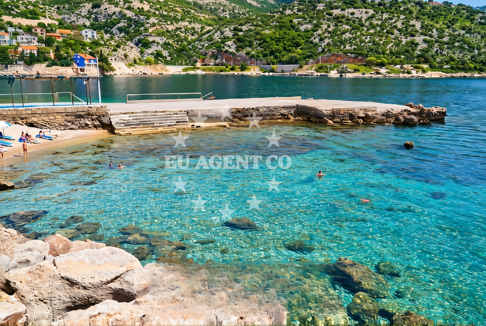
The beach's surface consists of gravel and concrete slabs, making it more suited for walking or light exploration than swimming. Its length of 70 meters means it is a modest stretch of shoreline, ideal for brief visits or as a stopover during a coastal journey. The lack of sandy terrain suggests it may be less common for sunbathing but could serve as a vantage point for observing the surrounding waters and landscape.Swimming and shore
Swimming conditions at Gradska Plaža are not explicitly detailed in available records. The rocky and gravelly nature of the beach may limit its appeal for swimmers, though the adjacent waters of the Adriatic are generally known for their clarity and mild temperatures during the summer months. Visitors should assess the shoreline's suitability for water activities based on the beach's physical characteristics.Facilities and activities
No specific facilities or activities are listed for Gradska Plaža. The beach appears to be a simple, unadorned shoreline without amenities such as showers, restrooms, or parking areas. Its primary function seems to be as a coastal access point rather than a recreational hub with structured offerings.Access and location
Gradska Plaža is situated in Karlobag, a coastal town in Croatia. The beach's coordinates (44.524053, 15.074439) place it along the Adriatic coastline, near the broader Istrian Peninsula region. Travelers arriving by land would likely approach via local roads connecting to Karlobag, while maritime visitors may find it accessible from nearby harbors or anchorages in the area.What to expect
Gradska Plaža is a short, gravelly beach offering minimal amenities. Visitors should expect a rocky shoreline rather than soft sand, with limited space for extended stays. The beach's compact size and lack of facilities suggest it is best suited for passing through rather than prolonged relaxation. Its location in Karlobag positions it as a potential waypoint for those exploring the Croatian coast.Practical tips
Due to the beach's gravel and concrete surface, visitors are advised to wear sturdy footwear. The absence of detailed facility information means it is prudent to bring essentials such as water and snacks. As with any coastal area, checking local conditions before visiting is recommended.Exploring the coast by yacht
For those interested in yacht charter experiences, the broader Karlobag region offers access to the Adriatic's sailing routes. Nearby harbors and anchorages may provide opportunities for exploring the coastline, though specific details about marinas or sailing distances are not included here. Yacht charterers should consult Euro-Agent's Yacht Search page for availability and itineraries tailored to this area.Regional Context
Karlobag is part of the Istrian Peninsula, a region known for its rugged coastline, historic towns, and maritime traditions. The area is dotted with smaller beaches, fishing villages, and scenic routes that cater to both land and sea travelers. Gradska Plaža, while modest in size, reflects the natural character of this coastal landscape.Anchorages in the surrounding area
- Anchorage — cesarica — 2.9 NM from beach
- Anchorage — cesarica — 3.2 NM from beach
- Anchorage — mazurani — 3.8 NM from beach
- Anchorage — mazurani — 3.9 NM from beach
- Anchorage — cesarica — 4.3 NM from beach
- Anchorage — prizna — 6.2 NM from beach
- Anchorage — novalja — pag — 6.7 NM from beach
- Anchorage — mandre — pag — 6.9 NM from beach
Distances are straight-line geographic distances, not sailing routes.
Mooring buoys in the surrounding area
- Jetty — zubovici — pag — 3.9 NM from beach
- Jetty — zubovici — pag — 4.2 NM from beach
- Jetty — simuni — pag — 5.9 NM from beach
- Buoy field — novalja — pag — 8.8 NM from beach
- Drljanda — stara novalja — pag — 9.8 NM from beach
Distances are straight-line geographic distances, not sailing routes.
Marine fuel stations
- Ina — rab — 19.4 NM from beach
- Ina — zadar — 25.3 NM from beach
- Ina — mali losinj — 26.2 NM from beach
- Adria Oil — mali losinj — 26.5 NM from beach
Distances are straight-line geographic distances, not sailing routes.
Harbours in the surrounding area
- Karlobag — 0.1 NM from beach
- Pag — 4.9 NM from beach
- Žigljen — zigljen — pag — 6.4 NM from beach
- Prizna — 6.5 NM from beach
- Lukovo Šugarje — lukovo sugarje — rudelici — 6.5 NM from beach
- Košljun — kosljun pag — 7.7 NM from beach
Distances are straight-line geographic distances, not sailing routes.
Marinas in the surrounding area
- ACI Marina Šimuni — simuni — pag — 6.1 NM from beach
- ACI Marina Rab — 19.3 NM from beach
- ACI Marina Supetarska Draga — rab — 22.4 NM from beach
- Marina Borik — zadar — 24.4 NM from beach
- Vitrenjak Zadar — 24.6 NM from beach
Distances are straight-line geographic distances, not sailing routes.
Restaurants near the beach
- Konoba Bile — pag — 4.9 NM from beach
- Dubrava — pag — 4.9 NM from beach
Distances are straight-line geographic distances, not sailing routes.
Navigation guides for the surrounding area
- Uvala Bliznica — 4.0 NM from beach
- Uvala Prizna — 6.4 NM from beach
- Caska — 6.5 NM from beach
- Novalja — 8.2 NM from beach
- OTOK PAG — 12.6 NM from beach
Distances are straight-line geographic distances, not sailing routes.
Yachts from nearby departure bases
Sailing yachts
- First 45 (Egeria) — Šimuni Kolan ACI Marina — 6.0 NM from departure base to beach
- Oceanis 40.1 — Zadar Marina Borik — 24.4 NM from departure base to beach
Motor yachts
- Absolute 50 Fly (Acrobat) — Rab ACI Marina — 19.3 NM from departure base to beach
Motor boats
- BWA Sport 22GT (BWA ) — Pag City Port — 4.9 NM from departure base to beach
- Balt 818 Titanium (Valentina 2) — Novalja — 8.5 NM from departure base to beach
- Balt 818 Titanium (Valentina) — Novalja — 8.5 NM from departure base to beach
- Merry Fisher 895 — Povljana Marina — 10.7 NM from departure base to beach
- Rancraft RM21 (Dugi otok) — Zadar Diklo Port — 23.0 NM from departure base to beach
- Rancraft RM19 (Daycruiser) — Zadar Diklo Port — 23.0 NM from departure base to beach
- Rancraft RS Cinque.5 — Zadar Diklo Port — 23.0 NM from departure base to beach
Distances are straight-line geographic distances, not sailing routes.
Nearby beaches
Karlobag: beaches and coves (2)
Karlobag
0.5 km
Karlobag beach
Varos 19, Karlobag
0.6 km
Tatinja beach
Naselje Bana Josipa Jelačića 19, Karlobag
1.2 km
Vidovac Cesarički: beaches and coves
Vidovac Cesarički
1.4 km
Vidovac Cesaricki
Vidovac Cesarički 19A, Karlobag
2.4 km
Staništa: beaches and coves (1)
Staništa
2.8 km
Baska slana beach
Juzni kraj 23, Metajna
3.0 km
Plaza Slana
, Metajna
3.6 km