Gornja uvala porat, Drvenik (Gradac) Beach, Croatia
Gornja uvala porat, located on the island of Drvenik (Gradac) in Croatia, is a compact beach characterized by its gravel shoreline and proximity to local amenities. Situated along the eastern coast of the Adriatic, this beach offers a straightforward setting for visitors seeking a quiet stretch of coastline with basic facilities. Its location within the Drvenik archipelago places it near several islands that are popular with yacht charter guests exploring the region.
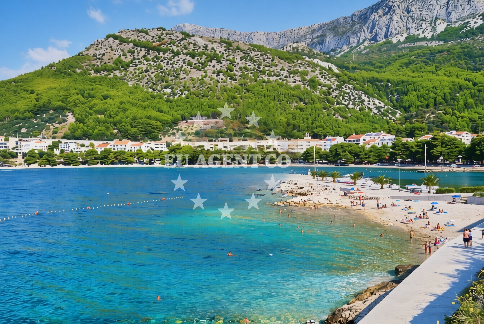
About this beach
Gornja uvala porat, Drvenik (Gradac)
Beach: Gornja uvala porat
Location: Drvenik (Gradac)
Characteristics and facilities
Gravel
40 m
Restaurant / snack bar
Caffe bar / Drinks stand
Beach character
The beach's gravel composition defines its shoreline, which extends approximately 40 meters along the coast. While not a traditional sandy beach, this gravelly stretch provides a stable surface for walking and offers a unique tactile experience for visitors. The beach is modest in size but benefits from its placement within the Drvenik (Gradac) area, which is known for its relatively unspoiled natural landscapes and clear waters typical of the Adriatic.
Swimming and shore
Swimming conditions at Gornja uvala porat are influenced by the open shoreline, which exposes the beach to wave action from the Adriatic Sea. The gravel substrate may make wading less comfortable compared to sandy beaches, but the area remains accessible for those seeking a direct entry point into the water. The beach's orientation and surrounding geography contribute to a generally open seascape, with visibility of nearby islands and coastal features common to the region.
Facilities and activities
On-site facilities include a restaurant/snack bar and a cafe bar/drinks stand, providing visitors with options for refreshments without needing to travel far. These amenities cater to both casual visitors and those staying in nearby accommodations. While no structured activities are listed for the beach itself, its proximity to Drvenik's other attractions and the broader Adriatic coastline offers opportunities for exploration beyond the immediate shoreline.
Access and location
Gornja uvala porat is situated on the island of Drvenik (Gradac), part of the Dalmatian coast's network of islands. Access to the beach is likely via local roads on the island, though specific transportation details are not outlined in the catalog. The beach's location within the Drvenik archipelago positions it near other islands such as Šolta and Brač, which are frequently visited during yacht charters in the area. This placement makes it a potential stop for sailors navigating the Adriatic's eastern coast.
What to expect
Visitors to Gornja uvala porat can expect a beach with a gravel shoreline and limited on-site amenities. The beach's character is defined by its natural substrate and its role as a minor coastal feature within the Drvenik (Gradac) area. While it does not offer extensive facilities or structured activities, its location near the Adriatic's sailing routes may make it a point of interest for those exploring the region by boat. The surrounding waters are known for their clarity, and the beach's proximity to other islands in the area could enhance its appeal for visitors combining land and sea experiences.
Practical tips
Given the beach's gravel composition, visitors may wish to wear sturdy footwear for walking along the shore. The on-site restaurant and cafe provide convenient options for meals and drinks, though their operating hours are not specified in the catalog. Those planning to visit should consider the beach's role within the broader Drvenik archipelago, which offers additional points of interest for exploration.
Exploring the coast by yacht
The Drvenik (Gradac) area is part of the Adriatic's sailing network, with yacht charter guests frequently navigating between nearby islands such as Šolta, Brač, and Hvar. Gornja uvala porat's location on Drvenik places it within reach of these destinations, making it a potentially useful reference point for sailors charting courses through the region. While the beach itself is not a major anchorage or marina, its proximity to the open sea and other islands supports its relevance to maritime activities in the area.
Regional Context and Sailing Proximity
The Drvenik archipelago, where Gornja uvala porat is located, is part of a larger network of islands that form a key corridor for yacht charters in the Adriatic. This region is characterized by its relatively calm waters and scenic coastal routes, making it a favored destination for both short and extended sailing trips. The proximity to the mainland and other islands ensures that visitors can easily combine land-based exploration with maritime travel, enhancing the overall appeal of the area for charter guests.
Anchorages in the surrounding area
Anchorages near Uvala Drvenik (Donja Vala) offer convenient stops for mooring in the surrounding area.
- Anchorage — drvenik — 0.7 NM from beach
- Anchorage — sucuraj — hvar — 3.7 NM from beach
- Anchorage — sucuraj — hvar — 4.6 NM from beach
- Anchorage — sucuraj — hvar — 5.2 NM from beach
- Anchorage — sucuraj — hvar — 5.3 NM from beach
- Anchorage — selca kod bogomolja — hvar — 5.5 NM from beach
- Anchorage — selca kod bogomolja — hvar — 5.6 NM from beach
- Anchorage — selca kod bogomolja — hvar — 6.8 NM from beach
Distances are straight-line geographic distances, not sailing routes.
Mooring buoys in the surrounding area
Mooring buoys at Drvenik Ferry Dock and nearby locations provide options for anchoring close to the beach.
- Drvenik - Ferry dock — drvenik ferry dock — 0.6 NM from beach
- Brist — 3.2 NM from beach
- Jetty — sucuraj — hvar — 3.5 NM from beach
- Konoba Gambo buoys — selca kod bogomolja — hvar — 7.3 NM from beach
- Kraj - Soline — kraj soline — drasnice — 7.9 NM from beach
Distances are straight-line geographic distances, not sailing routes.
Marine fuel stations
Marine fuel stations in Ploce, Korcula, and Makarska serve vessels traveling to the Drvenik region.
- Fuel station — ploce — 9.6 NM from beach
- Fuel station — korcula — 12.7 NM from beach
- Ina — makarska — 13.9 NM from beach
- Fuel station — sumartin — brac — 19.3 NM from beach
Distances are straight-line geographic distances, not sailing routes.
Harbours in the surrounding area
- Drvenik — 0.8 NM from beach
- Zaostrog — 0.9 NM from beach
- Sućuraj — sucuraj — hvar — 3.5 NM from beach
- Gradac — 4.4 NM from beach
- Živogošće — zivogosce — 5.1 NM from beach
- Igrane — 6.0 NM from beach
Distances are straight-line geographic distances, not sailing routes.
Marinas in the surrounding area
Marinas in Tučepi, Korcula, and Brac offer berthing facilities for yachts visiting the Drvenik area.
- Marina Tučepi — marina tucepi — 11.2 NM from beach
- ACI Marina Korčula — korcula — 12.7 NM from beach
- Marina Lumbarda — korcula — 14.0 NM from beach
- Marina Ramova — krvavica — 16.1 NM from beach
- Marina Baška Voda — marina baska voda — 18.6 NM from beach
Distances are straight-line geographic distances, not sailing routes.
Restaurants near the beach
Restaurants in Sućuraj and nearby villages provide dining options for visitors to Gornja uvala porat.
- Restaurant — sucuraj — hvar — 3.5 NM from beach
- Riblji Restoran — sucuraj — hvar — 3.5 NM from beach
Distances are straight-line geographic distances, not sailing routes.
Navigation guides for the surrounding area
Navigation guides for Uvala Drvenik, Otok Hvar, and Gradac assist with route planning near the beach.
- Uvala Drvenik (Donja Vala) — 0.4 NM from beach
- OTOK HVAR — 2.9 NM from beach
- Gradac — 4.6 NM from beach
- Uvala Divna — 8.2 NM from beach
- Trpanj — 8.2 NM from beach
Distances are straight-line geographic distances, not sailing routes.
Yachts from nearby departure bases
Yachts departing from Ploče City Port and Tučepi Port offer access to the Gornja uvala porat area.
Sailing yachts
- Elan 40 Impression (Karleta) — Ploče City Port — 9.5 NM from departure base to beach
- Sun Odyssey 419 (Luka Ploce) — Ploče City Port — 9.5 NM from departure base to beach
- Sun Odyssey 349 (Porto Tolero) — Ploče City Port — 9.5 NM from departure base to beach
- More 55 (MRS. ROBINSON) — Ploče City Port — 9.5 NM from departure base to beach
- Salona 44 (SAMOA) — Ploče City Port — 9.5 NM from departure base to beach
- Elan 514 Impression (Cesarica III) — Ploče City Port — 9.5 NM from departure base to beach
- Sun Odyssey 349 (Visnjica) — Ploče City Port — 9.5 NM from departure base to beach
- Bavaria 40 Cruiser (LADY BUTTERFLY) — Tučepi Port — 11.3 NM from departure base to beach
Catamarans
- Lagoon 450 Fly (Alba Mouse) — Ploče City Port — 9.5 NM from departure base to beach
Motor yachts
- Princess V53 (Chablis) — Makarska Port — 13.7 NM from departure base to beach
Distances are straight-line geographic distances, not sailing routes.