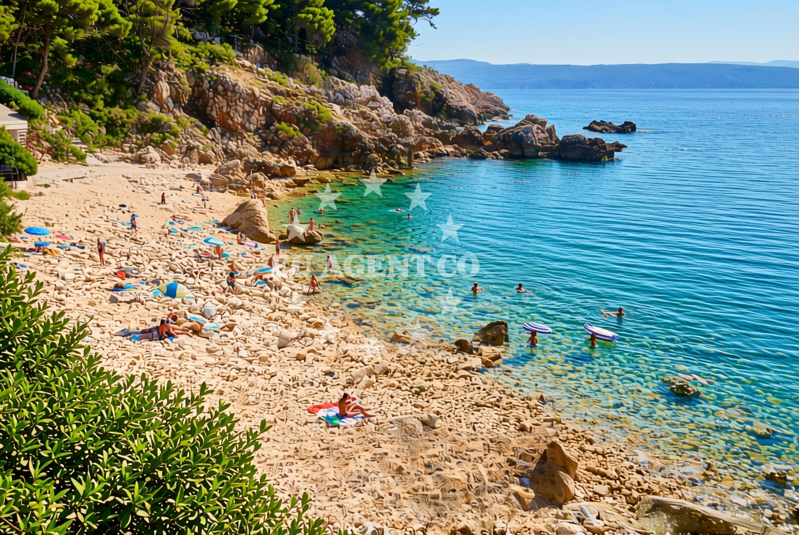
Glavotok, Brzac (Krk) Beach, Croatia
About this beach
Glavotok, Brzac (Krk)
Beach: Glavotok
Location: Brzac (Krk)
Characteristics and facilities
Pebbles, gravel, rocks
30 m
Natural shade
Beach character
The beach's primary feature is its rocky and pebbly substrate, which extends along the shoreline for approximately 30 meters. This composition suggests a dynamic coastal environment shaped by wave action and tidal influences. The absence of artificial structures or amenities means the beach retains a natural, unaltered character. The natural shade mentioned in the catalog may be attributed to low-lying vegetation or the orientation of the landform relative to the sun's path, though the exact source remains unspecified.Swimming and shore
Swimming conditions at Glavotok, Brzac (Krk) Beach are influenced by the rocky and pebbly seabed. While the terrain may present challenges for those unaccustomed to such surfaces, it also creates shallow, sheltered areas that could be suitable for calm-water swimming during low tide. The shore itself is marked by uneven terrain, requiring caution when navigating the beach. No lifeguard services or safety infrastructure are indicated in the catalog, so visitors should exercise care, particularly with children.Facilities and activities
The beach does not appear to have structured facilities such as restrooms, showers, or parking areas, as these are not mentioned in the catalog. Recreational activities are not explicitly listed, though the rocky shoreline may support rock climbing or coastal hiking in the surrounding area. The lack of formal amenities means visitors should plan accordingly, bringing personal items such as water, snacks, and sun protection.Access and location
Glavotok, Brzac (Krk) Beach is located on Krk Island, which lies northeast of the Istrian Peninsula and northwest of the city of Zadar. The island is accessible by ferry from the mainland, with connections to Rijeka and other coastal towns. The beach's precise location within Brzac suggests it may be near the village of the same name, though no specific road access details are provided. Visitors arriving by car would need to follow local routes to the coastal area.What to expect
Visitors should expect a rugged, natural shoreline composed of pebbles, gravel, and rocks. The beach's 30-meter length offers limited space for relaxation, with the natural shade providing partial relief from direct sunlight. The absence of formal facilities means visitors must bring their own supplies. The surrounding area of Krk Island offers broader opportunities for exploration, including historical sites and other coastal landscapes.Practical tips
Wear sturdy footwear to navigate the rocky terrain safely. Carry sufficient water and sun protection, as shade is limited to natural features. Check tide times to avoid hazardous conditions during low tide. Be mindful of the beach's short length when planning arrival times.Exploring the coast by yacht
For yacht charter guests, Krk Island is a well-established sailing destination in the Adriatic, offering a network of marinas and anchorages. While Glavotok, Brzac (Krk) Beach itself is not marked as a formal anchorage, the broader Krk region is known for its sheltered bays and scenic routes. Yacht charterers may explore the area using Euro-Agent's yacht search tool, which includes options for motor and sail boats operating from nearby bases. The beaches map at https://euro-agent.com/?open=beaches_map provides additional coastal context for planning sailing itineraries.Regional Context: Krk Island
Krk Island, where Glavotok, Brzac Beach is located, is renowned for its medieval architecture, such as the Krk Fortress, and its vineyards producing the island's signature white wines. The island's coastline alternates between rugged cliffs and sandy beaches, with Glavotok representing one of the more distinctive, rocky stretches. The nearby town of Krk serves as a hub for tourism, offering amenities and transport links to the mainland.Anchorages in the surrounding area
Anchorages near Glavotok, Brzac (Krk) Beach include Camp Glavotok and several in Krk.
- Camp Glavotok — krk — 0.1 NM from beach
- Anchorage — krk — 0.6 NM from beach
- Anchorage — krk — 1.3 NM from beach
- Anchorage — krk — 2.0 NM from beach
- Anchorage — krk — 2.3 NM from beach
- Anchorage — porat — krk — 2.7 NM from beach
- Anchorage — malinska — krk — 3.2 NM from beach
- Anchorage — pinezici — krk — 3.3 NM from beach
Distances are straight-line geographic distances, not sailing routes.
Mooring buoys in the surrounding area
Mooring buoys in the vicinity feature Camp Glavotok and fields in Pinezici, Krk.
- Camp Glavotok — krk — 0.2 NM from beach
- Jetty — pinezici — krk — 3.1 NM from beach
- Jetty — pinezici — krk — 3.2 NM from beach
- Buoy field — pinezici — krk — 3.6 NM from beach
- Jetty — pinezici — krk — 3.7 NM from beach
Distances are straight-line geographic distances, not sailing routes.
Marine fuel stations
- OMV — krk — 4.6 NM from beach
- Ina — krk — 7.0 NM from beach
- Flash — krk — 7.1 NM from beach
- Fuel station — cres — 8.2 NM from beach
Distances are straight-line geographic distances, not sailing routes.
Harbours in the surrounding area
Harbors near the beach include Glavotok, Club Harbour, and Porat in Krk.
- Glavotok — krk — 0.2 NM from beach
- Club Harbour — krk — 2.0 NM from beach
- Porat — krk — 3.0 NM from beach
- Vantačić — vantacic — vantacici — 3.2 NM from beach
- Beli — cres — 3.5 NM from beach
- Haludovo — malinska — krk — 4.5 NM from beach
Distances are straight-line geographic distances, not sailing routes.
Marinas in the surrounding area
- Omišalj Docks — omisalj — krk — 8.5 NM from beach
- ACI Marina Cres — 8.8 NM from beach
- Marina Punat — krk — 8.9 NM from beach
- Šilo — silo — krk — 10.4 NM from beach
- ACI Marina Opatija — 14.7 NM from beach
Distances are straight-line geographic distances, not sailing routes.
Restaurants near the beach
Restaurants in Porat, Malinska, and Pinezici offer dining options near the beach.
- Gostiona Sidro — porat — krk — 2.9 NM from beach
- Picolla Venezia — porat — krk — 2.9 NM from beach
- Porat — krk — 3.0 NM from beach
- Restaurant — beli — cres — 3.5 NM from beach
- Restaurant — pinezici — krk — 3.5 NM from beach
- Restaurant Obala — malinska — krk — 4.2 NM from beach
- Restaurant — malinska — krk — 4.5 NM from beach
Distances are straight-line geographic distances, not sailing routes.
Navigation guides for the surrounding area
Navigation guides cover Uvala Cavlena, Luka Torkul, and other nearby coastal features.
- Uvala Cavlena — 1.4 NM from beach
- Uvala Vala Jana — 2.0 NM from beach
- Luka Torkul — 3.1 NM from beach
- Uvala Sv. Fuska — 3.8 NM from beach
- Luka Kijac — 5.4 NM from beach
Distances are straight-line geographic distances, not sailing routes.
Yachts from nearby departure bases
Yachts depart from bases in Malinska and Krk Marina Punat, with some within 4 nautical miles.
Sailing yachts
- Sun Odyssey 29.2 (Mirabai) — Malinska Hotel Malin port — 3.9 NM from departure base to beach
- Bavaria 37 Cruiser (Funky) — Krk Marina Punat — 8.9 NM from departure base to beach
- Bavaria 41 (Azzurro) — Krk Marina Punat — 8.9 NM from departure base to beach
- Sun Odyssey 349 (Gin Tonic) — Krk Marina Punat — 8.9 NM from departure base to beach
Catamarans
- Astrea 42 (Flavia Augusta) — Krk Marina Punat — 8.9 NM from departure base to beach
- Lipari 41 (ARGOS) — Krk Marina Punat — 8.9 NM from departure base to beach
Motor yachts
- Galeon 500 Fly (Barbara) — Krk Marina Punat — 8.9 NM from departure base to beach
- Ferretti 460 (Summertime) — Krk Marina Punat — 8.9 NM from departure base to beach
Motor boats
- Prestige 36 (Fortuna) — Krk Marina Punat — 8.9 NM from departure base to beach
- Antares 42 (Santin) — Krk Marina Punat — 8.9 NM from departure base to beach
Distances are straight-line geographic distances, not sailing routes.