Glavica Beach, Žirje: A Coastal Escape in Croatia's Adriatic Heart
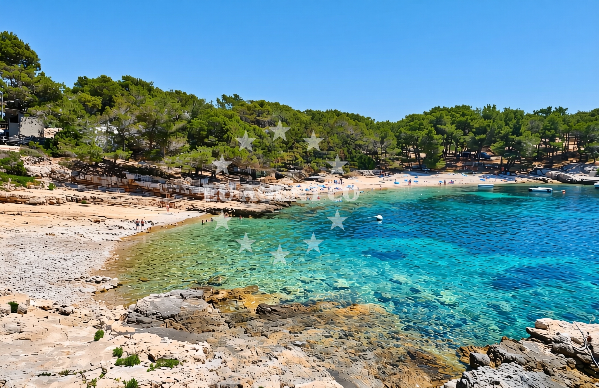
About this beach
Glavica, Žirje (Žirje)
Beach: Glavica
Location: Žirje (Žirje)
Beach character
Glavica Beach occupies a quiet corner of Žirje's eastern coastline, where the island's rugged terrain meets the sea. The beach's character is defined by its natural setting: unspoiled sands, modest size, and a lack of overt commercial development. The absence of modern infrastructure preserves its raw appeal, though this also means visitors should plan with self-sufficiency in mind. The surrounding landscape features low coastal bluffs and scattered pine groves, creating a contrast between the beach's openness and the island's inland topography.Swimming and shore
The beach's shallow, sandy bottom extends several meters from shore, making it accessible for swimmers of all ages. While no specific water quality data is available, the Adriatic's general reputation for clean waters applies here. The shore itself is relatively flat, with no prominent rock formations or tidal pools. The lack of nearby structures means the beach maintains a natural rhythm, with waves gently receding against the sand without the interference of piers or jetties.Facilities and activities
No formal facilities are listed for Glavica Beach itself, reflecting its undeveloped nature. However, the broader Žirje island offers basic amenities in its main settlement of Žirje village, including small shops, taverns, and a marina. For activities, the beach's proximity to the sea makes it a natural launching point for kayaking or snorkeling excursions. The island's limited road network means most exploration will be on foot or by bicycle, with trails connecting coastal points to inland forests.Access and location
Reaching Glavica Beach requires a combination of maritime and overland travel. The nearest major port is Split, from which ferries and catamarans operate to Žirje's main harbor. Once on the island, the beach is accessible via a short walk or bike ride from the village. The lack of direct road access means visitors should consider arriving by boat or arranging transport from the island's limited road network. For yacht charter guests, the nearby marina in Žirje village provides a convenient base for exploring the area.What to expect
Visitors to Glavica Beach should anticipate a quiet, low-key experience that prioritizes natural beauty over modern comforts. The beach is likely to be less crowded than more developed Adriatic destinations, appealing to those seeking solitude. The surrounding island offers opportunities for hiking, with trails leading to viewpoints overlooking the sea. While Žirje lacks the grandeur of larger Dalmatian islands, its relative seclusion makes it an ideal base for those wishing to explore the region's sailing routes at a slower pace.Practical tips
Given the beach's undeveloped nature, visitors should bring essentials like sunscreen, water, and a picnic setup. The nearest facilities are in Žirje village, so planning ahead for meals or supplies is advisable. For yacht charter guests, the island's marina offers mooring options, though availability should be confirmed through Euro-Agent's Yacht Search page.Exploring the coast by yacht
For yacht charter guests, Glavica Beach's location on Žirje positions it as a strategic stop along the Split-Korčula sailing route. The island's proximity to the mainland and its sheltered waters make it a useful waypoint for crews navigating the southern Adriatic. Euro-Agent's Yacht Search platform can help identify motor yachts or sailboats available for charter in the region, with bases in nearby ports such as Split or Dubrovnik. The surrounding waters offer opportunities for exploring the Elafiti Islands, the island of Mljet, and the historic town of Šibenik.Regional Context: Žirje's Place in the Adriatic
Žirje is one of the Žirje Islands, a small archipelago situated between the islands of Hvar and Korčula. This positioning places it at the crossroads of several key sailing routes, including the popular routes from Split to the Pelješac Peninsula and the quieter paths along the island's southern coast. The island's history is closely tied to maritime traditions, with evidence of ancient Roman settlements and medieval fortifications still visible in the inland areas.
Anchorages in the surrounding area
- Anchorage — zirje — 0.4 NM from beach
- Japlenišće — zirje — 2.8 NM from beach
- Anchorage — zirje — 3.3 NM from beach
- Vanjska — kaprije — 3.6 NM from beach
- Mala Stupica — zirje — 3.7 NM from beach
- Remetić — remetic — kaprije — 3.8 NM from beach
- Anchorage — kaprije — 3.9 NM from beach
- Anchorage — zirje — 4.0 NM from beach
Distances are straight-line geographic distances, not sailing routes.
Mooring buoys in the surrounding area
- Buoy field — zirje — 0.2 NM from beach
- Mikavica — zirje — 0.4 NM from beach
- Quay — zirje — 1.9 NM from beach
- Buoy field — kakan — 2.4 NM from beach
- Buoy field — kakan — 2.5 NM from beach
Distances are straight-line geographic distances, not sailing routes.
Marine fuel stations
- Ina — jezera — murter — 7.3 NM from beach
- Petrol — tribunj — 7.5 NM from beach
- Ina — vodice — 8.7 NM from beach
- Ina — murter — 9.8 NM from beach
Distances are straight-line geographic distances, not sailing routes.
Harbours in the surrounding area
- Muna — zirje — 1.3 NM from beach
- Kaprije — 3.8 NM from beach
- Jezera — murter — 7.3 NM from beach
- Tribunj — 7.4 NM from beach
- Prvić Šepurine — prvic sepurine — 8.1 NM from beach
- Konoba Stari Nanini at Prvić Port — prvic — 8.3 NM from beach
Distances are straight-line geographic distances, not sailing routes.
Marinas in the surrounding area
- ACI Marina Jezera — murter — 7.3 NM from beach
- Marina Tribunj — 7.5 NM from beach
- ACI Marina Vodice — 8.6 NM from beach
- Marina Pirovac — 9.3 NM from beach
- Marina Betina — murter — 9.9 NM from beach
Distances are straight-line geographic distances, not sailing routes.
Restaurants near the beach
- Konoba Tratinska — zirje — 0.1 NM from beach
- Julie — zirje — 0.1 NM from beach
- Restaurant — zirje — 0.4 NM from beach
- Buffet Masklin — zirje — 1.3 NM from beach
- Konoba Koromasna — zirje — 1.9 NM from beach
- Babalu — kakan — 2.4 NM from beach
- Nebo — kakan — 2.6 NM from beach
Distances are straight-line geographic distances, not sailing routes.
Navigation guides for the surrounding area
- Luka Muna — 1.4 NM from beach
- MAINLAND COAST AND MURTER — 6.1 NM from beach
- Uvala Sv. Nikola — 6.7 NM from beach
- Tučepi — 7.2 NM from beach
- Jezera — 7.2 NM from beach
Distances are straight-line geographic distances, not sailing routes.
Yachts from nearby departure bases
Sailing yachts
- Elan 450 (Eviva I) — Murter ACI Marina Jezera — 7.3 NM from departure base to beach
- First 35 (Capricorn) — Murter ACI Marina Jezera — 7.3 NM from departure base to beach
- Elan 50 Impression (Pancho I) — Murter ACI Marina Jezera — 7.3 NM from departure base to beach
- Oceanis 51.1 (Pisces) — Murter ACI Marina Jezera — 7.3 NM from departure base to beach
- Dehler 38 SQ (Blue Eye) — Murter ACI Marina Jezera — 7.3 NM from departure base to beach
- Elan 344 Impression (Vita I) — Murter ACI Marina Jezera — 7.3 NM from departure base to beach
- Bavaria 44 (Flipper I) — Murter ACI Marina Jezera — 7.3 NM from departure base to beach
- First 35 (Taurus) — Murter ACI Marina Jezera — 7.3 NM from departure base to beach
Motor boats
- Damor 980 Fjera (Neja) — Murter ACI Marina Jezera — 7.3 NM from departure base to beach
- Damor 980 Fjera (Neja) — Murter ACI Marina Jezera — 7.3 NM from departure base to beach
Distances are straight-line geographic distances, not sailing routes.