Gdinj (Hvar): Beaches and Coves, Croatia
About this beach
Gdinj (Hvar): beaches and coves
Beach character
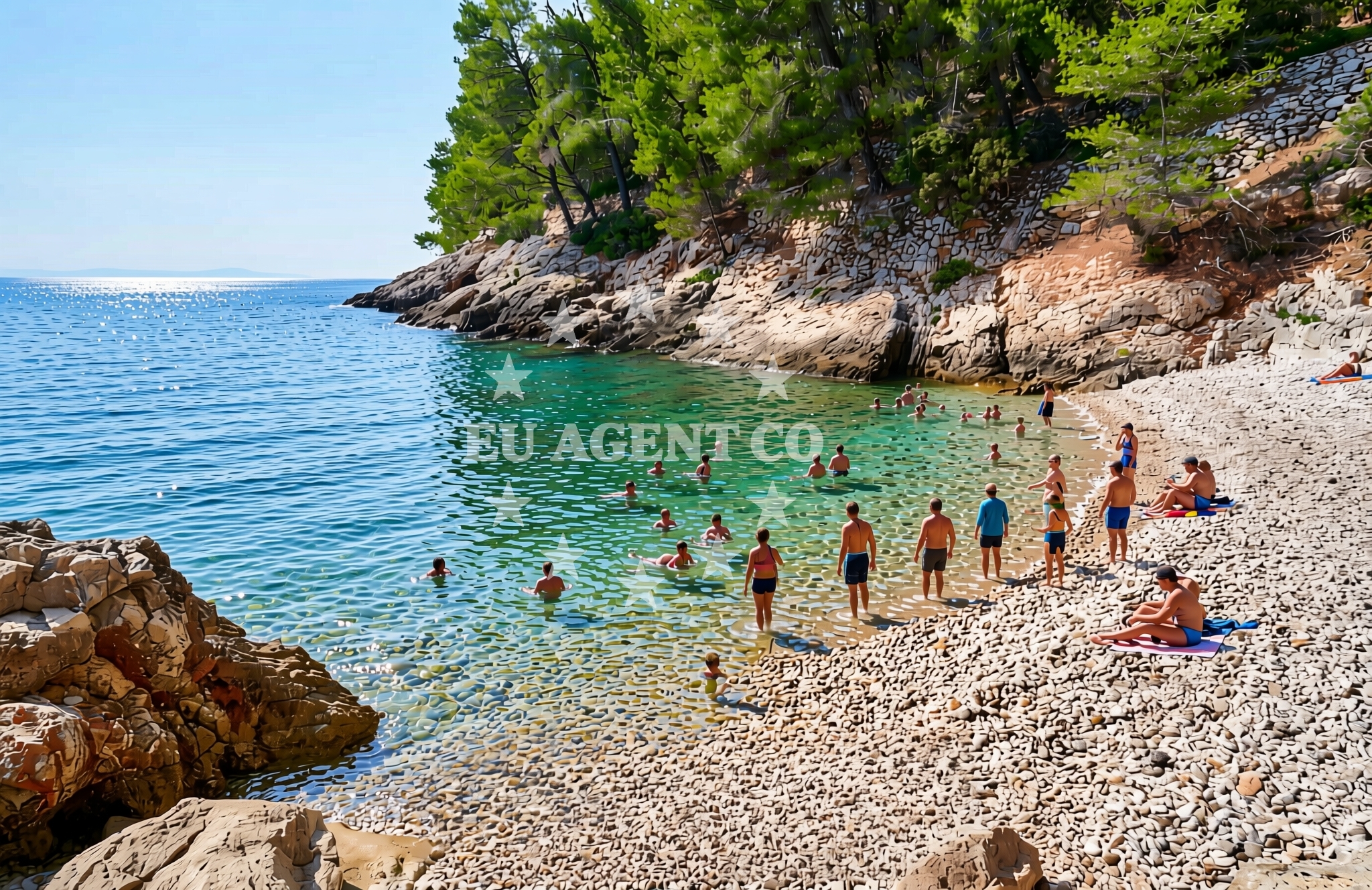
The beaches and coves of Gdinj are characterized by their natural simplicity. The shoreline here is predominantly composed of pebbles and small stones, with limited sandy patches. The waters are typically clear, reflecting the deep blue of the Adriatic Sea. The surrounding cliffs, which rise sharply from the water's edge in some areas, create a sense of seclusion. These features make the coves popular with swimmers and snorkelers who appreciate the absence of crowds. The lack of formal infrastructure means the area remains largely undeveloped, preserving its rustic charm.Swimming and shore
Swimming is possible along the more sheltered coves, where the sea is calmer and the water is shallower. The pebbled shore makes barefoot walking practical, though beach towels or mats are recommended for comfort. The cliffs that define many of the coves provide natural shade during the hottest parts of the day. Snorkeling is a common activity, with visibility often extending to depths of 10-15 meters. However, the absence of designated swimming areas means visitors should exercise caution, particularly in areas where the seabed drops off abruptly.Facilities and activities
There are no formal facilities such as showers, restrooms, or lifeguard services at the beaches of Gdinj. The nearest amenities are located in Hvar Town, approximately 10 kilometers to the south. Activities centered around the coastline include hiking along the island's trails, which offer panoramic views of the sea and surrounding villages. Kayaking and paddleboarding are available through local operators based in Hvar Town. The lack of commercialized beach services aligns with the area's focus on preserving its natural state.Access and location
Gdinj is accessible by road via the Hvar-Split coastal route, with the village located about 15 kilometers north of Hvar Town. The nearest major marina is in Hvar Town, which serves as a hub for both local and international yacht charter companies. From here, visitors can take a short boat trip to explore the coves of Gdinj and surrounding areas. The village itself has limited parking, with most visitors arriving by car or motorcycle. For those arriving by sea, the nearby anchorage at Hvar Town provides a convenient starting point for exploring the northern coast.What to expect
Visitors to Gdinj's beaches should expect a landscape defined by natural simplicity and minimal infrastructure. The coastline is best suited for those seeking solitude and a connection to the unspoiled Adriatic. The absence of commercial facilities means the area is not ideal for families requiring amenities like restrooms or shaded seating. However, the scenic beauty of the coves and the opportunity to explore Hvar's historic sites make it a compelling destination for independent travelers and those interested in cultural tourism. The best time to visit is during the shoulder seasons, when the crowds from Hvar Town are smaller.Practical tips
Bring a towel or mat for the pebbled shore, as there are no designated seating areas. A car is recommended for exploring the village and nearby trails, though parking can be limited. For meals and supplies, head to Hvar Town, which has a range of restaurants and shops. Local tour operators in Hvar Town can arrange boat trips to the coves of Gdinj.Exploring the coast by yacht
The waters around Hvar, including the coves of Gdinj, are part of a popular sailing route in the Adriatic. Yacht charter companies based in Hvar Town offer access to this region, with many boats departing from the marina to explore the island's coastline. The proximity to the Hvar-Split highway makes it easy to combine land and sea travel, with visitors able to dock in Hvar Town and then take a short drive or boat ride to Gdinj. For those chartering a yacht, the area offers opportunities to anchor in sheltered bays and explore the island's lesser-known shores.Historical Context of Gdinj
Gdinj's history is closely tied to Hvar's broader medieval past. The village is mentioned in historical records from the 13th century, though its development remained modest compared to Hvar Town. The area's strategic location on the northern coast made it a point of interest during various conflicts, including those involving the Venetian Republic. Today, the village retains a traditional character, with stone houses and narrow streets that reflect its long-standing connection to the sea.Anchorages in the surrounding area
Anchorages near Gdinj (Hvar) include those at Dugi Dolac and Gdinj.
- Anchorage — dugi dolac — hvar — 1.2 NM from beach
- Anchorage — gdinj — hvar — 1.2 NM from beach
- Anchorage — gdinj — hvar — 1.2 NM from beach
- Anchorage — gdinj — hvar — 1.2 NM from beach
- Anchorage — gdinj — hvar — 1.3 NM from beach
- Anchorage — dugi dolac — hvar — 1.5 NM from beach
- Anchorage — gdinj — hvar — 1.5 NM from beach
- Anchorage — dugi dolac — hvar — 1.8 NM from beach
Distances are straight-line geographic distances, not sailing routes.
Mooring buoys in the surrounding area
Mooring buoys in the vicinity of Gdinj (Hvar) are located at Quay, Pokrivenik, and other nearby points.
- Quay — hvar — 1.2 NM from beach
- Restaurant Preza quay — pokrivenik — hvar — 2.6 NM from beach
- Quay — bogomolje — hvar — 3.2 NM from beach
- Jetty — velika stiniva — hvar — 5.8 NM from beach
- Konoba Gambo buoys — selca kod bogomolja — hvar — 7.0 NM from beach
Distances are straight-line geographic distances, not sailing routes.
Marine fuel stations
Marine fuel stations can be found in Sumartin (Brac), Ina (Makarska), and other regions around Gdinj (Hvar).
- Fuel station — sumartin — brac — 9.9 NM from beach
- Ina — makarska — 10.3 NM from beach
- Ina — vrboska — hvar — 12.1 NM from beach
- Fuel station — korcula — 14.0 NM from beach
Distances are straight-line geographic distances, not sailing routes.
Harbours in the surrounding area
Harbours in the surrounding area include Lovište, Čaklje, and Podgora, among others.
- Lovište — loviste — 7.3 NM from beach
- Čaklje — caklje — podgora — 8.7 NM from beach
- Podgora — 8.8 NM from beach
- Drašnice — drasnice — 8.9 NM from beach
- Tučepi — tucepi — 9.3 NM from beach
- Igrane — 9.4 NM from beach
Distances are straight-line geographic distances, not sailing routes.
Marinas in the surrounding area
Marinas near Gdinj (Hvar) include Tučepi Marina, Marina Ramova, and others in the region.
- Marina Tučepi — marina tucepi — 9.4 NM from beach
- Marina Ramova — krvavica — 11.6 NM from beach
- ACI Marina Vrboska — hvar — 12.0 NM from beach
- ACI Marina Korčula — korcula — 13.5 NM from beach
- Marina Baška Voda — marina baska voda — 13.5 NM from beach
Distances are straight-line geographic distances, not sailing routes.
Restaurants near the beach
Restaurants near the beach include Pakomina and Restaurant Timun in Pokrivenik.
- Pakomina — hvar — 1.2 NM from beach
- Restaurant Timun — pokrivenik — hvar — 2.6 NM from beach
Distances are straight-line geographic distances, not sailing routes.
Navigation guides for the surrounding area
Navigation guides for the area include Uvala Pokrivenik and other nearby points.
- Uvala Pokrivenik — 2.5 NM from beach
- Uvala Duboka — 4.7 NM from beach
- Uvala Kozja — 4.9 NM from beach
- Podgora — 9.0 NM from beach
- Uvala Studena — 9.4 NM from beach
Distances are straight-line geographic distances, not sailing routes.
Yachts from nearby departure bases
Sailing yachts
- Bavaria 40 Cruiser (LADY BUTTERFLY) — Tučepi Port — 9.4 NM from departure base to beach
- Hanse 445 (HELIOS) — Baška Voda — 13.5 NM from departure base to beach
- D&D Kufner 54 (Komiza) — Baška Voda — 13.5 NM from departure base to beach
Catamarans
- Lagoon 450 (LAMANTIN) — Baška Voda — 13.5 NM from departure base to beach
Motor yachts
- Princess V53 (Chablis) — Makarska Port — 10.2 NM from departure base to beach
- Canados 86 (Karisma) — Baška Voda — 13.5 NM from departure base to beach
Motor boats
- Galeon 430 Skydeck (Bellagio) — Makarska Port — 10.2 NM from departure base to beach
- Jeanneau NC 37 (Black Pearl) — Makarska Port — 10.2 NM from departure base to beach
- Jeanneau NC 37 (Black Pearl) — Makarska Port — 10.2 NM from departure base to beach
- Galeon 430 Skydeck (BELLAGIO) — Makarska Port — 10.2 NM from departure base to beach
Distances are straight-line geographic distances, not sailing routes.