Galeb, Omiš Beach, Croatia
About this beach
Galeb, Omiš
Beach: Galeb
Location: Omiš
Characteristics and facilities
Sand
480 m
Restaurant / snack bar
Caffe bar / Drinks stand
Natural shade
shower
Training ground
Changing cabin
Beach character
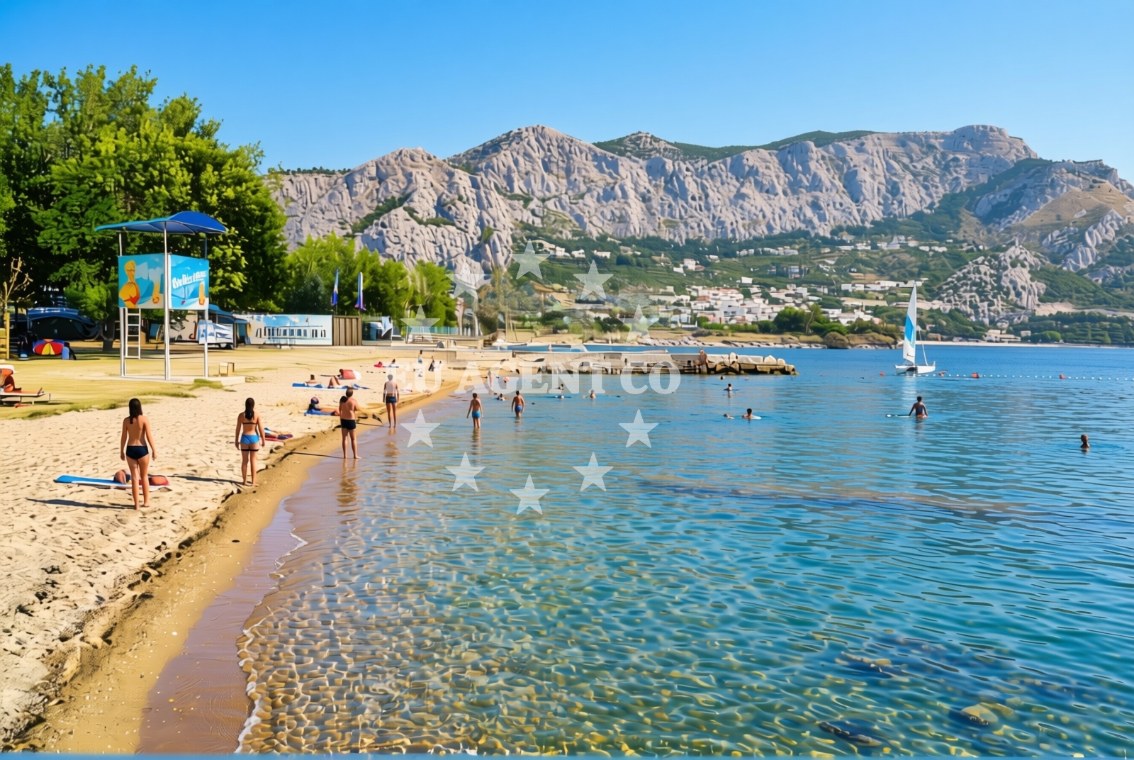
The beach is composed of fine sand, typical of the Adriatic’s southern coast. Its length provides space for sunbathing and casual relaxation, though it lacks the expansive layout of larger urban beaches. Natural shade is available in scattered areas, likely from nearby rock formations or vegetation, offering respite from the sun. The beach’s character is defined by its integration with the surrounding landscape, where the sea meets the rocky terrain characteristic of the Omiš region.Swimming and shore
Swimming conditions are not explicitly detailed in the catalog, but the presence of a training ground suggests the shore may be used for light athletic activities. The beach’s sand is suitable for walking, and the absence of explicit warnings about water conditions implies it is generally safe for swimmers. The shoreline’s proximity to Omiš’s historic landmarks, such as the fortress and old town, allows visitors to combine beach time with cultural exploration.Facilities and activities
Basic amenities include a restaurant/snack bar and a café/drinks stand, catering to casual dining needs. A shower facility and changing cabins are available, though the lack of detailed descriptions means their condition and capacity are unknown. The training ground is a unique feature, potentially supporting activities like volleyball or other sports. No explicit mention of water-based activities or rental equipment is provided, so visitors should assume these are not available unless confirmed locally.Access and location
The beach is situated in Omiš, a town on the southern Dalmatian coast, approximately 150 kilometers southeast of Split. Omiš itself is a gateway to the Cetina River canyon and the nearby Krka National Park, though the beach’s direct surroundings are more focused on the Adriatic Sea. Access is likely via local roads connecting to Omiš, which is served by regional transport links and is a common stop for cruise ships and charter yachts exploring the area.What to expect
Expect a modest beach experience centered on simplicity and integration with the natural environment. The 480-meter stretch of sand is suitable for sunbathing, and the available amenities—restaurant, café, showers, and changing cabins—support basic needs. The training ground adds a functional element, possibly for informal games. The beach’s location in Omiš means visitors can easily combine time at the shore with exploring the town’s medieval architecture, hiking in the surrounding hills, or visiting nearby attractions like the Cetina River canyon.Practical tips
Bring swimwear, sunscreen, and a towel, as the beach lacks detailed facilities for sun protection. The restaurant and café are ideal for light meals or drinks, but arrive early to secure a spot, especially during peak seasons. The training ground may be used for sports, so consider bringing equipment if planning to use it.Exploring the coast by yacht
For yacht charter guests, the Omiš region is a popular sailing destination due to its sheltered bays, clear waters, and proximity to cultural sites. While the beach itself is not marked as an anchorage or marina, the area around Omiš offers several options for mooring, including the Omiš Marina. Charter boats often explore the Cetina River and nearby islands, making this part of the coast a convenient base for longer sailing trips. For specific availability and routes, use the Euro-Agent Yacht Search tool.Historical and Cultural Context
Omiš, the town near Galeb Beach, is renowned for its well-preserved medieval architecture, including the Omiš Fortress and the Church of St. Nicholas. The area’s history as a Venetian stronghold and its role in the Adriatic trade routes add depth to any visit. The beach’s location provides a peaceful contrast to the town’s historic sites, offering a place to unwind after exploring Omiš’s cultural landmarks.Anchorages in the surrounding area
Nearby anchorages in Brac, including Postira, Splitska, and Supetar.
- Anchorage — postira — brac — 4.1 NM from beach
- Konopjikova — postira — brac — 4.4 NM from beach
- Anchorage — postira — brac — 4.5 NM from beach
- Anchorage — splitska — brac — 5.0 NM from beach
- Anchorage — supetar — brac — 7.0 NM from beach
- Tri luke — povlja — brac — 7.9 NM from beach
- Anchorage — povlja — brac — 8.5 NM from beach
- Anchorage — povlja — brac — 8.6 NM from beach
Distances are straight-line geographic distances, not sailing routes.
Mooring buoys in the surrounding area
Mooring buoys in Postira, Podstrana, and Povlja on Brac.
- Quay — postira — brac — 4.4 NM from beach
- Jetty — podstrana — 5.3 NM from beach
- Restaurant Pipo buoys — povlja — brac — 7.8 NM from beach
- Restaurant Pipo jetty — povlja — brac — 7.9 NM from beach
- Konoba Rojen jetty — povlja — brac — 8.0 NM from beach
Distances are straight-line geographic distances, not sailing routes.
Marine fuel stations
Marine fuel stations in Bol, Split, and Sumartin.
- Fuel station — bol — brac — 10.8 NM from beach
- Ina — split — 11.5 NM from beach
- Ina — split — 11.8 NM from beach
- Fuel station — sumartin — brac — 12.1 NM from beach
Distances are straight-line geographic distances, not sailing routes.
Harbours in the surrounding area
Harbors in Omiš, Dugi Rat, and Splitska.
- Omiš — omis — 0.7 NM from beach
- Dugi Rat — 1.7 NM from beach
- Sumpetar — dugi rat — 2.4 NM from beach
- Krilo — jesenice — 3.7 NM from beach
- Postira — brac — 4.4 NM from beach
- Splitska — brac — 4.9 NM from beach
Distances are straight-line geographic distances, not sailing routes.
Marinas in the surrounding area
Marinas in Podstrana, Split, and Milna Brac.
- Marina Lav — podstrana — 6.9 NM from beach
- ACI Marina Split — 11.5 NM from beach
- ACI Marina Milna — milna brac — 12.2 NM from beach
- Marina Milna Kanarija — milna brac — 12.3 NM from beach
- Marina Vlaška — milna brac — 12.3 NM from beach
Distances are straight-line geographic distances, not sailing routes.
Restaurants near the beach
Restaurants in Omiš, Postira, and Splitska.
- Konoba Milo — omis — 0.7 NM from beach
- Restaurant — postira — brac — 4.3 NM from beach
- Galija — postira — brac — 4.3 NM from beach
- Vala — splitska — brac — 5.0 NM from beach
Distances are straight-line geographic distances, not sailing routes.
Navigation guides for the surrounding area
Navigation guides to nearby points including Dugi Rat and Postire.
- Omis — 0.9 NM from beach
- Dugi Rat (Uvala Orisac) — 1.6 NM from beach
- Postire — 4.3 NM from beach
- Uvala Spliska (Splitska) — 4.9 NM from beach
- Pucisca — 6.1 NM from beach
Distances are straight-line geographic distances, not sailing routes.
Yachts from nearby departure bases
Yachts departing from Omiš, Sumpetar, Dugi Rat, and Podstrana.
Sailing yachts
- Jeanneau 53 (Win Win) — Podstrana Marina Lav — 6.9 NM from departure base to beach
Catamarans
- Lagoon 450 Fly (Falco) — Sumpetar Port — 2.4 NM from departure base to beach
Motor yachts
- Ferretti 500 (Roch Antonio) — Podstrana Marina Lav — 6.9 NM from departure base to beach
Gulets / Cruisers
- Gulet (PATRONICE) — Omiš City Port — 0.7 NM from departure base to beach
- Gulet (Trebenna) — Omiš City Port — 0.7 NM from departure base to beach
- Gulet (Primorac) — Omiš City Port — 0.7 NM from departure base to beach
- Gulet (Cataleya) — Sumpetar Port — 2.4 NM from departure base to beach
- Gulet (Altair) — Sumpetar Port — 2.4 NM from departure base to beach
- Gulet cruiser (AGORA) — Dugi Rat Luka Krilo — 3.7 NM from departure base to beach
Motor boats
- Cranchi 43 Sport Top (Chiara) — Podstrana Marina Lav — 6.9 NM from departure base to beach
Distances are straight-line geographic distances, not sailing routes.