Feronija Beach - Ivan Dolac, Croatia
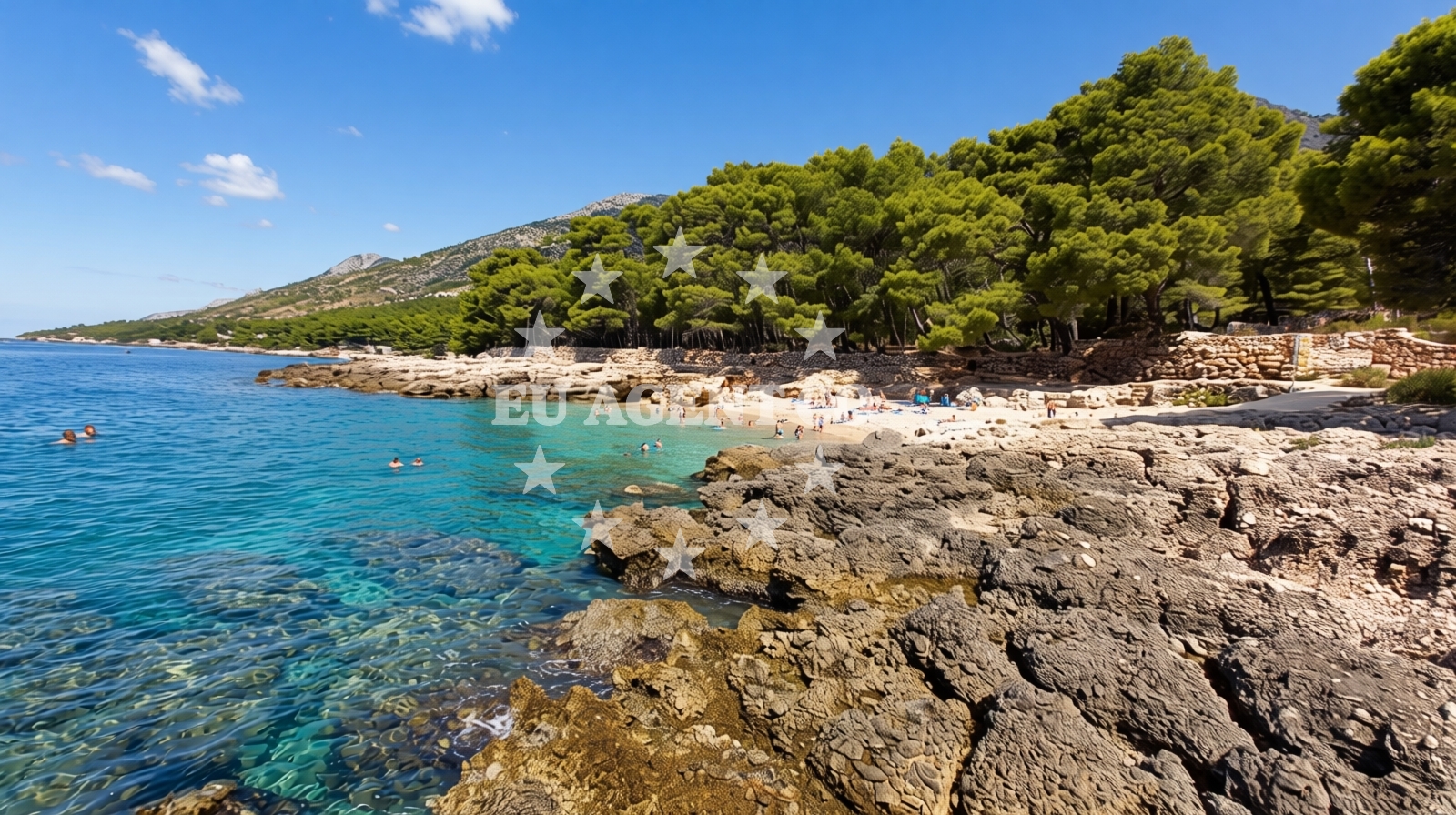
Beach character
The beach's defining characteristic is its pebbled shoreline, which extends 10 meters wide at its broadest point. The natural shade provided by the surrounding cliffs offers intermittent relief from direct sunlight, though visitors should still bring sun protection. The sea floor consists of small pebbles that slope gradually into the water, creating a safe swimming environment. This gradual depth increase is particularly notable for families with young children, as it allows for easy entry and exit from the water. The beach's orientation and sheltered position contribute to its relatively calm waters, though ocean swells during strong winds may occasionally affect the shoreline.Swimming and shore
The beach's shallow, gradually sloping profile makes it suitable for swimmers of all abilities. The smooth transition from the pebbled shore to deeper water reduces the risk of injury compared to rocky coastlines. For snorkeling enthusiasts, the clear waters reveal a vibrant marine ecosystem, though the pebbled seabed may limit visibility compared to sandy beaches. Kayaking is a popular activity in the area, with the sheltered cove providing a stable environment for both beginners and experienced paddlers. The absence of artificial structures means visitors must bring their own equipment for these activities.Facilities and activities
Feronija Beach lacks formal amenities such as showers, restrooms, or umbrellas. This minimal infrastructure aligns with its character as a natural coastal site rather than a developed resort beach. The primary activities available are kayaking and snorkeling, both of which require visitors to bring their own equipment. The beach's pebbled surface means that sunbeds or beach towels are essential for comfort. While there are no designated picnic areas, the surrounding cliffs provide natural seating opportunities for those seeking to enjoy meals outdoors.Access and location
Located in Ivan Dolac on the Adriatic coast, Feronija Beach is accessible via local roads that connect to the broader Istrian peninsula network. The coordinates (43.12526, 16.64552) place it within a region known for its rugged coastline and maritime traditions. The beach's position near Ivan Dolac means it's within reach of nearby towns that offer basic services, though visitors should plan accordingly for provisions. The surrounding area's geography influences access, with the beach's orientation creating a natural landing point for those arriving by boat.What to expect
Visitors should anticipate a beach experience centered on natural features rather than luxury amenities. The pebbled shoreline requires beach towels or mats for comfort, and the lack of formal facilities means preparation for self-sufficiency. The beach's popularity during high season means crowds can be dense, though the natural setting provides a sense of openness. The calm waters and gradual depth make it a practical choice for families, while the absence of artificial structures maintains a rustic character. Those seeking a more developed beach experience may find Feronija's simplicity to be either a refreshing contrast or a limitation depending on preferences.Practical tips
For visitors, consider bringing water shoes to navigate the pebbled shoreline comfortably. Sun protection is essential despite the natural shade provided by the cliffs. Arriving early can help avoid the busiest times during peak season. The beach's orientation makes it a potential spot for spontaneous boat landings, though no formal mooring facilities exist.Exploring the coast by yacht
The surrounding waters of Ivan Dolac are part of a sailing region that connects to larger Adriatic routes. While Feronija Beach itself is not a formal anchorage, the nearby coastline includes marinas and harbors that serve as bases for yacht charters. The area's geography, with its sheltered coves and open sea access, makes it a transitional point for sailors exploring the Istrian coast. Yacht charter companies operating in the region may include Feronija in itineraries as a natural stop for shore excursions, though the beach's lack of formal docking facilities means visitors must rely on nearby ports for boat access.Regional Context
The beach lies within a coastal stretch known for its rugged terrain and traditional fishing communities. The nearby town of Ivan Dolac reflects this heritage, with stone buildings and a focus on maritime activities. The broader Istrian peninsula offers a mix of coastal villages, vineyards, and historical sites that can be explored as part of a wider itinerary.
Anchorages in the surrounding area
Anchorages in the surrounding area, including those in Hvar, offer nearby options for mooring.
- Anchorage — hvar — 0.1 NM from beach
- Anchorage — zavala — hvar — 2.3 NM from beach
- Anchorage — vrboska — hvar — 3.8 NM from beach
- Anchorage — scedro — 3.9 NM from beach
- Anchorage — scedro — 4.0 NM from beach
- Anchorage — vrboska — hvar — 4.1 NM from beach
- Anchorage — scedro — 4.1 NM from beach
- Anchorage — hvar — 4.4 NM from beach
Distances are straight-line geographic distances, not sailing routes.
Mooring buoys in the surrounding area
- Jetty — zavala — hvar — 2.3 NM from beach
- Buoy field Lovišće, Šćedro — buoy field lovisce scedro — 3.1 NM from beach
- Lovisce — scedro — 3.2 NM from beach
- Konoba Mostir buoys — scedro — 3.3 NM from beach
- Buoy field — stari grad — hvar — 4.2 NM from beach
Distances are straight-line geographic distances, not sailing routes.
Marine fuel stations
Marine fuel stations in the vicinity, including those in Vrboska and Bol, ensure refueling options for boats.
- Ina — vrboska — hvar — 3.5 NM from beach
- Fuel station — bol — brac — 8.1 NM from beach
- Fuel station — hvar — 9.2 NM from beach
- Ina — vela luka — korcula — 10.3 NM from beach
Distances are straight-line geographic distances, not sailing routes.
Harbours in the surrounding area
- Marina Bilo Idro — sveta nedjelja — hvar — 2.6 NM from beach
- Port Jelsa — hvar — 3.1 NM from beach
- Vrboska — hvar — 3.6 NM from beach
- Stari Grad — hvar — 4.3 NM from beach
- Bol — brac — 8.2 NM from beach
- Hvar — 9.4 NM from beach
Distances are straight-line geographic distances, not sailing routes.
Marinas in the surrounding area
- ACI Marina Vrboska — hvar — 3.5 NM from beach
- Marina Korkyra — vela luka — korcula — 10.3 NM from beach
- ACI Marina Palmižana — aci marina palmizana — st klement — 11.2 NM from beach
- ACI Marina Milna — milna brac — 14.9 NM from beach
- Marina Milna Kanarija — milna brac — 15.0 NM from beach
Distances are straight-line geographic distances, not sailing routes.
Restaurants near the beach
Restaurants near the beach, such as Davor in Zavala and Tamaris in Sveta Nedjelja, offer dining choices for visitors.
- Davor — zavala — hvar — 2.2 NM from beach
- Tamaris — sveta nedjelja — hvar — 2.6 NM from beach
- Bilo Idro — sveta nedjelja — hvar — 2.7 NM from beach
- Restaurant Murvica — jelsa — hvar — 2.9 NM from beach
- Tavern Turan — jelsa — hvar — 3.0 NM from beach
- Rato — scedro — 3.0 NM from beach
- Restaurant — jelsa — hvar — 3.0 NM from beach
Distances are straight-line geographic distances, not sailing routes.
Navigation guides for the surrounding area
Navigation guides for the surrounding area, including Zavala and Jelsa, assist in route planning near Feronija beach.
- Zavala (Pitavska Plaza) — 2.4 NM from beach
- Luka Lovisce — 3.2 NM from beach
- Jelsa — 3.3 NM from beach
- Uvala Manastir — 3.5 NM from beach
- Vrboska — 3.6 NM from beach
Distances are straight-line geographic distances, not sailing routes.
Yachts from nearby departure bases
Yachts from nearby departure bases, such as Milna Marina Vlaška and Omiš City Port, provide options for chartering in the region.
Sailing yachts
- Hanse 505 (AVALON) — Milna Marina Vlaška — 15.2 NM from departure base to beach
- Hanse 388 (BANJO) — Milna Marina Vlaška — 15.2 NM from departure base to beach
- Bavaria 46 Cruiser (MO) — Milna Marina Vlaška — 15.2 NM from departure base to beach
- Hanse 455 (AURUM 1) — Milna Marina Vlaška — 15.2 NM from departure base to beach
Motor yachts
- Princess V53 (Chablis) — Makarska Port — 19.2 NM from departure base to beach
Gulets / Cruisers
- Gulet (Trebenna) — Omiš City Port — 19.1 NM from departure base to beach
- Gulet (Primorac) — Omiš City Port — 19.1 NM from departure base to beach
Motor boats
- Jeanneau NC 37 (Black Pearl) — Makarska Port — 19.2 NM from departure base to beach
- Galeon 430 Skydeck (BELLAGIO) — Makarska Port — 19.2 NM from departure base to beach
- Jeanneau NC 37 (Black Pearl) — Makarska Port — 19.2 NM from departure base to beach
Distances are straight-line geographic distances, not sailing routes.