Duba zapad, Duba Pelješka Beach, Croatia
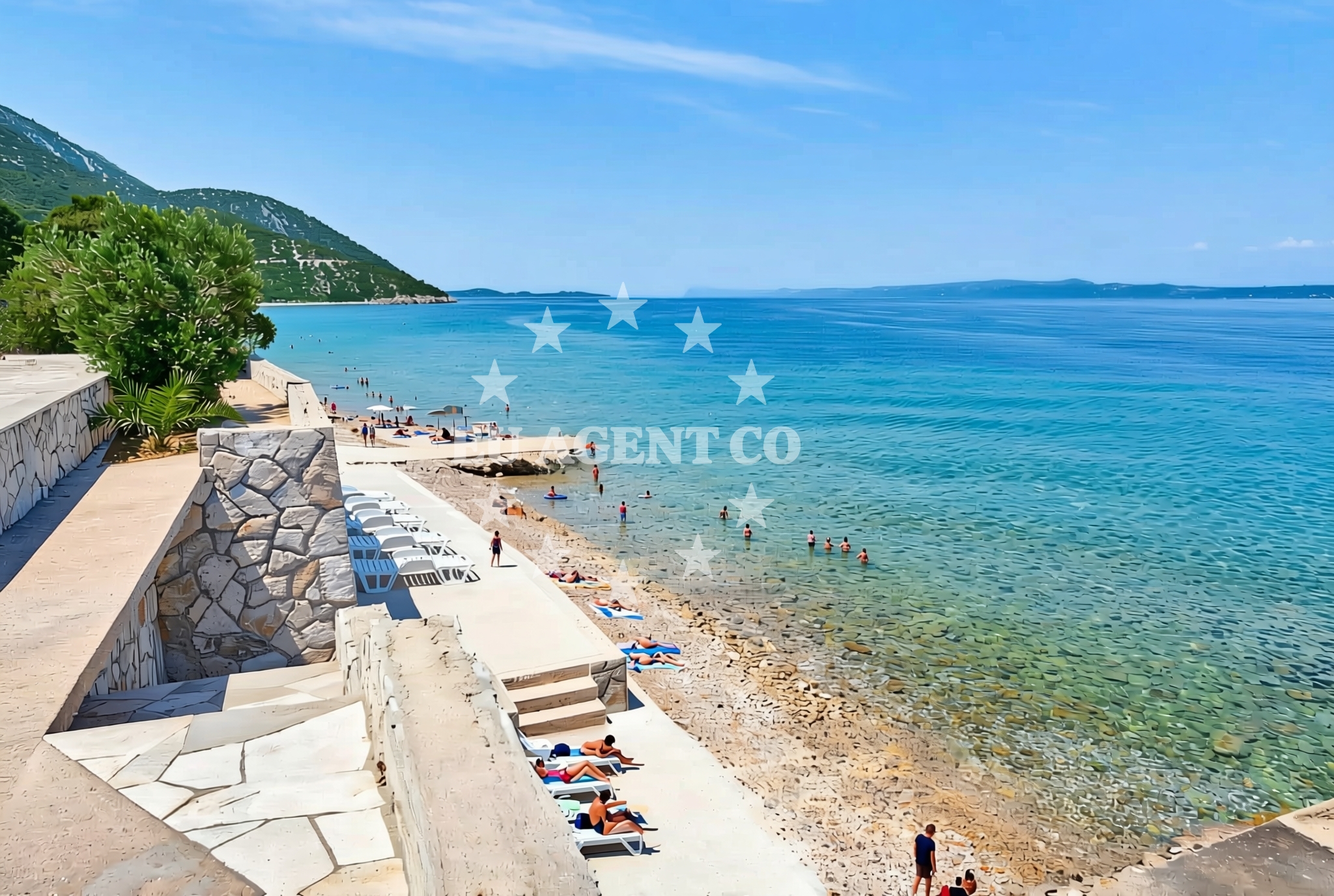
About this beach
Duba zapad, Duba Pelješka
Beach: Duba zapad
Location: Duba Pelješka
Characteristics and facilities
Gravel, concrete / stone slabs
80 m
Beach character
The beach’s surface is composed primarily of gravel and concrete/stone slabs, as noted in the authoritative catalog. This composition suggests it may be more suited for walking or casual strolls than for sunbathing or swimming. The 80-meter length is relatively modest, making it a secluded spot compared to larger, more developed beaches in the region. The absence of detailed amenities or facilities in the catalog indicates that visitors should expect a natural, unembellished shoreline, likely requiring appropriate footwear for comfort.Swimming and shore
While the beach’s characteristics do not specify swimming conditions, its location within the Duba Pelješka area—a region known for its clear waters and coastal activities—suggests that swimming may be possible. However, the gravel and stone slabs along the shore could make direct water access challenging. Visitors are advised to assess local conditions and consider nearby alternatives for more conventional swimming experiences.Facilities and activities
The beach does not list specific facilities or activities in the catalog, indicating a focus on natural access rather than structured amenities. This aligns with its description as a short, gravel-surfaced shoreline. Potential activities may include walking along the beach’s length, exploring the surrounding coastal landscape, or using the area as a starting point for nearby excursions. The lack of detailed activity listings means visitors should plan accordingly, relying on general coastal recreation opportunities.Access and location
Duba zapad, Duba Pelješka Beach is situated in the Duba Pelješka region, a part of Croatia’s Dalmatian coast. Its coordinates (43.024791, 17.167214) place it near the broader Pelješka area, which includes settlements and natural attractions. Access to the beach is likely via local roads, though specific parking or transportation details are not provided in the catalog. Visitors should consider the region’s infrastructure and plan accordingly for reaching the site.What to expect
Visitors to Duba zapad, Duba Pelješka Beach should expect a short, gravel-and-stone-slab shoreline measuring approximately 80 meters. The beach’s natural composition means it lacks the soft sands of other Adriatic beaches but offers a unique, rugged coastal experience. Its location within the Duba Pelješka region connects it to a broader area known for its scenic coastline, making it a potential starting point for exploring nearby settlements, anchorages, or sailing routes. Due to the absence of detailed facilities in the catalog, visitors should prepare for a self-sufficient visit, focusing on the beach’s natural character and surrounding environment.Practical tips
Given the beach’s gravel and stone-slab surface, visitors are advised to wear sturdy footwear for comfort. The absence of specific facilities in the catalog means amenities such as restrooms, showers, or changing rooms are unlikely to be available. Visitors should also consider the beach’s modest size when planning activities, as it may not accommodate large groups or extended stays.Exploring the coast by yacht
Duba zapad, Duba Pelješka Beach lies within the Adriatic region, a popular sailing destination known for its clear waters and scenic coastlines. While the beach itself is not marked as an anchorage or marina in the catalog, its proximity to the Duba Pelješka area suggests it may be near established sailing routes or ports. Yacht charter visitors exploring the Dalmatian coast may find this region advantageous for accessing nearby settlements, natural attractions, or other coastal landmarks. For detailed yacht availability and sailing area information, visitors are encouraged to use the Euro-Agent Yacht Search platform.Regional Context and Coastal Exploration
The Duba Pelješka region is part of Croatia’s Dalmatian coast, a stretch renowned for its dramatic cliffs, historic towns, and sailing opportunities. Nearby settlements may offer additional amenities, while the broader area is dotted with anchorages and marinas catering to yacht charter guests. The beach’s location provides a quiet vantage point for observing the coastal landscape, though visitors should consult local maps or the Euro-Agent beaches map for precise navigation details.Anchorages in the surrounding area
- Anchorage — duba peljeska — 1.5 NM from beach
- Anchorage — loviste — 4.4 NM from beach
- Anchorage — korcula — 4.4 NM from beach
- Anchorage — badija — 4.4 NM from beach
- Anchorage — korcula — 4.5 NM from beach
- Anchorage — korcula — 4.6 NM from beach
- Anchorage — korcula — 4.7 NM from beach
- Anchorage — korcula — 4.8 NM from beach
Distances are straight-line geographic distances, not sailing routes.
Mooring buoys in the surrounding area
Mooring buoys in the surrounding area are located near Stupe and Korcula.
- Restaurant Moro buoys — stupe — 3.9 NM from beach
- Fuel jetty — korcula — 4.3 NM from beach
- Jetty — korcula — 4.7 NM from beach
- Vrnik Arts Club buoys — 5.2 NM from beach
- Quay — vrnik — 5.2 NM from beach
Distances are straight-line geographic distances, not sailing routes.
Marine fuel stations
- Fuel station — korcula — 4.3 NM from beach
- Fuel station — ploce — 11.9 NM from beach
- Ina — makarska — 17.5 NM from beach
- Ina — vela luka — korcula — 20.2 NM from beach
Distances are straight-line geographic distances, not sailing routes.
Harbours in the surrounding area
Harbours in the surrounding area include Duba Pelješka and Orebić.
- Duba — duba peljeska — 0.2 NM from beach
- Orebić — orebic — 3.1 NM from beach
- Kučišće — kucisce — 3.5 NM from beach
- Viganj — 3.9 NM from beach
- Korčula W harbour — korcula — 4.0 NM from beach
- Korčula E harbour — korcula — 4.1 NM from beach
Distances are straight-line geographic distances, not sailing routes.
Marinas in the surrounding area
Marinas in the surrounding area are found in Korcula and Lumbarda.
- ACI Marina Korčula — korcula — 4.2 NM from beach
- Marina Lumbarda — korcula — 6.0 NM from beach
- Marina Tučepi — marina tucepi — 15.1 NM from beach
- Marina Ramova — krvavica — 19.7 NM from beach
- Marina Korkyra — vela luka — korcula — 20.4 NM from beach
Distances are straight-line geographic distances, not sailing routes.
Restaurants near the beach
Restaurants near the beach are located in Korcula and Stupe.
- Moro — stupe — 3.8 NM from beach
- Restaurant — korcula — 4.0 NM from beach
- Adio Mare — korcula — 4.0 NM from beach
- Restaurant Lesic Dimitri — korcula — 4.0 NM from beach
- Restaurant — korcula — 4.0 NM from beach
- Restaurant Filippi — korcula — 4.0 NM from beach
- Aterina — korcula — 4.1 NM from beach
Distances are straight-line geographic distances, not sailing routes.
Navigation guides for the surrounding area
Navigation guides for the surrounding area include Otocic Badija and other nearby landmarks.
- Uvala Divna — 1.8 NM from beach
- Orebic — 3.1 NM from beach
- Otocic Badija — 4.4 NM from beach
- Uvala Banja — 4.4 NM from beach
- Trpanj — 4.6 NM from beach
Distances are straight-line geographic distances, not sailing routes.
Yachts from nearby departure bases
Yachts from nearby departure bases in Ploče and Tučepi.
Sailing yachts
- Elan 40 Impression (Karleta) — Ploče City Port — 11.8 NM from departure base to beach
- Sun Odyssey 349 (Porto Tolero) — Ploče City Port — 11.8 NM from departure base to beach
- Elan 514 Impression (Cesarica III) — Ploče City Port — 11.8 NM from departure base to beach
- More 55 (MRS. ROBINSON) — Ploče City Port — 11.8 NM from departure base to beach
- Salona 44 (SAMOA) — Ploče City Port — 11.8 NM from departure base to beach
- Sun Odyssey 419 (Luka Ploce) — Ploče City Port — 11.8 NM from departure base to beach
- Sun Odyssey 349 (Visnjica) — Ploče City Port — 11.8 NM from departure base to beach
- Bavaria 40 Cruiser (LADY BUTTERFLY) — Tučepi Port — 15.1 NM from departure base to beach
Catamarans
- Lagoon 450 Fly (Alba Mouse) — Ploče City Port — 11.8 NM from departure base to beach
Motor yachts
- Princess V53 (Chablis) — Makarska Port — 17.3 NM from departure base to beach
Distances are straight-line geographic distances, not sailing routes.