Donja uvala porat sjever, Drvenik (Gradac) Beach, Croatia
About this beach
Donja uvala porat sjever, Drvenik (Gradac)
Beach: Donja uvala porat sjever
Location: Drvenik (Gradac)
Characteristics and facilities
Gravel
10 m
Restaurant / snack bar
Caffe bar / Drinks stand
Beach character
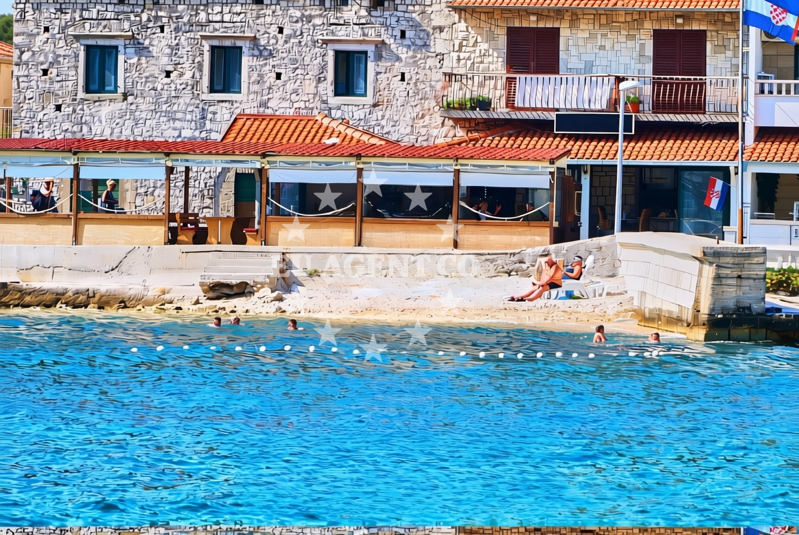
The beach’s gravel composition sets it apart from the typical sandy shores found along Croatia’s coast. This texture may appeal to those seeking a more rugged or unconventional shoreline experience. The beach extends for approximately 10 meters, offering limited space for relaxation or recreation. While not ideal for swimming, the gravel terrain could be suitable for walking or as a vantage point for observing the surrounding waters. The beach’s character is reflective of the broader geological features found in the Drvenik area, where rocky inlets and shallow bays are common.Swimming and shore
Swimming is not a primary activity at Donja uvala porat sjever due to the gravel shoreline. The shallow, rocky seabed may make wading difficult, and the beach’s limited width reduces its utility for water-based recreation. However, the area’s proximity to the open sea and its position within a natural inlet could provide opportunities for viewing marine life or enjoying the horizon from the shore. Visitors should note that the beach’s characteristics are more suited to leisurely observation than active water use.Facilities and activities
The beach is equipped with basic amenities, including a restaurant, snack bar, and caffe bar, which are likely located within the nearby village of Drvenik (Gradac). These facilities provide visitors with options for meals and refreshments, though the beach itself does not appear to have additional infrastructure such as showers, toilets, or parking. The absence of structured activities or recreational facilities suggests that the beach is best experienced as a simple coastal stop rather than a destination for organized events or sports.Access and location
Donja uvala porat sjever is located in the village of Drvenik (Gradac), part of the municipality of Supetar on the island of Brač. The beach’s position within this region, known for its historic fishing traditions and scenic coastal routes, places it near several other notable Adriatic landmarks. Travelers arriving by land would likely access the beach via local roads connecting Drvenik to the broader Brač island network. For sailors, the area’s proximity to established Adriatic sailing routes and nearby marinas may offer logistical advantages for exploring the region.What to expect
Visitors to Donja uvala porat sjever should expect a beach experience defined by its gravel shoreline and minimal infrastructure. The beach’s compact size and terrain make it more suitable for brief stops rather than extended stays. Nearby amenities in Drvenik (Gradac) provide essential services, but the beach itself lacks facilities such as parking or restrooms. The area’s appeal lies in its quiet setting and connection to the broader Adriatic sailing environment, making it a potential waypoint for those exploring the region by boat.Practical tips
Given the beach’s gravel composition, visitors may wish to wear sturdy footwear for comfort. The limited space and lack of dedicated facilities mean that the beach is best visited during off-peak hours to avoid congestion. Those planning to explore the area by sea should note its proximity to established Adriatic sailing routes, which may be of interest to yacht charter guests.Exploring the coast by yacht
For sailors and yacht charter guests, the Drvenik area offers access to a network of Adriatic anchorages and coastal routes. While Donja uvala porat sjever itself is not a formal marina or anchorage, its location within the Brač island region provides opportunities to explore nearby ports, bays, and historic maritime sites. The surrounding waters are part of a larger sailing region that includes popular destinations such as Hvar, Split, and the islands of Vis and Korčula. Yacht charter guests may find the area’s proximity to these locations advantageous for planning multi-day itineraries.Regional Context and Cultural Notes
The village of Drvenik (Gradac) is part of the municipality of Supetar on Brač, a region with a long history of maritime activity and cultural heritage. The area is known for its traditional fishing villages, stone architecture, and connections to the Adriatic’s historic trade routes. Visitors interested in exploring beyond the beach may find local landmarks, such as the Supetar harbor and the nearby village of Vela Luka, worth visiting. The region’s blend of natural beauty and cultural history offers a broader context for those seeking to understand the area’s significance beyond its coastal features.Anchorages in the surrounding area
Anchorages in Drvenik and Sucuraj offer nearby mooring options clear of ferry and swimming areas.
- Anchorage — drvenik — 0.1 NM from beach
- Anchorage — sucuraj — hvar — 3.3 NM from beach
- Anchorage — sucuraj — hvar — 4.1 NM from beach
- Anchorage — sucuraj — hvar — 4.7 NM from beach
- Anchorage — sucuraj — hvar — 4.7 NM from beach
- Anchorage — selca kod bogomolja — hvar — 5.0 NM from beach
- Anchorage — selca kod bogomolja — hvar — 5.1 NM from beach
- Anchorage — selca kod bogomolja — hvar — 6.2 NM from beach
Distances are straight-line geographic distances, not sailing routes.
Mooring buoys in the surrounding area
- Drvenik - Ferry dock — drvenik ferry dock — 0.2 NM from beach
- Jetty — sucuraj — hvar — 3.1 NM from beach
- Brist — 4.0 NM from beach
- Konoba Gambo buoys — selca kod bogomolja — hvar — 6.7 NM from beach
- Kraj - Soline — kraj soline — drasnice — 7.1 NM from beach
Distances are straight-line geographic distances, not sailing routes.
Marine fuel stations
- Fuel station — ploce — 10.4 NM from beach
- Fuel station — korcula — 12.7 NM from beach
- Ina — makarska — 13.1 NM from beach
- Fuel station — sumartin — brac — 18.6 NM from beach
Distances are straight-line geographic distances, not sailing routes.
Harbours in the surrounding area
Drvenik Harbor is a short distance away, offering direct access to the beach area.
- Drvenik — 0.0 NM from beach
- Zaostrog — 1.7 NM from beach
- Sućuraj — sucuraj — hvar — 3.1 NM from beach
- Živogošće — zivogosce — 4.3 NM from beach
- Gradac — 5.2 NM from beach
- Igrane — 5.2 NM from beach
Distances are straight-line geographic distances, not sailing routes.
Marinas in the surrounding area
- Marina Tučepi — marina tucepi — 10.5 NM from beach
- ACI Marina Korčula — korcula — 12.7 NM from beach
- Marina Lumbarda — korcula — 14.2 NM from beach
- Marina Ramova — krvavica — 15.3 NM from beach
- Marina Baška Voda — marina baska voda — 17.9 NM from beach
Distances are straight-line geographic distances, not sailing routes.
Restaurants near the beach
Restaurants in Sucuraj provide dining options near the beach with views of the surrounding area.
- Restaurant — sucuraj — hvar — 3.1 NM from beach
- Riblji Restoran — sucuraj — hvar — 3.1 NM from beach
- Mlaska — sucuraj — hvar — 4.6 NM from beach
Distances are straight-line geographic distances, not sailing routes.
Navigation guides for the surrounding area
Navigation guides for Uvala Drvenik and Otok Hvar assist in planning routes from the beach.
- Uvala Drvenik (Donja Vala) — 0.4 NM from beach
- OTOK HVAR — 2.5 NM from beach
- Gradac — 5.4 NM from beach
- Uvala Divna — 8.4 NM from beach
- Trpanj — 8.7 NM from beach
Distances are straight-line geographic distances, not sailing routes.
Yachts from nearby departure bases
Yachts departing from Ploče City Port and Tučepi Port are positioned within sailing distance of the beach.
Sailing yachts
- Elan 40 Impression (Karleta) — Ploče City Port — 10.3 NM from departure base to beach
- More 55 (MRS. ROBINSON) — Ploče City Port — 10.3 NM from departure base to beach
- Sun Odyssey 349 (Visnjica) — Ploče City Port — 10.3 NM from departure base to beach
- Salona 44 (SAMOA) — Ploče City Port — 10.3 NM from departure base to beach
- Sun Odyssey 419 (Luka Ploce) — Ploče City Port — 10.3 NM from departure base to beach
- Elan 514 Impression (Cesarica III) — Ploče City Port — 10.3 NM from departure base to beach
- Sun Odyssey 349 (Porto Tolero) — Ploče City Port — 10.3 NM from departure base to beach
- Bavaria 40 Cruiser (LADY BUTTERFLY) — Tučepi Port — 10.5 NM from departure base to beach
Catamarans
- Lagoon 450 Fly (Alba Mouse) — Ploče City Port — 10.3 NM from departure base to beach
Motor yachts
- Princess V53 (Chablis) — Makarska Port — 12.9 NM from departure base to beach
Distances are straight-line geographic distances, not sailing routes.