Donja Banda, Zlarin (Zlarin) Beach, Croatia
7 photos
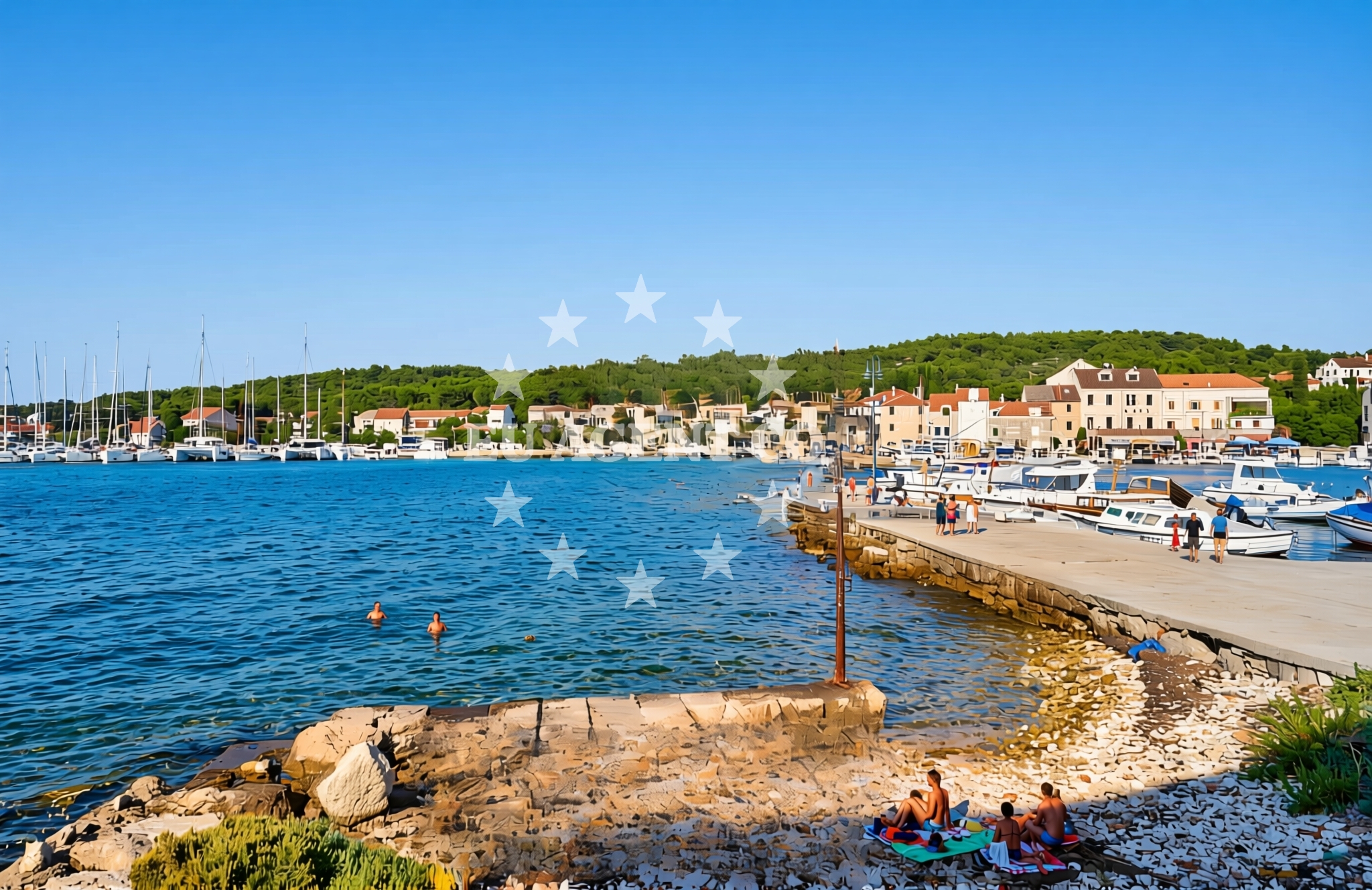
About this beach
Donja Banda, Zlarin (Zlarin)
Beach: Donja Banda
Location: Zlarin (Zlarin)
Characteristics and facilities
Gravel, concrete / stone slabs, rocks
shower
Changing cabin
Beach character
The beach's surface is composed of gravel, concrete slabs, and natural rock, creating a rugged shoreline that contrasts with the more common sandy beaches of the Adriatic. This composition may make it less ideal for sunbathing but offers a distinctive setting for visitors seeking a different coastal experience. The presence of a shower and changing cabin suggests that the beach is maintained for basic use, though no additional amenities such as umbrellas, seating, or food services are indicated.Swimming and shore
Swimming conditions at Donja Banda are not explicitly detailed in available records. The rocky and gravelly terrain may influence water access, potentially making it more suitable for wading or snorkeling in shallower areas. As with any coastal location, swimmers should exercise caution near rocky outcrops and be mindful of tidal changes.Facilities and activities
Facilities at Donja Banda Beach include a shower and a changing cabin, which are essential for visitors seeking to refresh after a day at the shore. No additional recreational activities or services are listed, indicating that the beach is primarily used for basic access to the sea. The lack of detailed activity listings suggests that the area may not be centered around organized tourism but could serve as a local or passing destination.Access and location
Located in Zlarin, a small coastal town on the Adriatic Sea, Donja Banda Beach is part of a region with historical and cultural significance. Zlarin itself is known for its medieval architecture and proximity to the island of Vis, a popular sailing destination. The beach's position within the town may provide visitors with opportunities to explore nearby landmarks, though specific access routes or parking details are not documented in the available information.What to expect
Visitors to Donja Banda Beach should expect a rocky and gravelly shoreline with minimal amenities. The beach is equipped with a shower and changing cabin, catering to basic needs for those seeking access to the sea. The area's character is defined by its natural terrain, which may appeal to those interested in a more rugged coastal experience. Given its location in Zlarin, the beach serves as a gateway to the broader Adriatic region, where historical sites and sailing routes are prominent.Practical tips
Due to the beach's gravel and rocky surface, visitors may want to wear sturdy footwear for comfort. As no detailed access information is available, it is advisable to check local guidelines or contact Zlarin's municipal authorities for further details on reaching the beach.Exploring the coast by yacht
Donja Banda Beach is situated in Zlarin, a coastal town on the Adriatic Sea, which is a well-known sailing area. Euro-Agent offers yacht charters in this region, allowing visitors to explore the surrounding waters and nearby islands such as Vis and Hvar. The beach's location provides a convenient starting point for those interested in sailing excursions along the Croatian coast, though specific marina details or distances are not included in this description.Historical Context of Zlarin
Zlarin is a town with a rich history dating back to the medieval period. It is home to the Zlarin Fortress, a 16th-century structure that offers panoramic views of the Adriatic Sea and the surrounding islands. The town's strategic position has made it a focal point for maritime trade and defense, contributing to its historical significance in the region.Anchorages in the surrounding area
- Anchorage — zlarin — 1.2 NM from beach
- Anchorage — jadria — 1.8 NM from beach
- Anchorage — zlarin — 2.1 NM from beach
- Anchorage — sibenik — 2.1 NM from beach
- Sepurine — prvic sepurine — 2.6 NM from beach
- Anchorage — tijat — 2.9 NM from beach
- Anchorage — zmajan — 2.9 NM from beach
- Anchorage — prvic sepurine — 2.9 NM from beach
Distances are straight-line geographic distances, not sailing routes.
Mooring buoys in the surrounding area
- Buoy field — zlarin — 0.2 NM from beach
- Sv. Nikola — sv nikola — zablace — 1.7 NM from beach
- Buoy field — prvic — 2.1 NM from beach
- Jetty — obonjan — 2.2 NM from beach
- Obonjan N quay — 2.2 NM from beach
Distances are straight-line geographic distances, not sailing routes.
Marine fuel stations
- Lukoil — sibenik — 2.9 NM from beach
- Ina — sibenik — 3.3 NM from beach
- Ina — vodice — 4.2 NM from beach
- Petrol — tribunj — 4.8 NM from beach
Distances are straight-line geographic distances, not sailing routes.
Harbours in the surrounding area
- Zlarin — 0.1 NM from beach
- Zablaće — zablace — 1.6 NM from beach
- Jadria — 1.7 NM from beach
- Konoba Stari Nanini at Prvić Port — prvic — 2.0 NM from beach
- Prvić Šepurine — prvic sepurine — 2.9 NM from beach
- Srima — 3.1 NM from beach
Distances are straight-line geographic distances, not sailing routes.
Marinas in the surrounding area
- Amadria Yacht Marines — sibenik — 2.0 NM from beach
- Marina Mandalina — sibenik — 3.2 NM from beach
- ACI Marina Vodice — 4.2 NM from beach
- Marina Zaton — zaton near sibenik — 4.8 NM from beach
- Marina Tribunj — 4.9 NM from beach
Distances are straight-line geographic distances, not sailing routes.
Restaurants near the beach
- Konoba Aldura — zlarin — 0.1 NM from beach
- Koralj — zlarin — 0.2 NM from beach
- Ivana — zlarin — 0.2 NM from beach
- Konoba Prslika — zlarin — 0.3 NM from beach
- Pizzaria Zora — zablace — 1.7 NM from beach
- Punta — prvic — 2.0 NM from beach
- Mareta — prvic — 2.0 NM from beach
Distances are straight-line geographic distances, not sailing routes.
Navigation guides for the surrounding area
- Luka Zlarin — 0.2 NM from beach
- Tučepi — 2.1 NM from beach
- Šibenik — 3.4 NM from beach
- Vodice — 4.1 NM from beach
- Krapanj — 4.3 NM from beach
Distances are straight-line geographic distances, not sailing routes.
Yachts from nearby departure bases
Sailing yachts
- Elan Impression 50.1 (Evana) — Šibenik Marina Mandalina — 3.2 NM from departure base to beach
- Dufour 470 (Avanti) — Šibenik Marina Mandalina — 3.2 NM from departure base to beach
- Hanse 458 (Terna) — Šibenik Marina Mandalina — 3.2 NM from departure base to beach
Catamarans
- Elba 45 (Alize) — Šibenik Marina Mandalina — 3.2 NM from departure base to beach
- Bali Catspace (Free Flow) — Šibenik Marina Mandalina — 3.2 NM from departure base to beach
- Lagoon 42 (Maximus) — Šibenik Marina Mandalina — 3.2 NM from departure base to beach
Motor yachts
- Sunseeker Manhattan 73 (Goldeneye) — Šibenik Marina Mandalina — 3.2 NM from departure base to beach
- Azimut Grande 26M (First Horizon) — Šibenik Marina Mandalina — 3.2 NM from departure base to beach
Motor boats
- Azimut 53 Fly (Leeloo) — Šibenik Marina Mandalina — 3.2 NM from departure base to beach
- Sessa Fly 42 (YES) — Šibenik Marina Mandalina — 3.2 NM from departure base to beach
Distances are straight-line geographic distances, not sailing routes.
Nearby beaches
Luka, Zlarin (Zlarin) Beach
Luka
0.2 km
Tucić, Zlarin (Zlarin)
Tucić
0.2 km
Pristanište, Zlarin (Zlarin) Beach
Pristanište
0.3 km
Trutin Beach
Put Re?kova 3, Zlarin
0.3 km
Donja Banda (dog beach), Zlarin (Zlarin) Beach
Donja Banda (plaža za pse)
0.4 km
Banj, Zlarin (Zlarin) Beach
Banj
0.4 km
Zlarin (Zlarin): beaches and coves (17)
Zlarin (Zlarin)
0.5 km
Oštrica, Zlarin (Zlarin) Beach
Oštrica
0.5 km