Doli Beaches and Coves, Croatia
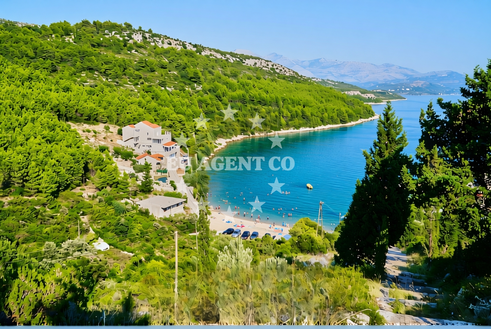
About this beach
Doli: beaches and coves
Beach character
The shoreline features a mix of pebbled coves and sandy stretches, with rock formations creating natural shelters that protect the waters from rougher sea conditions. The gradient from shore to sea is generally gentle, with shallow waters that recede gradually. Vegetation along the cliffs includes olive trees and Mediterranean shrubs, while the intertidal zones reveal a diversity of marine life. The absence of large-scale development preserves the area's raw coastal character, though the lack of formal signage or infrastructure means visitors should exercise caution when navigating the shoreline.Swimming and shore
The waters around Doli are known for their clarity and moderate temperatures, making them suitable for swimming during the late spring through early autumn months. The shorelines vary in accessibility - some coves require a short walk from nearby roads, while others are reachable via narrow coastal paths. The rocky terrain in certain areas necessitates careful footing, and visitors should be mindful of tide changes that may affect access points. The absence of artificial structures means the beach experience remains entirely natural, with no lifeguard services or designated swimming zones.Facilities and activities
There are no formal facilities at the beach itself, including restrooms, showers, or parking areas. The nearest amenities are located in the surrounding coastal settlements, which typically offer basic services like cafes, fuel stations, and small shops. The area's primary appeal lies in its natural features rather than organized recreation. While there are no marked trails or guided tours, the coastline's topography invites exploration through hiking or kayaking. The lack of commercial infrastructure means the experience remains unfiltered and authentic.Access and location
Doli's beaches are accessible via a network of local roads that connect to the Dalmatian coast's main thoroughfares. The nearest significant settlement is approximately 12 kilometers inland, with road access requiring navigation through rural terrain. Public transportation options are limited, making private vehicle access the most practical approach. For those arriving by sea, the proximity to established sailing routes in the Adriatic makes this area a logical stop for yachts exploring the region's eastern coast. The exact location coordinates (42.8118176, 17.7925557) place it within a sailing triangle between Split, Brač, and Hvar.What to expect
Visitors should prepare for an experience defined by natural simplicity and limited infrastructure. The beach's character is shaped by its position on Croatia's less-developed eastern coast, where the emphasis is on raw coastal beauty rather than tourist amenities. The area's appeal lies in its isolation - while this means fewer crowds, it also requires self-sufficiency in terms of provisions and navigation. The rocky shoreline and lack of formal access points mean visitors should plan carefully, particularly when considering entry and exit points. The surrounding region's cultural heritage, however, offers opportunities to explore nearby coastal towns that provide essential services and historical context.Practical tips
For those planning a visit, consider the following: 1) Check tide tables before attempting to access more secluded coves, as some areas may be inaccessible during high water. 2) Carry sufficient water and provisions, as there are no facilities on-site. 3) Use caution on rocky sections of the shoreline, especially during wet weather. 4) Consider visiting during the shoulder season (late spring or early autumn) for fewer crowds and more favorable swimming conditions.Exploring the coast by yacht
For yacht charter guests, Doli's location offers strategic advantages as part of the Adriatic's eastern sailing corridor. The area's sheltered coves provide natural anchorage options, though formal marinas are not present. Yachts exploring this region typically connect with the broader Dalmatian sailing network via routes that pass through Split and the nearby islands of Brač and Hvar. The proximity to established sailing routes makes this area a logical waypoint for those circumnavigating the Croatian coast, with opportunities to combine anchoring in natural bays with visits to nearby coastal settlements for provisions and cultural experiences.Regional Context and Cultural Connections
The Doli coastline is part of a larger cultural and historical landscape that includes medieval fortifications and Venetian-era settlements. The surrounding region has been shaped by centuries of maritime trade, with archaeological sites revealing evidence of ancient shipwrecks and coastal settlements. Nearby towns offer insights into this heritage through local museums and historic architecture, though the area remains less commercialized than western Dalmatia. This makes it an appealing destination for those seeking a more authentic connection to the region's maritime past.Anchorages in the surrounding area
Anchorages in Broce and Banici lie near Doli.
- Anchorage — broce — 2.2 NM from beach
- Anchorage — broce — 2.4 NM from beach
- Anchorage — banici — 2.7 NM from beach
- Anchorage — broce — 2.8 NM from beach
- Anchorage — olipa — 2.8 NM from beach
- Ribnja — broce — 3.4 NM from beach
- Anchorage — broce — 3.9 NM from beach
- Anchorage — mali ston — 4.4 NM from beach
Distances are straight-line geographic distances, not sailing routes.
Mooring buoys in the surrounding area
- Konoba Nico jetty — kobas — 2.2 NM from beach
- Quay — kobas — 2.2 NM from beach
- Lukas Taverna jetty — kobas — 2.2 NM from beach
- Quay — slano — 2.8 NM from beach
- Jetty — slano — 4.1 NM from beach
Distances are straight-line geographic distances, not sailing routes.
Marine fuel stations
Fuel stations in Sobra, Dubrovnik, and Ploce serve the Doli region.
- Fuel station — sobra — mljet — 8.7 NM from beach
- Ina — dubrovnik — 15.6 NM from beach
- Ina — dubrovnik — 16.9 NM from beach
- Fuel station — ploce — 21.3 NM from beach
Distances are straight-line geographic distances, not sailing routes.
Harbours in the surrounding area
Harbors in Doli, Ston, and Mali Ston are located close to the beach.
- Doli — 0.3 NM from beach
- Ston — 4.4 NM from beach
- Mali Ston — 4.4 NM from beach
- Slano — 4.5 NM from beach
- Prapranto Ferry Harbour — prapratno — 5.0 NM from beach
- Hodilje — 5.3 NM from beach
Distances are straight-line geographic distances, not sailing routes.
Marinas in the surrounding area
- ACI Marina Slano — 4.6 NM from beach
- Marina Frapa Dubrovnik — 15.7 NM from beach
- ACI Marina Dubrovnik — 16.9 NM from beach
- Marina Lumbarda — korcula — 28.1 NM from beach
Distances are straight-line geographic distances, not sailing routes.
Restaurants near the beach
Restaurants in Kobas and Slano provide dining choices near Doli.
- Nico — kobas — 2.2 NM from beach
- Gastro Mare — kobas — 2.2 NM from beach
- Luka's Taverna — lukas taverna — kobas — 2.2 NM from beach
- Restaurant — banici — 2.8 NM from beach
- Nono — slano — 4.1 NM from beach
- Mirakul — slano — 4.1 NM from beach
- Bota Sare — mali ston — 4.4 NM from beach
Distances are straight-line geographic distances, not sailing routes.
Navigation guides for the surrounding area
Navigation guides for Uvala Lupeska and Broce assist in exploring Doli's vicinity.
- Doli — 0.5 NM from beach
- Uvala Lupeska — 2.7 NM from beach
- Broce — 3.2 NM from beach
- Excursions — 3.6 NM from beach
- Luka (Sipanska Luka) — 3.9 NM from beach
Distances are straight-line geographic distances, not sailing routes.
Yachts from nearby departure bases
Sailing yachts
- Oceanis 45 (Cancan) — Slano ACI Marina — 4.6 NM from departure base to beach
- Elan 45 Impression (Skyfall) — Slano ACI Marina — 4.6 NM from departure base to beach
- Elan 50 Impression (Timeless) — Slano ACI Marina — 4.6 NM from departure base to beach
- Oceanis 45 (Soul) — Slano ACI Marina — 4.6 NM from departure base to beach
- Oceanis 45 (Mambo 1) — Slano ACI Marina — 4.6 NM from departure base to beach
Catamarans
- Lagoon 450 Flybridge (ANJA I) — Slano ACI Marina — 4.6 NM from departure base to beach
- Lagoon 40 (SAILOR MOON) — Slano ACI Marina — 4.6 NM from departure base to beach
- Lagoon 40 (SUNLIGHT) — Slano ACI Marina — 4.6 NM from departure base to beach
- Lagoon 42 (HAPPY KEY) — Slano ACI Marina — 4.6 NM from departure base to beach
- MY 37 (Jam) — Slano ACI Marina — 4.6 NM from departure base to beach
Distances are straight-line geographic distances, not sailing routes.