Dječje selo, Promajna Beach, Croatia
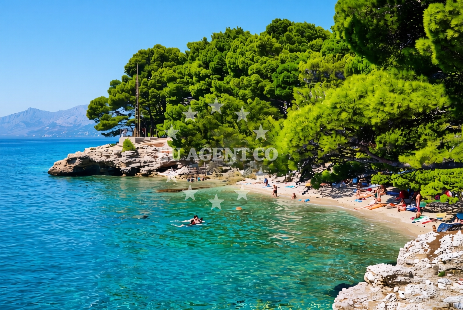
Dječje selo, Promajna Beach lies along the Adriatic coast in Croatia, offering a rugged shoreline characterized by gravel and rock formations. This beach stretches approximately 100 meters, with natural shade provided by its topography. While it lacks formal amenities, its raw coastal character makes it a unique destination for visitors seeking a more secluded experience.
About this beach
Dječje selo, Promajna
Beach: Dječje selo
Location: Promajna
Characteristics and facilities
Gravel, rocks
100 m
Natural shade
Beach character
The beach’s composition of gravel and rocks defines its profile, creating a landscape that contrasts with the sandy shores found elsewhere in the region. The natural shade, likely provided by overhanging terrain or vegetation, offers a respite from direct sunlight. This beach is not suited for swimming but serves as a vantage point for observing the surrounding coastal environment. Its compact size and lack of infrastructure make it an ideal spot for those looking to escape crowded tourist areas.
Swimming and shore
Swimming is not recommended at Promajna Beach due to the gravel and rock substrate, which can make water entry uncomfortable. The shore’s uneven surface is better suited for walking or sitting rather than wading. The beach’s natural shade provides limited protection from the sun, though visitors may find shelter in shaded rock formations along the shoreline.
Facilities and activities
No formal facilities or activities are listed for Promajna Beach. Its minimal infrastructure means there are no showers, restrooms, or餐饮 options available. The beach’s primary appeal lies in its unspoiled natural setting, making it a destination for those interested in exploring lesser-known coastal areas without the distractions of modern amenities.
Access and location
Located in Dječje selo, Promajna Beach is part of the broader Adriatic coastline, which is a popular sailing region. Its proximity to the open sea and the absence of nearby settlements suggest it is accessible primarily by foot or vehicle from nearby towns. The beach’s position in this area connects it to the larger network of coastal routes and anchorages that characterize the Croatian Adriatic.
What to expect
Visitors to Promajna Beach should expect a rugged, unspoiled shoreline composed of gravel and rocks. The beach’s natural shade offers limited relief from the sun, and its 100-meter length provides a compact space for relaxation. There are no formal amenities, so visitors should come prepared with their own supplies. The beach’s location in Dječje selo places it within reach of other coastal attractions in the region, though its remote character ensures a quieter experience compared to more developed beaches.
Practical tips
Bring sturdy footwear to navigate the gravel and rock surfaces comfortably. The natural shade can be a benefit for sun protection, but visitors should still apply sunscreen for exposed skin. Due to the lack of amenities, consider bringing water, snacks, and any necessary items for a self-sufficient visit.
Exploring the coast by yacht
While Promajna Beach itself is not a typical anchorage, its location in the Adriatic places it within reach of yacht charter routes that explore the Croatian coast. Euro-Agent specializes in yacht charters for this region, offering access to nearby marinas and sailing areas. Visitors arriving by boat may find this beach a convenient stop for a brief exploration of the coastline before continuing their journey along the Adriatic.
Regional Context
Dječje selo is a small settlement on the Adriatic coast, known for its traditional fishing heritage and proximity to the open sea. The area’s rugged coastline, including Promajna Beach, reflects the natural diversity of the region. Nearby, visitors may find more developed beaches and marinas, but Promajna Beach retains its character as a quiet, unspoiled spot.
Anchorages in the surrounding area
Anchorages in the surrounding area include Promajna, Makarska, and Sumartin-Brac, offering nearby mooring options.
- Anchorage — promajna — 0.3 NM from beach
- Anchorage — makarska — 3.2 NM from beach
- Anchorage — sumartin — brac — 3.9 NM from beach
- Anchorage — povlja — brac — 4.5 NM from beach
- Anchorage — povlja — brac — 4.7 NM from beach
- Anchorage — povlja — brac — 5.1 NM from beach
- Anchorage — povlja — brac — 5.4 NM from beach
- Anchorage — povlja — brac — 5.5 NM from beach
Distances are straight-line geographic distances, not sailing routes.
Mooring buoys in the surrounding area
- Baško Polje — basko polje — baska voda — 0.6 NM from beach
- Quay — krvavica — 1.2 NM from beach
- Konoba Rojen jetty — povlja — brac — 7.3 NM from beach
- Restaurant Pipo jetty — povlja — brac — 7.4 NM from beach
- Restaurant Pipo buoys — povlja — brac — 7.5 NM from beach
Distances are straight-line geographic distances, not sailing routes.
Marine fuel stations
Marine fuel stations in the area include Ina-Makarska and Sumartin-Brac, ensuring refueling options nearby.
- Ina — makarska — 3.4 NM from beach
- Fuel station — sumartin — brac — 5.4 NM from beach
- Fuel station — bol — brac — 14.3 NM from beach
- Ina — vrboska — hvar — 15.9 NM from beach
Distances are straight-line geographic distances, not sailing routes.
Harbours in the surrounding area
- Brela — 2.2 NM from beach
- Harbour — makarska — 2.9 NM from beach
- Stomarica — 3.4 NM from beach
- Makarska — 3.5 NM from beach
- Sumartin — brac — 5.2 NM from beach
- Pisak — 5.9 NM from beach
Distances are straight-line geographic distances, not sailing routes.
Marinas in the surrounding area
- Marina Ramova — krvavica — 1.1 NM from beach
- Marina Baška Voda — marina baska voda — 1.4 NM from beach
- Marina Tučepi — marina tucepi — 6.0 NM from beach
- ACI Marina Vrboska — hvar — 15.9 NM from beach
- Marina Lav — podstrana — 20.8 NM from beach
Distances are straight-line geographic distances, not sailing routes.
Restaurants near the beach
Restaurants near the beach include Konoba Feral-Brela and Restoran Ivo-Makarska, offering dining options in the vicinity.
- Restaurant Ramova — krvavica — 1.2 NM from beach
- Restoran King — baska voda — 1.5 NM from beach
- Konoba Feral — brela — 2.2 NM from beach
- Marko — brela — 2.2 NM from beach
- Restoran Ivo — makarska — 3.4 NM from beach
Distances are straight-line geographic distances, not sailing routes.
Navigation guides for the surrounding area
Navigation guides for the surrounding area include Su martin and Uvala Studena, assisting with local sailing routes.
- Su martin — 5.0 NM from beach
- Uvala Studena — 6.5 NM from beach
- Uvala Luka — 7.1 NM from beach
- Podgora — 7.7 NM from beach
- Mi mice — 7.8 NM from beach
Distances are straight-line geographic distances, not sailing routes.
Yachts from nearby departure bases
Yachts from nearby departure bases include those departing from Baška Voda, located close to the beach.
Sailing yachts
- Elan 50 Impression (FINES DE CLAIRES) — Baška Voda — 1.4 NM from departure base to beach
- Hanse 445 (HELIOS) — Baška Voda — 1.4 NM from departure base to beach
- Elan 45 Impression (Showtime) — Baška Voda — 1.4 NM from departure base to beach
- Bavaria 41 (Seagoll) — Baška Voda — 1.4 NM from departure base to beach
- D&D Kufner 54 (Komiza) — Baška Voda — 1.4 NM from departure base to beach
- Bavaria 44 (TARISA ) — Baška Voda — 1.4 NM from departure base to beach
- Bavaria 46 Cruiser (Silvanac) — Baška Voda — 1.4 NM from departure base to beach
- Sun Odyssey 409 (ARIES) — Baška Voda — 1.4 NM from departure base to beach
Catamarans
- Lagoon 450 (LAMANTIN) — Baška Voda — 1.4 NM from departure base to beach
Motor yachts
- Canados 86 (Karisma) — Baška Voda — 1.4 NM from departure base to beach
Distances are straight-line geographic distances, not sailing routes.