Dinjiška Sredina Beach, Pag: A Natural Haven on Croatia's Adriatic Coast
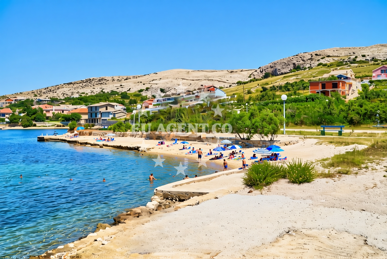
About this beach
Dinjiška sredina, Dinjiška (Pag)
Beach: Dinjiška sredina
Location: Dinjiška (Pag)
Characteristics and facilities
Gravel, concrete / stone slabs
80 m
Restaurant / snack bar
Caffe bar / Drinks stand
Natural shade
Beach character
Dinjiška Sredina's gravel and stone slabs define its character, creating a surface that is both stable and texturally distinct. The beach's 80-meter length is modest but sufficient for a relaxed visit. The absence of sand and the presence of natural shade from the landscape make this a different kind of Adriatic beach experience. Pag Island itself is known for its arid, rocky terrain and unique geological formations, and Dinjiška Sredina fits seamlessly into this environment. The beach does not extend into the water, maintaining its focus on the shoreline and adjacent land features.Swimming and shore
The gravel and stone composition of the beach may make it less ideal for swimming compared to sandy shores, but it offers a unique vantage point for observing the surrounding Adriatic Sea. The shoreline is primarily composed of gravel and concrete slabs, which are stable but not suited for barefoot walking. The beach does not have designated swimming areas or lifeguard services, reflecting its more natural, low-impact character.Facilities and activities
The beach includes a restaurant/snack bar and a caffe bar/drinks stand, providing basic amenities for visitors. These facilities are integrated into the beach's layout, making them accessible without requiring significant movement. No other structured activities or equipment rentals are listed in the catalog, emphasizing the beach's role as a simple, unembellished coastal spot.Access and location
Dinjiška Sredina Beach is situated in the village of Dinjiška on Pag Island, a region known for its stark, stone-covered landscapes. Pag's coastline is marked by its unique geological features, including the famous 'stone fields' that stretch inland from the shore. The beach is part of this broader environment, offering visitors a chance to experience the island's natural character. Access to the beach is likely via local roads, though specific details about parking or road conditions are not provided in the catalog.What to expect
Expect a gravel-and-stone shoreline with a 80-meter length, complemented by a restaurant/snack bar and caffe bar/drinks stand. The beach provides natural shade from its surrounding landscape, though it lacks artificial amenities like showers or restrooms. The area is part of Pag Island's distinctive karst terrain, which includes extensive stone fields and minimal coastal development. The beach is not suited for swimming but offers a quiet place to enjoy the Adriatic Sea's views.Practical tips
Consider wearing sturdy footwear for the gravel surface. The on-site dining options may have limited hours, so it's advisable to confirm availability if planning to use them. The beach's natural setting means it may be less crowded than more developed coastal areas.Exploring the coast by yacht
Pag Island is a popular sailing destination in the Adriatic, with its sheltered bays and clear waters attracting yachts. While Dinjiška Sredina Beach itself is not a marina or anchorage, its location on Pag's northern coast provides easy access to the island's sailing routes. Euro-Agent can help charter yachts in the region, allowing visitors to explore Pag's coastline, including nearby anchorages and the island's famed stone fields.Pag's Unique Landscape
Pag Island is renowned for its arid, karstic terrain, characterized by vast stone fields that extend inland from the coast. This geological feature is visible from Dinjiška Sredina Beach, where the gravel shoreline mirrors the island's broader landscape. The absence of sand and the prevalence of stone create an environment distinct from many other Adriatic beaches.Anchorages in the surrounding area
- Dinjiška — dinjiska — pag — 0.4 NM from beach
- Anchorage — smokvica — 2.5 NM from beach
- Anchorage — vlasici — pag — 2.7 NM from beach
- Anchorage — povljana — pag — 2.8 NM from beach
- Mlinica — kosljun pag — 3.5 NM from beach
- Anchorage — povljana — pag — 3.9 NM from beach
- Anchorage — tribanj — 4.3 NM from beach
- Anchorage — vrsi — 4.6 NM from beach
Distances are straight-line geographic distances, not sailing routes.
Mooring buoys in the surrounding area
- Vir — 5.8 NM from beach
- Šibuljina Point — sibuljina point — 6.6 NM from beach
- Jetty — ljubac — 7.4 NM from beach
- Punta Skala — petrcane — 10.1 NM from beach
- Jetty — simuni — pag — 11.3 NM from beach
Distances are straight-line geographic distances, not sailing routes.
Marine fuel stations
- Ina — zadar — 14.5 NM from beach
- Ina — preko — ugljan — 16.9 NM from beach
- Fuel station — sukosan — 18.9 NM from beach
- Ina — zaglav — dugi otok — 24.6 NM from beach
Distances are straight-line geographic distances, not sailing routes.
Harbours in the surrounding area
- Miškovići — miskovici — pag — 2.1 NM from beach
- Povljana — pag — 3.8 NM from beach
- Košljun — kosljun pag — 5.3 NM from beach
- Lukovo Šugarje — lukovo sugarje — rudelici — 5.4 NM from beach
- Mulo — nin — 6.0 NM from beach
- Privlaka — 6.4 NM from beach
Distances are straight-line geographic distances, not sailing routes.
Marinas in the surrounding area
- ACI Marina Šimuni — simuni — pag — 12.1 NM from beach
- Marina Borik — zadar — 13.7 NM from beach
- Vitrenjak Zadar — 13.9 NM from beach
- Marina Zadar — 14.4 NM from beach
- Olive Island Marina — sutomiscica — ugljan — 15.7 NM from beach
Distances are straight-line geographic distances, not sailing routes.
Restaurants near the beach
- Mornar — povljana — pag — 3.3 NM from beach
- Nirvana — povljana — pag — 3.6 NM from beach
- Lanterna — povljana — pag — 3.9 NM from beach
- Villa Kaštel — povljana — pag — 3.9 NM from beach
- Restaurant — vir — 4.9 NM from beach
Distances are straight-line geographic distances, not sailing routes.
Navigation guides for the surrounding area
- OTOK PAG — 4.0 NM from beach
- KrusCica and Uvala KrusCica Duboka — 5.7 NM from beach
- Privlaka — 6.3 NM from beach
- Uvala Bliznica — 7.4 NM from beach
- VELESITSKI KANAL (S) — 7.8 NM from beach
Distances are straight-line geographic distances, not sailing routes.
Yachts from nearby departure bases
Sailing yachts
- First 45 (Egeria) — Šimuni Kolan ACI Marina — 12.2 NM from departure base to beach
- Oceanis 40.1 — Zadar Marina Borik — 13.7 NM from departure base to beach
Catamarans
- Sunreef 60 (SINATA) — Zadar Marina Borik — 13.7 NM from departure base to beach
Motor yachts
- Ferretti 780 (TESORO) — Zadar Marina Borik — 13.7 NM from departure base to beach
Motor boats
- Merry Fisher 895 — Povljana Marina — 3.7 NM from departure base to beach
- BWA Sport 22GT (BWA ) — Pag City Port — 7.8 NM from departure base to beach
- Rancraft RM21 (Dugi otok) — Zadar Diklo Port — 12.4 NM from departure base to beach
- Rancraft RS Cinque.5 — Zadar Diklo Port — 12.4 NM from departure base to beach
- Rancraft RM19 (Daycruiser) — Zadar Diklo Port — 12.4 NM from departure base to beach
- Merry Fisher 895 (VIP 3029ZD) — Zadar Marina Borik — 13.7 NM from departure base to beach
Distances are straight-line geographic distances, not sailing routes.