Dinjiška istok, Dinjiška (Pag) Beach, Croatia
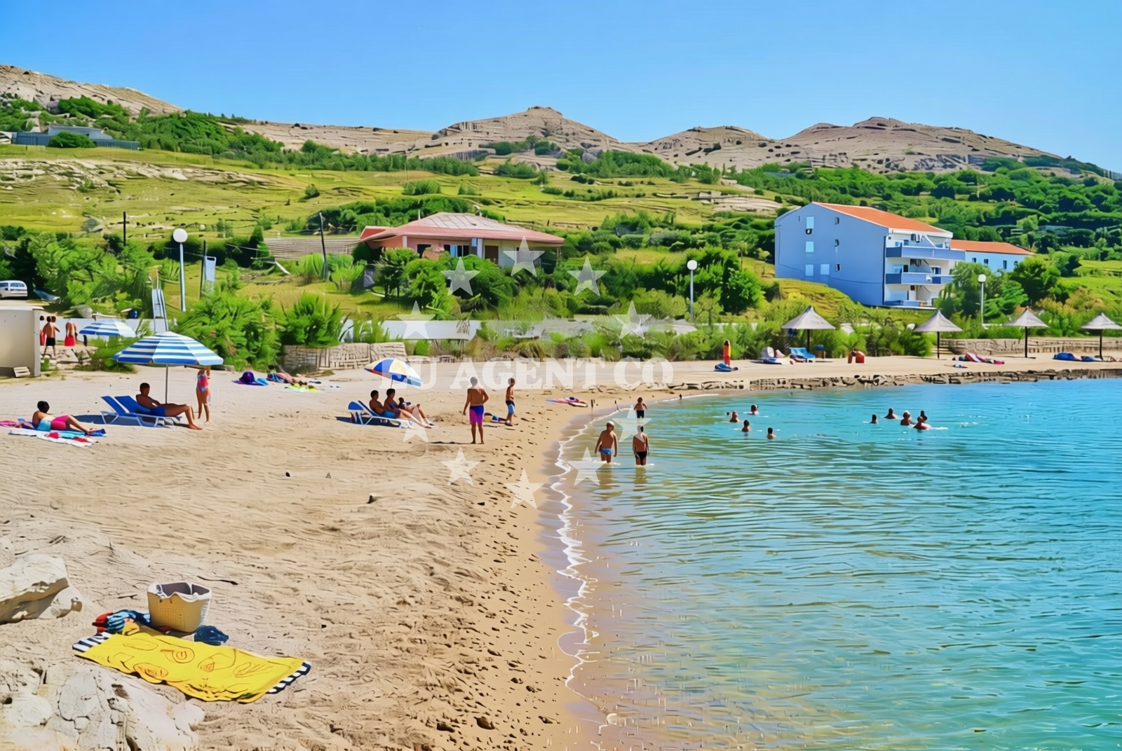
About this beach
Dinjiška istok, Dinjiška (Pag)
Beach: Dinjiška istok
Location: Dinjiška (Pag)
Characteristics and facilities
Gravel
150 m
Restaurant / snack bar
Caffe bar / Drinks stand
Beach character
The beach's gravel composition creates a distinct textural contrast to the typical sandy shores of the Adriatic. While the gravel may not be ideal for barefoot walking, it contributes to the beach's natural character. The shoreline extends approximately 150 meters, providing a modest but accessible stretch for visitors. The beach's positioning on Pag Island's eastern coast means it benefits from the island's reputation for clean waters and strong maritime traditions.Swimming and shore
The gravel substrate may present challenges for swimmers seeking soft sand, though the Adriatic's generally clear waters remain a consistent feature along Pag's coastline. No specific swimming conditions are documented for this beach, reflecting the catalog's focus on structural characteristics rather than water quality metrics.Facilities and activities
Basic amenities include a restaurant/snack bar and a caffe bar/drinks stand, suggesting limited but functional services for visitors. While no structured activities are listed, the beach's proximity to Pag's historic core and maritime infrastructure offers indirect opportunities for cultural exploration or yacht-related services.Access and location
Situated on Pag Island's eastern coast, the beach lies within the Zadar County region of Croatia. The island's well-connected road network provides access to nearby settlements like Nošara and Škrip, which offer additional services and cultural attractions. Pag's coastal positioning makes it a natural waypoint for sailors navigating the Adriatic's northern reaches.What to expect
Visitors should anticipate a gravel shoreline with limited recreational infrastructure. The beach's primary features include its natural substrate and proximity to basic amenities. The surrounding area offers connections to Pag's historic maritime heritage and the broader Adriatic sailing network, though no specific visitor experiences are documented in the catalog.Practical tips
Comfortable footwear is recommended for the gravel shoreline. The nearby restaurant/snack bar and caffe bar provide essential services, though visitors should confirm operating hours directly with the facilities.Exploring the coast by yacht
Pag Island's coastline, including Dinjiška istok Beach, lies within a popular sailing region for Euro-Agent yacht charter guests. The island's sheltered waters and proximity to Zadar make it a common stop for vessels exploring the northern Adriatic. While no specific marinas are mentioned for this beach, Pag's well-developed maritime infrastructure supports yacht operations in the area.Regional Context
Pag Island's eastern coast, where Dinjiška istok Beach is located, reflects the island's unique geological profile shaped by the Adriatic Sea. The area's gravel beaches contrast with the more famous white sand beaches of Pag's western shore, offering a different coastal experience. The island's historic connection to salt production and shipbuilding remains evident in nearby settlements.Anchorages in the surrounding area
Anchorages in the surrounding area include options near Dinjiška and other nearby locations on Pag.
- Dinjiška — dinjiska — pag — 0.3 NM from beach
- Anchorage — smokvica — 2.4 NM from beach
- Anchorage — vlasici — pag — 2.6 NM from beach
- Anchorage — povljana — pag — 2.9 NM from beach
- Mlinica — kosljun pag — 3.6 NM from beach
- Anchorage — povljana — pag — 4.0 NM from beach
- Anchorage — tribanj — 4.2 NM from beach
- Anchorage — vrsi — 4.5 NM from beach
Distances are straight-line geographic distances, not sailing routes.
Mooring buoys in the surrounding area
- Vir — 5.8 NM from beach
- Šibuljina Point — sibuljina point — 6.5 NM from beach
- Jetty — ljubac — 7.3 NM from beach
- Punta Skala — petrcane — 10.0 NM from beach
- Jetty — simuni — pag — 11.5 NM from beach
Distances are straight-line geographic distances, not sailing routes.
Marine fuel stations
Marine fuel stations are located in areas such as Zadar and Ugljan, providing refueling options for vessels traveling to the beach.
- Ina — zadar — 14.4 NM from beach
- Ina — preko — ugljan — 16.8 NM from beach
- Fuel station — sukosan — 18.8 NM from beach
- Ina — zaglav — dugi otok — 24.5 NM from beach
Distances are straight-line geographic distances, not sailing routes.
Harbours in the surrounding area
- Miškovići — miskovici — pag — 1.9 NM from beach
- Povljana — pag — 3.9 NM from beach
- Košljun — kosljun pag — 5.4 NM from beach
- Lukovo Šugarje — lukovo sugarje — rudelici — 5.5 NM from beach
- Mulo — nin — 5.9 NM from beach
- Privlaka — 6.3 NM from beach
Distances are straight-line geographic distances, not sailing routes.
Marinas in the surrounding area
- ACI Marina Šimuni — simuni — pag — 12.3 NM from beach
- Marina Borik — zadar — 13.6 NM from beach
- Vitrenjak Zadar — 13.8 NM from beach
- Marina Zadar — 14.3 NM from beach
- Olive Island Marina — sutomiscica — ugljan — 15.7 NM from beach
Distances are straight-line geographic distances, not sailing routes.
Restaurants near the beach
Restaurants near the beach include options in Povljana and Vir, offering meals close to the Dinjiška istok area.
- Mornar — povljana — pag — 3.4 NM from beach
- Nirvana — povljana — pag — 3.7 NM from beach
- Lanterna — povljana — pag — 4.0 NM from beach
- Villa Kaštel — povljana — pag — 4.0 NM from beach
- Restaurant — vir — 4.9 NM from beach
Distances are straight-line geographic distances, not sailing routes.
Navigation guides for the surrounding area
Navigation guides for the surrounding area cover locations such as Otok Pag and nearby channels, aiding in route planning.
- OTOK PAG — 4.0 NM from beach
- KrusCica and Uvala KrusCica Duboka — 5.6 NM from beach
- Privlaka — 6.3 NM from beach
- Uvala Bliznica — 7.5 NM from beach
- VELESITSKI KANAL (S) — 7.7 NM from beach
Distances are straight-line geographic distances, not sailing routes.
Yachts from nearby departure bases
Sailing yachts
- First 45 (Egeria) — Šimuni Kolan ACI Marina — 12.3 NM from departure base to beach
- Bavaria Cruiser 37 (JULIA) — Zadar Marina Borik — 13.6 NM from departure base to beach
Catamarans
- Sunreef 60 (SINATA) — Zadar Marina Borik — 13.6 NM from departure base to beach
Motor yachts
- Prestige 460 (ADUDU 2) — Zadar Marina Borik — 13.6 NM from departure base to beach
Motor boats
- Merry Fisher 895 — Povljana Marina — 3.8 NM from departure base to beach
- BWA Sport 22GT (BWA ) — Pag City Port — 7.9 NM from departure base to beach
- Rancraft RM19 (Daycruiser) — Zadar Diklo Port — 12.3 NM from departure base to beach
- Rancraft RM21 (Dugi otok) — Zadar Diklo Port — 12.3 NM from departure base to beach
- Rancraft RS Cinque.5 — Zadar Diklo Port — 12.3 NM from departure base to beach
- Merry Fisher 895 — Zadar Marina Borik — 13.6 NM from departure base to beach
Distances are straight-line geographic distances, not sailing routes.