Desna luka, Duba Pelješka Beach, Croatia
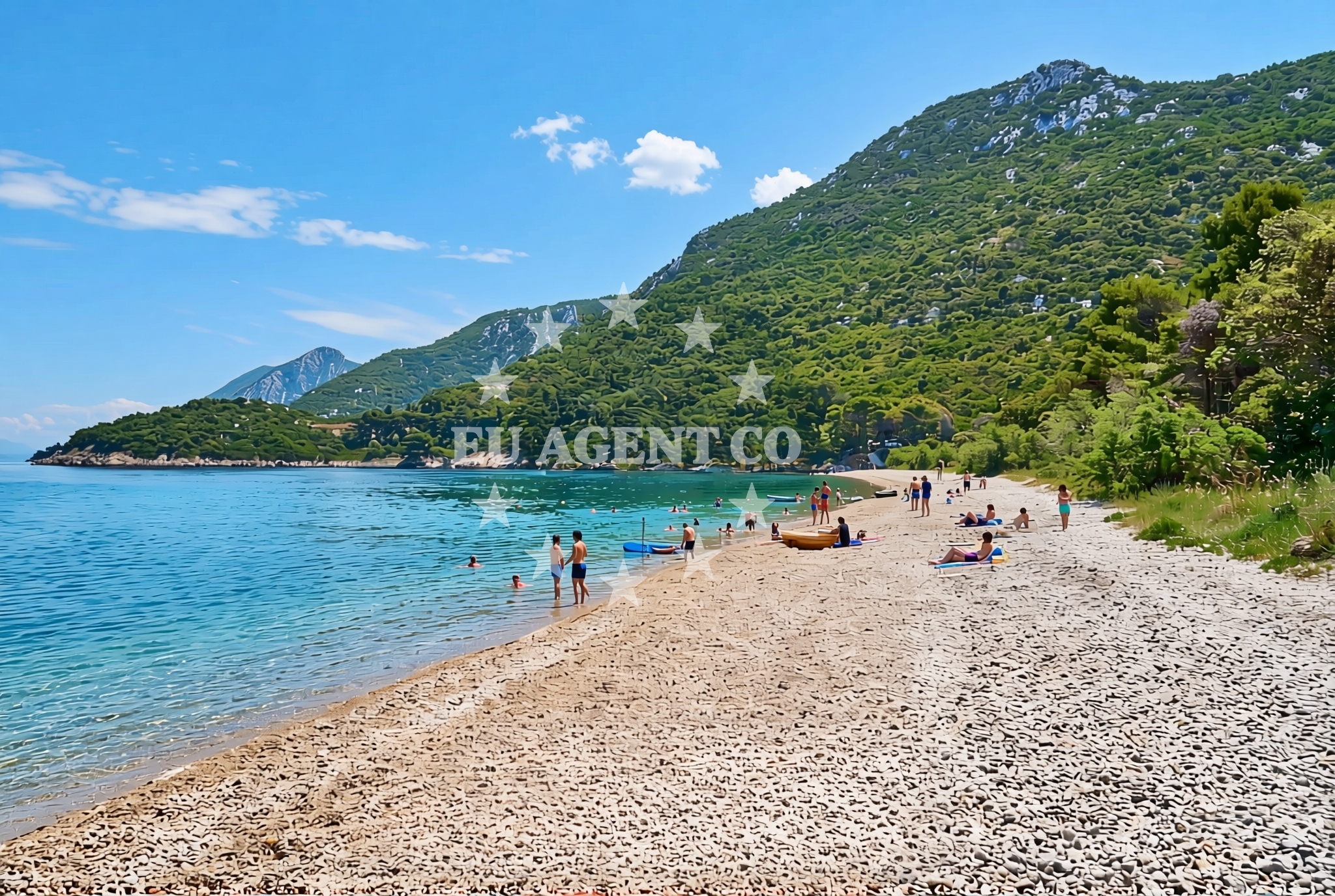
About this beach
Desna luka, Duba Pelješka
Beach: Desna luka
Location: Duba Pelješka
Characteristics and facilities
Pebbles, gravel
450 m
Beach character
The beach is defined by its pebble and gravel substrate, which extends along the shoreline without artificial modifications. This natural composition creates a stark contrast to the sandy beaches of the region, offering a more rugged experience for visitors. The 450-meter length provides space for walking or exploring, though the uneven surface may require sturdy footwear. The beach’s orientation and proximity to the open sea mean it is subject to wave action, particularly during stronger winds, which can affect accessibility and comfort.Swimming and shore
Swimming is possible at Desna luka, but the pebble-strewn shore makes it less ideal for those preferring soft sand. The water quality aligns with regional standards for Adriatic beaches, though no specific testing data is available for this location. The shoreline’s natural contours create a direct connection to the open sea, making it a spot where the transition between land and water is immediate. This characteristic may appeal to visitors seeking a more authentic coastal experience, though it may not suit those looking for sheltered swimming areas.Facilities and activities
There are no explicitly listed facilities at Desna luka, Duba Pelješka Beach. The absence of amenities such as showers, restrooms, or sunbeds suggests a focus on the beach’s natural state. Activities are limited to passive recreation like walking along the shore or observing the landscape. The beach’s positioning near the Pelješac Peninsula means it is within reach of cultural sites such as the Ston City walls and the Đakovo Monastery, though these require travel beyond the immediate shoreline.Access and location
Desna luka is located within the Duba Pelješka area, part of the Pelješac Peninsula in southern Croatia. The beach is accessible via local roads connecting to the peninsula’s main settlements, including the town of Ston. Its proximity to the Strait of Otranto means it is near the maritime boundary between the Adriatic Sea and the Ionian Sea, a route historically significant for trade and naval movements. Visitors arriving by yacht may find anchorage options in nearby bays or marinas along the peninsula’s coastline.What to expect
Visitors to Desna luka, Duba Pelješka Beach should expect a natural, unmodified shoreline composed of pebbles and gravel. The beach’s 450-meter length offers space for exploration but lacks artificial amenities such as sunbeds, umbrellas, or parking. The area’s rugged character is consistent with the Pelješac Peninsula’s landscape, which includes vineyards, historic forts, and coastal trails. The beach’s orientation toward the open sea means it is exposed to wave action, which may affect comfort during windy conditions.Practical tips
Sturdy footwear is recommended for walking on the pebble-strewn shore. Sun protection and hydration are essential, given the exposure to direct sunlight. Visitors interested in exploring the Pelješac Peninsula may want to plan additional travel to nearby cultural or natural sites, as the beach itself does not include facilities for extended stays.Exploring the coast by yacht
For yacht charter guests, Desna luka’s location on the Pelješac Peninsula offers proximity to several sailing routes and anchorages. The nearby town of Ston provides access to marinas and fuel stations, while the peninsula’s coastline features sheltered bays suitable for anchoring. The beach’s position near the Strait of Otranto places it within reach of routes connecting the Adriatic to the Ionian Sea, making it a potential stop for longer coastal voyages. Charterers exploring the region may find the surrounding waters ideal for sailing between the Pelješac Peninsula and the islands of Korčula or Mljet.Regional Context and Coastal Routes
The Pelješac Peninsula is a key area for yacht charter operations, with its mix of sheltered anchorages, historic sites, and vineyard-covered hills. Desna luka’s position along the peninsula’s eastern coast means it is near routes connecting to the Bay of Kali, a popular anchorage for sailors. The region’s maritime history includes medieval fortifications and modern marinas, reflecting its enduring role in Adriatic navigation.
Anchorages in the surrounding area
Anchorages in the surrounding area include Duba Pelješka, Badija, and Korčula.
- Anchorage — duba peljeska — 1.2 NM from beach
- Anchorage — badija — 4.3 NM from beach
- Anchorage — korcula — 4.4 NM from beach
- Anchorage — korcula — 4.5 NM from beach
- Anchorage — loviste — 4.6 NM from beach
- Anchorage — korcula — 4.7 NM from beach
- Anchorage — korcula — 4.8 NM from beach
- Anchorage — korcula — 4.8 NM from beach
Distances are straight-line geographic distances, not sailing routes.
Mooring buoys in the surrounding area
Mooring buoys in the surrounding area include Restaurant Moro buoys at Stupe and Fuel jetty in Korčula.
- Restaurant Moro buoys — stupe — 3.7 NM from beach
- Fuel jetty — korcula — 4.2 NM from beach
- Jetty — korcula — 4.7 NM from beach
- Vrnik Arts Club buoys — 5.1 NM from beach
- Quay — vrnik — 5.1 NM from beach
Distances are straight-line geographic distances, not sailing routes.
Marine fuel stations
Marine fuel stations nearby include those in Korčula and Ploče.
- Fuel station — korcula — 4.2 NM from beach
- Fuel station — ploce — 11.6 NM from beach
- Ina — makarska — 17.7 NM from beach
- Ina — vela luka — korcula — 20.5 NM from beach
Distances are straight-line geographic distances, not sailing routes.
Harbours in the surrounding area
Harbours in the surrounding area include Duba Pelješka and Orebić.
- Duba — duba peljeska — 0.2 NM from beach
- Orebić — orebic — 2.9 NM from beach
- Kučišće — kucisce — 3.6 NM from beach
- Korčula W harbour — korcula — 4.0 NM from beach
- Viganj — 4.0 NM from beach
- Korčula E harbour — korcula — 4.1 NM from beach
Distances are straight-line geographic distances, not sailing routes.
Marinas in the surrounding area
Marinas in the surrounding area include ACI Marina Korčula and Marina Lumbarda.
- ACI Marina Korčula — korcula — 4.2 NM from beach
- Marina Lumbarda — korcula — 5.9 NM from beach
- Marina Tučepi — marina tucepi — 15.3 NM from beach
- Marina Ramova — krvavica — 19.9 NM from beach
- Marina Korkyra — vela luka — korcula — 20.6 NM from beach
Distances are straight-line geographic distances, not sailing routes.
Restaurants near the beach
Restaurants near the beach include Moro in Stupe and several options in Korčula.
- Moro — stupe — 3.6 NM from beach
- Restaurant — korcula — 4.0 NM from beach
- Adio Mare — korcula — 4.0 NM from beach
- Restaurant Lesic Dimitri — korcula — 4.0 NM from beach
- Restaurant Filippi — korcula — 4.0 NM from beach
- Restaurant — korcula — 4.0 NM from beach
- Aterina — korcula — 4.0 NM from beach
Distances are straight-line geographic distances, not sailing routes.
Navigation guides for the surrounding area
Navigation guides for the surrounding area include Uvala Divna and Orebic.
- Uvala Divna — 1.5 NM from beach
- Orebic — 3.0 NM from beach
- Otocic Badija — 4.3 NM from beach
- Trpanj — 4.3 NM from beach
- Uvala Banja — 4.4 NM from beach
Distances are straight-line geographic distances, not sailing routes.
Yachts from nearby departure bases
Yachts from nearby departure bases include those departing from Ploče City Port and Tučepi Port.
Sailing yachts
- Elan 40 Impression (Karleta) — Ploče City Port — 11.5 NM from departure base to beach
- Sun Odyssey 349 (Porto Tolero) — Ploče City Port — 11.5 NM from departure base to beach
- Salona 44 (SAMOA) — Ploče City Port — 11.5 NM from departure base to beach
- Sun Odyssey 419 (Luka Ploce) — Ploče City Port — 11.5 NM from departure base to beach
- More 55 (MRS. ROBINSON) — Ploče City Port — 11.5 NM from departure base to beach
- Elan 514 Impression (Cesarica III) — Ploče City Port — 11.5 NM from departure base to beach
- Sun Odyssey 349 (Visnjica) — Ploče City Port — 11.5 NM from departure base to beach
- Bavaria 40 Cruiser (LADY BUTTERFLY) — Tučepi Port — 15.3 NM from departure base to beach
Catamarans
- Lagoon 450 Fly (Alba Mouse) — Ploče City Port — 11.5 NM from departure base to beach
Motor yachts
- Princess V53 (Chablis) — Makarska Port — 17.5 NM from departure base to beach
Distances are straight-line geographic distances, not sailing routes.