Dančanje: Beaches and Coves, Croatia
3 photos
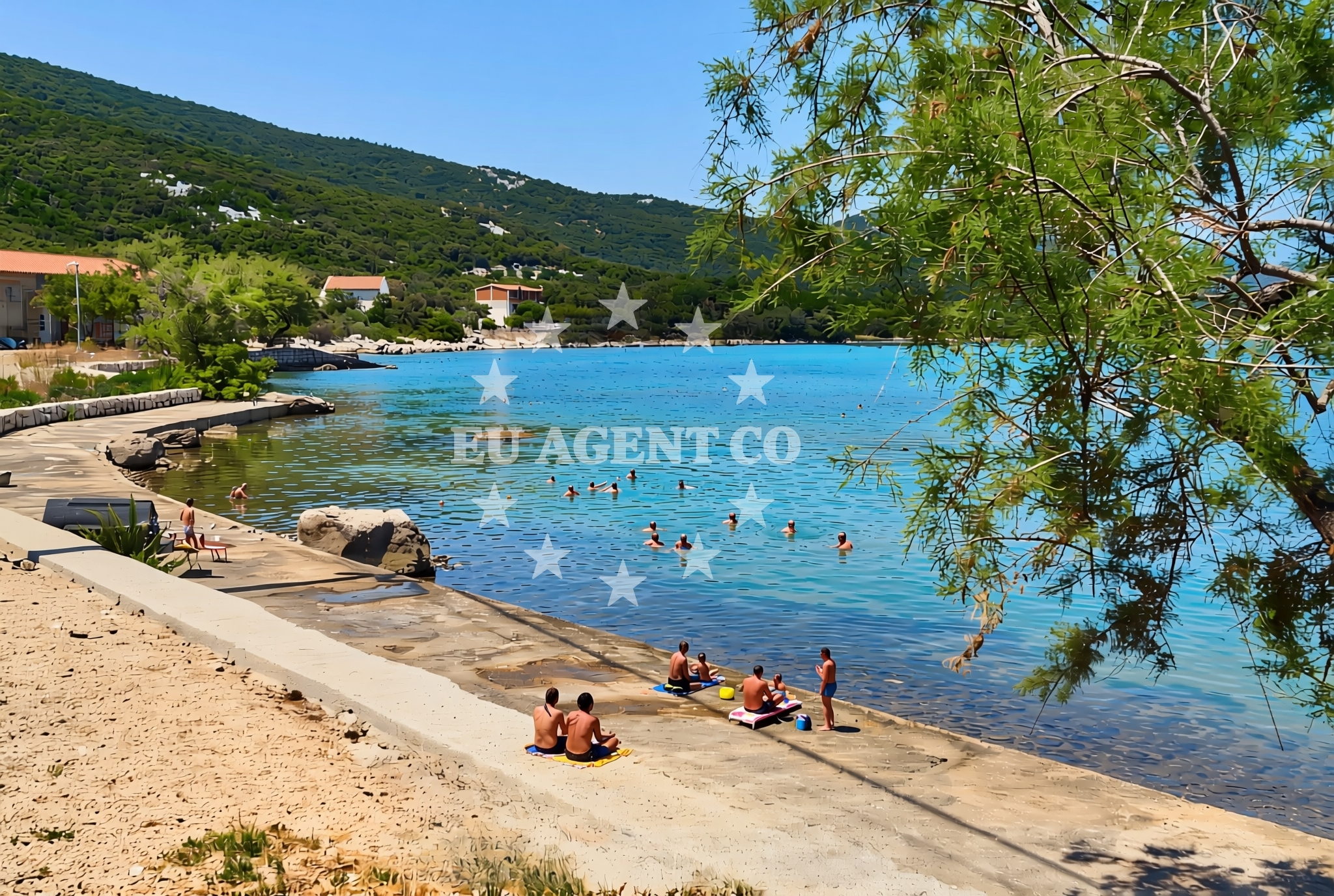
About this beach
Dančanje: beaches and coves
Beach character
The beaches and coves of Dančanje are characterized by their natural formation, likely featuring a mix of pebbled shores, rocky outcrops, and sheltered inlets typical of the Adriatic. The absence of structured amenities suggests a focus on unspoiled coastal experiences, where visitors can enjoy the raw beauty of the landscape. The region's topography may include gentle slopes leading to the water's edge, with views of the open sea and distant islands that define the Adriatic's scenic character.Swimming and shore
Swimming conditions at Dančanje are likely influenced by the area's natural geography, with water clarity and temperature aligning with the Adriatic's seasonal patterns. The shorelines may offer varying degrees of accessibility, depending on the specific cove or beach. While no formal facilities are documented, the natural setting implies a focus on self-contained exploration, with visitors expected to bring their own equipment and supplies for beach activities.Facilities and activities
No structured amenities or activities are explicitly documented for Dančanje. The lack of formalized facilities suggests a focus on natural immersion, with visitors encouraged to engage with the environment through self-guided exploration. The area's potential for hiking, coastal walks, and photography aligns with the broader Dalmatian coast's appeal to nature enthusiasts.Access and location
Dančanje is situated in a region of Croatia known for its historic coastal towns and island clusters. Access to the beaches and coves likely involves navigating through local settlements or via maritime routes that connect to the broader Adriatic network. The area's proximity to established sailing routes and cultural landmarks positions it as a potential waypoint for those exploring the region by boat or yacht.What to expect
Visitors to Dančanje can anticipate a landscape defined by natural coastal formations, with beaches and coves that reflect the Adriatic's rugged beauty. The area's lack of formalized amenities emphasizes a connection to the environment, requiring visitors to prepare for self-sufficient exploration. The region's geography may include opportunities for scenic walks, with views of the sea and surrounding cliffs that are characteristic of the Dalmatian coast.Practical tips
Given the area's natural character, visitors should consider bringing essentials such as water, sunscreen, and appropriate footwear for uneven terrain. The absence of formal facilities means that waste management and self-care are the responsibility of individual visitors. Local knowledge about tide patterns or seasonal weather variations may enhance the experience, though specific details are not documented.Exploring the coast by yacht
The waters around Dančanje are part of a larger sailing region known for its clear waters and scenic routes, making it a potential interest point for yacht charter guests exploring the Adriatic. While specific marinas or anchorages are not detailed here, the area's proximity to established sailing destinations suggests opportunities for exploration. For those considering yacht charter in the region, the Euro-Agent Yacht Search page provides tools to identify vessels and routes that align with the coastal context of Dančanje and neighboring areas.Regional Context and Coastal Exploration
Dančanje's location places it within a region of Croatia that is historically significant for its maritime traditions and cultural heritage. The surrounding area likely includes settlements with connections to the Adriatic's sailing history, offering opportunities to explore local culture alongside natural landscapes. For visitors interested in broader coastal experiences, the nearby towns and islands may provide additional points of interest, though specific details are not documented here.Anchorages in the surrounding area
- Anchorage — brijesta — 2.5 NM from beach
- Anchorage — klek — 4.1 NM from beach
- Anchorage — klek — 4.1 NM from beach
- Anchorage — duboka — 4.3 NM from beach
- Anchorage — zuljana — 5.1 NM from beach
- Anchorage — zuljana — 5.2 NM from beach
- Anchorage — prapratno — 6.0 NM from beach
- Anchorage — mali ston — 6.3 NM from beach
Distances are straight-line geographic distances, not sailing routes.
Mooring buoys in the surrounding area
- Brijesta — 2.4 NM from beach
- Quay — prapratno — 5.9 NM from beach
- Quay — sobra — mljet — 8.3 NM from beach
- Quay — sobra — mljet — 8.4 NM from beach
- Jetty — blace — 8.5 NM from beach
Distances are straight-line geographic distances, not sailing routes.
Marine fuel stations
- Fuel station — sobra — mljet — 8.5 NM from beach
- Fuel station — ploce — 12.1 NM from beach
- Fuel station — korcula — 19.0 NM from beach
- Ina — dubrovnik — 26.1 NM from beach
Distances are straight-line geographic distances, not sailing routes.
Harbours in the surrounding area
- Žuljana — zuljana — 5.1 NM from beach
- Hodilje — 5.5 NM from beach
- Drače — drace — 6.1 NM from beach
- Prapranto Ferry Harbour — prapratno — 6.2 NM from beach
- Ston — 6.3 NM from beach
- Mali Ston — 6.3 NM from beach
Distances are straight-line geographic distances, not sailing routes.
Marinas in the surrounding area
- ACI Marina Slano — 15.2 NM from beach
- Marina Lumbarda — korcula — 17.6 NM from beach
- ACI Marina Korčula — korcula — 19.6 NM from beach
- Marina Frapa Dubrovnik — 26.1 NM from beach
- ACI Marina Dubrovnik — 27.5 NM from beach
Distances are straight-line geographic distances, not sailing routes.
Navigation guides for the surrounding area
- Uvala Lopata — 3.3 NM from beach
- Uvala Kljemtine — 3.9 NM from beach
- Uvala Klek — 4.0 NM from beach
- Uvala Bjejvica — 4.5 NM from beach
- Luka — 5.3 NM from beach
Distances are straight-line geographic distances, not sailing routes.
Yachts from nearby departure bases
Sailing yachts
- Elan 40 Impression (Karleta) — Ploče City Port — 12.1 NM from departure base to beach
- More 55 (MRS. ROBINSON) — Ploče City Port — 12.1 NM from departure base to beach
- Sun Odyssey 349 (Visnjica) — Ploče City Port — 12.1 NM from departure base to beach
- Sun Odyssey 419 (Luka Ploce) — Ploče City Port — 12.1 NM from departure base to beach
- Elan 514 Impression (Cesarica III) — Ploče City Port — 12.1 NM from departure base to beach
- Salona 44 (SAMOA) — Ploče City Port — 12.1 NM from departure base to beach
- Sun Odyssey 349 (Porto Tolero) — Ploče City Port — 12.1 NM from departure base to beach
- Oceanis 45 (Soul) — Slano ACI Marina — 15.2 NM from departure base to beach
Catamarans
- Lagoon 450 Fly (Alba Mouse) — Ploče City Port — 12.1 NM from departure base to beach
- Lagoon 450 Flybridge (MALA MARE) — Slano ACI Marina — 15.2 NM from departure base to beach
Distances are straight-line geographic distances, not sailing routes.
Frequently asked questions
Are there facilities or services available at Dančanje?
No formal amenities or services are documented for Dančanje. The area appears to focus on natural immersion, with visitors expected to bring their own supplies for beach activities.Is Dančanje accessible by boat or yacht?
The area's proximity to established sailing routes suggests potential for maritime access. However, specific details about anchorages or marinas are not provided here. For yacht charter inquiries, the Euro-Agent Yacht Search page can help identify suitable vessels and routes.Nearby beaches
Zabrđe (Ston): beaches and coves
Zabrđe (Ston)
2.6 km
Putniković: beaches and coves (2)
Putniković
3.1 km
Tomislavovac: beaches and coves
Tomislavovac
4.1 km
Vrelo, Brijesta
Vrelo
4.3 km
Brijesta: beaches and coves (3)
Brijesta
4.3 km
Brijesta beach
Brijesta 20, Janjina
4.4 km
Sparagovići: beaches and coves
Sparagovići
4.4 km
Porat, Brijesta Beach
Porat
4.6 km