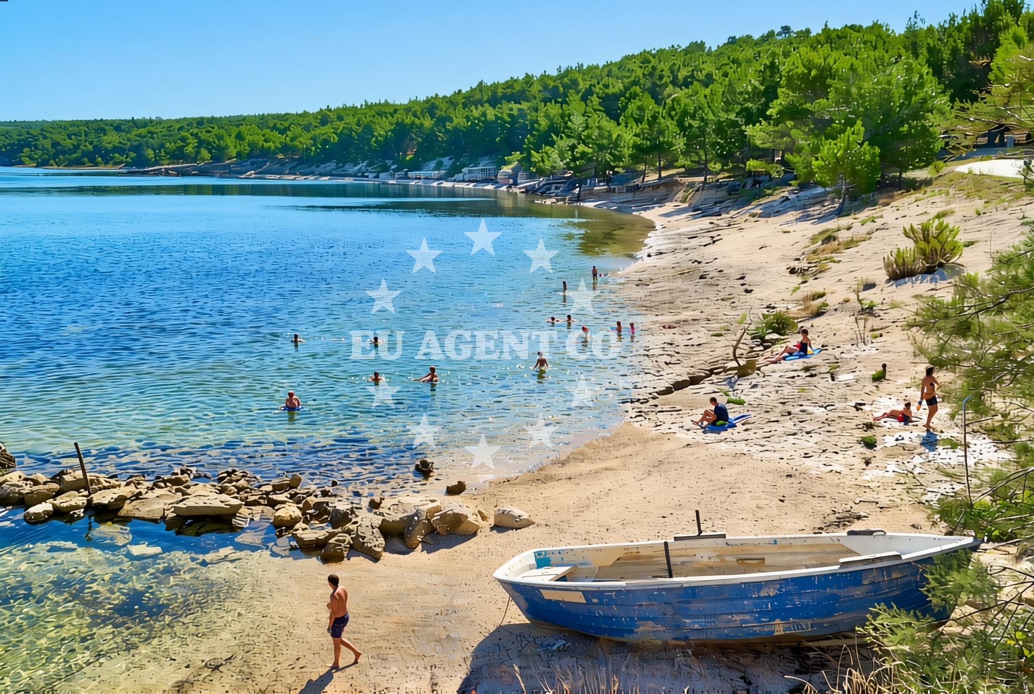
Ćuskijaš jug, Pridraga Beach, Croatia
About this beach
Ćuskijaš jug, Pridraga
Beach: Ćuskijaš jug
Location: Pridraga
Characteristics and facilities
Gravel, rocks
100 m
Natural shade
Beach character
The beach consists primarily of gravel and exposed rock formations, creating a rugged coastline profile. Natural shade is provided by the beach's own contours, offering intermittent relief from direct sunlight. The absence of artificial structures or amenities emphasizes the beach's connection to the surrounding landscape. The shoreline's composition suggests it may be less suited for traditional sunbathing but could appeal to visitors interested in exploring coastal geology or enjoying a more secluded environment.Swimming and shore
Swimming conditions at Ćuskijaš jug are influenced by the beach's rocky terrain. The shoreline's composition may create uneven entry points into the water, with potential for shallow, uneven seabeds near the shore. The Adriatic Sea's general clarity and moderate temperatures during summer months suggest the area could be navigable for swimmers willing to navigate the rocky access points. However, the lack of designated swimming zones or safety infrastructure means caution is advised.Facilities and activities
No formal facilities such as restrooms, showers, or changing rooms are reported at the beach. The absence of structured amenities aligns with the beach's natural character. Activities associated with the area are not explicitly documented, though the rocky shoreline may support limited exploration or photography opportunities. Nearby settlements may offer additional services, but specific details about accessible amenities remain unspecified in available records.Access and location
Located in the Pridraga area, the beach is positioned along Croatia's Adriatic coastline. Its exact coordinates (44.14605°N, 15.599888°E) place it within a region known for its rugged coastlines and historic settlements. The beach's proximity to the mainland suggests it may be accessible via local roads, though specific transportation details are not documented. The surrounding area includes traditional coastal villages that may provide contextual insights into the region's maritime heritage.What to expect
Visitors should anticipate a beach experience defined by its natural, unmodified state. The gravel and rock composition creates a distinct shoreline profile, with natural shade provided by the beach's topography. The absence of formal facilities means visitors should plan accordingly, bringing necessary provisions for comfort. The beach's location within Croatia's Adriatic coast places it near sailing routes that connect to larger coastal towns and yacht charter hubs, though specific maritime infrastructure details remain unspecified.Practical tips
Given the beach's gravel and rocky nature, appropriate footwear is recommended for walking along the shoreline. Sun protection is essential, as natural shade is intermittent. Visitors should be aware of the beach's lack of formal amenities and plan accordingly. The area's connection to the Adriatic Sea suggests potential for coastal exploration, though swimmers should assess conditions carefully due to the rocky access points.Exploring the coast by yacht
The beach's location along Croatia's Adriatic coast places it within a region popular with yacht charter guests. The surrounding waters are part of established sailing routes that connect to nearby marinas and coastal settlements. While specific distances to yacht bases are not documented, the area's proximity to traditional sailing regions suggests it could serve as a point of interest for sailors exploring the Croatian coastline. Charter guests may find the beach's natural setting appealing for anchoring or shore excursions, though formal docking facilities are not reported.Regional Context and Coastal Character
The beach lies within a stretch of Croatia's coast known for its rugged, less-developed shorelines. The surrounding area includes historic villages with connections to maritime traditions, though specific details about local culture or tourism infrastructure remain sparse. The Adriatic Sea's generally mild climate supports year-round coastal activity, with summer months attracting visitors interested in sailing, snorkeling, and exploring lesser-known shorelines.Anchorages in the surrounding area
Anchorages near Pridraga include Karin dock and nearby anchorage spots in Karin and Novigrad.
- Karin dock — 1.3 NM from beach
- Anchorage — karin — 1.3 NM from beach
- Anchorage — novigrad — 2.4 NM from beach
- Anchorage — maslenica — 3.9 NM from beach
- Anchorage — vinjerac — 8.9 NM from beach
- Anchorage — ljubac — 14.5 NM from beach
- Anchorage — ljubac — 14.7 NM from beach
- Anchorage — mrljane — pasman — 14.7 NM from beach
Distances are straight-line geographic distances, not sailing routes.
Mooring buoys in the surrounding area
Mooring buoys in the area include fields in Sukosan and the Crvena Luka jetty.
- Buoy field — sukosan — 13.9 NM from beach
- Buoy field — sukosan — 14.0 NM from beach
- Crvena Luka jetty — 14.8 NM from beach
- Jetty — ljubac — 14.9 NM from beach
Distances are straight-line geographic distances, not sailing routes.
Marine fuel stations
- Fuel station — sukosan — 14.2 NM from beach
- Ina — biograd na moru — 14.2 NM from beach
- Ina — zadar — 16.1 NM from beach
- Ina — preko — ugljan — 18.0 NM from beach
Distances are straight-line geographic distances, not sailing routes.
Harbours in the surrounding area
Harbours in the vicinity include Obrovac, Maslenica, and Vinjerac.
- Obrovac — 4.9 NM from beach
- Maslenica — 5.2 NM from beach
- Vinjerac — 9.0 NM from beach
- Seline — 9.5 NM from beach
- Starigrad Paklenica — 11.3 NM from beach
- Sv. Filip and Jakov — sv filip and jakov — sveti filip i jakov — 13.5 NM from beach
Distances are straight-line geographic distances, not sailing routes.
Marinas in the surrounding area
Marinas nearby include Dry Dock Marina Biograd and Molum Marine Club in Sveti Filip i Jakov.
- Dry dock marina Biograd — biograd na moru — 13.0 NM from beach
- Molum Marine Club — sveti filip i jakov — 13.5 NM from beach
- Marina Dalmacija — sukosan — 14.0 NM from beach
- Marina Kornati — biograd na moru — 14.0 NM from beach
- Marina Šangulin — marina sangulin — biograd na moru — 14.1 NM from beach
Distances are straight-line geographic distances, not sailing routes.
Navigation guides for the surrounding area
Navigation guides cover areas like Posedarje and Starigrad-Paklenica.
- Posedarje (Novigradsko More) — 6.4 NM from beach
- Starigrad-Paklenica {Velebitski Kanai) — 11.1 NM from beach
- Filip Jakov — 13.4 NM from beach
- Turanj — 13.5 NM from beach
- O. Pasman & O. Ugljan — 14.4 NM from beach
Distances are straight-line geographic distances, not sailing routes.
Yachts from nearby departure bases
Yachts depart from nearby bases such as Novigrad Dalmatia and Sukošan Brodogradilište Filipi.
Sailing yachts
- Dufour 470 (CUPID) — Sukošan Marina Dalmacija — 14.0 NM from departure base to beach
Catamarans
- Bali 4.8 (Aldebaran) — Sukošan Marina Dalmacija — 14.0 NM from departure base to beach
Motor yachts
- Manhattan 50 (FOREVER MAJA) — Sukošan Marina Dalmacija — 14.0 NM from departure base to beach
Motor boats
- Merry Fisher 795 () — Novigrad Dalmatia — 3.1 NM from departure base to beach
- Merry Fisher 695 — Sukošan Brodogradilište Filipi — 13.8 NM from departure base to beach
- Elan 650 (Biokovo) — Sukošan Brodogradilište Filipi — 13.8 NM from departure base to beach
- Quicksilver Activ 555 — Sukošan Brodogradilište Filipi — 13.8 NM from departure base to beach
- Zar 57 WD — Sukošan Brodogradilište Filipi — 13.8 NM from departure base to beach
- Zar 65 Suite — Sukošan Brodogradilište Filipi — 13.8 NM from departure base to beach
- Zar 61 Suite (Tucepi) — Sukošan Brodogradilište Filipi — 13.8 NM from departure base to beach
Distances are straight-line geographic distances, not sailing routes.