Crna luka, Blato (Korčula) Beach, Croatia
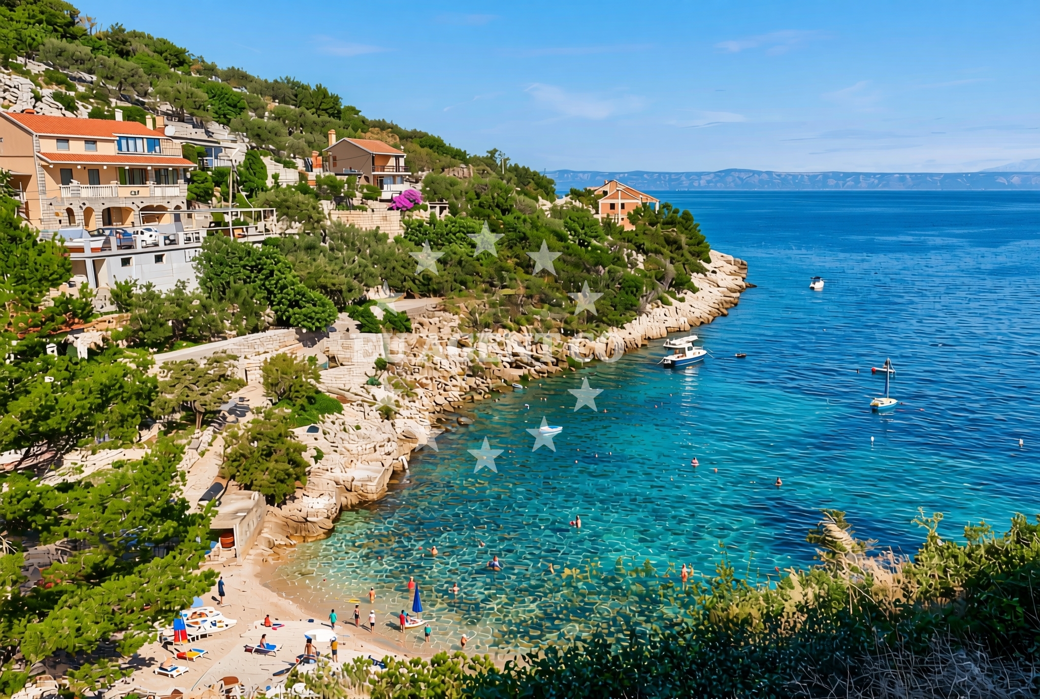
About this beach
Crna luka, Blato (Korčula)
Beach: Crna luka
Location: Blato (Korčula)
Characteristics and facilities
Gravel, concrete / stone slabs, rocks
Beach character
The beach’s surface is composed of gravel, concrete/stone slabs, and exposed rock formations, reflecting its natural coastal development. These features indicate a shoreline shaped by wave action and geological composition rather than fine sand. The lack of detailed natural features in the catalog suggests the beach may lack extensive vegetation or dunes, focusing instead on its rocky and semi-urban character. This type of beach is often found in areas where coastal erosion or human development has altered the landscape.Swimming and shore
Swimming conditions at Crna luka are not explicitly detailed in the catalog, but the rocky terrain may create uneven entry points into the water. The beach’s proximity to Blato Bay, which is known for its sheltered waters, could imply calmer conditions in nearby areas. However, visitors should be cautious of uneven surfaces and potential tidal changes near the shore. The beach does not appear to have designated swimming zones or lifeguard services, as no such amenities are listed in the authoritative features.Facilities and activities
No specific facilities or activities are listed in the catalog for this beach. The absence of structured amenities such as showers, restrooms, or parking suggests it may be a more informal or less-developed site. However, its location within Blato, a region with historical and cultural significance, could offer opportunities for walking, cycling, or exploring nearby landmarks such as the Blato Monastery or the village of Blato itself.Access and location
Crna luka is situated in Blato, a bay on the western coast of Korčula Island. The beach is accessible via local roads connecting to the village of Blato and the main town of Korčula. Korčula, a UNESCO-protected island, is known for its medieval architecture, vineyards, and proximity to other Dalmatian islands. Visitors may reach the beach by car, motorcycle, or on-foot from nearby settlements, though no specific parking details are provided in the catalog.What to expect
Visitors to Crna luka, Blato (Korčula) Beach should expect a shoreline defined by gravel, concrete slabs, and rocky outcrops. This terrain may appeal to those seeking a more rugged coastal experience rather than soft sand. The beach’s location within Blato Bay offers proximity to Korčula’s cultural and natural attractions, though the lack of detailed facilities suggests it may be best suited for brief visits or as part of a broader exploration of the island. The area’s historical context, including nearby Blato Monastery and Korčula Town, provides opportunities for cultural engagement beyond the beach itself.Practical tips
Wear sturdy footwear to navigate the gravel and rocky terrain. The beach’s proximity to Blato and Korčula offers opportunities to explore local landmarks, but plan transportation in advance as no specific parking details are available. Check local guidelines for any restrictions on access or activities, though none are explicitly mentioned in the catalog.Exploring the coast by yacht
For sailors and yacht charter guests, Crna luka’s location on Korčula Island places it within a popular sailing area of the Adriatic. Korčula is a key stop on routes connecting the Dalmatian coast, Pelješac Peninsula, and the islands of Hvar and Brač. Yacht charter companies operating in the region often include Korčula in itineraries due to its historic sites, vineyards, and sheltered bays. Nearby marinas in Korčula Town and along the island’s coast provide docking options for visitors exploring the area by sea.Cultural and Historical Context
Blato, where Crna luka is located, has historical ties to Korčula’s medieval heritage. The nearby Blato Monastery, dating to the 13th century, reflects the region’s religious significance. Korčula Town, a short distance away, is renowned for its well-preserved Old Town, which features Venetian architecture and the famous Korčula Tower. These cultural assets make the area appealing to visitors interested in history and local traditions.Anchorages in the surrounding area
Anchorages in the surrounding area include Vela Luka and Prizba, offering nearby options for mooring.
- Anchorage — vela luka — korcula — 3.8 NM from beach
- Anchorage — vela luka — korcula — 3.8 NM from beach
- Anchorage — prizba — korcula — 4.0 NM from beach
- Anchorage — prizba — korcula — 4.1 NM from beach
- Karbuni — zvirinovic — 4.1 NM from beach
- Anchorage — korcula — 4.2 NM from beach
- Gradina — vela luka — korcula — 4.4 NM from beach
- Anchorage — vela luka — korcula — 5.0 NM from beach
Distances are straight-line geographic distances, not sailing routes.
Mooring buoys in the surrounding area
Mooring buoys in the surrounding area feature buoy fields and jetties in Vela Luka and Proizd, situated near the beach.
- Buoy field — vela luka — korcula — 2.8 NM from beach
- Quay — vela luka — korcula — 3.8 NM from beach
- Gradina buoy field — vela luka — korcula — 4.4 NM from beach
- Jetty — vela luka — korcula — 5.4 NM from beach
- Jetty — proizd — 6.9 NM from beach
Distances are straight-line geographic distances, not sailing routes.
Marine fuel stations
- Ina — vela luka — korcula — 2.7 NM from beach
- Ina — vrboska — hvar — 13.3 NM from beach
- Ina — ubli — lastovo — 13.7 NM from beach
- Fuel station — korcula — 16.4 NM from beach
Distances are straight-line geographic distances, not sailing routes.
Harbours in the surrounding area
- Prigradica — korcula — 1.6 NM from beach
- Vela Luka — korcula — 2.6 NM from beach
- Brna — korcula — 5.4 NM from beach
- Zavalatica — korcula — 7.8 NM from beach
- Račišće — racisce — korcula — 10.8 NM from beach
- Lovište — loviste — 11.6 NM from beach
Distances are straight-line geographic distances, not sailing routes.
Marinas in the surrounding area
Marinas in the surrounding area feature Marina Korkyra in Vela Luka, alongside options on Lastovo and Hvar.
- Marina Korkyra — vela luka — korcula — 2.8 NM from beach
- Marina Solitudo — lastovo — 12.5 NM from beach
- ACI Marina Vrboska — hvar — 13.3 NM from beach
- ACI Marina Korčula — korcula — 15.9 NM from beach
- Marina Lumbarda — korcula — 17.7 NM from beach
Distances are straight-line geographic distances, not sailing routes.
Restaurants near the beach
Restaurants near the beach include Bistro Prigradica and several dining options in Vela Luka.
- Bistro Prigradica — korcula — 1.6 NM from beach
- Pod Bore — vela luka — korcula — 2.6 NM from beach
- Konoba Skalinada — vela luka — korcula — 2.6 NM from beach
- Nautica — vela luka — korcula — 2.6 NM from beach
- Pizzeria Alfa — vela luka — korcula — 2.6 NM from beach
- Konoba Bata — vela luka — korcula — 2.6 NM from beach
- Konoba Bata — vela luka — korcula — 2.6 NM from beach
Distances are straight-line geographic distances, not sailing routes.
Navigation guides for the surrounding area
Navigation guides for the surrounding area include Uvala Prihonja and Uvala Grscica, useful for local sailing routes.
- Uvala Prihonja — 3.3 NM from beach
- Uvala Grscica — 3.8 NM from beach
- Luka Karbuni — 3.9 NM from beach
- Uvala Prizba Mali — 4.0 NM from beach
- Uvala Sveti Ivan (Uvala Gradina) — 4.2 NM from beach
Distances are straight-line geographic distances, not sailing routes.
Yachts from nearby departure bases
Yachts from nearby departure bases such as Tučepi Port and Makarska Port offer access to the beach area.
Sailing yachts
- Bavaria 40 Cruiser (LADY BUTTERFLY) — Tučepi Port — 21.5 NM from departure base to beach
- Hanse 445 (HELIOS) — Baška Voda — 24.5 NM from departure base to beach
- Bavaria 44 (TARISA ) — Baška Voda — 24.5 NM from departure base to beach
Catamarans
- Lagoon 450 (LAMANTIN) — Baška Voda — 24.5 NM from departure base to beach
Motor yachts
- Princess V53 (Chablis) — Makarska Port — 22.1 NM from departure base to beach
- Canados 86 (Karisma) — Baška Voda — 24.5 NM from departure base to beach
Motor boats
- Jeanneau NC 37 (Black Pearl) — Makarska Port — 22.1 NM from departure base to beach
- Galeon 430 Skydeck (Bellagio) — Makarska Port — 22.1 NM from departure base to beach
- Jeanneau NC 37 (Black Pearl) — Makarska Port — 22.1 NM from departure base to beach
- Galeon 430 Skydeck (BELLAGIO) — Makarska Port — 22.1 NM from departure base to beach
Distances are straight-line geographic distances, not sailing routes.