Crkvice jug, Kuna Pelješka Beach, Croatia
About this beach
Crkvice jug, Kuna Pelješka
Beach: Crkvice jug
Location: Kuna Pelješka
Characteristics and facilities
Gravel, concrete / stone slabs
60 m
Natural shade
Beach character
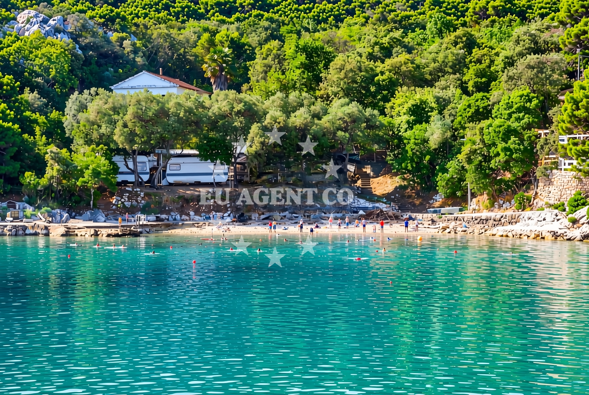
The beach's surface is composed of gravel and concrete/stone slabs, making it suitable for those preferring a firm footing over sand. Its length of 60 meters is complemented by natural shade, which provides relief from the sun. The absence of artificial amenities means the beach remains unaltered, reflecting its natural state.Swimming and shore
Swimming conditions are not explicitly detailed in the beach's records, but the gravel and stone composition suggest the shoreline is more suited for walking or standing than for extended water activities. The natural shade offers a practical benefit for visitors spending time on the beach during warmer hours.Facilities and activities
No structured facilities or activities are listed for this beach. Its defining features are the gravel surface, concrete/stone slabs, and natural shade. The beach appears to cater to visitors seeking a minimalistic coastal experience without the need for additional infrastructure.Access and location
Crkvice jug, Kuna Pelješka Beach is situated in the Kuna Pelješka region, part of Croatia's Adriatic coastline. The area is known for its rugged terrain and smaller settlements, which contribute to the beach's character. Nearby, the broader region includes coastal towns and islands that are part of the Dalmatian coast, a popular area for maritime exploration.What to expect
Visitors to Crkvice jug, Kuna Pelješka Beach should expect a short, gravelly shoreline with natural shade. The beach lacks artificial amenities, making it a straightforward destination for those seeking a quiet, unaltered coastal experience. Its location within the Kuna Pelješka area places it near the broader Dalmatian coast, which is known for its scenic sailing routes and historic settlements.Practical tips
Given the gravel and stone surface, visitors may wish to wear sturdy footwear. The beach's natural shade can provide relief during peak sun hours, though sun protection is still recommended. The area's proximity to the Adriatic offers opportunities for nearby exploration, including coastal towns and sailing routes.Exploring the coast by yacht
The Kuna Pelješka region, where Crkvice jug is located, lies along the Adriatic Sea, a well-traveled area for yacht charters. Nearby marinas and anchorages are accessible to sailors exploring the Dalmatian coast, making the region a viable starting point for those interested in coastal cruising. The beach itself is not a designated anchorage but is situated within a sailing area that connects to larger maritime hubs.Regional Context and Coastal Exploration
The Kuna Pelješka area is part of Croatia's central Dalmatia region, known for its limestone cliffs, vineyards, and historic villages. The coastline here is characterized by a mix of pebble beaches and rocky inlets, with settlements that date back to ancient times. Nearby, the town of Šibenik offers a cultural hub with a UNESCO-listed fortress and a vibrant port. For yacht charter guests, the region's proximity to the Šibenik-Kornati National Park provides opportunities for sailing through a network of islands and islets.Anchorages in the surrounding area
- Anchorage — crikvice — 0.0 NM from beach
- Anchorage — trstenik — 3.6 NM from beach
- Anchorage — trstenik — 3.8 NM from beach
- Anchorage — trstenik — 4.2 NM from beach
- Anchorage — podobuce — 4.2 NM from beach
- Anchorage — trpanj — 4.4 NM from beach
- Anchorage — blace — 4.8 NM from beach
- Anchorage — duba — 5.2 NM from beach
Distances are straight-line geographic distances, not sailing routes.
Mooring buoys in the surrounding area
Mooring buoys in the surrounding area include Blace Jetty and Brijesta, situated in different regions.
- Jetty — blace — 4.9 NM from beach
- Brijesta — 8.0 NM from beach
- Restaurant Moro buoys — stupe — 8.1 NM from beach
- Brist — 9.0 NM from beach
- Vrnik Arts Club buoys — 9.4 NM from beach
Distances are straight-line geographic distances, not sailing routes.
Marine fuel stations
- Fuel station — ploce — 5.4 NM from beach
- Fuel station — korcula — 10.0 NM from beach
- Fuel station — sobra — mljet — 17.8 NM from beach
- Ina — makarska — 24.9 NM from beach
Distances are straight-line geographic distances, not sailing routes.
Harbours in the surrounding area
- Sresar — rat — 3.5 NM from beach
- Trstenik — 3.6 NM from beach
- Drače — drace — 4.2 NM from beach
- Trpanj — 5.2 NM from beach
- Ploče — ploce — 5.4 NM from beach
- Žuljana — zuljana — 6.1 NM from beach
Distances are straight-line geographic distances, not sailing routes.
Marinas in the surrounding area
Marinas in the surrounding area include Lumbarda and Korčula, situated in various regions.
- Marina Lumbarda — korcula — 9.4 NM from beach
- ACI Marina Korčula — korcula — 10.5 NM from beach
- Marina Tučepi — marina tucepi — 22.2 NM from beach
- ACI Marina Slano — 25.4 NM from beach
- Marina Ramova — krvavica — 27.1 NM from beach
Distances are straight-line geographic distances, not sailing routes.
Navigation guides for the surrounding area
Navigation guides for the surrounding area cover locations such as Trstenik and Blace, each at specific distances.
- Trstenik — 3.8 NM from beach
- Bl ace — 5.0 NM from beach
- Trpanj — 5.1 NM from beach
- Place (Kardeljeva) — 5.3 NM from beach
- Uvala Divna — 7.8 NM from beach
Distances are straight-line geographic distances, not sailing routes.
Yachts from nearby departure bases
Yachts from nearby departure bases include sail boats and catamarans based in Ploče City Port and Tučepi Port.
Sailing yachts
- Elan 40 Impression (Karleta) — Ploče City Port — 5.3 NM from departure base to beach
- More 55 (MRS. ROBINSON) — Ploče City Port — 5.3 NM from departure base to beach
- Sun Odyssey 349 (Porto Tolero) — Ploče City Port — 5.3 NM from departure base to beach
- Sun Odyssey 419 (Luka Ploce) — Ploče City Port — 5.3 NM from departure base to beach
- Salona 44 (SAMOA) — Ploče City Port — 5.3 NM from departure base to beach
- Elan 514 Impression (Cesarica III) — Ploče City Port — 5.3 NM from departure base to beach
- Sun Odyssey 349 (Visnjica) — Ploče City Port — 5.3 NM from departure base to beach
- Bavaria 40 Cruiser (LADY BUTTERFLY) — Tučepi Port — 22.2 NM from departure base to beach
Catamarans
- Lagoon 450 Fly (Alba Mouse) — Ploče City Port — 5.3 NM from departure base to beach
Motor yachts
- Princess V53 (Chablis) — Makarska Port — 24.6 NM from departure base to beach
Distances are straight-line geographic distances, not sailing routes.