Crikvenica Beach, Croatia
Crikvenica Beach, located in Senj on Croatia’s northern Adriatic coast, is a compact cove measuring 60 meters by 30 meters. Its gray pebble surface contrasts with the surrounding mountainous terrain, offering a unique landscape that blends natural rock formations with the sea. The beach’s shallow, gradually deepening waters make it suitable for families, while its sheltered position provides respite from stronger coastal currents.
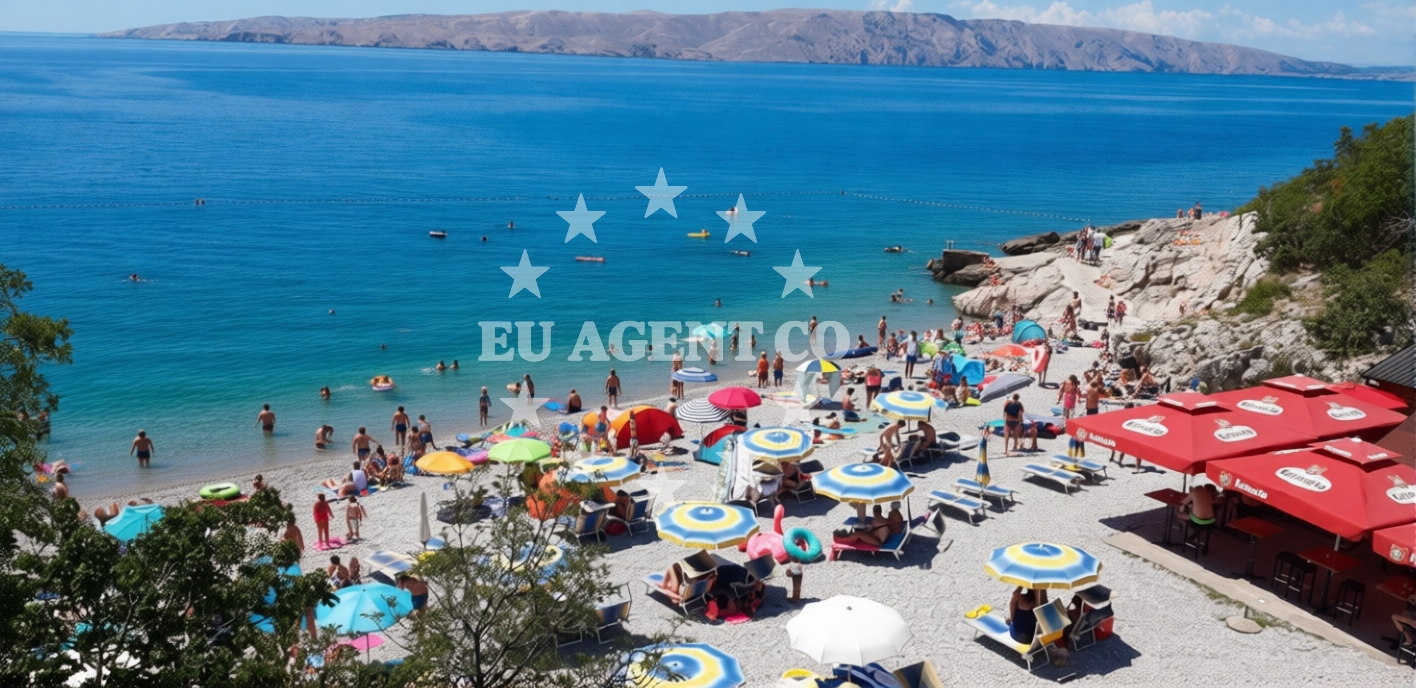
Beach character
The beach is defined by its pebble-covered shore, with small pebbles forming the primary surface. Natural shade is provided by nearby cliffs and mountains, creating a microclimate that remains cooler during peak summer months. The seabed slopes smoothly toward deeper waters, ensuring safe swimming conditions for children and non-swimmers. This geological profile also supports activities like snorkeling, where the gradual depth transition allows easy access to underwater exploration.
Swimming and shore
The shallow, gently sloping seabed ensures safe swimming conditions, with water depth increasing gradually from the shore. This makes it ideal for families with young children. The pebble-covered shore requires sturdy footwear for comfortable walking, though the smooth surface of the pebbles minimizes discomfort. The absence of sand means the beach is less prone to erosion, maintaining its natural contours over time.
Facilities and activities
Crikvenica Beach supports a range of water-based activities, including stand-up paddleboarding (SUP), surfing, snorkeling, and general water entertainment. The beach’s sheltered cove and consistent wave patterns create favorable conditions for surfing, while the clear waters enhance visibility for snorkeling. No formal facilities are listed, but the natural landscape provides an unspoiled setting for these pursuits.
Access and location
Located in Senj, a town on the Kvarner Gulf, Crikvenica Beach is part of a region known for its dramatic coastal landscapes and historical significance. The area is within easy reach of the Istrian Peninsula, a popular sailing destination. While specific access details like parking are not documented, the beach’s proximity to Senj’s infrastructure suggests accessibility via local roads. For precise navigation, the beaches map provides geographic context.
What to expect
Crikvenica Beach offers a tranquil environment with minimal artificial development. The gray pebble shore and natural shade from cliffs create a setting that feels removed from crowded tourist hubs. Visitors can expect moderate crowd levels during peak season, with the beach’s size accommodating groups without overwhelming the space. The beach’s suitability for families is enhanced by its shallow, safe waters. For those seeking solitude, the cove’s enclosed nature provides a sense of seclusion despite its proximity to Senj.
Practical tips
Visitors should wear sturdy footwear to navigate the pebble-covered shore comfortably. The beach’s shallow waters are ideal for children, but supervision is recommended near the shoreline. The lack of formal facilities means bringing personal items like towels and sunscreen is advisable. The beach’s natural contours make it a good spot for photography, particularly during sunrise or sunset when the interplay of light on the pebbles and water is striking.
Exploring the coast by yacht
For yacht charter guests, Crikvenica Beach lies within a region of the Adriatic renowned for its sailing routes. The Kvarner Gulf and surrounding areas offer a network of anchorages, harbors, and marinas that cater to both motor and sail yachts. The proximity to the Istrian Peninsula and the town of Rijeka provides access to diverse sailing itineraries. Those interested in exploring the region’s coastal towns, islands, and marine life can use the Yacht Search tool to find available charters. The beach itself, while not a marina, is part of a coastline that supports safe anchoring and scenic sailing conditions.
Regional Context and Sailing Routes
The area around Crikvenica Beach is part of Croatia’s northern Adriatic, where the coastline transitions from rugged cliffs to more open waters. Sailing routes from Senj extend toward the Istrian Peninsula, the town of Rijeka, and the islands of Cres and Lošinj. The region’s sheltered bays and consistent winds make it a favored spot for both leisure and competitive sailing. Yacht charter guests can explore nearby anchorages such as those in the town of Opatija or the island of Rab, with Euro-Agent’s Yacht Search tool providing real-time availability and pricing.
Anchorages in the surrounding area
Anchorages near Senj and Krk offer nearby mooring options.
- Anchorage — senj — 1.0 NM from beach
- Anchorage — senj — 1.7 NM from beach
- Anchorage — senj — 1.8 NM from beach
- Mala Luka — krk — 4.2 NM from beach
- Vela Luka — krk — 4.2 NM from beach
- Anchorage — st juraj — 4.5 NM from beach
- Anchorage — zrnovnica — 5.7 NM from beach
- Anchorage — klenovica — 6.4 NM from beach
Distances are straight-line geographic distances, not sailing routes.
Mooring buoys in the surrounding area
- Jetty — krk — 4.1 NM from beach
- Jetty — krk — 4.3 NM from beach
- Quay — zrnovnica — 5.7 NM from beach
- Quay — zrnovnica — 6.2 NM from beach
- Jetty — klenovica — 6.5 NM from beach
Distances are straight-line geographic distances, not sailing routes.
Marine fuel stations
- INA — novi vinodolski — 8.9 NM from beach
- Fuel station — crikvenica — 13.5 NM from beach
- Flash — krk — 13.9 NM from beach
- Ina — krk — 14.0 NM from beach
Distances are straight-line geographic distances, not sailing routes.
Harbours in the surrounding area
Harbors in Senj and Klenovica are located close to the beach.
- Senj — 0.5 NM from beach
- St. Juraj — st juraj — 4.3 NM from beach
- Baška — baska — krk — 6.1 NM from beach
- Klenovica — 6.7 NM from beach
- Lukovo — 8.6 NM from beach
- Novi Vinodolski — 9.0 NM from beach
Distances are straight-line geographic distances, not sailing routes.
Marinas in the surrounding area
Marinas in Novi Vinodolski and Krk are situated nearby.
- Mitan Marina — novi vinodolski — 8.3 NM from beach
- Marina Novi — novi vinodolski — 9.0 NM from beach
- Marina Punat — krk — 11.7 NM from beach
- Šilo — silo — krk — 13.3 NM from beach
- ACI Marina Supetarska Draga — rab — 13.9 NM from beach
Distances are straight-line geographic distances, not sailing routes.
Restaurants near the beach
- Riva — senj — 0.5 NM from beach
- Mala Luka — krk — 4.2 NM from beach
- Vela Luka — krk — 4.3 NM from beach
Distances are straight-line geographic distances, not sailing routes.
Navigation guides for the surrounding area
Navigation guides for Senj and Uvala Sv. Jelena assist in local sailing routes.
- Senj — 0.6 NM from beach
- Uvala Sv. Jelena — 1.0 NM from beach
- Uvala Vela Luka — 3.9 NM from beach
- Jurjevo (Luka Sv. Juraj) — 4.2 NM from beach
- Baška — 5.9 NM from beach
Distances are straight-line geographic distances, not sailing routes.
Yachts from nearby departure bases
Sailing yachts
- Bavaria C38 (Mila) — Vinodolski Novi Marina — 9.0 NM from departure base to beach
- Bavaria Cruiser 37 (Maci) — Vinodolski Novi Marina — 9.0 NM from departure base to beach
- Elan 40 Impression (AVISA) — Vinodolski Novi Marina — 9.0 NM from departure base to beach
- Oceanis 50 (Elise) — Vinodolski Novi Marina — 9.0 NM from departure base to beach
Catamarans
- Lagoon 40 (Paco) — Vinodolski Novi Marina — 9.0 NM from departure base to beach
- Lagoon 380 (Queen Mia) — Vinodolski Novi Marina — 9.0 NM from departure base to beach
- Bali 4.6 (MY QUEEN) — Vinodolski Novi Marina — 9.0 NM from departure base to beach
- Aventura 37 (THOMAS) — Vinodolski Novi Marina — 9.0 NM from departure base to beach
Motor yachts
- Galeon 700 (Obsession two) — Vinodolski Novi Mitan Marina — 8.3 NM from departure base to beach
Motor boats
- Adriana 36 (Gaja) — Vinodolski Novi Marina — 9.0 NM from departure base to beach
Distances are straight-line geographic distances, not sailing routes.