Crikvenica Beach, Croatia
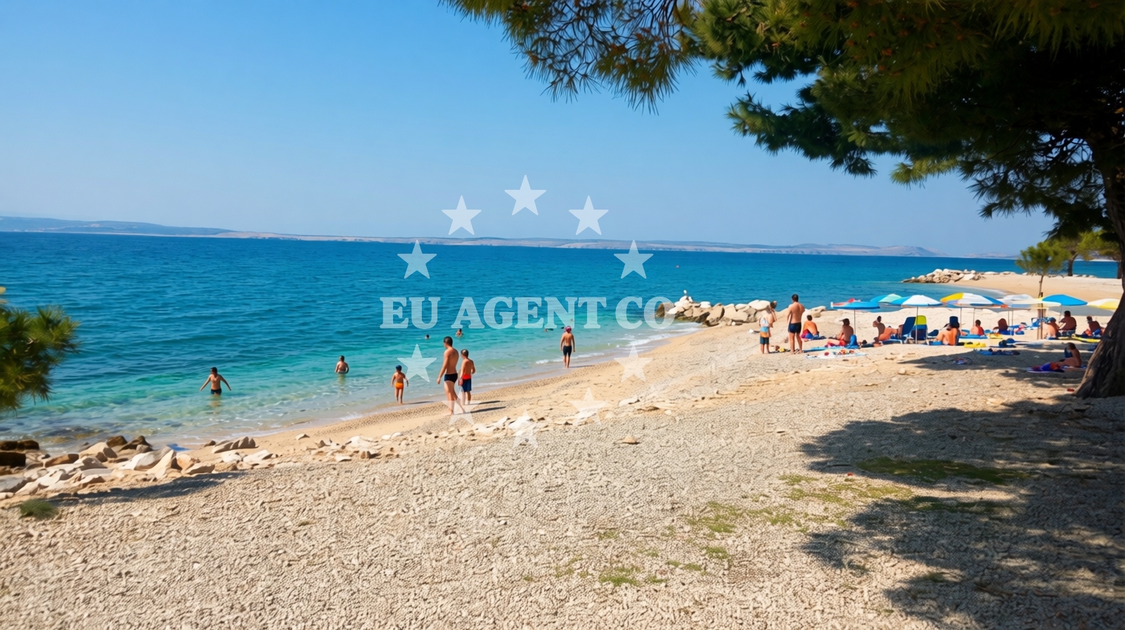
Beach character
The beach features a straight shoreline with a width of 30 meters, characterized by a mix of beige sand and pebbles. The seabed consists of sand and large boulders, with a moderate depth increase. Natural shade is available along parts of the beach, providing some relief from direct sunlight. The beach is noted for its accessibility to travelers with dogs, though dedicated areas for pets are indicated via information signs.Swimming and shore
Swimming conditions are influenced by the seabed composition, which includes sand and boulders. The depth increases moderately along the shore, making it suitable for a range of water activities. The beach's natural landscape offers a mix of open areas and shaded spots, though the overall cleanliness index is reported as very poor, which may affect the overall experience for visitors.Facilities and activities
Crikvenica Beach is associated with several water-based activities, including diving, stand-up paddleboarding (SUP), surfing, snorkeling, parasailing, jetskiing, and general water entertainment. While no specific facilities such as showers, restrooms, or parking are mentioned in the beach's authoritative features, the surrounding area of Crikvenica offers infrastructure typical of coastal towns in the region.Access and location
Located at 39 Ulica kralja Zvonimira in Crikvenica, the beach is accessible via local roads connecting to the town and broader Istrian Peninsula. The coordinates (45.17582, 14.68544) place it within a region known for its coastal tourism and maritime activities. Nearby, the town of Crikvenica provides amenities and services for visitors, including accommodations and dining options.What to expect
Crikvenica Beach is best suited for travelers seeking leisure activities and those with pets, as the beach allows dogs in designated areas. The beach's natural features, including its mix of sand and pebbles, create a unique setting for water sports. However, visitors should be prepared for a high crowd index during peak season and note the reported cleanliness challenges. The area is well-connected to the surrounding coast, which is popular among yacht charter guests exploring the Adriatic.Practical tips
Given the beach's reported cleanliness index, visitors may wish to bring additional supplies for personal hygiene. The presence of pebbles along parts of the shoreline suggests that water shoes could be useful for comfort. Travelers with dogs should follow the designated area signs to ensure compliance with local guidelines.Exploring the coast by yacht
The coastal region surrounding Crikvenica is a well-established sailing area, with marinas and anchorages accessible to motor yachts and sailing boats. Yacht charter guests exploring this part of the Adriatic may find the proximity to Crikvenica Beach a convenient stop for shore excursions. For more details on available yachts and sailing itineraries, visitors can use the Euro-Agent Yacht Search page to explore options in the region.Regional Context and Coastal Tourism
Crikvenica is part of the Istrian Peninsula, a region renowned for its coastal landscapes, historic towns, and maritime traditions. The area is a popular destination for both domestic and international tourists, with a focus on sailing, fishing, and cultural heritage. The beach's location near the town center makes it a convenient starting point for exploring nearby attractions, including vineyards, historic sites, and other beaches along the coast.Anchorages in the surrounding area
Anchorages in the surrounding area include Dramalj, Kacjak, Silo, and Krk, situated near Crikvenica beach.
- Anchorage — dramalj — 1.3 NM from beach
- Anchorage — kacjak — 2.1 NM from beach
- Anchorage — silo — krk — 2.1 NM from beach
- Anchorage — kacjak — 2.3 NM from beach
- Anchorage — krk — 2.7 NM from beach
- Anchorage — selce — 2.9 NM from beach
- Anchorage — krk — 3.1 NM from beach
- Anchorage — krk — 3.4 NM from beach
Distances are straight-line geographic distances, not sailing routes.
Mooring buoys in the surrounding area
Mooring buoys and jetties in the vicinity include Crikvenica buoy field and jetties in Dramalj and Selce, close to the beach.
- Buoy field — crikvenica — 0.2 NM from beach
- Jetty — dramalj — 1.3 NM from beach
- Jetty — dramalj — 1.3 NM from beach
- Jetty — selce — 1.6 NM from beach
- Buoy field — selce — 1.8 NM from beach
Distances are straight-line geographic distances, not sailing routes.
Marine fuel stations
- Fuel station — crikvenica — 0.4 NM from beach
- INA — novi vinodolski — 5.3 NM from beach
- Flash — krk — 10.3 NM from beach
- Ina — krk — 10.3 NM from beach
Distances are straight-line geographic distances, not sailing routes.
Harbours in the surrounding area
Harbors nearby include Crikvenica, Podvorska, Selce, and Šilo, located in the surrounding area of the beach.
- Crikvenica — 0.2 NM from beach
- Podvorska — crikvenica — 0.4 NM from beach
- Selce — 1.8 NM from beach
- Šilo — silo — krk — 1.9 NM from beach
- Klimno — krk — 3.1 NM from beach
- Slivanjska — rudine — krk — 3.1 NM from beach
Distances are straight-line geographic distances, not sailing routes.
Marinas in the surrounding area
Marinas in the area include Šilo, Marina Novi, and Omišalj Docks, situated near Crikvenica beach.
- Šilo — silo — krk — 1.7 NM from beach
- Marina Novi — novi vinodolski — 5.2 NM from beach
- Omišalj Docks — omisalj — krk — 6.0 NM from beach
- Mitan Marina — novi vinodolski — 6.1 NM from beach
- Marina Punat — krk — 9.1 NM from beach
Distances are straight-line geographic distances, not sailing routes.
Restaurants near the beach
Restaurants near the beach include Tamaris and other dining options in Crikvenica and Krk.
- Tamaris — crikvenica — 0.2 NM from beach
- Restaurant — crikvenica — 0.5 NM from beach
- Restaurant — silo — krk — 1.9 NM from beach
- Restaurant — silo — krk — 1.9 NM from beach
- Restaurant — silo — krk — 2.0 NM from beach
- Zal — klimno — krk — 3.0 NM from beach
- Val — klimno — krk — 3.0 NM from beach
Distances are straight-line geographic distances, not sailing routes.
Navigation guides for the surrounding area
Navigation guides cover areas such as Crikvenica, Uvala Stipanja, and Se Ice, relevant to the surrounding waters.
- Crikvenica — 0.5 NM from beach
- Uvala Stipanja {Silo) — 1.6 NM from beach
- Se Ice — 2.0 NM from beach
- Uvala Siana — 2.3 NM from beach
- Uvala Jasenova — 3.1 NM from beach
Distances are straight-line geographic distances, not sailing routes.
Yachts from nearby departure bases
Yachts depart from nearby bases including Crikvenica City Port and Vinodolski Novi Marina, offering access to the area.
Sailing yachts
- Elan 40 Impression (AVISA) — Vinodolski Novi Marina — 5.2 NM from departure base to beach
- Bavaria C38 (Popaj) — Vinodolski Novi Marina — 5.2 NM from departure base to beach
- Sun Odyssey 33i (Paola) — Vinodolski Novi Marina — 5.2 NM from departure base to beach
- Oceanis 43 (Josefina) — Vinodolski Novi Marina — 5.2 NM from departure base to beach
Catamarans
- Excess 12 (Kiss Me Twice) — Vinodolski Novi Marina — 5.2 NM from departure base to beach
- Lagoon 380 (Queen Mia) — Vinodolski Novi Marina — 5.2 NM from departure base to beach
- Lagoon 40 (Paco) — Vinodolski Novi Marina — 5.2 NM from departure base to beach
Motor boats
- Barracuda 590 (Barracuda 12) — Crikvenica City Port — 0.6 NM from departure base to beach
- Barracuda 590 (Solta) — Crikvenica City Port — 0.6 NM from departure base to beach
- Adriana 36 (Gaja) — Vinodolski Novi Marina — 5.2 NM from departure base to beach
Distances are straight-line geographic distances, not sailing routes.