Čeprljanda Sjever, Ugljan Beach, Croatia
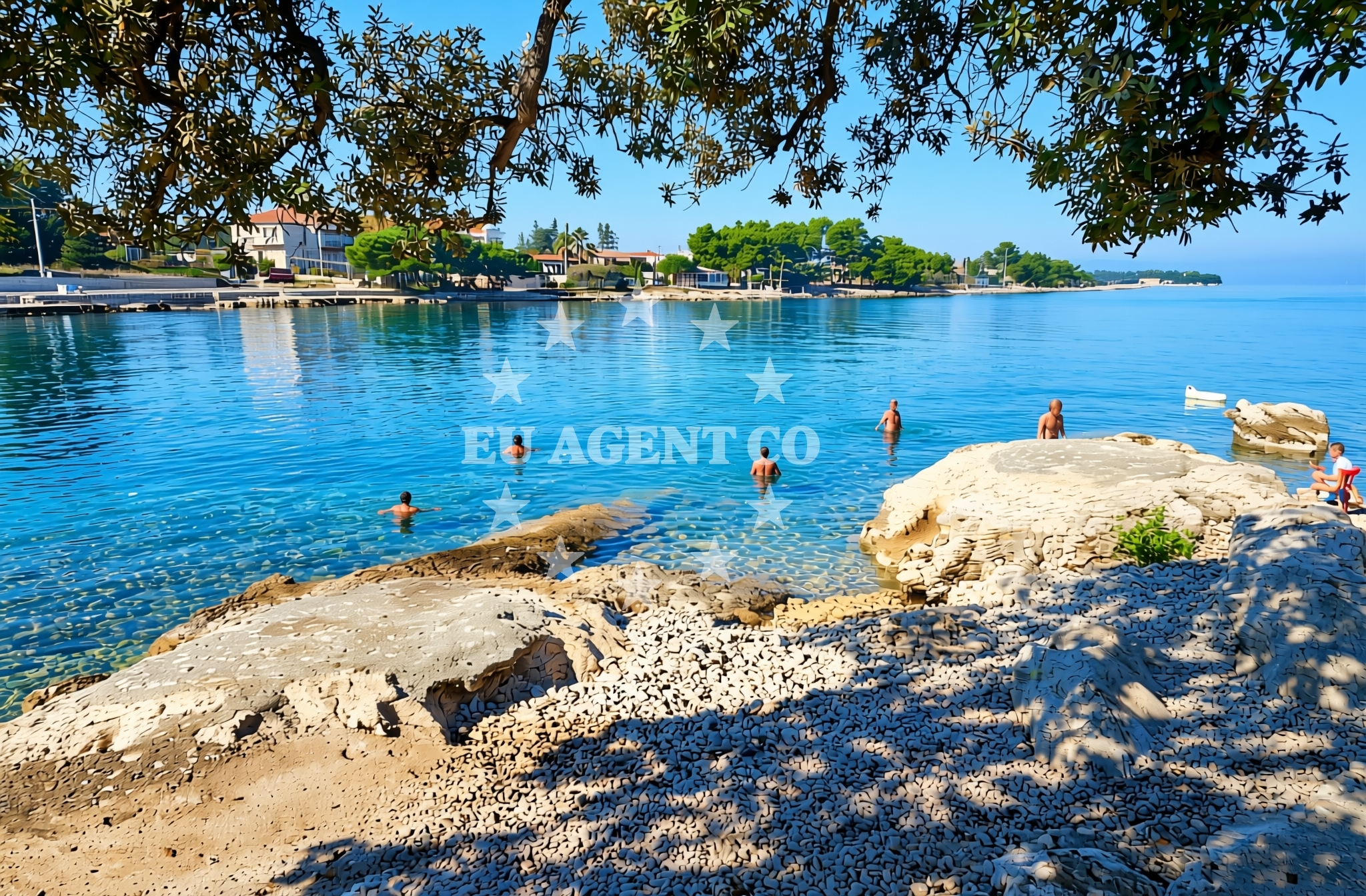
About this beach
Čeprljanda sjever, Ugljan (Ugljan)
Beach: Čeprljanda sjever
Location: Ugljan (Ugljan)
Characteristics and facilities
Gravel, concrete / stone slabs, rocks
Restaurant / snack bar
Caffe bar / Drinks stand
Beach character
The beach’s surface is dominated by gravel and rocky sections, which define its accessibility and use. These features make it more suitable for short walks or as a vantage point rather than for extended sunbathing. The rocky terrain suggests that swimming may be limited to specific areas where the seabed is less obstructed. The beach’s character is shaped by its position on Ugljan, an island known for its historical ties to the Roman Empire and its role in Croatia’s medieval maritime history. The surrounding waters, part of the Adriatic Sea’s broader sailing network, offer visibility into the region’s nautical significance.Swimming and shore
Swimming conditions at Čeprljanda Sjever are influenced by the beach’s rocky and gravelly shoreline. While the sea itself is part of the Adriatic’s generally calm waters, the immediate shore may present challenges for swimmers due to uneven surfaces. The beach does not feature dedicated swimming zones, lifeguards, or safety equipment, which aligns with its low-key profile. The shore’s composition suggests that visitors should exercise caution when entering the water, particularly near the rocky sections. The nearby restaurant and café provide a convenient option for those seeking to enjoy the coastal setting without venturing into the sea.Facilities and activities
The beach is equipped with a restaurant and a café, both of which are essential for visitors seeking sustenance or refreshments. These facilities are positioned to serve the immediate needs of beachgoers, though they do not extend to amenities like showers, changing rooms, or parking. The absence of additional infrastructure reflects the beach’s modest scale and its role as a supplementary stop for those exploring Ugljan’s coastline. Activities associated with the beach are limited to passive enjoyment of the shoreline and the use of nearby facilities. There is no indication of organized recreational programs or rental services for water sports.Access and location
Situated on Ugljan Island, Čeprljanda Sjever is accessible by road or boat, depending on the visitor’s starting point. Ugljan itself is part of the Zadar archipelago, a cluster of islands in the northern Adriatic that includes larger destinations like Zadar and smaller islets such as Šćepanovo and Kukljica. The beach’s location places it within proximity to Zadar’s historic Old Town, which is approximately 20 kilometers to the northwest. Visitors arriving by car may need to navigate local island roads, while those arriving by boat can anchor in nearby bays or use marinas on Ugljan, such as the one in the village of Škrip. The beach’s position on the island’s northern coast makes it a potential waypoint for sailors exploring the region’s coastal routes.What to expect
Visitors to Čeprljanda Sjever should expect a beach that prioritizes natural terrain over comfort-focused amenities. The gravel and rocky surfaces define the shoreline, making it more suitable for brief visits or as a scenic overlook rather than for prolonged relaxation. The presence of a restaurant and café ensures that visitors can obtain food and drinks, though these facilities are not extensive. The beach’s character is shaped by its position on Ugljan, an island with historical and cultural significance. Those planning to visit should consider the beach’s practical nature, its limited facilities, and its role as a quieter alternative to more developed coastal spots on the island.Practical tips
Given the beach’s rocky and gravelly terrain, visitors may want to wear sturdy footwear for walking along the shore. The restaurant and café are the primary on-site facilities, so those seeking more extensive amenities may need to travel to nearby settlements on Ugljan. The beach’s lack of dedicated swimming areas means that visitors should assess water conditions carefully before entering the sea.Exploring the coast by yacht
For yacht charter guests, Čeprljanda Sjever’s location on Ugljan offers a strategic position within the northern Adriatic’s sailing network. The island is part of a route that connects Zadar, the nearby mainland, and other islands in the Zadar archipelago. Yacht charterers may find the beach a useful reference point for navigating the area, particularly when anchoring in nearby bays or using marinas on Ugljan. The Adriatic’s generally favorable sailing conditions make this region a popular choice for charter trips, and the beach’s proximity to Zadar’s historic sites adds cultural value to the journey.Historical Context of Ugljan Island
Ugljan, the island where Čeprljanda Sjever is located, has a history dating back to Roman times, with archaeological evidence of settlements from the 1st century BCE. The island was later influenced by Byzantine and Venetian rule, leaving behind a legacy of fortifications and maritime traditions. Today, Ugljan is known for its olive groves and vineyards, which contribute to the region’s agricultural identity. The island’s coastline, including spots like Čeprljanda Sjever, reflects its long-standing relationship with the sea, serving as both a practical and symbolic boundary between land and water.Anchorages in the surrounding area
Nearby anchorages include Ceprljanda and Ugljan, located within 1.22 nautical miles of Čeprljanda sjever, Ugljan (Ugljan) Beach.
- Anchorage — ceprljanda — ugljan — 0.2 NM from beach
- Anchorage — ugljan — 1.0 NM from beach
- Anchorage — ugljan — 1.0 NM from beach
- Anchorage — ugljan — 1.1 NM from beach
- Anchorage — ugljan — 1.2 NM from beach
- Anchorage — ugljan — 1.2 NM from beach
- Anchorage — muline — ugljan — 2.0 NM from beach
- Anchorage — muline — ugljan — 2.2 NM from beach
Distances are straight-line geographic distances, not sailing routes.
Mooring buoys in the surrounding area
Mooring buoys and jetties such as Jetty — ugljan and Buoy field Muline — ugljan are situated within 2.23 nautical miles of the beach.
- Jetty — ugljan — 1.1 NM from beach
- Buoy field Muline — ugljan — 2.2 NM from beach
- Buoy field — muline — ugljan — 2.2 NM from beach
- Jetty — iz veli — 4.1 NM from beach
- Punta Skala — petrcane — 4.2 NM from beach
Distances are straight-line geographic distances, not sailing routes.
Marine fuel stations
- Ina — preko — ugljan — 4.4 NM from beach
- Ina — zadar — 4.8 NM from beach
- Fuel station — sukosan — 8.9 NM from beach
- Ina — zaglav — dugi otok — 10.6 NM from beach
Distances are straight-line geographic distances, not sailing routes.
Harbours in the surrounding area
Harbours such as Čeprljanda — ceprljanda — ugljan and Ugljan are located within 0.52 nautical miles of the beach.
- Čeprljanda — ceprljanda — ugljan — 0.0 NM from beach
- Ugljan — 0.5 NM from beach
- Lukoran — ugljan — 2.0 NM from beach
- Muline — ugljan — 2.1 NM from beach
- Sutomišćica — sutomiscica — ugljan — 2.8 NM from beach
- Poljana — ugljan — 3.5 NM from beach
Distances are straight-line geographic distances, not sailing routes.
Marinas in the surrounding area
- Olive Island Marina — sutomiscica — ugljan — 2.9 NM from beach
- Marina Borik — zadar — 4.0 NM from beach
- Marina Preko — ugljan — 4.1 NM from beach
- Vitrenjak Zadar — 4.3 NM from beach
- Marina Veli Iž — iz veli — 4.5 NM from beach
Distances are straight-line geographic distances, not sailing routes.
Restaurants near the beach
Restaurants like Kaleta — ugljan and Pizzaria Muline — ugljan are located within 2.1 nautical miles of the beach.
- Kaleta — ugljan — 0.6 NM from beach
- Trapula — ugljan — 0.6 NM from beach
- Apollo — ugljan — 0.6 NM from beach
- Pizzaria Muline — ugljan — 2.0 NM from beach
- Stivon — muline — ugljan — 2.1 NM from beach
- Kažot — muline — ugljan — 2.1 NM from beach
- Olive Garden — sutomiscica — ugljan — 2.9 NM from beach
Distances are straight-line geographic distances, not sailing routes.
Navigation guides for the surrounding area
- Ugljan — 0.3 NM from beach
- Ceprljanda — 0.4 NM from beach
- Lukoran Veli — 2.1 NM from beach
- Muline — 2.1 NM from beach
- Marina (Marina Maslina) — 3.0 NM from beach
Distances are straight-line geographic distances, not sailing routes.
Yachts from nearby departure bases
Sailing yachts
- Elan Impression 40 (Val) — Ugljan Sutomišćica Olive Island — 2.9 NM from departure base to beach
- Dufour 460 (Proizd) — Zadar Marina Borik — 4.0 NM from departure base to beach
- Bavaria Cruiser 37 (Lupe) — Zadar Marina Borik — 4.0 NM from departure base to beach
Catamarans
- Leopard 50 (Solaia) — Zadar Marina Borik — 4.0 NM from departure base to beach
- Sunreef 60 (SINATA) — Zadar Marina Borik — 4.0 NM from departure base to beach
Motor yachts
- Prestige 460 (ADUDU 2) — Zadar Marina Borik — 4.0 NM from departure base to beach
- Prestige 550 Fly (Floria) — Zadar Marina Borik — 4.0 NM from departure base to beach
Motor boats
- Quicksilver Activ 905 (Galeb) — Ugljan Sutomišćica Olive — 2.9 NM from departure base to beach
- Merry Fisher 895 (Ohana) — Zadar Marina Borik — 4.0 NM from departure base to beach
- Antares 9 OB (M & N) — Zadar Marina Borik — 4.0 NM from departure base to beach
Distances are straight-line geographic distances, not sailing routes.