Čeprljanda jug, Ugljan (Ugljan) Beach, Croatia
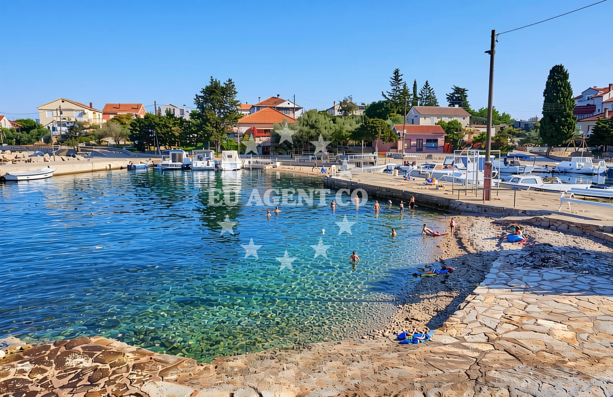
About this beach
Čeprljanda jug, Ugljan (Ugljan)
Beach: Čeprljanda jug
Location: Ugljan (Ugljan)
Characteristics and facilities
Gravel, concrete / stone slabs
Restaurant / snack bar
Caffe bar / Drinks stand
Beach character
The beach’s terrain consists of gravel and stone slabs, creating a distinct contrast to the sandy shores typical of many Mediterranean beaches. This rocky composition suggests a more utilitarian or less conventional use for swimming, though the area’s natural features may appeal to those seeking a different kind of coastal experience. Nearby, a restaurant/snack bar and a café bar/drinks stand provide basic amenities for visitors.Swimming and shore
The gravel and stone slabs that define Čeprljanda jug’s shoreline may limit traditional swimming activities. However, the beach’s presence on Ugljan—a historically significant island in the Adriatic—connects it to a broader network of maritime routes and coastal settlements. The lack of detailed natural features in the catalog means specific conditions for water access or shore stability are not provided.Facilities and activities
The beach is equipped with a restaurant/snack bar and a café bar/drinks stand, offering visitors the opportunity to enjoy meals or refreshments. These facilities are likely positioned to serve tourists and locals, though no details about their operating hours or seasonal availability are included in the catalog.Access and location
Ugljan, where Čeprljanda jug is located, is part of Croatia’s Split-Dalmatia County and lies near the islands of Hvar and Brač. The island is accessible by ferry from the mainland and is known for its vineyards and olive groves. The beach’s position on Ugljan places it within a sailing area that includes the broader Adriatic coast, though specific navigational details are not outlined in the catalog.What to expect
Čeprljanda jug is a beach with a distinct rocky shoreline, suitable for those interested in non-traditional coastal environments. The presence of a restaurant/snack bar and café bar/drinks stand indicates basic catering for visitors. The beach’s location on Ugljan, an island with historical and agricultural significance, connects it to the broader Dalmatian coast, which is a hub for maritime activity and yacht charter opportunities.Practical tips
Visitors should consider the gravel and stone slabs when planning activities, as they may affect comfort during walks or sunbathing. The nearby amenities suggest that the beach is accessible for short stays, though further details about parking or seasonal closures are not provided in the catalog.Exploring the coast by yacht
The Dalmatian coast, including Ugljan, is a popular region for yacht charters, with its clear waters and proximity to islands like Hvar and Brač. While Čeprljanda jug itself is not described as an anchorage or marina, the surrounding area offers opportunities for sailing and exploration. For more information on nearby coastal points, visitors can consult Euro-Agent’s beaches map.Cultural and Historical Context of Ugljan
Ugljan has a rich history dating back to ancient times, with evidence of Greek and Roman settlements. The island is also known for its production of high-quality wine and olive oil, which are integral to the local economy. This cultural backdrop adds depth to the experience of visiting Čeprljanda jug, which is part of a landscape shaped by centuries of maritime and agricultural activity.Anchorages in the surrounding area
Anchorages near Čeprljanda jug include the nearby ceprljanda anchorage and several others within 2.2 nautical miles in Ugljan.
- Anchorage — ceprljanda — ugljan — 0.2 NM from beach
- Anchorage — ugljan — 1.0 NM from beach
- Anchorage — ugljan — 1.0 NM from beach
- Anchorage — ugljan — 1.1 NM from beach
- Anchorage — ugljan — 1.1 NM from beach
- Anchorage — ugljan — 1.2 NM from beach
- Anchorage — muline — ugljan — 2.0 NM from beach
- Anchorage — muline — ugljan — 2.2 NM from beach
Distances are straight-line geographic distances, not sailing routes.
Mooring buoys in the surrounding area
Mooring buoys in the surrounding area feature the jetty in Ugljan and buoy fields in Muline, located up to 2.2 nautical miles away.
- Jetty — ugljan — 1.1 NM from beach
- Buoy field Muline — ugljan — 2.2 NM from beach
- Buoy field — muline — ugljan — 2.2 NM from beach
- Jetty — iz veli — 4.1 NM from beach
- Punta Skala — petrcane — 4.2 NM from beach
Distances are straight-line geographic distances, not sailing routes.
Marine fuel stations
- Ina — preko — ugljan — 4.4 NM from beach
- Ina — zadar — 4.8 NM from beach
- Fuel station — sukosan — 8.9 NM from beach
- Ina — zaglav — dugi otok — 10.6 NM from beach
Distances are straight-line geographic distances, not sailing routes.
Harbours in the surrounding area
The closest harbour is Čeprljanda in Ugljan, just 0.02 nautical miles from Čeprljanda jug.
- Čeprljanda — ceprljanda — ugljan — 0.0 NM from beach
- Ugljan — 0.5 NM from beach
- Lukoran — ugljan — 2.0 NM from beach
- Muline — ugljan — 2.1 NM from beach
- Sutomišćica — sutomiscica — ugljan — 2.8 NM from beach
- Poljana — ugljan — 3.5 NM from beach
Distances are straight-line geographic distances, not sailing routes.
Marinas in the surrounding area
- Olive Island Marina — sutomiscica — ugljan — 2.9 NM from beach
- Marina Borik — zadar — 4.0 NM from beach
- Marina Preko — ugljan — 4.1 NM from beach
- Vitrenjak Zadar — 4.3 NM from beach
- Marina Veli Iž — iz veli — 4.5 NM from beach
Distances are straight-line geographic distances, not sailing routes.
Restaurants near the beach
Restaurants near the beach include Kaleta, Trapula, and Apollo, all within 0.59 nautical miles in Ugljan.
- Kaleta — ugljan — 0.6 NM from beach
- Trapula — ugljan — 0.6 NM from beach
- Apollo — ugljan — 0.6 NM from beach
- Pizzaria Muline — ugljan — 2.0 NM from beach
- Stivon — muline — ugljan — 2.1 NM from beach
- Kažot — muline — ugljan — 2.1 NM from beach
- Olive Garden — sutomiscica — ugljan — 2.9 NM from beach
Distances are straight-line geographic distances, not sailing routes.
Navigation guides for the surrounding area
Navigation guides cover areas such as Ceprljanda and Lukoran Veli, situated within 2.05 nautical miles of the beach.
- Ceprljanda — 0.4 NM from beach
- Ugljan — 0.4 NM from beach
- Lukoran Veli — 2.0 NM from beach
- Muline — 2.1 NM from beach
- Marina (Marina Maslina) — 3.0 NM from beach
Distances are straight-line geographic distances, not sailing routes.
Yachts from nearby departure bases
Sailing yachts
- Elan Impression 40 (Val) — Ugljan Sutomišćica Olive Island — 2.9 NM from departure base to beach
- Dufour 560 (Anatoli) — Zadar Marina Borik — 4.0 NM from departure base to beach
- Dufour 450 Grand (Paklenica) — Zadar Marina Borik — 4.0 NM from departure base to beach
Catamarans
- Leopard 50 (Solaia) — Zadar Marina Borik — 4.0 NM from departure base to beach
- Sunreef 60 (SINATA) — Zadar Marina Borik — 4.0 NM from departure base to beach
Motor yachts
- Prestige 550 Fly (Floria) — Zadar Marina Borik — 4.0 NM from departure base to beach
- Ferretti 780 (TESORO) — Zadar Marina Borik — 4.0 NM from departure base to beach
Motor boats
- Quicksilver Activ 905 (Galeb) — Ugljan Sutomišćica Olive — 2.9 NM from departure base to beach
- Merry Fisher 895 (Joy) — Zadar Marina Borik — 4.0 NM from departure base to beach
- Merry Fisher 795 (KlaPa) — Zadar Marina Borik — 4.0 NM from departure base to beach
Distances are straight-line geographic distances, not sailing routes.