Celebanovo istok, Milohnići (Krk) Beach, Croatia
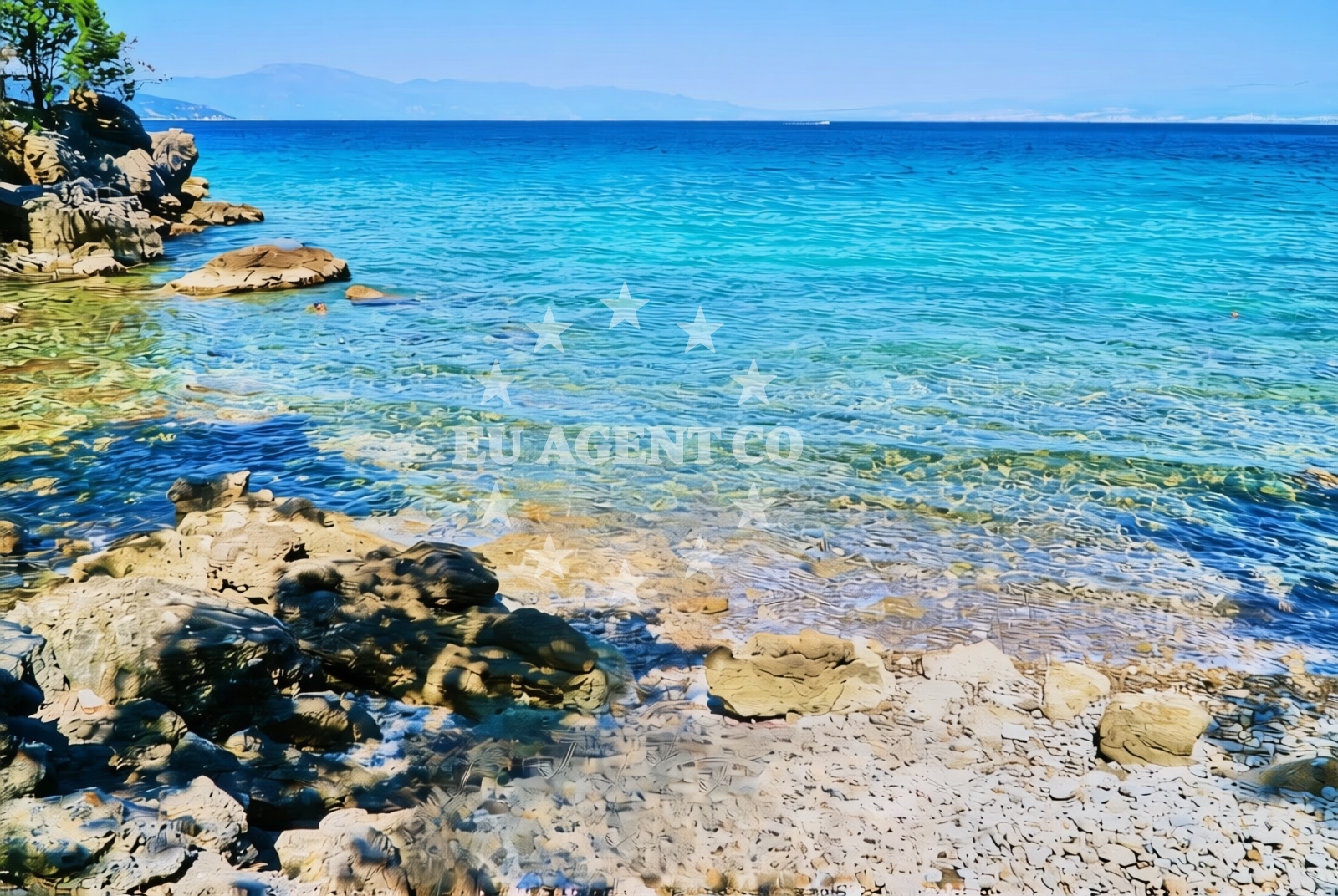
Celebanovo istok, located in the village of Milohnići on the island of Krk, is a short, gravelly shoreline that offers a quiet contrast to the more developed beaches of the northern Adriatic. Situated along the eastern coast of Krk, this beach is part of a rugged coastline characterized by rocky outcrops and shallow waters. While not ideal for swimming, it provides a unique vantage point for observing the interplay between land and sea in this part of the Adriatic. The beach’s natural shade, formed by coastal topography, offers a rare respite from direct sunlight in an otherwise exposed location.
About this beach
Celebanovo istok, Milohnići (Krk)
Beach: Celebanovo istok
Location: Milohnići (Krk)
Characteristics and facilities
Gravel, rocks
20 m
Natural shade
Beach character
The beach consists of gravel and loose rock, with a length of approximately 20 meters. The composition makes it unsuitable for traditional sunbathing but creates a stable surface for walking along the shore. The natural shade, likely provided by a combination of coastal vegetation and the beach’s orientation, is a notable feature for visitors seeking partial relief from the sun. The immediate shoreline is marked by shallow waters that recede quickly, exposing a mix of pebbles and larger stones. This type of beach is typical of Krk’s eastern coast, where the island’s geological history has shaped a landscape of cliffs and rocky inlets.
Swimming and shore
Swimming is not recommended at Celebanovo istok due to the gravelly seabed and shallow waters. The shoreline is more suited for leisurely walks, where visitors can observe the intertidal zone and the patterns of wave action against the rocks. The beach’s short length means it is best experienced as a brief stop during a coastal exploration. The natural shade provides a practical benefit for those who wish to avoid prolonged sun exposure, though the area lacks formal amenities such as seating or umbrellas.
Facilities and activities
No formal facilities are present at Celebanovo istok. The absence of infrastructure aligns with its status as a minor shoreline within the broader Milohnići area. Activities are limited to passive observation of the coastal environment, though the nearby village of Milohnići offers access to Krk’s cultural and historical sites. The beach’s proximity to the main road connecting Krk to the mainland makes it a potential waypoint for drivers exploring the island’s eastern coast.
Access and location
Celebanovo istok is located on the eastern side of Krk, a large island in the northern Adriatic. The beach is accessible via the main road that runs along the island’s coast, which connects to the ferry terminal in Krk Town. This positioning places it within reach of both local residents and visitors traveling by car or ferry. The beach’s remoteness from major settlements contributes to its quiet character, though it remains within a short drive of Krk’s more populated areas, including the island’s administrative center.
What to expect
Celebanovo istok is a modest shoreline that reflects the natural contours of Krk’s eastern coast. Visitors should expect a gravelly beach with limited space for relaxation, best suited for brief stops during a coastal drive. The natural shade is a practical feature for those seeking temporary relief from the sun, though the beach lacks formal amenities. The surrounding area offers opportunities to explore Krk’s rural landscapes, with the village of Milohnići serving as a nearby hub for basic services and historical landmarks.
Practical tips
Visitors should wear sturdy footwear to navigate the gravelly surface and consider bringing a towel or mat for comfort. The natural shade can be utilized during midday hours, but sun protection is still recommended. Due to the beach’s short length, it is advisable to combine a visit with exploration of nearby areas, such as the village of Milohnići or the island’s eastern cliffs.
Exploring the coast by yacht
The proximity of Celebanovo istok to Krk’s main road and ferry connections makes it a potential reference point for sailors exploring the island’s coastline. Charter yachts navigating the northern Adriatic often pass through this area, using Krk as a base for trips to the Istrian Peninsula or the Kvarner Gulf. While the beach itself is not a designated anchorage, the surrounding waters are part of a sailing route that includes marinas in Krk Town and the nearby island of Rab. Yacht charter guests may use this area as a vantage point to observe the island’s rugged eastern shore.
Geological Context of Krk’s Eastern Coast
The rocky shoreline of Celebanovo istok is representative of Krk’s eastern coast, where the island’s geological history has shaped a landscape of cliffs and shallow bays. The island’s position at the northern end of the Adriatic Sea exposes it to strong winds and wave action, contributing to the formation of its rugged coastline. This geological character is evident in the beach’s gravelly composition and the absence of sandy stretches, which are more common in sheltered bays further south on the island.
Anchorages in the surrounding area
Anchorages in Krk, including Glavotok and Porat, are within a few nautical miles of Celebanovo istok, Milohnići (Krk) Beach.
- Anchorage — krk — 0.4 NM from beach
- Anchorage — krk — 0.4 NM from beach
- Camp Glavotok — krk — 1.0 NM from beach
- Anchorage — porat — krk — 2.0 NM from beach
- Anchorage — malinska — krk — 2.2 NM from beach
- Anchorage — krk — 2.3 NM from beach
- Anchorage — krk — 2.5 NM from beach
- Anchorage — pinezici — krk — 3.3 NM from beach
Distances are straight-line geographic distances, not sailing routes.
Mooring buoys in the surrounding area
Mooring buoys in Glavotok and Pinezici, part of Krk, are situated near Celebanovo istok, Milohnići (Krk) Beach.
- Camp Glavotok — krk — 0.9 NM from beach
- Jetty — pinezici — krk — 3.1 NM from beach
- Jetty — pinezici — krk — 3.2 NM from beach
- Buoy field — pinezici — krk — 3.6 NM from beach
- Jetty — pinezici — krk — 3.6 NM from beach
Distances are straight-line geographic distances, not sailing routes.
Marine fuel stations
- OMV — krk — 4.4 NM from beach
- Ina — krk — 6.4 NM from beach
- Flash — krk — 6.5 NM from beach
- Fuel station — cres — 8.6 NM from beach
Distances are straight-line geographic distances, not sailing routes.
Harbours in the surrounding area
Harbors like Glavotok and Porat in Krk are within a few nautical miles of Celebanovo istok, Milohnići (Krk) Beach.
- Glavotok — krk — 1.2 NM from beach
- Porat — krk — 2.1 NM from beach
- Vantačić — vantacic — vantacici — 2.2 NM from beach
- Club Harbour — krk — 2.3 NM from beach
- Haludovo — malinska — krk — 3.5 NM from beach
- Haludovo — malinska — krk — 3.5 NM from beach
Distances are straight-line geographic distances, not sailing routes.
Marinas in the surrounding area
- Omišalj Docks — omisalj — krk — 7.7 NM from beach
- Marina Punat — krk — 8.1 NM from beach
- ACI Marina Cres — 9.2 NM from beach
- Šilo — silo — krk — 9.4 NM from beach
- Marina Novi — novi vinodolski — 13.9 NM from beach
Distances are straight-line geographic distances, not sailing routes.
Restaurants near the beach
Restaurants in Porat and Malinska, part of Krk, are located near Celebanovo istok, Milohnići (Krk) Beach.
- Gostiona Sidro — porat — krk — 2.0 NM from beach
- Picolla Venezia — porat — krk — 2.0 NM from beach
- Porat — krk — 2.0 NM from beach
- Restaurant Obala — malinska — krk — 3.2 NM from beach
- Restaurant — pinezici — krk — 3.5 NM from beach
- Restaurant — malinska — krk — 3.6 NM from beach
- Restaurant — malinska — krk — 3.6 NM from beach
Distances are straight-line geographic distances, not sailing routes.
Navigation guides for the surrounding area
- Uvala Cavlena — 0.5 NM from beach
- Uvala Vala Jana — 2.2 NM from beach
- Luka Torkul — 3.3 NM from beach
- Uvala Sv. Fuska — 3.7 NM from beach
- Luka Kijac — 4.5 NM from beach
Distances are straight-line geographic distances, not sailing routes.
Yachts from nearby departure bases
Sailing yachts
- Sun Odyssey 29.2 (Mirabai) — Malinska Hotel Malin port — 2.9 NM from departure base to beach
- Oceanis 40 (IMAGINE ) — Krk Marina Punat — 8.1 NM from departure base to beach
- Sun Odyssey 349 (Antonija) — Krk Marina Punat — 8.1 NM from departure base to beach
- Xp 44 (Aqua Nomis) — Krk Marina Punat — 8.1 NM from departure base to beach
Catamarans
- Lagoon 40 (Sunset) — Krk Marina Punat — 8.1 NM from departure base to beach
- Lagoon 42 (Marianne) — Krk Marina Punat — 8.1 NM from departure base to beach
Motor yachts
- Galeon 500 Fly (Barbara) — Krk Marina Punat — 8.1 NM from departure base to beach
- Elegance 60 Fly (LIFESTYLE 1) — Krk Marina Punat — 8.1 NM from departure base to beach
Motor boats
- Gobbi 425 (Lady Veronika) — Krk Marina Punat — 8.1 NM from departure base to beach
- Beneteau Flyer 9 (Beneteau 9) — Krk Marina Punat — 8.1 NM from departure base to beach
Distances are straight-line geographic distances, not sailing routes.