Burnji Kraj, Soline (Sali) (Dugi otok) Beach, Croatia
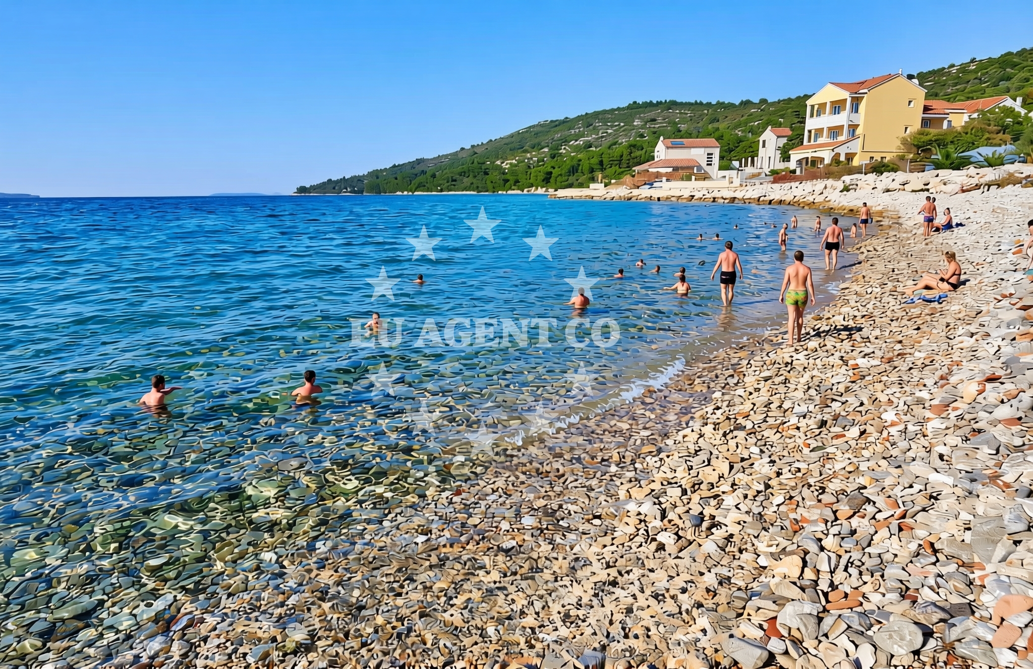
About this beach
Burnji Kraj, Soline (Sali) (Dugi otok)
Beach: Burnji Kraj
Location: Soline (Sali) (Dugi otok)
Characteristics and facilities
Gravel
Caffe bar / Drinks stand
Beach character
The beach is characterized by its gravel composition, which contrasts with the more common sandy shores of the Adriatic. This texture makes it less ideal for sunbathing but offers a unique tactile experience for visitors. The area is marked by the presence of a caffe bar or drinks stand, suggesting limited on-site refreshment options. The beach's location on Dugi Otok, one of the largest islands in the Zadar Archipelago, places it near several protected natural areas and historical sites.Swimming and shore
Swimming conditions at Burnji Kraj are influenced by the island's coastal geography. The gravel substrate may make direct entry into the water less comfortable for some visitors, though the shoreline is accessible for those seeking a more rugged coastal experience. The surrounding waters are part of the Adriatic Sea's broader ecosystem, with visibility and temperature varying seasonally. Nearby, the island's cliffs and pine forests create a dramatic backdrop, offering opportunities for photography and short walks along the shore.Facilities and activities
Facilities at the beach are minimal, with the presence of a caffe bar or drinks stand indicating the primary on-site offering. No formal showers, restrooms, or parking areas are listed in the beach catalog. The gravel surface may limit the use of beach equipment such as umbrellas or loungers. For activities, the beach's location on Dugi Otok provides access to hiking trails, cycling routes, and boat tours departing from the island's marinas. The nearby village of Sali offers additional services, including accommodations and dining options.Access and location
Burnji Kraj Beach is located on the eastern coast of Dugi Otok, approximately 25 kilometers from Zadar and 15 kilometers from the island's northern tip. The beach is accessible by road via the island's main coastal route, which connects Sali to the village of Škabrnja. For visitors arriving by sea, the nearest marinas are in Sali and Škabrnja, both of which are part of the Zadar Archipelago's sailing network. The beach's position makes it a potential stop for yachts exploring the northern Adriatic, with easy access to other islands like Šolta and Vis.What to expect
Visitors to Burnji Kraj should expect a gravel beach with limited on-site facilities. The caffe bar or drinks stand is the primary service available, making it suitable for brief stops rather than extended stays. The beach's location on Dugi Otok offers proximity to the island's natural attractions, including the Dugi Otok Nature Park and the Škabrnja Cave. The area is generally quiet, with fewer crowds compared to more developed beaches on the island. Those seeking amenities may need to travel to Sali or Škabrnja for additional services.Practical tips
Wear sturdy footwear for the gravel shoreline. Bring your own beach essentials, as on-site options are limited. Check tide times for optimal access to the beach. Consider visiting during the early morning for fewer crowds.Exploring the coast by yacht
For yacht charter guests, Burnji Kraj's location on Dugi Otok provides a strategic vantage point for exploring the Zadar Archipelago. The island's marinas in Sali and Škabrnja are popular bases for sailing trips to nearby islands and the mainland. The beach's proximity to the Dugi Otok Nature Park makes it a potential anchor point for those combining land and sea activities. Yacht charterers may also consider the island's hiking trails and cultural sites, such as the medieval fortress of Fortica, as part of a broader itinerary.Dugi Otok's Coastal Landscape
Dugi Otok's coastline is a mix of rugged cliffs, sandy coves, and gravel beaches like Burnji Kraj. The island's protected status ensures minimal development, preserving its natural character. The northern part of the island, near Škabrnja, features dramatic rock formations and sea caves, while the southern coast has more accessible beaches.Sailing in the Zadar Archipelago
The Zadar Archipelago is a favored sailing destination, with Dugi Otok serving as a key waypoint. Yachts often anchor near Sali or Škabrnja to explore the island's trails or continue to Šolta, Vis, or the mainland. The region's clear waters and consistent winds make it suitable for both leisurely cruises and more ambitious sailing routes.Anchorages in the surrounding area
Anchorages in the surrounding area include Soline, Dugi Otok, and Zverinac, offering nearby mooring options.
- Anchorage — soline — dugi otok — 0.1 NM from beach
- Sakarun — soline — dugi otok — 0.6 NM from beach
- Lučica — soline — dugi otok — 0.6 NM from beach
- Anchorage — dugi otok — 0.9 NM from beach
- Anchorage — dugi otok — 1.3 NM from beach
- Anchorage — dugi otok — 1.5 NM from beach
- Zverinac North — 1.7 NM from beach
- Anchorage — zverinac — 2.3 NM from beach
Distances are straight-line geographic distances, not sailing routes.
Mooring buoys in the surrounding area
- Buoy field Sakarun — soline — dugi otok — 0.6 NM from beach
- Buoy field — verunic — dugi otok — 0.8 NM from beach
- Jetty — verunic — dugi otok — 0.9 NM from beach
- Jetty — verunic — dugi otok — 1.0 NM from beach
- Slatine cove — dugi otok — 1.9 NM from beach
Distances are straight-line geographic distances, not sailing routes.
Marine fuel stations
- Ina — preko — ugljan — 14.1 NM from beach
- Ina — zadar — 15.1 NM from beach
- Ina — zaglav — dugi otok — 16.2 NM from beach
- Fuel station — sukosan — 18.8 NM from beach
Distances are straight-line geographic distances, not sailing routes.
Harbours in the surrounding area
- Božava — bozava — dugi otok — 1.1 NM from beach
- Veli Rat — dugi otok — 1.3 NM from beach
- Zverinac — 1.9 NM from beach
- Harbour Marina Molat — 4.3 NM from beach
- Hrvatin — sestrunj — 5.1 NM from beach
- Brgulje — molat — 5.4 NM from beach
Distances are straight-line geographic distances, not sailing routes.
Marinas in the surrounding area
- Marina Veli Rat — dugi otok — 1.4 NM from beach
- Marina Veli Iž — iz veli — 11.3 NM from beach
- Olive Island Marina — sutomiscica — ugljan — 12.8 NM from beach
- Marina Preko — ugljan — 13.8 NM from beach
- Marina Borik — zadar — 14.2 NM from beach
Distances are straight-line geographic distances, not sailing routes.
Restaurants near the beach
Restaurants near the beach include Amarcord in Soline and Gostionica Oleander in Božava, offering local cuisine.
- Amarcord — soline — dugi otok — 0.7 NM from beach
- DiM — verunic — dugi otok — 1.0 NM from beach
- Gostionica Oleander — bozava — dugi otok — 1.1 NM from beach
- Restaurant Konoba Kadulja — bozava — dugi otok — 1.1 NM from beach
- Restaurant — bozava — dugi otok — 1.2 NM from beach
- Veli Kamik — bozava — dugi otok — 1.2 NM from beach
- Boxavia — bozava — dugi otok — 1.2 NM from beach
Distances are straight-line geographic distances, not sailing routes.
Navigation guides for the surrounding area
Navigation guides for Dugi Otok, Bozava, and Zverinac assist in planning routes around the area.
- Dugi Otok -Bozava — 0.2 NM from beach
- Luka Soliscica — 1.0 NM from beach
- Božava — 1.4 NM from beach
- Zverinac — 2.0 NM from beach
- Uvala Lucina (Molat) Fl.R.3s6m4M — 4.6 NM from beach
Distances are straight-line geographic distances, not sailing routes.
Yachts from nearby departure bases
Sailing yachts
- Elan Impression 40 (Val) — Ugljan Sutomišćica Olive Island — 12.8 NM from departure base to beach
- Bavaria Cruiser 37 (Lupe) — Zadar Marina Borik — 14.2 NM from departure base to beach
Catamarans
- Sunreef 60 (SINATA) — Zadar Marina Borik — 14.2 NM from departure base to beach
Motor yachts
- Prestige 460 (Adudu 2) — Zadar Marina Borik — 14.2 NM from departure base to beach
Motor boats
- Adria 28 Luxus (Ana) — Brbinj Marina — 6.1 NM from departure base to beach
- Quicksilver Activ 905 (Galeb) — Ugljan Sutomišćica Olive — 12.8 NM from departure base to beach
- Rancraft RS Cinque.5 — Zadar Diklo Port — 13.9 NM from departure base to beach
- Rancraft RM21 (Dugi otok) — Zadar Diklo Port — 13.9 NM from departure base to beach
- Rancraft RM19 (Daycruiser) — Zadar Diklo Port — 13.9 NM from departure base to beach
- Axopar 37 T Top TT — Zadar Marina Borik — 14.2 NM from departure base to beach
Distances are straight-line geographic distances, not sailing routes.